Easy walking-tour to the Riffelsee (2676) and the Riffelsee alpine chalet (2289)


- Brief description
-
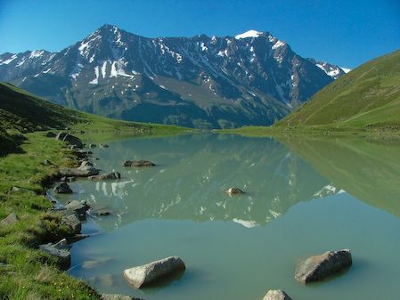
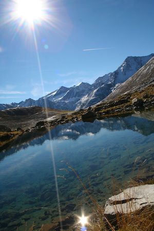
Imposing situated great moraine lake under the southern peak of Kaunergrat. In the spring- and in the sommertime pink alpine roses bloom around the lake.
The Round is marvelous for beginners and Families.
In the winter it is possible to do cross country ski run around the lake.
- Starting point
-
Hotel Kirchenwirt - Plangeross 1616 m
- Route
-
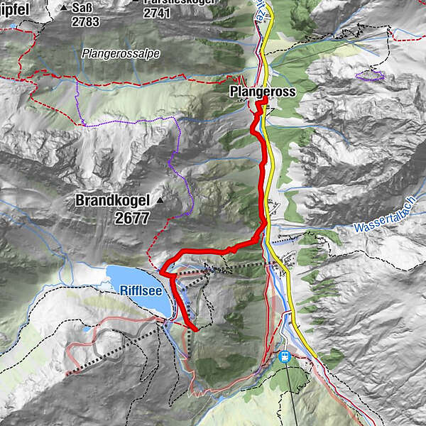
Pfarrkirche PlangerossPlangerossBergwerk0.1 kmTieflehn1.5 kmHirschtallift3.2 kmGasthaus Riffelseerestaurant3.6 kmRiffelseehütte4.3 km
- Description
-
You walk from Plangeroß,1616 m southern to Mandarfen, 1736 m. From Mandarfen there are 3 possibilities to achieve the Riffelsee. First you walk through the Tschachtal, along a burn. The second way is through the Hirschtal, which is result to a rampant path (number 8). the third and the easiest way to get to the Riffelsee is the glacier mountain railway from Mandarfen. Above the Riffelsee hut is situated between cliffs. The Riffelsee is a great moraine lake which is beautiful situated on the southern of Kaunergrat, Zurakogel, Hoher Kogel, Seekerlesschneid, Seekogel and Rostizkogel.
- Highest point
- 2,286 m
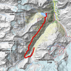
- Height profile
-

- Author
-
The tour Easy walking-tour to the Riffelsee (2676) and the Riffelsee alpine chalet (2289) is used by outdooractive.com provided.