


- Brief description
-
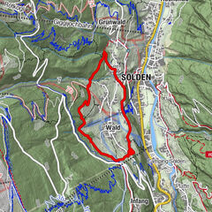
Sölden - Windachtal - Waalweg Mooserstegle - Sölden
- Difficulty
-
easy
- Rating
-
- Starting point
-
Sölden
- Route
-
Sölden (1,368 m)4.5 km
- Best season
-
JanFebMarAprMayJunJulAugSepOctNovDec
- Description
-
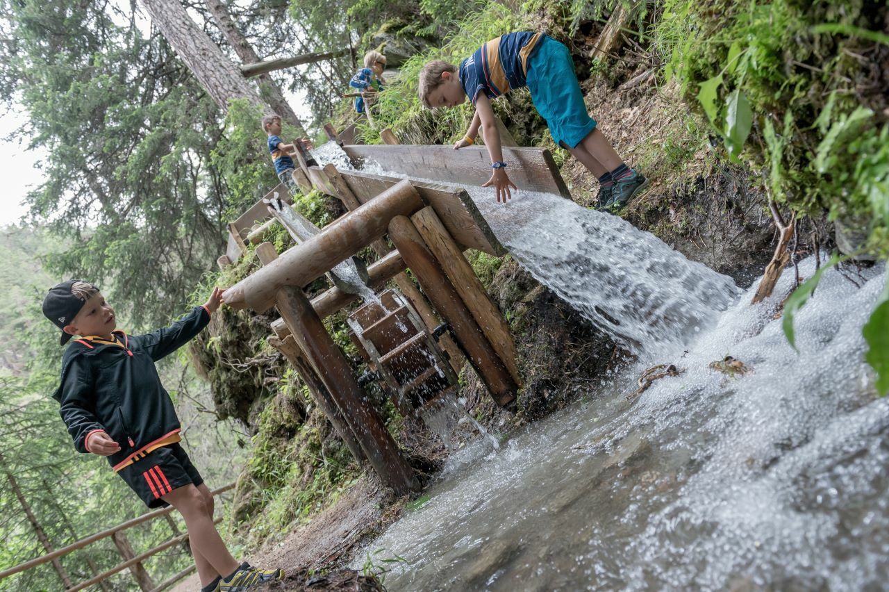
On this amazing thematic trail, you can enjoy the tranquility and beauty of Sölden's quiet side.
From the Sölden Information office, the route leads along the Adventure Mile,past the Sölden social center and on a steep ascent to the hamlet of Granbichl.
You continue to hike along the meadow slopes and on the old path into the Windachtal side valley (part of the Central Alpine Trail), always with a deepview of the Windach Ache ravine. Here you can admire the influence of waterover the last centuries, deeply carved into rocks and stones.
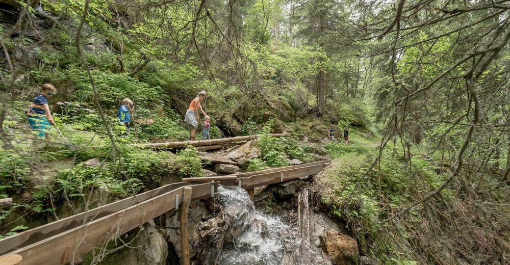
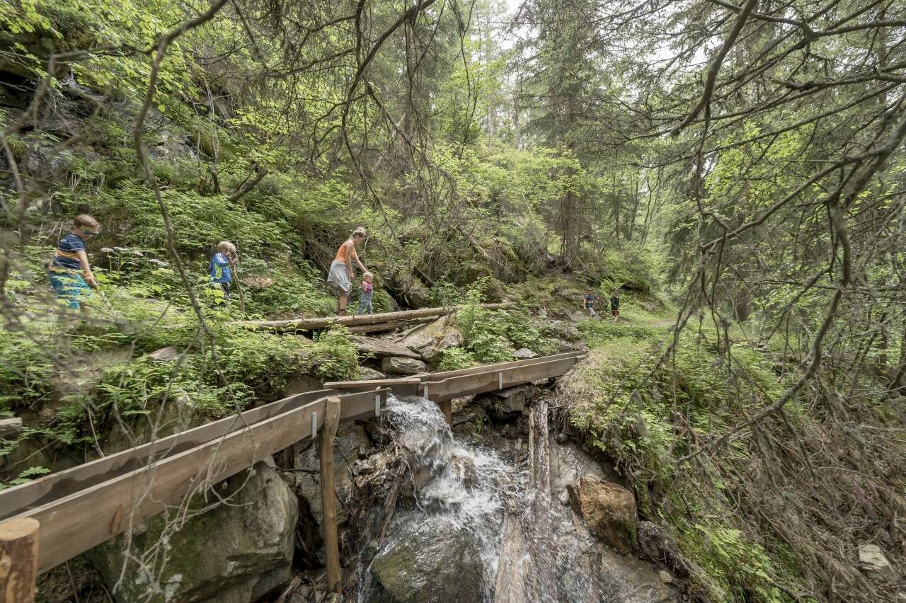
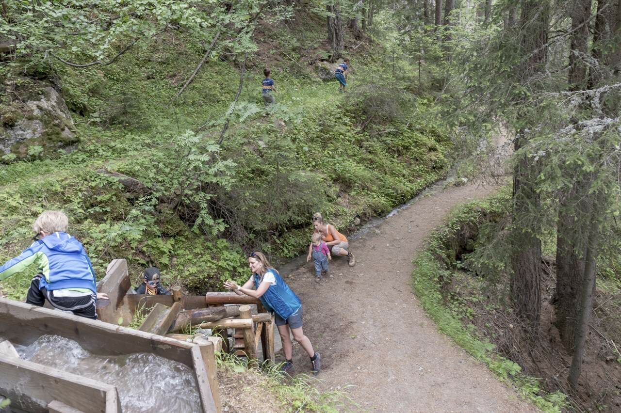
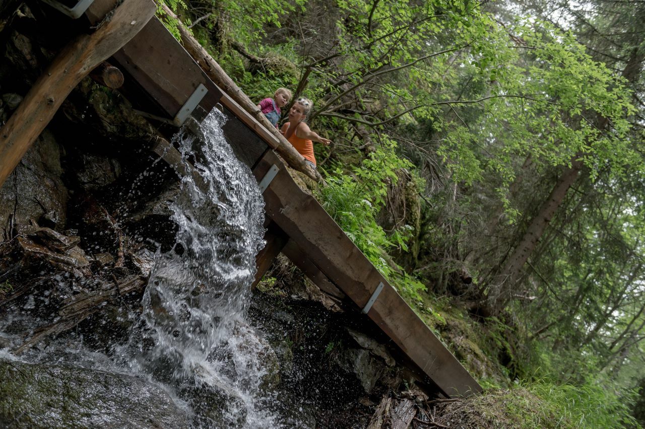
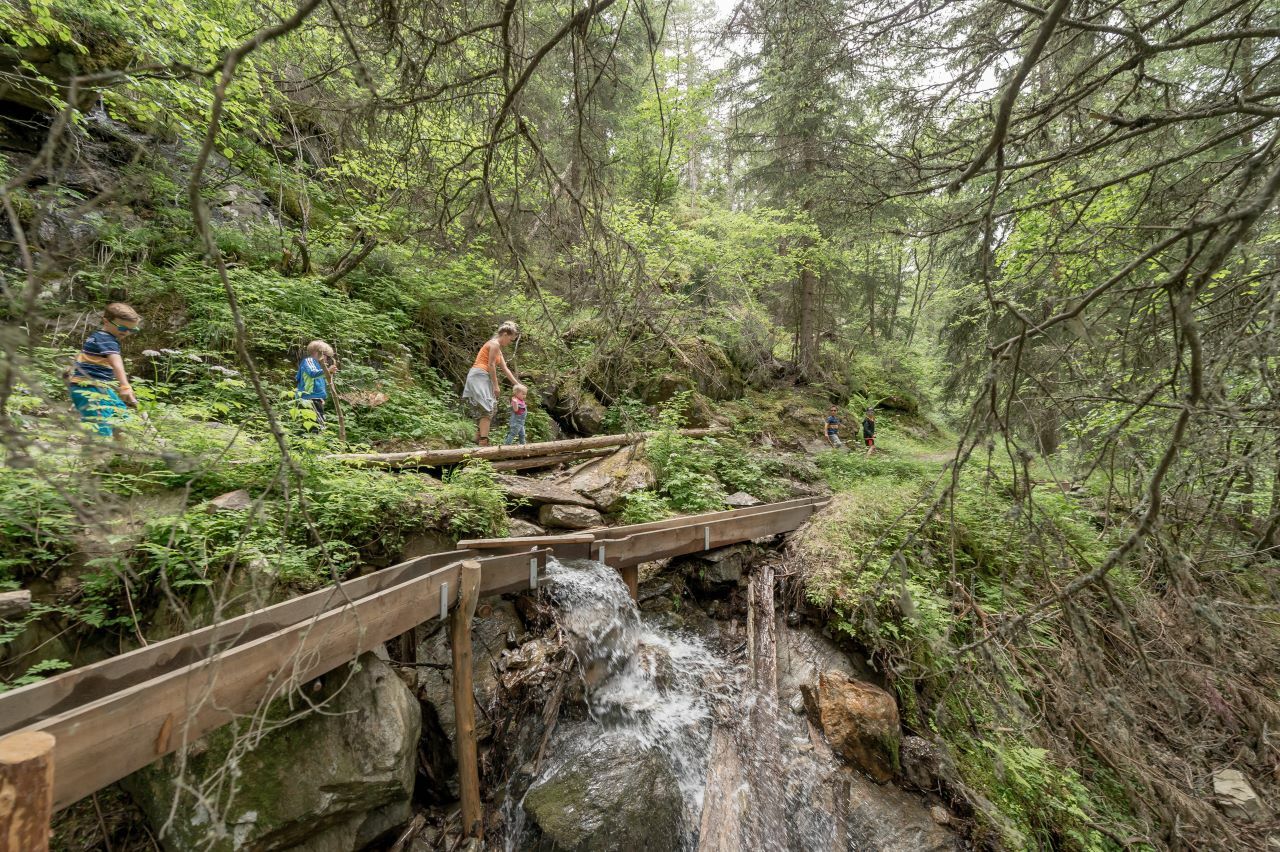
Following the valley you come a little closer to the water. Until the trail leads over a bridgeto Mooserstegle, we take a short break in the cozy hammocks. Then you hikedown to the right and walk through the mystical forest to the waterbed of Windach Ache mountain brook.There you cross the small bridge and continue on the opposite side along Mooserstegle, a drainage channel of Windach Ache from an earlier time. Enjoythis stretch, always accompanied by the reconstructed Waal which enchantsespecially the youngest hikers.
It continues comfortably past quiet and fairytale-like places until shortly before the barbecue area in Sölden. From there the path leads out of the valley, past the Windauer Mühle down to the hamlet of Windau.
You can take a break and gather strength at the station in the Ötztal Nature Park before returning to the starting point.
- Directions
-
ALONG THE HISTORICALLY GROWN WAALWEGE - EXPERIENCE THE QUIET AND BEAUTY OF SÖLDEN'S QUIET SIDE
From the Information Office in Sölden, the path leads along the experience mile at the social center in Sölden via a steep ascent to the Granbichl hamlet. You continue to hike along the meadow path into the Windachtal (part of the Central Alpine Trail), always with a deep insight of the Windacher Ache.
Here you can see the work of water over the last centuries, cut deep into rock and stone. Further down in the valley you come a little closer to the water. The path leads over a bridge to Mooserstegle, where we take a short break in the hammocks.
Then you hike down to the right and hike through the mythical forest to the waterbed of the Windacher Ache. There you cross a small bridge and follow the Mooserstegle on the opposite side, a derived Waal of the Windacher Ache from an earlier time.
You continue to hike, always accompanied by the reconstructed Waal, which especially inspires the little ones of your family.
It continues comfortably past quiet and fairytale-like places until shortly before the barbecue area in Sölden. From there the path leads out of the valley, past the Windauer Mühle down to the hamlet of Windau.
You can take a break and gather strength at the station in the Ötztal Nature Park before returning to the starting point.
- Highest point
- 1,585 m
- Endpoint
-
Sölden
- Height profile
-

- Equipment
-
Appropriate equipment such as breathable suitable outdoor clothes for the weather, ankle-high walking boots, wind-, rain- & sun protection, hat, possibly gloves, is for all hikes and tours necessary. Please bring a first-aid box, a mobile phone, a walking map and if there is no hut on the way a snack and enough to drink.
- Additional information
-
Waalweg Theme Trails
In the past, the so-called "Waal" water trails were man-made irrigation ditches for providing the Alpine fields and pastures with enough water. Still today, some of them are used by the local farmers. For our ancestors these "Waalweg" trails were essential for cultivating their meadows and fields.WATER IN THE ÖTZTAL VALLEY
Water, the element which has shaped the Ötztal valley.
The glaciers are melted by the sunshine, releasing fresh water which feeds into the meadows and the Ötztaler Ache river which winds its way along the 65 km long valley. The Ötztaler Ache catchment area extends over 893 km² with an elevation from 700 to 3,774 m. This glacial meltwater fills the reservoir used by the local population and provides a supply of drinking water.
Glaciers store ¾ of the world’s freshwater reserves and therefore represent the biggest natural waterstorage in the world.
In the year 1770, the advancing ice dammed many of the big lakes here which triggered catastrophic flooding across the entire Ötztal and Inntal regions when they burst their banks. Natural hazards and disaster made people want to know more about and better understand nature, which also facilitated glacier research. The many facets of water in the Ötztal is not just of interest for scientists. The Ötztal glaciers are recreational destinations for locals and guests alike as these ice worlds offer great hiking and skiing in surroundings of outstanding natural beauty. Crystal clear river waters swollen by icy glacier meltwater make for superb rafting, white water canoeing and other action-packed activities.More details about hiking In Ötztal: https://www.oetztal.com/wandern
- Directions
- Public transportation
- Parking
-
The following parking facilities are available in Sölden:
- Parking lot
- parking lot Stiegele
- stair parking
- Giggijochbahn + underground garage
- Gaislachkoglbahn + underground garage
All parking is free during the day.
Parking for several days (eg hike tour):
- Parkticket either online or directly at the cash desk of the Gaislachkoglbahn


- Author
-
The tour Water Walk Waalweg Mooserstegle Sölden is used by outdooractive.com provided.


")