

© Panoramahotel Talhof - Tanja Weirather

- Brief description
-
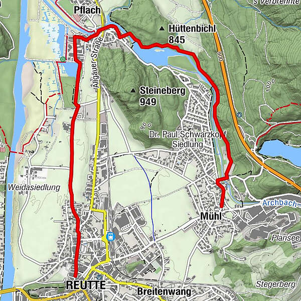
Von Mühl in Richtung Urisee, nach Überquerung der Archbachbrücke links abzweigen, entlang dem Archbach bis Pflach. Nach erneuter Überquerung des Archbaches links über Pestfriedhof, oder rechts über Pflach (Straßenunterführung) und Lüß zurück nach Reutte.
- Difficulty
-
easy
- Rating
-
- Route
-
MühlArchbach Siedlung0.9 kmHüttenbichl2.2 kmHüttkapelle2.2 kmPflach (840 m)2.4 kmEdelweis4.4 kmReutte (853 m)4.7 km
- Best season
-
JanFebMarAprMayJunJulAugSepOctNovDec
- Highest point
- 859 m
- Endpoint
-
Reutte
- Height profile
-

- Author
-
The tour Archbach Waldlehrpfad is used by outdooractive.com provided.
GPS Downloads


Other tours in the regions
-
Allgäu
2360
-
Naturparkregion Reutte
1429
-
Lechaschau
570


