
- Brief description
-
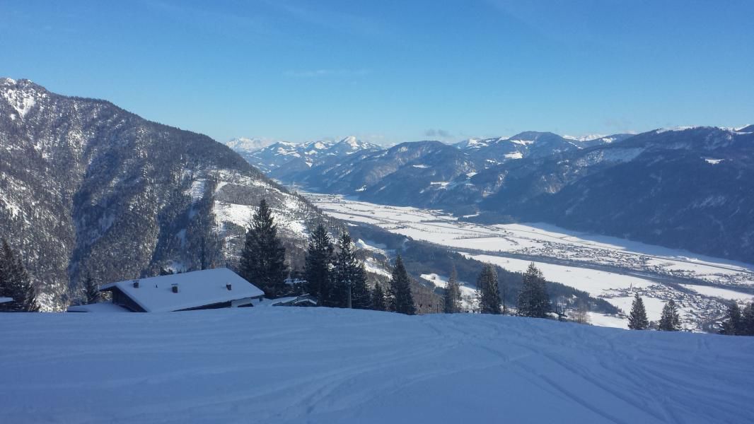
Demanding tour with considerable elevation gain to the Berghaus Sonnwendjoch
- Difficulty
-
difficult
- Rating
-
- Starting point
-
Kramsach Sonnwendjochbergbahn (defunct chairlift)
- Route
-
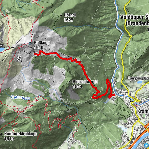
RadetzkywegMariatal (533 m)0.6 kmSonnwendjochhaus5.9 km
- Best season
-
AugSepOctNovDecJanFebMarAprMayJunJul
- Description
-
Walking time: approx. 4 hours – 1.230 m elevation gain up to the Berghaus Sonnwendjoch
By bus: bus numbers 4113/bus stop: Kramsach Achenrain and 4070/bus stop: Abzw. Mariatal
The ascent follows the "Kaltes Wasserl" toboggan run towards the middle station. Soon one reaches the former ski piste. Continue uphill to the middle station and then steep uphill to the Berghaus Sonnwendjoch ski slope.
Descent: as the ascent; snow conditions permitting one can also ski westwards from the Berghaus Sonnwendjoch via a furrow to the "Ludoialm" and on to the "Pletzach Niederleger" past the "Bayreuther Hüttenweg" to the bottom station. Food and drinks: depending on snow conditions the Berghaus Sonnwendjoch is open at weekends, for information please call tel. +43 699 101 322 39
- Highest point
- 1,778 m
- Endpoint
-
Kramsach Sonnwendjochbergbahn (defunct chairlift)
- Exposition
- Height profile
-

- Equipment
-
Ski touring equipment, something to eat and drink
- Safety instructions
- Directions
-
A12, motorway exit Kramsach/Brixlegg, towards Kramsach, defunct Sonnwendjochbergbahn
- Public transportation
- Parking
-
Kramsach car parl defunct Sonnwendjochbergbahn
- Author
-
The tour Ski tour Sonnwendjoch is used by outdooractive.com provided.


General info
-
Alpbachtal
109
-
Kramsach
21