


- Brief description
-
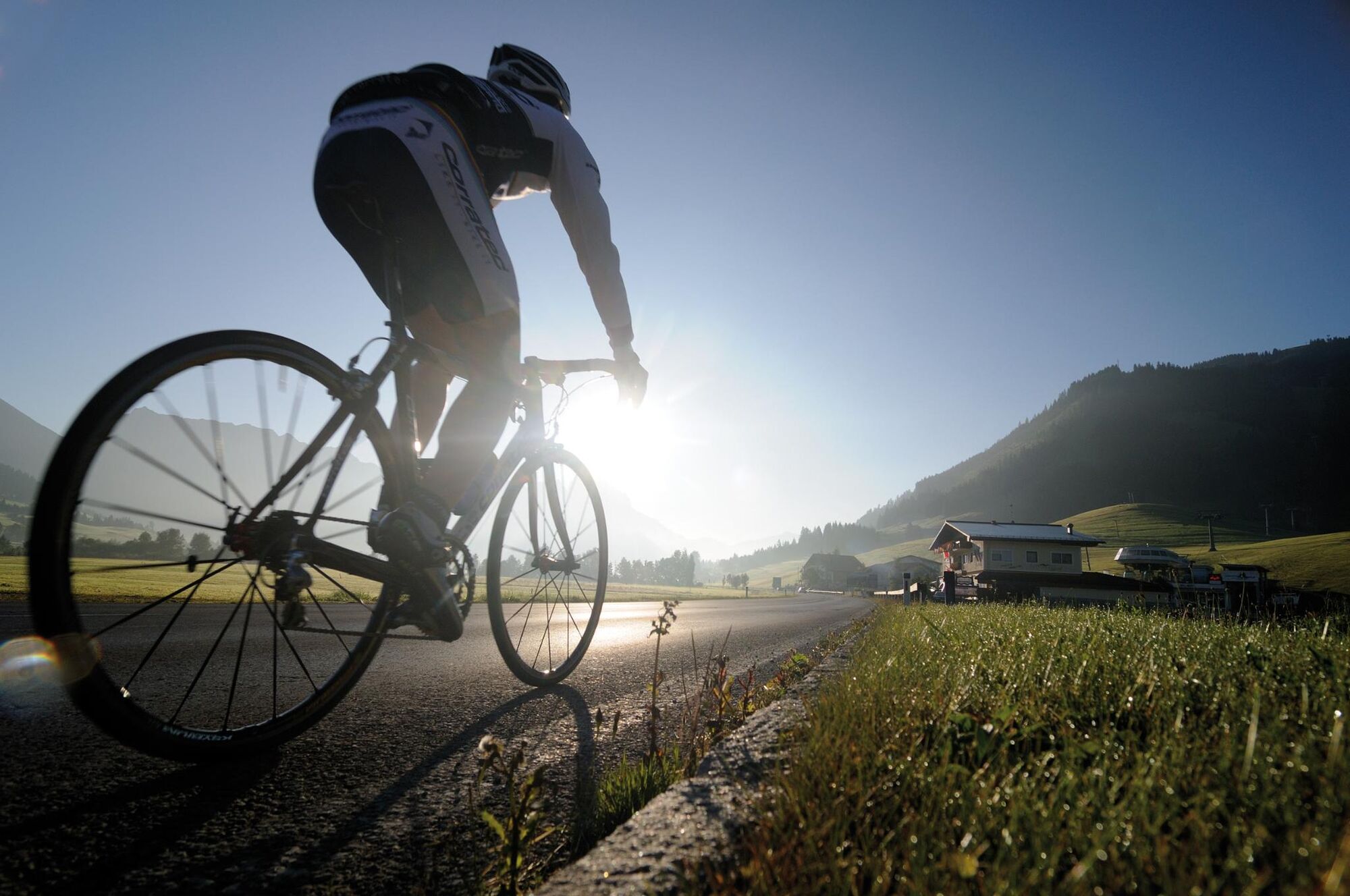
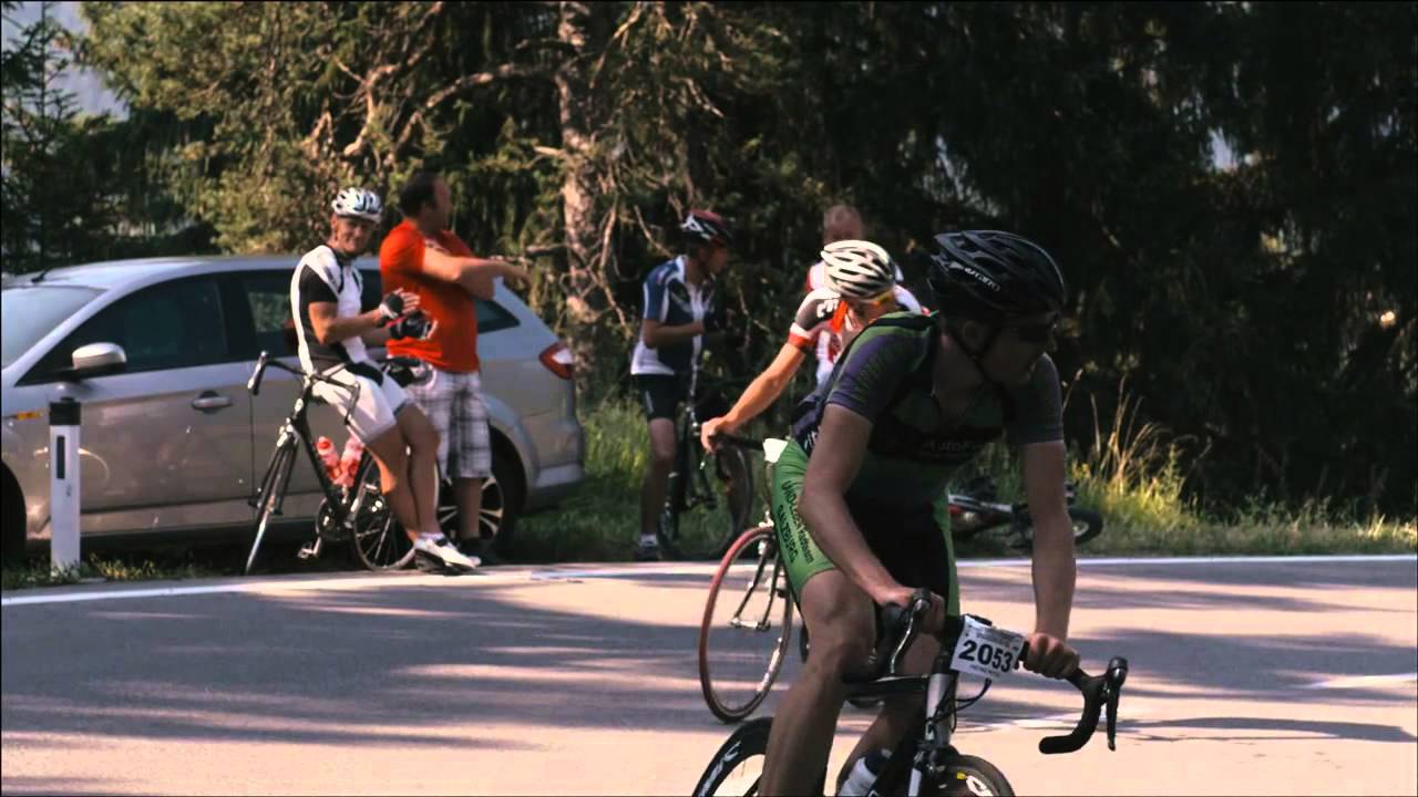
The "short" route of the cycling marathon leads from Tannheim via Grän to Pfronten and along the river Lech to the turning point in Vorderhornbach. In Weißenbach the Gaichtpaß is waiting for you, which is very easy to ride with a gradient of about 5%. The scenically very attractive route is particularly suitable for beginners and all those who want to take it easy.
- Difficulty
-
medium
- Rating
-
- Starting point
-
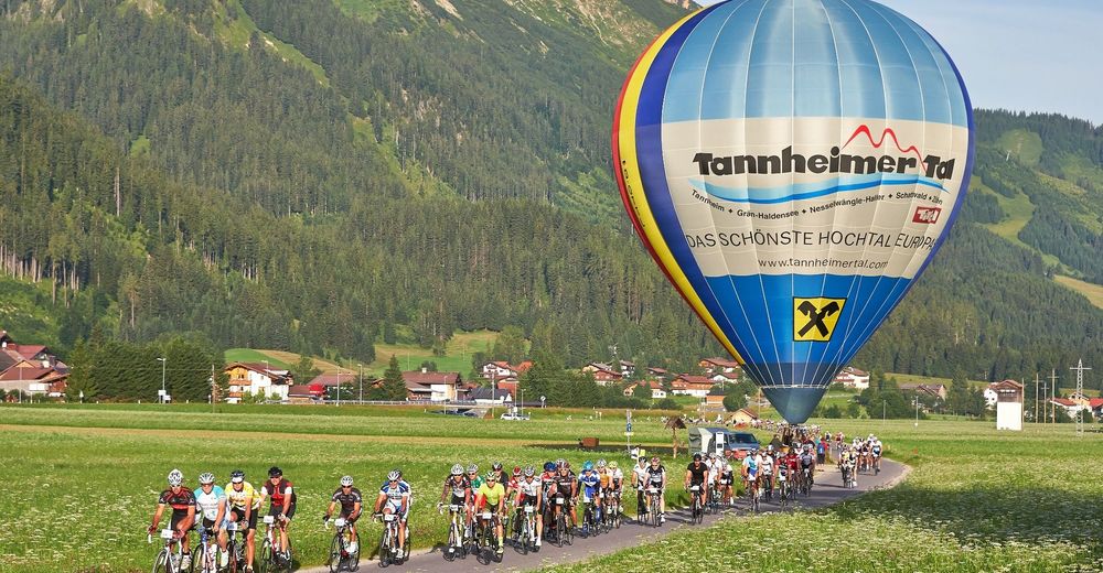
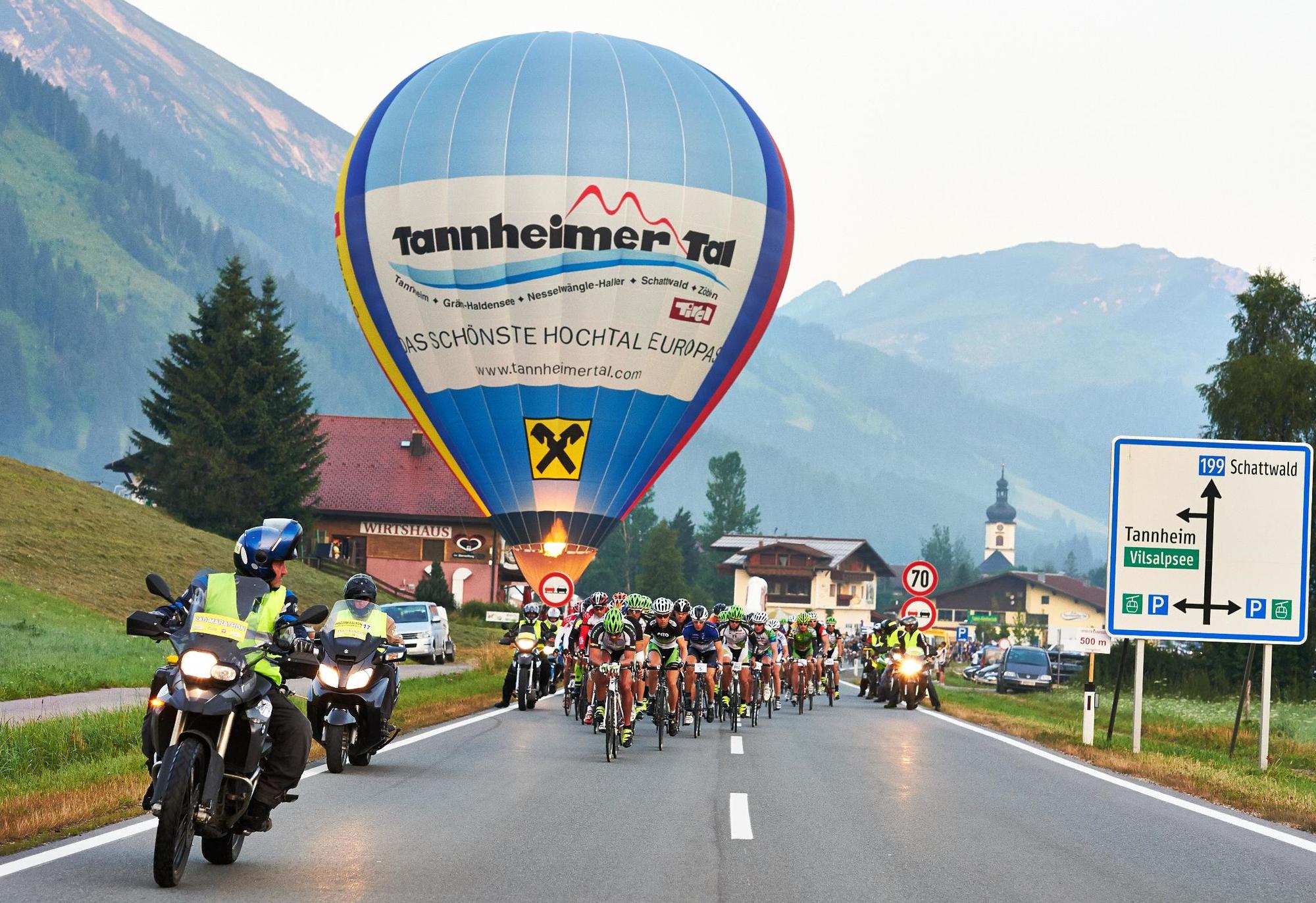
Tannheim / Tannheimer Tal / Tyrol - indoor tennis hall Sägerklause, Rossberg
- Route
-
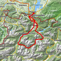
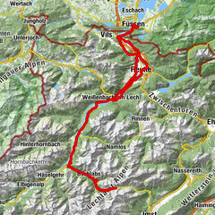
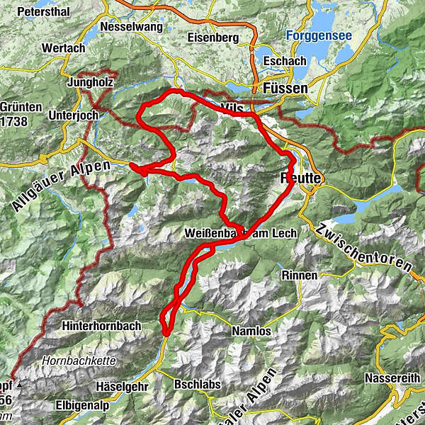
Geist0.1 kmSt. Nikolaus0.9 kmTannheim (1,097 m)1.0 kmSt. Martin2.2 kmInnergschwend2.4 kmLumberg4.4 kmMichaelskapelle4.8 kmWasserscheide Vils/Steinacher Achen (1145m)4.9 kmEnge5.2 kmSeealp7.4 kmÖsch15.0 kmSteinach15.6 kmSt. Michael15.8 kmSchönbichl18.1 kmSchwarzer Adler21.0 kmVils (826 m)21.1 kmKrone21.2 kmRiedle25.0 kmMusau (821 m)25.3 kmLeite25.9 kmBrandstatt (842 m)26.6 kmHl. Antonius26.6 kmMariae Heimsuchung27.3 kmRoßschläg27.4 kmOberletzen28.7 kmMariahilfkapelle29.1 kmOberletzen29.2 kmHinterbichl30.7 kmReutte (853 m)32.4 kmLechaschauer Kirche32.4 kmLechaschau (846 m)32.7 kmBuchenort32.8 kmGraben33.8 kmPlatten34.1 kmSoyers Sennerland34.7 kmHöfen (868 m)34.8 kmThermic Ranch34.8 kmHornberg35.7 kmWeißenbach am Lech (885 m)39.9 kmStuibenhütte (920 m)43.9 kmViele Brunnen45.5 kmJagdthüttenalpe47.3 kmStanzach (940 m)50.3 kmVorderhornbach (973 m)52.7 kmPfarrkirche Vorderhornbach52.7 kmGasthof Rose52.7 kmFilialkirche Martinau54.0 kmStanzach (940 m)58.0 kmGasthaus Post58.1 kmPfarrkirche Stanzach58.1 kmBlockau58.8 kmForchach (910 m)62.7 kmDorfkirche68.5 kmWeißenbach am Lech (885 m)68.5 kmRauth73.3 kmStegmühlkapelle73.4 kmGasthof Klausenstüberl73.4 kmMariahilf Kapelle74.4 kmNesselwängle (1,136 m)75.9 kmSchmitte77.0 kmSchmittekapelle77.2 kmHaller78.0 kmSt. Johannes78.3 kmVia Salina Hotel am See78.4 kmHaldensee80.1 kmSt. Jakobus80.1 kmTannheim (1,097 m)83.8 kmNeu Kienzen84.4 kmKienzen85.8 kmKapelle85.9 kmGeist86.7 km
- Best season
-
JanFebMarAprMayJunJulAugSepOctNovDec
- Description
-
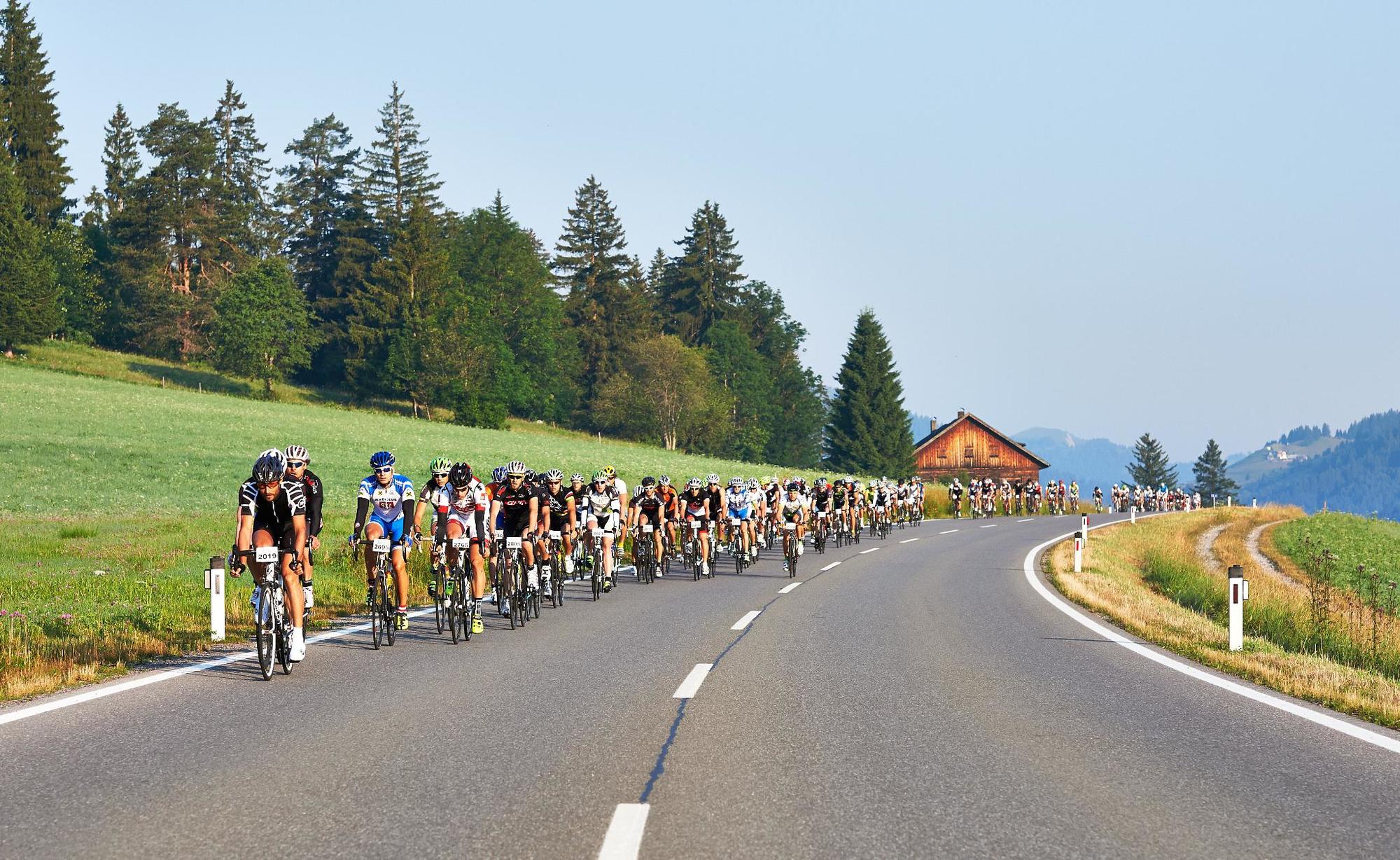
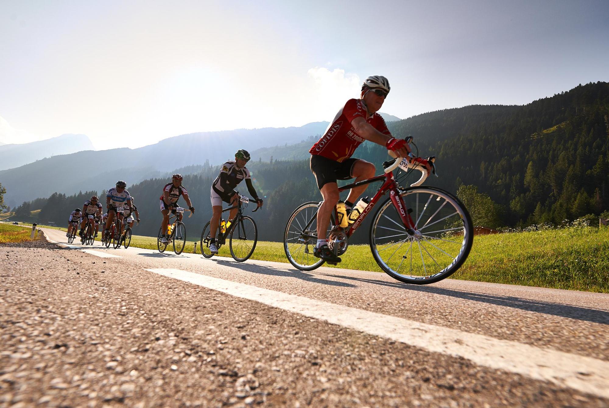
Starting from Tannheim directly from the centre towards Grän and downhill to Pfronten in the Ostallgäu and back to Tyrol. Through the small town of Vils, on to Musau and in the middle of the Lechauen up to Lechaschau on the B198 and turn right to Weißenbach am Lech. Turn right before the Johannes Bridge and through the scenic Black Water to Vorderhornbach, where the first refreshment stop is waiting. Turn left at the Martinauer Lechbrücke. This is the turning point and further through Stanzach to Weißenbach to the second refreshment station. Then turn left at the roundabout and cross the Gaichtpaß back to the Tannheimer Tal.
- Directions
-
Start in Tannheim, Rossberg, Sägerklause in the direction of the village centre to the church, continue through the underpass and in the direction of Innergschwend to Grän/Lumberg. There turn left onto the L261 through the Engetal downhill to Pfronten until the main road in Pfronten Steinach. There turn right and follow the sign Vils/Reutte. After crossing the border through the small town of Vils and further to Stegen and turn right onto the L69 towards Musau, after Roßschläg/Bärenfalle onto the cycle path towards Oberletzten (motor vehicle ban) and in the middle of the Lechauen to Lechaschau. Turn right there in front of the church and through Höfen to Weißenbach am Lech. There, at the roundabout, go straight ahead into the Lech Valley and before the Johannis Bridge turn right onto the cycle path into the Schwarzwasser (no motor vehicles allowed). The single-lane road rises slightly there and leads into the forest where the cycle path runs along the Lech river. The scenery is wonderful and the road is varied all the way to Stanzach, where you leave the cycle path again and go to the first refreshment station in Vorderhornbach. Continue to Martinau, turn left at the Lech bridge and follow the B198 towards Reutte. In Weißenbach, parallel to the B198, the second refreshment station is ready before you take the exit into the Tannheimer Tal at the roundabout and cycle over the Gaichtpaß along the Haldensee back to the starting point in Tannheim.
- Highest point
- 1,151 m
- Endpoint
-
Tannheim / Tannheimer Tal / Tyrol - indoor tennis hall Sägerklause, Rossberg
- Height profile
-

- Equipment
-
road bike is recommendable, it can also be ridden with any touring bike
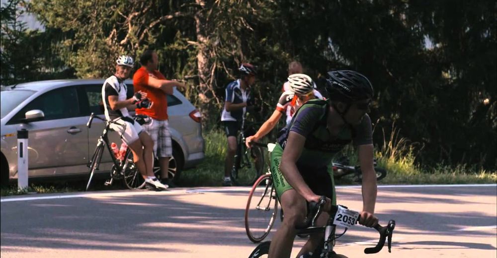
Wearing a crash helmet is mandatory.
Each participant has to carry a spare tube on his own.
Escort vehicles are undesirable - please keep to this!
!!! No driving in the black water !!!
- Safety instructions
-
Every cyclist from the age of 18 (of full age) is entitled to start. Participants from the age of 12 can participate in the 85 km distance in the company of their parents, or with the consent of their legal guardian. By paying the entry fee, the participant comprehensively accepts all of the organizer's conditions of participation. The participation is at your own risk!In addition, each participant declares to release the organizers from any civil or criminal liability for personal injury and/or property damage caused by or arising from the participant. The participant declares that he/she has trained sufficiently for the "Rad-Marathon Tannheimer Tal", that he/she is physically healthy and that his/her state of health has been medically confirmed.
In case of bad weather or other unforeseen events, the organiser is entitled to shorten the course and change the time limit.In case of danger, the authorities may also cancel or abandon the event.
The organizer can remove participants from the competition who do not follow the instructions.
- Additional information
-
www.rad-marathon.at
www.tannheimertal.com
- Directions
-
On the motorway A7 at the exit "Oy-Mittelberg" on the B310 towards Wertach and to Oberjoch. There follow the signposting "Tannheimer Tal" B199, exit Tannheim, Neunerköpfle mountain railway.
From the Tyrolean side via Reutte on the B198 towards Lechtal to Weißenbach, over the Gaichtpass along the B199 to the exit Tannheim, Neunerköpfle Bergbahn.
- Public transportation
-
By train to Sonthofen, Pfronten/Ried or Reutte, then by bus to Tannheim.
- Parking
-
Directly at the start (Tourismusinfo Tannheim) possible - parking lot of the Tannheimer Bergbahnen
- Author
-
The tour 2018_bike marathon_TT_85km distance is used by outdooractive.com provided.


General info
-
Allgäu
65
-
Tannheimer Tal
52
-
Nesselwängle
25