
- Brief description
-
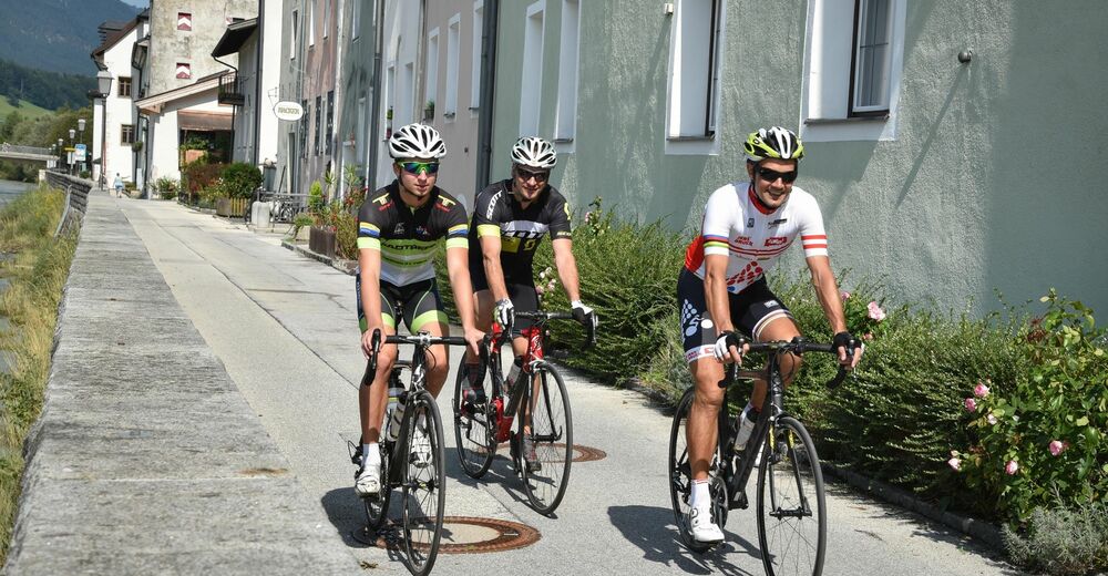
An easy tour avoiding busy main roads, leading throught the villages to the right hand side of the Ziller Valley. Ideal route if you are new to cycling.
- Difficulty
-
easy
- Rating
-
- Starting point
-
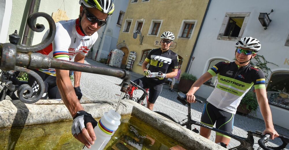
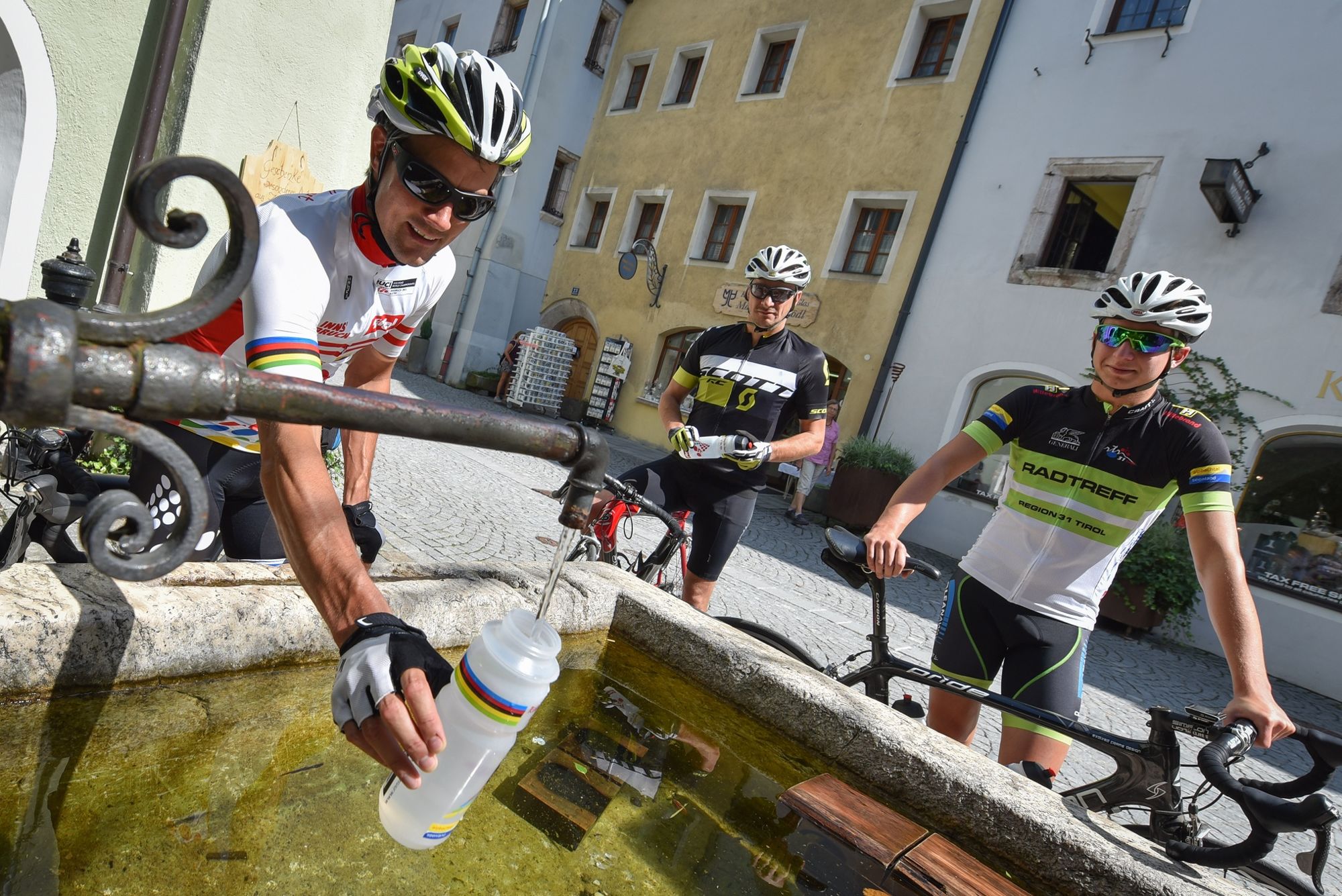
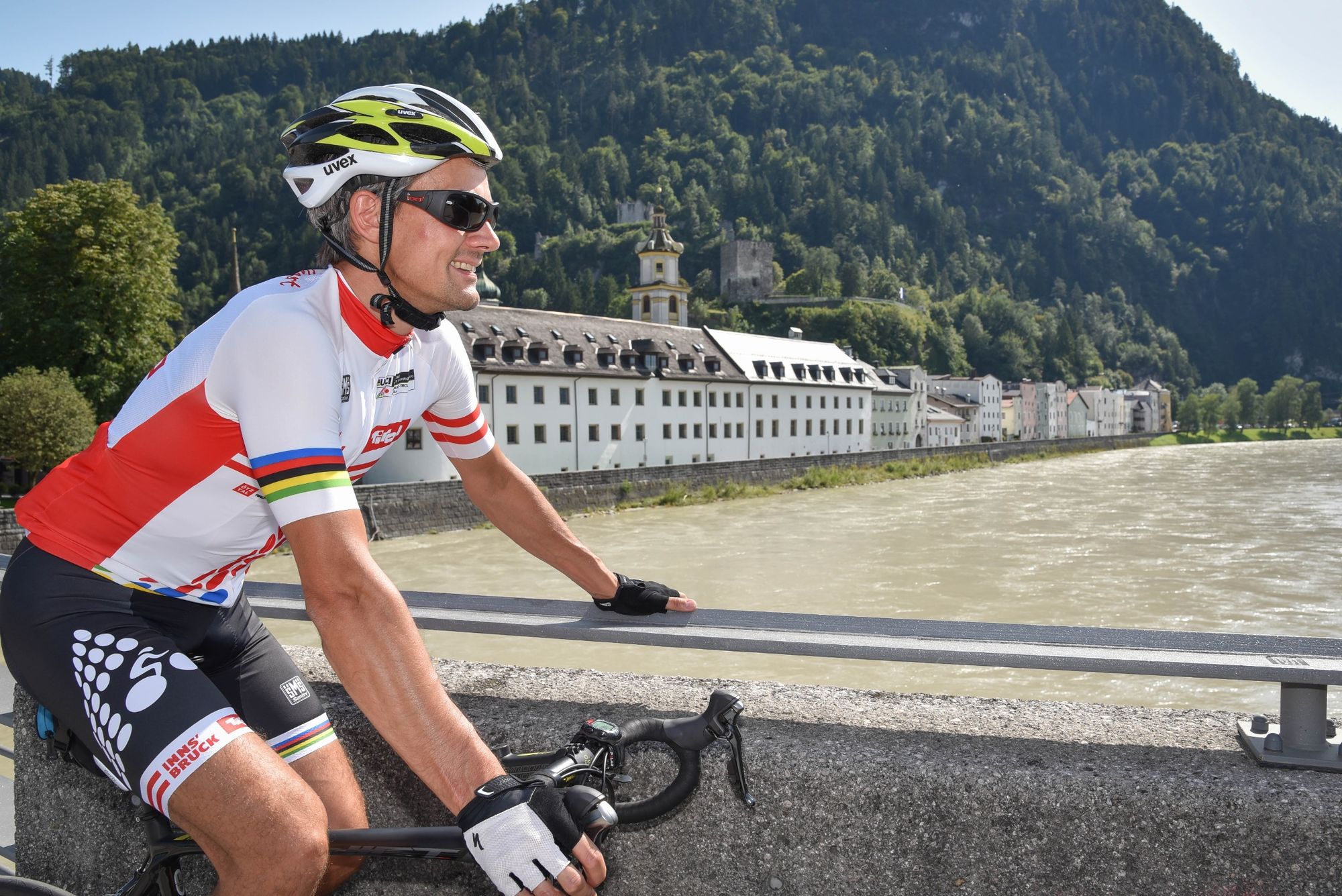
Rattenberg, town main square fountain
- Route
-
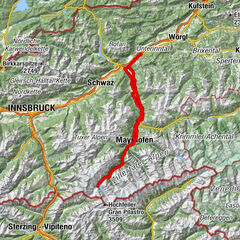
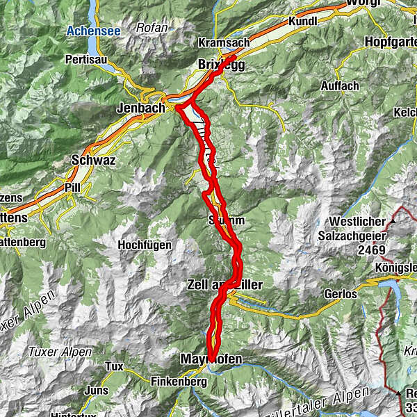
Rattenberg0.0 kmBrixlegg1.9 kmWeng (526 m)2.5 kmRestaurant Gut Matzen3.3 kmLichtwerth (529 m)3.8 kmFilialkirche St. Gertraudi4.7 kmSankt Gertraudi (527 m)4.8 kmLandhauskapelle6.5 kmPfarrkirche Bruck7.9 kmGasthof Dorfwirt7.9 kmBruck am Ziller (579 m)8.0 kmImming9.4 kmHelfenstein14.7 kmHaselbach15.7 kmFinsing16.0 kmStumm (556 m)20.3 kmHeiliger Rupert20.4 kmKapelle Neuhausweg21.7 kmGasthof Rissbacherhof21.9 kmWhite Horse23.4 kmAschau im Zillertal (567 m)23.8 kmIn Teufels Küche / Der Tuxa26.9 kmZapfenkapelle27.2 kmZell am Ziller (575 m)28.5 kmZellbergeben28.6 kmZell am Ziller (560 m)28.8 kmRamsau im Zillertal32.1 kmMaria sieben Schmerzen32.1 kmUnterbichl33.0 kmOberbichl33.7 kmEckartau34.1 kmHollenzen34.6 kmGH Bruggerstube34.7 kmLaubichl35.5 kmMayrhofen (633 m)36.2 kmBurgstall38.0 kmNeu-Burgstall38.5 kmMühlbach38.7 kmSidan38.8 kmStockach39.1 kmSchwendau39.6 kmHippach40.2 kmHeiliger Ingenuin und Albuin40.7 kmLaimach42.1 kmKirche Laimach42.2 kmZell am Ziller (575 m)44.3 kmZellbergeben44.4 kmGasthaus Weiherwirt47.6 kmKruma48.2 kmMaria zum Siege48.4 kmAschau im Zillertal (567 m)48.5 kmReisrach51.5 kmKaltenbach (558 m)52.2 kmRestaurant Liebstöckl52.3 kmMariä Heimsuchung52.3 kmWöscherkapelle52.8 kmRied im Zillertal53.3 kmHeiliger Johannes der Täufer53.4 kmPlunggenkapelle55.7 kmUderns56.6 kmHeiliger Briccius56.8 kmUderns im Zillertal (544 m)57.3 kmFinsing57.4 kmKapelle Kapfing58.0 kmKapfing58.3 kmFügen (545 m)59.7 kmPfarrkirche Fügen59.9 kmKapelle60.5 kmGagering62.2 kmSchlitters (548 m)63.6 kmGasthof Jäger63.6 kmStrass im Zillertal (525 m)66.3 kmStrass im Zillertal (523 m)66.8 kmPfarrkirche Strass66.8 kmPfarrkirche zum Heiligen Jakobus d. Ä66.8 kmFilialkirche St. Gertraudi69.3 kmSankt Gertraudi (527 m)69.5 kmLichtwerth (529 m)70.6 kmRestaurant Gut Matzen71.3 kmWeng (526 m)72.0 kmBrixlegg72.7 kmRattenberg74.7 km
- Best season
-
JanFebMarAprMayJunJulAugSepOctNovDec
- Description
-
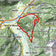
TVB Tour 12 – Zillertal Cappucino
Distance 76 km Elevation gain 500 m Gradient max. 6 % Best time Spring – late autumn Grading moderate - Directions
-
Rattenberg - Bruck am Ziller - Zell am Ziller - Mayrhofen - Kaltenbach - Fügen - Strass im Zillertal - Rattenberg
0 Km (from the start) start Rattenberg, Notburga fountain to Brixlegg 3rd exit at the roundabout 5,5 km to Landhaus 6,4 left Landhaus, turn-off L 294 to Bruck/Imming 3,0 km 9,4 left Imming, turn-off turn right after 50 m turn right after 3,1 km at the junction continue along the road for 2,9 km 15,4 left Haselbach, turn-off turn right after 600 m 4,6 km to Stumm 20,6 straight Stumm / church 6,5 km along the L 216 and the Ahrnbachstraße 27,1 right Zell am Ziller / mountain lift bottom station continue along the road for 1,6 km 28,7 right Zell am Ziller, railroad crossing turn left after 70 m continue along the road for 1,0 km 29,8 right B 169 junction continue along the road for 1,8 km 31,6 left Ramsau (M-Preis) turn-off cross the car park to the right after 500 m keep left after a further 300 m keep right 4,0 km via Hollenzen to Mayrhofen 36,6 right Mayrhofen centre, turn-off turn half-right after 100 m, then cross the B 169 and rail tracks 36,8 right Bäckerei Eberharter, on the Schwendau-Straße turn left after 200 m, cross the bridge and turn right 4,0 km to Burgstall and Stockach 41,0 straight Hippach, church 3,6 km along the L 300 44,6 straight Zellbergeben 6,0 km along the L 300 through Aschau 50,6 ! left ! To Aschau, turn-off turn right after 200 m at the intersection, to Kaltenbach 52,1 left Kaltenbach – bottom station, turn-off turn right after 400 m and then left continue along the road to Ried 54,0 left Ried, turn-off (360 m after the church) turn right after 60 m, continue along the Kirchweg 56,4 left Uderns – golf course, turn-off turn right after 500 m at the church and 60 m into Dorfstraße 57,0 left Uderns, turn-off Dorfstraße 3,0 km via Finsing and Kapfing to Fügen 60,0 straight Fügen centre turn left after 850 m onto the Radweg (not the B 169!) 5,6 km via Schlitters to Strass 66,4 right Strass, turn-off after 1,2 km B 171 junction to Rattenberg 75 finish Rattenberg - Highest point
- 625 m
- Endpoint
-
Rattenberg, town main square fountain
- Height profile
-

- Equipment
-
Helmet, sun glasses, gloves, rain proof clothing, bike outfit, first aid kit, replacement inner tube, tire lever, bike pump or cartridge, mobile phone, cash, bank card, drinking bottle, energy gel or bar, cap or bandana, leg and arm warmers.
In any case - equipment should be adapted to the time of year.
- Safety instructions
-
Right-hand traffic in practice. Please obey the highway code, road safety and vehicle rules.
- Additional information
- Directions
- Public transportation
- Parking
-
By train to Rattenberg train station, by car to one of the parking areas in Rattenberg (east or west).

-

-
AuthorThe tour Road bike 12 Zillertal Cappucino is used by outdooractive.com provided.