
- Brief description
-
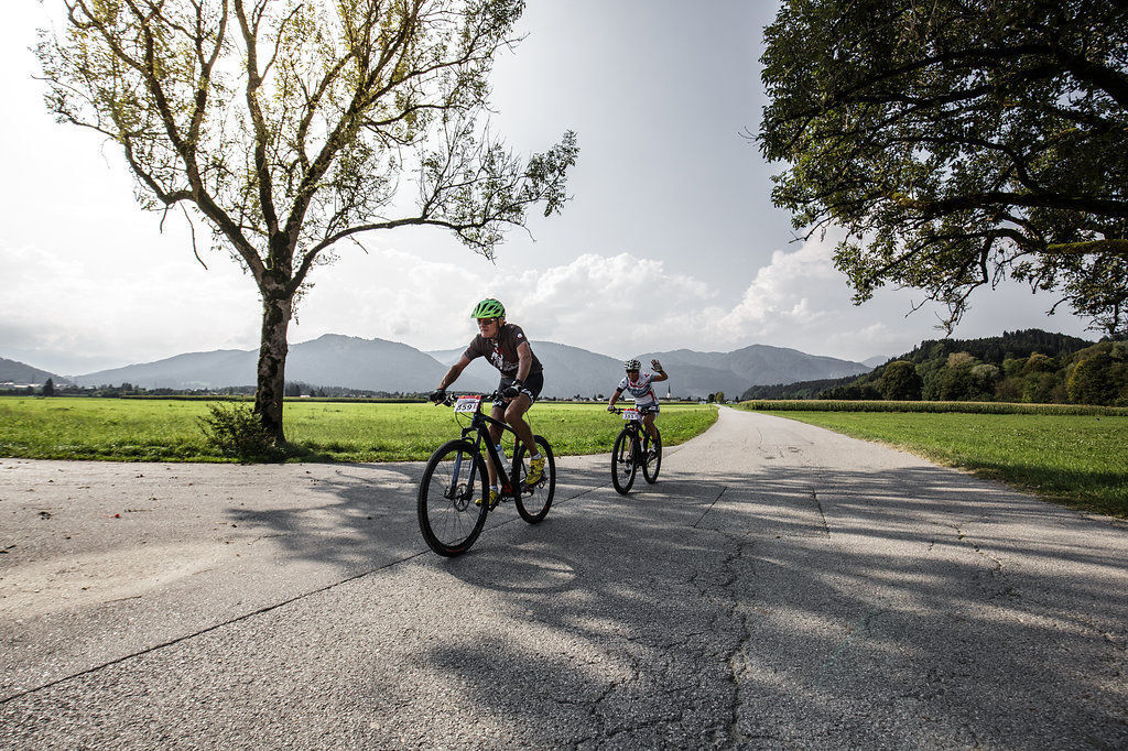
This day tour through the Krimmltal, Gerlostal and Zillertal valleys packs a punch and puts your endurance and muscles to the test. The tour is recommendable in any case during the week, since the traffic on weekends is partly very heavy.
- Difficulty
-
difficult
- Rating
-
- Starting point
-
Kufstein city centre
- Route
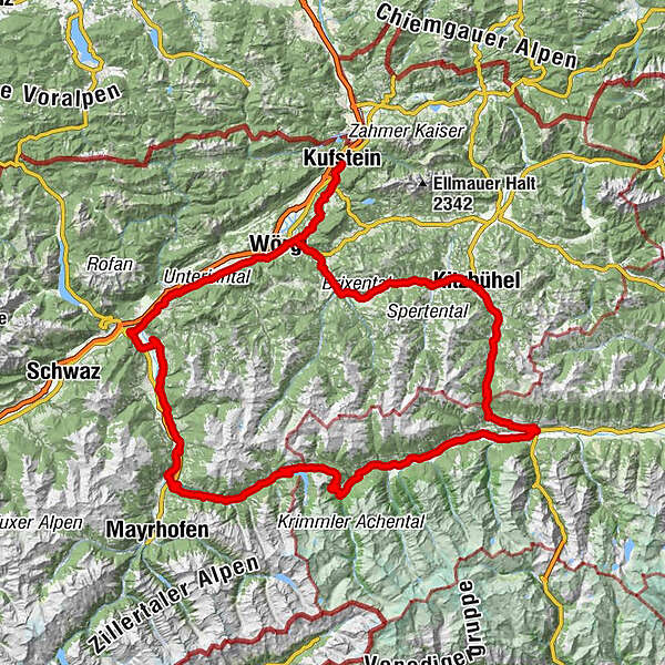
-
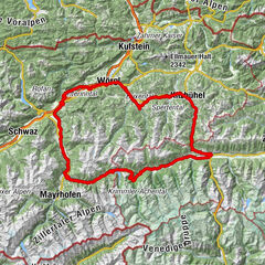
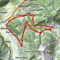
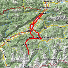
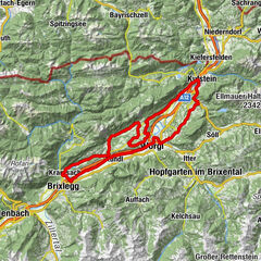
KufsteinEndach1.6 kmRussland3.6 kmRied4.0 kmAm Bach4.4 kmMoosham4.9 kmSchwoich5.4 kmNeuwirt5.5 kmPfarrkirche Heiliger Ägidius5.5 kmKirchenwirt5.5 kmMaisfeld6.1 kmHabring8.7 kmLourdeskapelle9.8 kmOsterndorf9.8 kmPfarrkirche Heiliger Johannes der Täufer10.3 kmBad Häring10.4 kmDon Peppe10.5 kmSchönau10.8 kmBoden (528 m)14.3 kmBruckhäuslwirt14.6 kmBruckhäusl (534 m)14.8 kmWörgler Boden (535 m)14.8 kmSankt Peter und Paul15.0 kmLuech (553 m)16.4 kmEinöden (559 m)17.3 kmGrieswirt18.4 kmTirolerhof20.1 kmHopfgarten20.1 kmHopfgarten im Brixental20.6 kmKühle Luft (595 m)20.8 kmBoden (604 m)21.7 kmElsbethen (611 m)22.0 kmHaslau (613 m)22.3 kmMühltal25.7 kmStocker-Marter-Kapelle25.8 kmWestendorf26.2 kmStraßhäusl26.6 kmMoosen27.5 kmGasthaus Aschenwald27.7 kmHof29.1 kmSonnenlift29.4 kmBrixen im Thale29.9 kmPfarrkirche Mariä Himmelfahrt30.0 kmLauterbach30.7 kmKirchberg in Tirol35.4 kmHeiliger Ulrich von Augsburg35.6 kmKlausen-Kapelle37.5 kmSchwedenkapelle37.6 kmFranziskanerkirche42.0 kmKitzbühel42.0 kmBusiness43.5 kmAuwirt Hotel & Restaurant45.5 kmUnteraurach45.5 kmGrillstation Kebab 9246.0 kmAurach bei Kitzbühel46.7 kmGrill House48.7 kmPfarrkirche Heiliger Wolfgang50.7 kmJochberg50.7 kmAlpenland51.0 kmDorfstub'n Jochberg51.2 kmGasthof Alte Wacht53.6 kmWaldwirt55.9 kmWallfahrtskirche Mariae Heimsuchung56.0 kmPaßthurn61.8 kmHohe Brücke62.9 kmThalbach66.9 kmBurk69.4 kmMittersill70.4 kmEvang. Annakirche70.5 kmArndorf73.8 kmHollersbach im Pinzgau75.2 kmMühlbach78.8 kmBramberg am Wildkogel81.1 kmWeyer83.3 kmNeukirchen am Großvenediger87.2 kmGasthof Venedigerblick88.8 kmVenedigersiedlung88.9 kmRosental89.9 kmTrattenbach90.8 kmLahn91.3 kmWald im Pinzgau (855 m)91.4 kmRestaurant Walderwirt91.4 kmPfarrkirche St. Nikolaus91.5 kmRestaurant Kirchplatzl91.6 kmLahn93.0 kmFamiliengasthof Schranz93.2 kmVorderkrimml93.7 kmGasthaus Pension Marienhof94.5 kmKrimml (911 m)94.5 kmKrimml (1,067 m)96.6 kmKehre 1 / Burgwald (1,135 m)98.3 kmKehre 2 / Trattenköpfl (1,167 m)98.9 kmKehre 4 (1,353 m)101.3 kmKehre 5 (1,384 m)101.6 kmKehre 6 (1,419 m)102.1 kmKehre 7102.3 kmAlmhotel Schönmoosalm (1,493 m)102.3 kmKehre 8 / Schönmoosalm (1,167 m)102.5 kmKlausboden113.0 kmInnertal115.3 kmJägerstüberl115.8 kmIsskogelstüberl115.9 kmOberhof116.0 kmMitterhof116.3 kmGaspi's Woodfired Grill116.9 kmGerlos (1,247 m)116.9 kmRied117.5 kmGmünd119.7 kmKapelle Kühle Rast121.0 kmHainzenberg (910 m)129.0 kmWaidachhof130.7 kmZell am Ziller (575 m)134.2 kmZellbergeben134.4 kmGasthaus Weiherwirt137.5 kmAschau im Zillertal (567 m)138.8 kmWhite Horse139.2 kmGasthof Rissbacherhof140.7 kmKapelle Neuhausweg141.1 kmHeiliger Rupert142.2 kmStumm (556 m)142.4 kmFinsing146.5 kmHaselbach147.1 kmHelfenstein148.2 kmGasthof Hamberg149.2 kmPfarrkirche Heiliger Bartholomäus150.3 kmHart im Zillertal (666 m)150.3 kmImming156.0 kmSchlitters-Bruck am Ziller (535 m)157.4 kmSchlitters (548 m)157.4 kmGasthof Jäger157.7 kmStrass im Zillertal (525 m)160.4 kmStrass im Zillertal (523 m)160.8 kmPfarrkirche Strass160.8 kmPfarrkirche zum Heiligen Jakobus d. Ä160.8 kmSankt Gertraudi (527 m)163.4 kmFilialkirche St. Gertraudi163.5 kmLichtwerth (529 m)164.6 kmRestaurant Gut Matzen165.3 kmWeng (526 m)166.1 kmBrixlegg166.7 kmRattenberg168.7 kmRadfeld170.1 kmSt. Leonhard174.1 kmWallfahrtskirche St. Leonhard174.3 kmKundl176.2 kmKapelle Sankt Maria176.4 kmLahntal (507 m)180.7 kmTaufkapelle183.0 kmStadtpfarrkirche Hl. Laurentius183.0 kmWörgl (513 m)183.0 kmHalligalli184.4 kmGasthaus Grattenbrücke184.6 kmSchönau187.9 kmDon Peppe188.1 kmBad Häring188.2 kmPfarrkirche Heiliger Johannes der Täufer188.4 kmOsterndorf188.7 kmLourdeskapelle188.9 kmHabring190.0 kmMaisfeld192.6 kmPfarrkirche Heiliger Ägidius193.1 kmKirchenwirt193.1 kmSchwoich193.2 kmNeuwirt193.2 kmMoosham193.6 kmAm Bach194.2 kmRied194.5 kmRussland195.2 kmEndach197.1 kmKufstein198.8 km
- Best season
-
JanFebMarAprMayJunJulAugSepOctNovDec
- Description
-
Kufsteinerland is far behind you in Kitzbühel, with the route now proceeding from Jochberg to Pass Thurn. The route goes downhill fast to Mittersill, then flattens out until the woodlands in Pinzgau. A ride where you can’t really get into a rhythm starts here on the old Gerlosstraße. The first kilometres tickle your muscles with a gradient of 8.5 %. Then follow longer sections with 12.5 % and ascents with 17 %. The reservoir finally heralds a bit of relaxation for your muscles. On the rapid descent to the Zillertal valley don’t be distracted by the views to the snow-covered 3,000-metre peaks. Back in the valley you can wind down on the 50 kilometres from Zell am Ziller to Kufsteinerland.
- Highest point
- 1,628 m
- Endpoint
-
Kufstein city centre
- Height profile
-

- Equipment
-
Cycling helmet, comfortable cycling clothing, change of clothes, wind protection, cycling gloves, possibly rucksack with water bottle and food, first aid equipment, possibly service/repair kit, cycling map, tour description and information material (GPX track), ID card, insurance card, cash
- Directions
-
From the Inntal motorway A12, take the Kufstein Nord exit.
- Public transportation
-
Kufstein main railway station is only a few minutes' walk from the starting point.
- Parking
-
Kufstein centre
- Author
-
The tour 12 - Krimmler Waterfalls is used by outdooractive.com provided.


-
Region Hohe Salve
49
-
Kelchsau
10