© Rudi Wyhlidal - Rudi Wyhlidal / WEST - Kollreide
Tour data
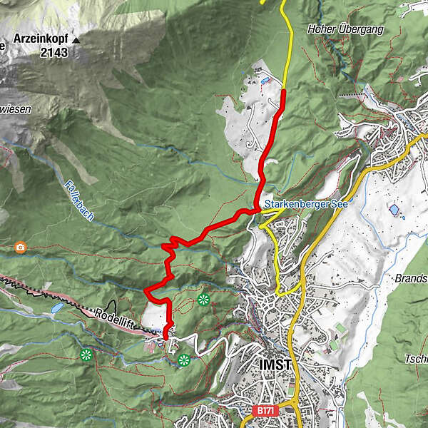
4.71km
978
- 1,067m
134hm
134hm
00:30h
- Difficulty
-
medium
- Rating
-
- Starting point
-
Hoch-Imst
- Route
-
HochimstSonneck0.0 kmImst (827 m)0.2 km
- Best season
-
JanFebMarAprMayJunJulAugSepOctNovDec
- Highest point
- 1,067 m
- Rest/Retreat
-
Einkehrmöglichkeiten in Hoch-Imst und Imst
- Ticket material
-
Imst Tourismus
GPS Downloads


Surfaces
Asphalt
Gravel
Forest
Mountain paths
Single trails
Trial
Traffic
Other tours in the regions
-
Outdoorregion Imst
42
-
Imst
20