- Brief description
-
Together with Pastor Martin Ferner, Hans Staud has created the Romedius Pilgrim's Way from Thaur to San Romedio with the help of various records and maps. The impressive pilgrimage path provides the pilgrim with moments of rest and contemplation. Along the way you cross borders - not only those between North Tyrol, South Tyrol and Trentino but also your own borders.
Discover your spiritual side on the traces of Saint Romedius.
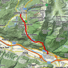
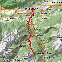
From the Romediuskirchl in Thaur along the St. Romedius Path down into the Inn Valley, on to Innsbruck, through the wildly romantic Sill Gorge to the Stefansbrücke bridge and on the gallery path to Mieders in the Stubaital.
- Difficulty
-
medium
- Rating
-
- Route
-
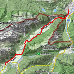
Schlosskirche St. RomediusRomediwirt0.0 kmThaur (633 m)1.0 kmRum (621 m)2.0 kmMarienkapelle2.3 kmGewerbegebiet Mühlau/Arzl5.6 kmSillzwickel7.0 kmKärntner Park7.6 kmDreiheiligen8.6 kmInnsbruck (574 m)8.9 kmTivoli9.6 kmUnterberg17.2 kmRestaurant Europabrücke19.0 kmSchönberg im Stubaital (1,013 m)20.1 kmPfarrkirche Mariä Geburt23.6 kmMieders (952 m)23.7 kmKalvarienberg-Kirchlein24.0 km
- Best season
-
JanFebMarAprMayJunJulAugSepOctNovDec
- Description
-
From the Romediuskirchl in Thaur along the St. Romedius Path down into the Inn Valley, on to Innsbruck, through the wildly romantic Sill Gorge to the Stefansbrücke bridge and on the tunnel climb to Mieders in the Stubaital.
- Directions
-
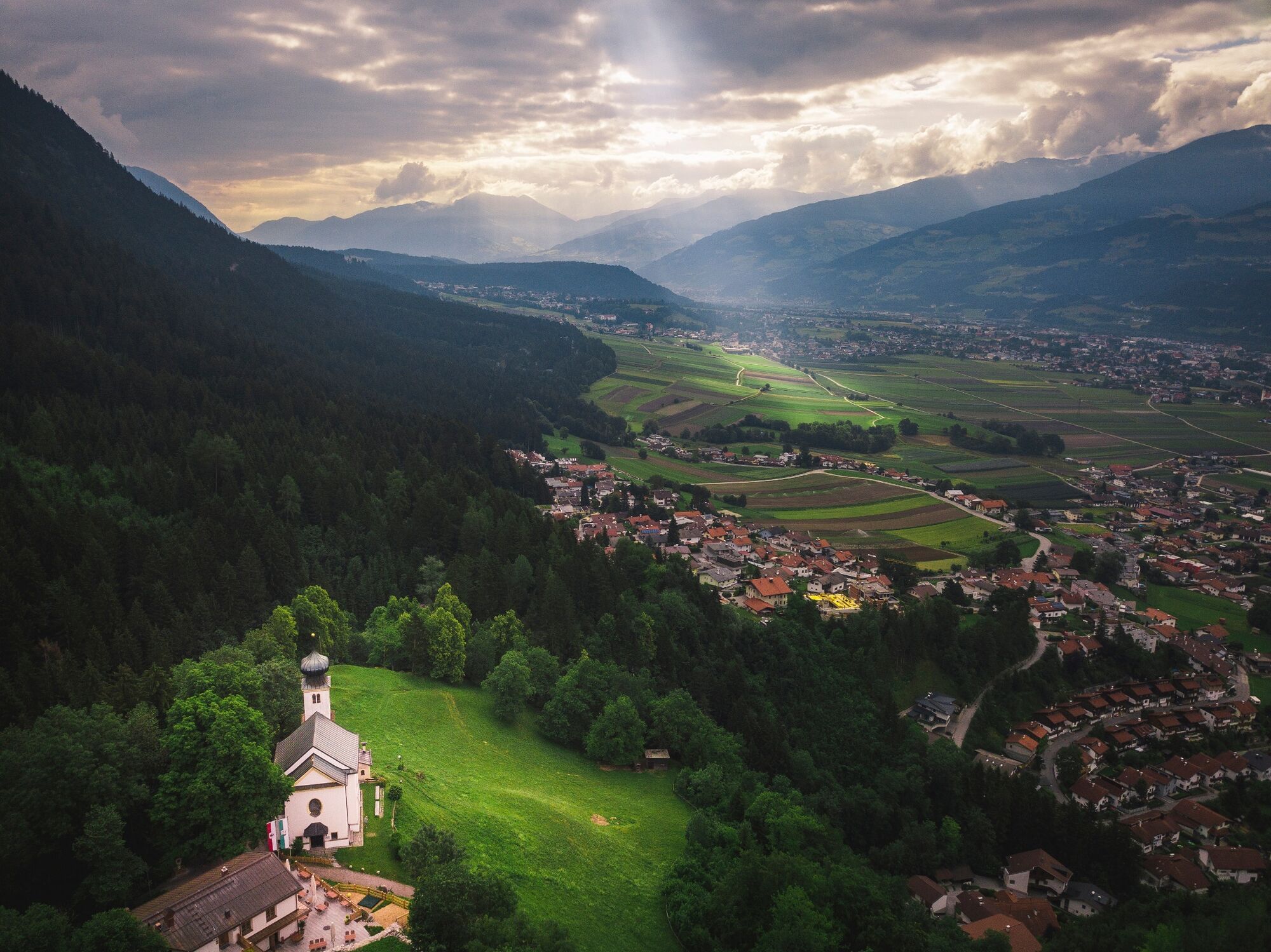
The pilgrimage trail begins in Thaur near the Romedius Church at 790 m, with a magnificent view of the Inn Valley and far into the Wipptal and Stubaital, where today's stage ends.
We walk through the portal of the former castle of Thaur, down the gravel path and turn right at the first fork into the St. Romedius Path. At a farmhouse on St. Romedius path no. 6, it is worth taking a look at an old mural painting depicting St. Romedius and the original village of Thaur.
From Thaur we walk along a dirt road via Rum, passing the Chapel of Mary on the left and reaching the roundabout. Shortly before, on the path, we descend to the junction of Murstraße - Auweg and continue on the right, past the secondary school, along the field path, then above the railway line on a narrow path to a path. Follow this path briefly down and further north of the railway line to Schusterbergweg.
From the railway underpass at Schusterbergweg, walk along the pavement to the main road. Cross the road and the river Inn and after the bridge walk along the banks of the Inn, along the footpath past the "Sandwirt" inn, until the confluence of the Sill and Inn rivers. Continue along the footpath along the banks of the Sill through the city park, cross the Amraser Straße, continue along the banks of the Sill, cross the Trienter bridge until you reach a tunnel. Immediately before this tunnel, the path branches off to the right into the Sill gorge.
Over a pedestrian bridge we reach the Sill gorge. Follow the path in the narrow romantic gorge until just before the second bridge. From there we continue on the narrow, somewhat exposed Seberiny Steig, which runs a little sideways to the Sill, following it until we reach the Zenzenhof Bridge. Continue straight on along the road, pass the railway underpass and turn right after about 50 metres. Follow this path uphill to the ÖAMTC site - then follow the signs "Vill-Unterberg" on the road to Unterberg station. Cross the Sill River on a mighty metal bridge and the inn "Stefansbrücke" appears in front of us on the opposite side of the valley (refreshment stop).
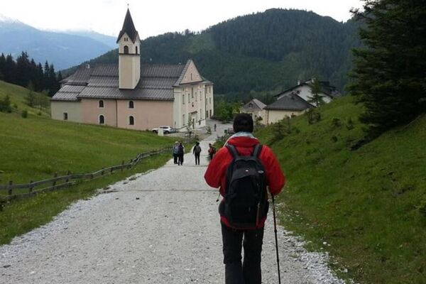
Above the inn on the way further past the monument commemorating the journey of Pope Pius VI, towards Schönberg - Mieders. About 100 m after a large water basin, the tunnel path branches off to the right. On the flat forest path we hike for about 1 hour until we reach a forest path and meet the "Quo vadis Pilgrims' Way". Follow the signs for the "Quo vadis Pilgrim's Way" and you will reach the centre of Mieders, passing the princely house in Mieders, which was the summer residence of the prince-bishops of Brixen in the 18th century. Today's destination is the small chapel on the Calvary in the centre of Mieders on a small mountain.
- Highest point
- 968 m
- Endpoint
-
Mieders
- Height profile
-

- Public transportation
-
With bus 501, 502 or 503 to "Thaur Mitte"
-

-
AuthorThe tour Romedius Pilgrim`s Way is used by outdooractive.com provided.


General info
-
Innsbruck und seine Feriendörfer
1520
-
Igls
440