

- Brief description
-
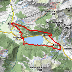
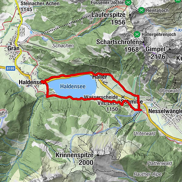
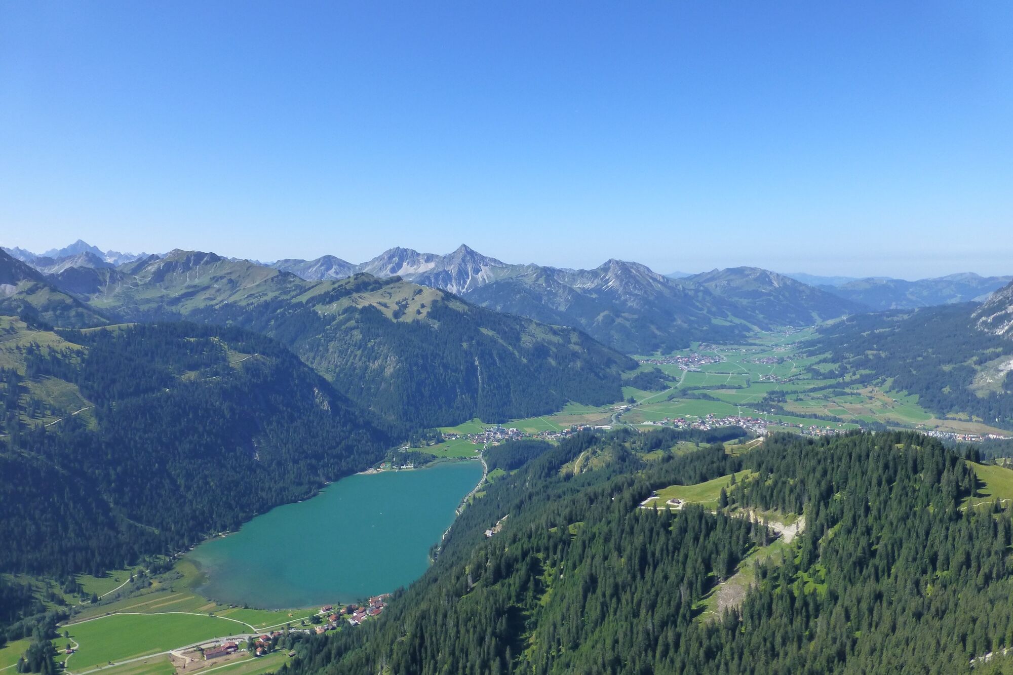
A wonderful running round, enjoy the beautiful landscape around the Haldensee
- Difficulty
-
easy
- Rating
-
- Starting point
-
Lift parking Krinnenalpe in Nesselwängle
- Route
-
Schmitte0.3 kmDreikreuzkapelle0.7 kmHaller1.7 kmVia Salina Hotel am See2.0 kmHaldensee3.6 kmSchmitte6.8 km
- Best season
-
JanFebMarAprMayJunJulAugSepOctNovDec
- Description
-
Experience the running and Nordic Walking Arena Tannheimer Tal
Whether you are a breathless beginner or a well-trained mountaineer: in the Tannheimer Tal everyone who likes to get some fresh air and explore the surrounding mountains on foot gets his money's worth. All active people, from hobby sportsmen to professionals, are spoilt for choice day after day: Tyrol's largest path network offers 26 marked routes which extend over a total of 186 kilometres. Beginner's loops are just as much a part of it as demanding mountain runs. And so that all guests know which route suits their physical condition and requirements, a specially prepared map and small boards provide information about the elevation profile, reason for difficulty and length of the route - the running and Nordic walking map.
Along meadows, over green pastures, along glittering mountain lakes... Walking and running in the Tannheimer Tal is not only the best training for the body, but above all a balm for the soul. The starting points for all those hungry for exercise are in the six villages Tannheim, Grän- Haldensee, Nesselwängle-Haller, Zöblen, Schattwald and Jungholz. From here, walkers, Nordic walkers and runners follow the signs. They are easy to recognize: Male with the sticks. In addition, all routes, as well as ski slopes, are divided into the categories black, red and blue. An optimal marking, which among other things has contributed to the fact that since 2005 the probably most beautiful high valley in Europe can officially call itself "Running and Walking Competence Tower".
- Directions
-
Head north past the sports centre and along the main road along the stream to the Sulzbach fork in the road. Continue west to Haller and above the Haldensee lake parallel to the main road. Keep left at the Haldensee fork and cross the main road at the zebra crossing. Past the lido and at the bridge keep left along the southern shore of Haldensee until you reach the starting point.
- Highest point
- 1,185 m
- Endpoint
-
Lift parking Krinnenalpe in Nesselwängle
- Height profile
-

- Equipment
-
Die persönliche Ausrüstung muss sicher und gebrauchsfähig sein und dem jeweiligen technischen Standard entsprechen. Jedem wird empfohlen, sich in Fachliteratur oder vor Ort über die geplanten Touren zu informieren. Vollständige Ausrüstung auch für Geübte unbedingt empfohlen!
- Safety instructions
-
It should be noted that running and walking may involve a risk of accident and injury. Despite careful route planning, a basic risk always remains. Tour preparation through endurance sports, appropriate technical training and further education as well as personal prudence reduces the risk of accidents and injuries.
- Tips
-
Benches on the banks of the Haldensee invite you to linger.
- Additional information
-
Tourist office Tannheimer Tal
- Directions
-
On the motorway A7 at the exit "Oy-Mittelberg" on the B310 towards Wertach and to Oberjoch. There follow the signposting "Tannheimer Tal" B199 until you reach Nesselwängle. From the Tyrolean side via Reutte on the B198 towards Lechtal until Weißenbach, over the Gaichtpass along the B199 until Nesselwängle.
- Public transportation
-
By train to Sonthofen, Pfronten/Ried or Reutte, then by bus to Nesselwängle.
- Parking
-
Lift parking place in Nesselwängle - with costs

-

-
AuthorThe tour Haller Haldensee round is used by outdooractive.com provided.


General info
-
Allgäu
101
-
Tannheimer Tal
47
-
Nesselwängle
29