© Ferienregion TirolWest - Rupert Gapp

© Ferienregion TirolWest - Huber Roman

© Ferienregion TirolWest - Auer Erich

© Ferienregion TirolWest - Huber Roman

© Ferienregion TirolWest - Rupert Gapp
- Brief description
-
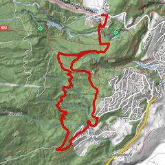
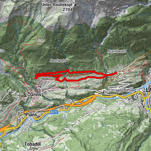
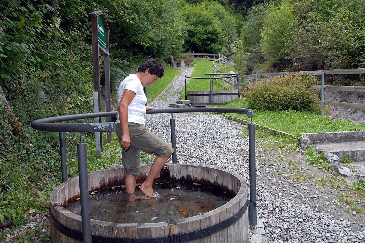
Der Ausgangspunkt dieser wunderschönen Runde ist das Zwetschkendorf Stanz. Entlang von Wiesen und Obstkulturen gelangt man zur Grinner Kneippanlage, die zur wohltuenden Erfrischung einlädt. Auf teilweise schmalen Waldwegen entlang eines Teils des Waals führt die Route wieder ins Dorf zurück.
- Route
-
Stanz bei Landeck (1,040 m)Laurentiuskapelle0.1 kmLoch0.2 kmDorfwirt Stanz0.2 kmGempelkapelle1.7 kmDorfwirt Stanz6.5 kmLoch6.6 kmLaurentiuskapelle6.6 kmStanz bei Landeck (1,040 m)6.8 km
- Highest point
- 1,176 m
- Height profile
-


- Author
-
The tour Stanz - Grins is used by outdooractive.com provided.
GPS Downloads


Other tours in the regions