- Brief description
-
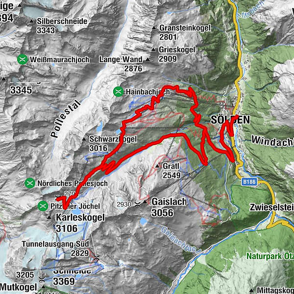
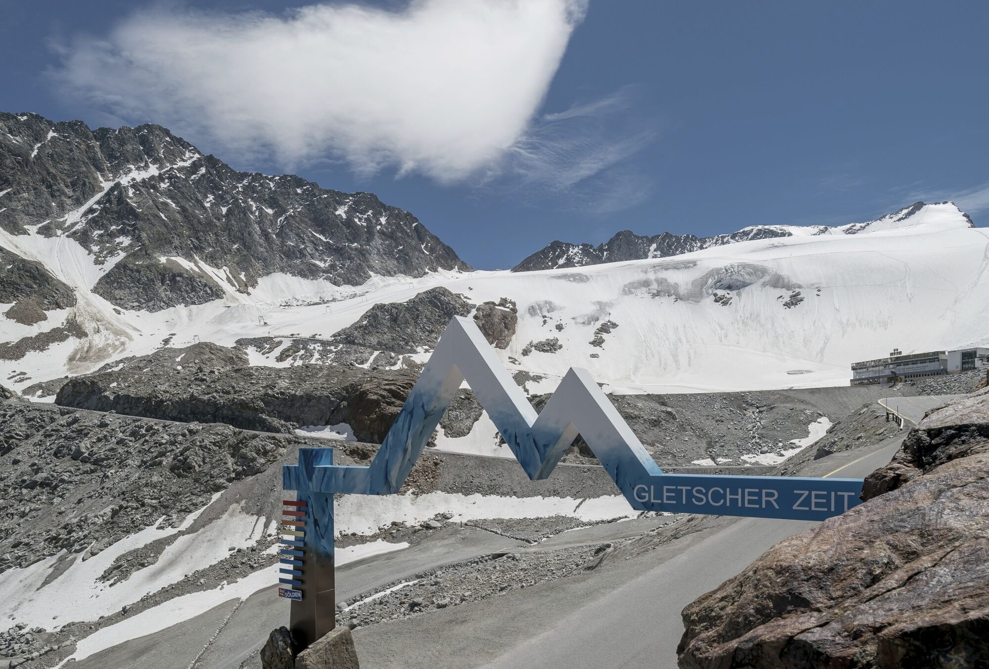
The queen's stage for all mountain bike aficionados in Sölden, leading up to the eternal ice of Rettenbach Glacier at 2800 m above sea level.
- Difficulty
-
difficult
- Rating
-
- Route
-
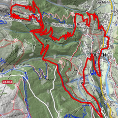
Mariä Heimsuchung0.3 kmSölden (1,368 m)0.4 kmSee1.3 kmWald2.2 kmKehre 12.8 kmKehre 23.0 kmInfang3.1 kmKehre 34.8 kmKehre 46.1 kmKehre 510.7 kmKehre 611.0 kmKehre 711.7 kmKehre 812.0 kmRotkogelhütte19.8 kmHainbachkar20.2 kmHochsölden (2,083 m)23.8 kmKehre 327.2 kmInfang28.7 kmKehre 228.7 kmKehre 129.0 kmWald29.7 kmSee30.6 kmSölden (1,368 m)31.6 kmMariä Heimsuchung31.6 km
- Best season
-
JanFebMarAprMayJunJulAugSepOctNovDec
- Description
-
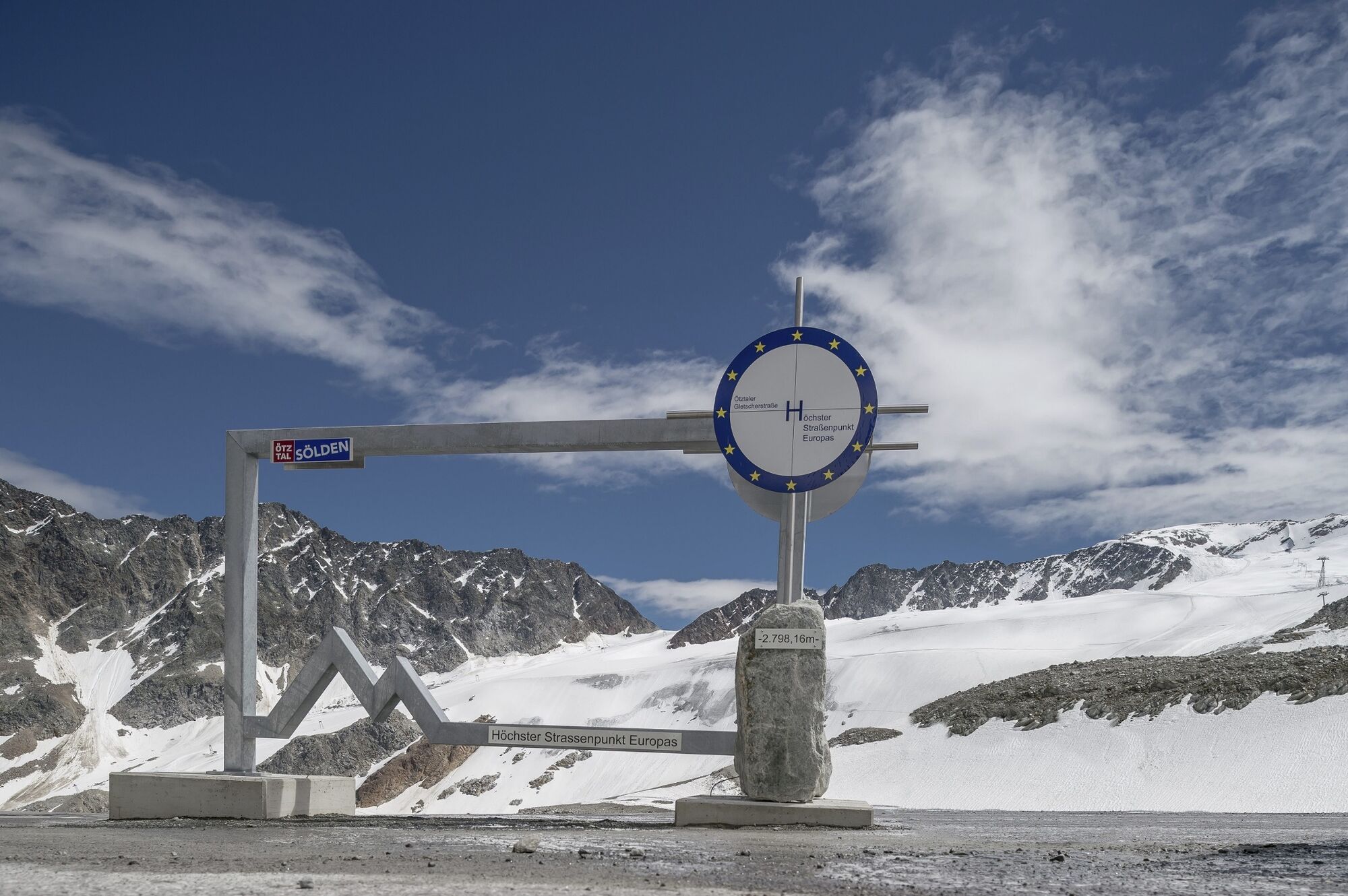
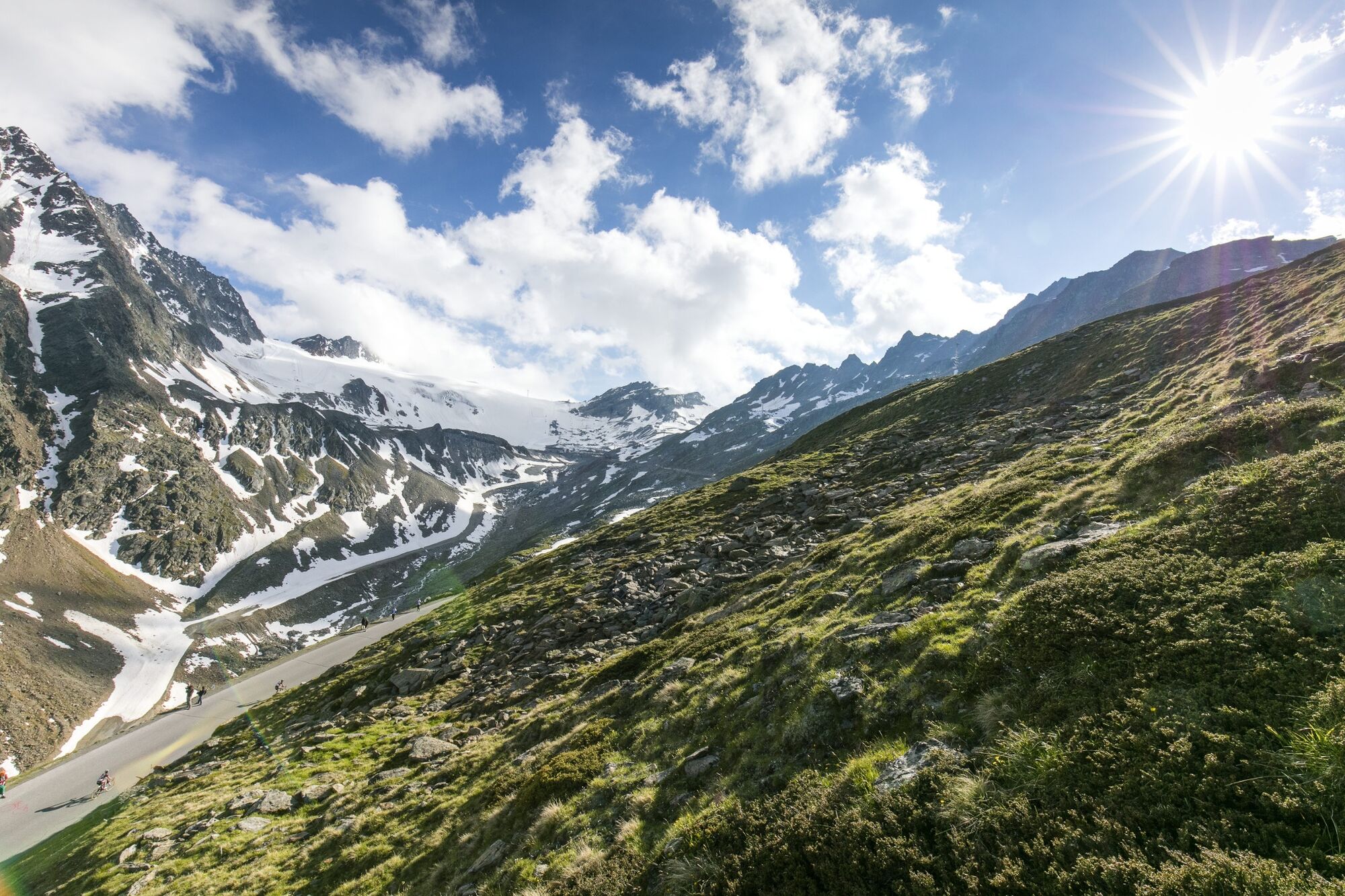
Even the key features of this challenging mountain bike tour are quite impressing: 32 kilometers (6.5 km above 2500 m) and 1600 meters of altitude gain! For sure, this is one of the valley's most demanding routes. From Freizeit Arena you follow the federal road towards the upper valley, turn right at the BP gas station after approx. 1 km. The climbing road takes you through the hamlets of Außerwald and Innerwald to the Glacier Road. Here you start the almost endless climb on the Ötztal Glacier Road, following the tracks of highly renowned cycling events like the queen's stage of the Tour de Suisse and Deutschland Tour. Also for the Pros it is a truly unique challenge to conquer 1500 altitude meters in a row. The highest point is the car park of Rettenbach Glacier at 2800 m - Europe's highest road point! The same road takes you back to Freizeit Arena, a great downhill ride.
- Directions
-
Even the key features of this challenging mountain bike tour are quite impressing: 32 kilometers (6.5 km above 2500 m) and 1600 meters of altitude gain! For sure, this is one of the valley's most demanding routes. From Freizeit Arena you follow the federal road towards the upper valley, turn right at the BP gas station after approx. 1 km. The climbing road takes you through the hamlets of Außerwald and Innerwald to the Glacier Road. Here you start the almost endless climb on the Ötztal Glacier Road, following the tracks of highly renowned cycling events like the queen's stage of the Tour de Suisse and Deutschland Tour. Also for the Pros it is a truly unique challenge to conquer 1500 altitude meters in a row. The highest point is the car park of Rettenbach Glacier at 2800 m - Europe's highest road point! The same road takes you back to Freizeit Arena, a great downhill ride.
- Highest point
- 2,791 m
- Endpoint
-
Freizeit Arena
- Height profile
-

- Additional information
-
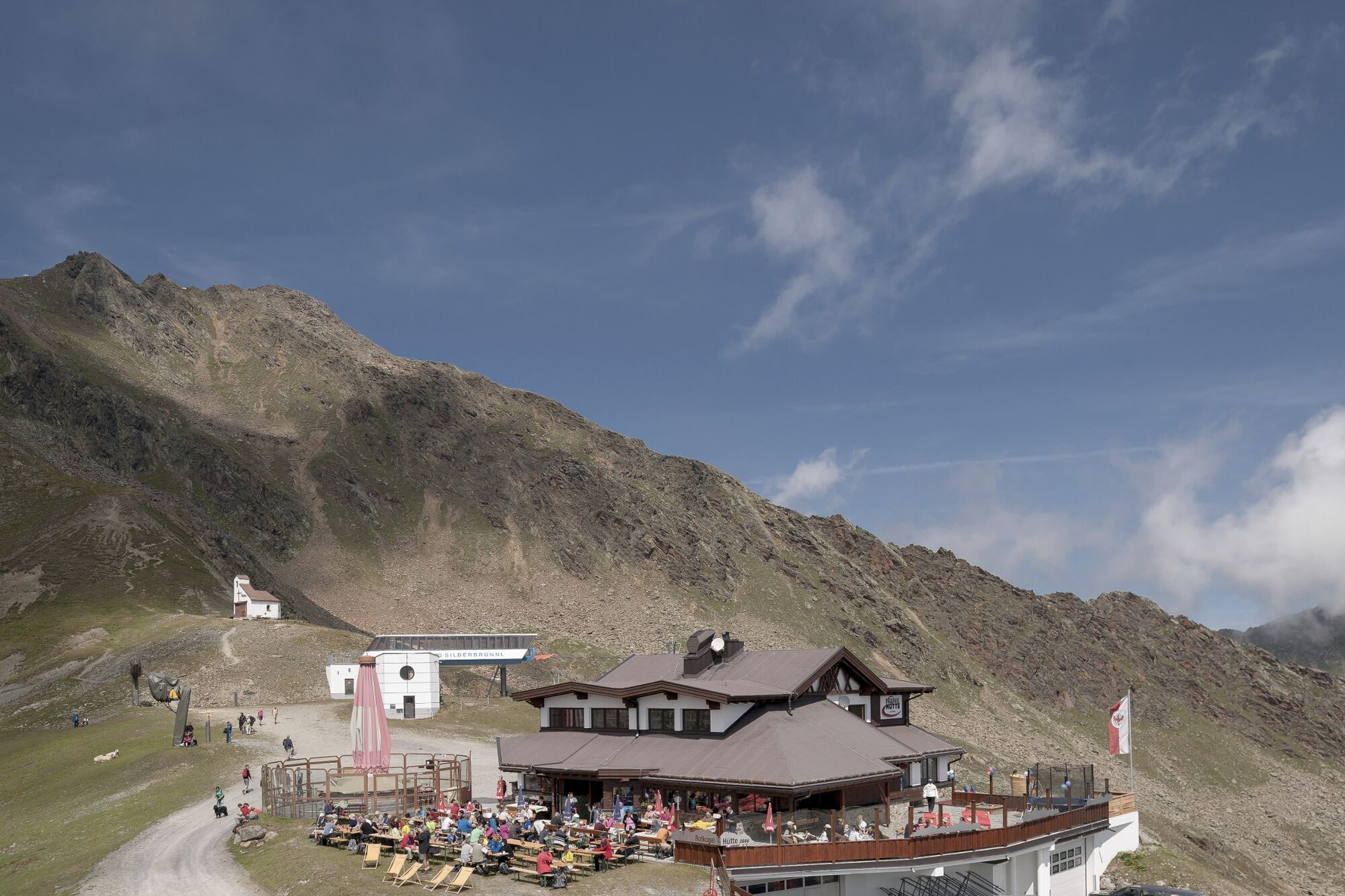
You should still have some energy left for the descent as there is another strenuous climb - 150 altitude meters - up to Rotkogeljoch Hütte where the downhill trail to Sölden starts. Biking through the wide open slopes of Sölden's "Golden Gate" ski area is a true pleasure but requires excellent biking techniques due to very steep and demanding gravel paths. From Hochsölden you take the asphalt road leading down to Sölden's village center.
Alternatively, also other single trails lead down to Sölden.
Leiterberg Trail (672) - Traien Trail (677) - Harise Trail (670)
More details about biking & cycling in Ötztal: https://www.oetztal.com/biken
- Directions
-
WHERE IS SÖLDEN?
Sölden is located in the West of Austria, more exactly in the Province of TIROL. It nestles amidst the ÖTZTAL Valley, a south-facing side valley of the Inntal.
Best travel route from the West:
From Vorarlberg to Tirol via Arlberg Pass or through Arlberg Tunnel (S 16 Federal Road) - direction Landeck - change to A 12 Autobahn (direction Innsbruck) - exit: Ötztal after driving through Roppener Tunnel - on B 186 Federal Road (35 km) to Sölden
From the North:
- Bad Tölz - Achen Pass - B 181 Federal Road - Jenbach - A 12 Autobahn towards Innsbruck (direction Bregenz) - exit: Ötztal - B 186 Federal Road (35 km) to Sölden
- Pfronten - Reutte - Fernpass - Imst - A 12 Autobahn (direction Innsbruck) - exit: Ötztal after driving through Roppener Tunnel or on B 171 Federal Road to Ötztal (no Vignette toll-sticker required!) - B 186 Federal Road (35 km) to Sölden
- Garmisch Partenkirchen - Ehrwald - Lermoos - Fernpass - Imst - A 12 Autobahn (direction Innsbruck) – exit: Ötztal after driving through Roppener Tunnel or on B 171 Federal Road to Ötztal (no Vignette toll-sticker required!) - B 186 Federal Road (35 km) to Sölden
- Garmisch Partenkirchen - Mittenwald - Scharnitz - Seefeld - Telfs - A 12 Autobahn (direction Bregenz) - exit: Ötztal or on B 171 Federal Road to Ötztal (no Vignette toll-sticker required!) - B 186 Federal Road (35 km) to Sölden
From the East:
Munich or Salzburg - A 93 Autobahn to Kufstein - A 12 Autobahn (direction Bregenz) via Innsbruck – exit: Ötztal - B 186 Federal Road (35 km) to Sölden
From the South:
From Bozen/Bolzano towards Brenner Pass (toll road) – on Brenner Autobahn via Schönberg toll station (direction Innsbruck) to Innsbruck - then change to A 12 Autobahn (direction Bregenz) – exit: Ötztal - B 186 Federal Road (35 km) to Sölden
- Public transportation
-
Arriving by Train
Enjoy a comfortable and relaxing train ride to the train station in Ötztal Bahnhof. The public bus lines to all holiday resorts in the valley (direction Obergurgl) leave directly in front of the train station. The bus ride to Sölden takes about 1 – 1.5 hours.
All important details on bus timetables, direct connections and taxi services are available here.
- Parking
-
There are ample parking areas and covered parking garages at the base stations of Gaislachkogl and Giggijoch Mountain Gondolas. Parking is free of charge between 8.00 am and 7.00 pm!
Night-time parking of motor cars is subject to a charge and allowed only in the parking garage next to Gaislachkogl Mountain Gondola:

-

-
AuthorThe tour Bike Route Gletscher Express (648) is used by outdooractive.com provided.


General info
-
Ötztal
155
-
Hochsölden
61


")