


- Brief description
-
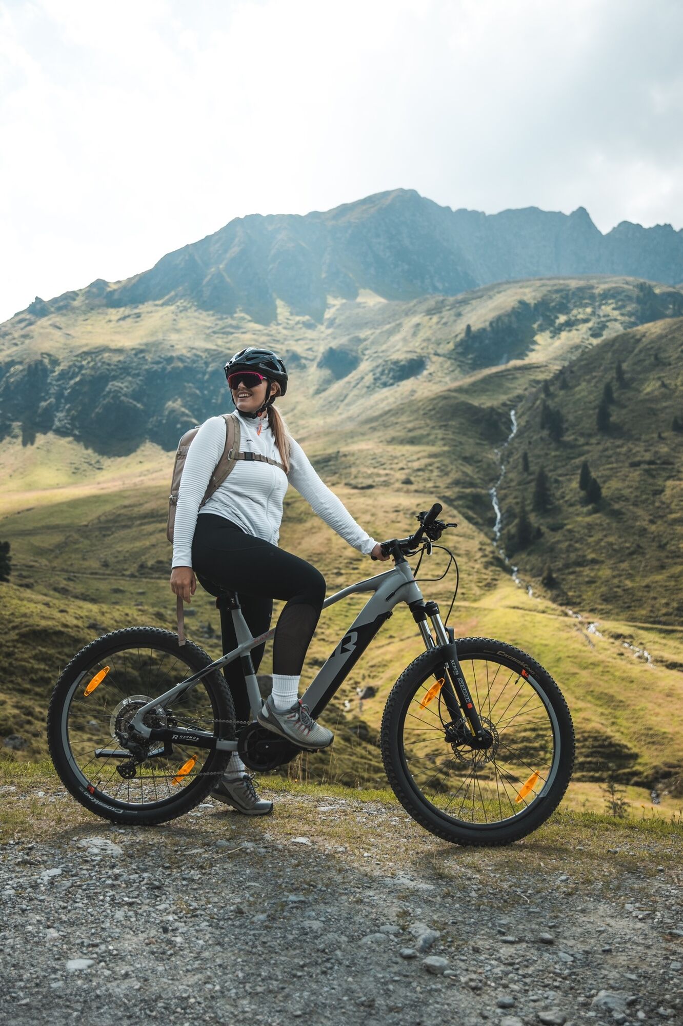
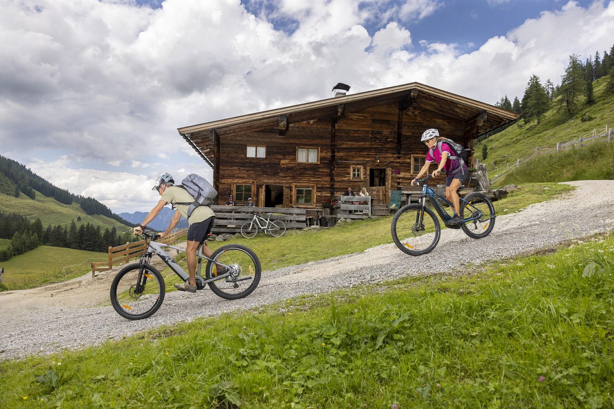
Combine a culinary bike tour to the Steinbergalm with an unforgettable mountain top experience! Ideal mountain bike or e-bike tour
- Difficulty
-
difficult
- Rating
-
- Starting point
-
Alpbach
- Route
-
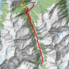
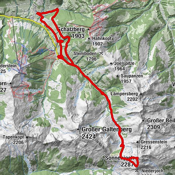
Pfarrkirche Alpbach0.0 kmAlpbach (975 m)0.0 kmHeiligenkasten0.0 kmRossmooskapelle2.2 kmAlpengasthof Roßmoos2.2 kmKreuz4.5 kmHubertuskapelle6.2 kmKühtalalm7.5 kmFaulbaumgarten Alm10.4 kmFaulbaumgartenalm (1,507 m)10.4 kmFilzalm (1,634 m)11.8 kmSteinbergalm12.4 kmSteinbergalm (1,712 m)12.6 kmSonnenjoch (2,287 m)15.4 kmSteinbergalm (1,712 m)17.6 kmFilzalm (1,634 m)18.3 kmFaulbaumgartenalm (1,507 m)19.7 kmFaulbaumgarten Alm19.7 kmKühtalalm22.5 kmHubertuskapelle23.9 kmBuamkapelle24.3 kmConny Tiroler Wirtshaus25.2 kmInneralpbach25.3 kmAlpbach (975 m)29.8 kmPfarrkirche Alpbach29.8 kmHeiligenkasten29.8 km
- Best season
-
JanFebMarAprMayJunJulAugSepOctNovDec
- Description
-
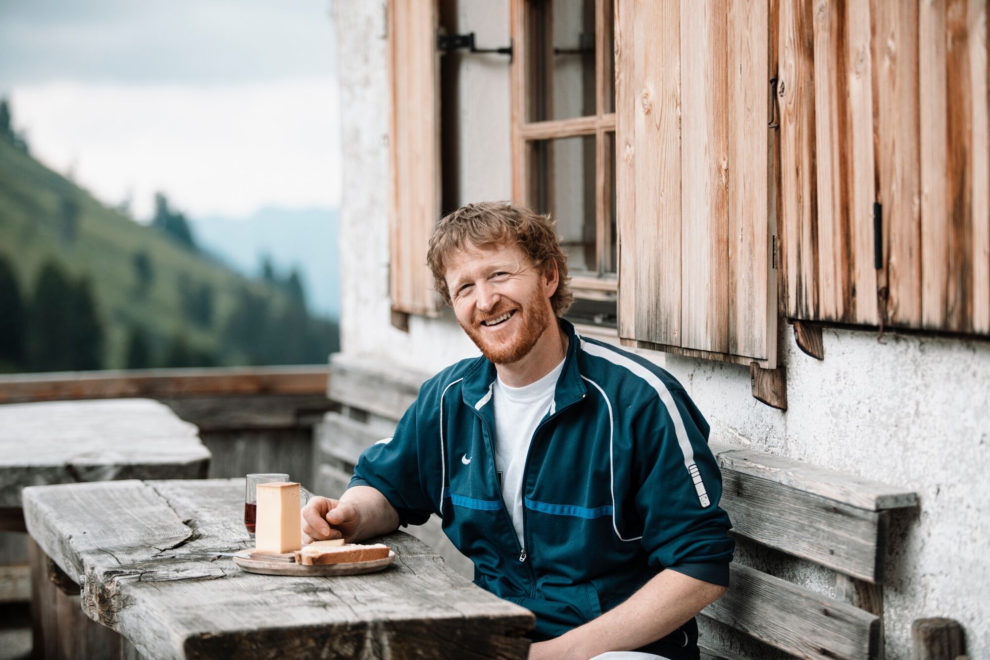
Bike:
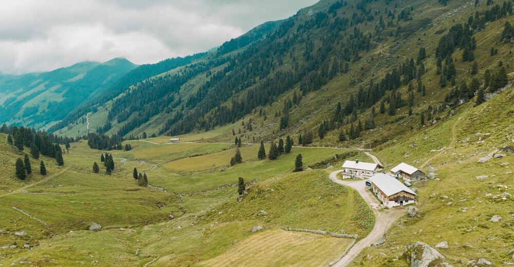
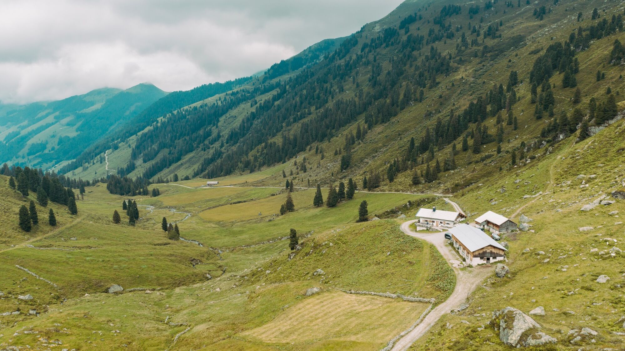
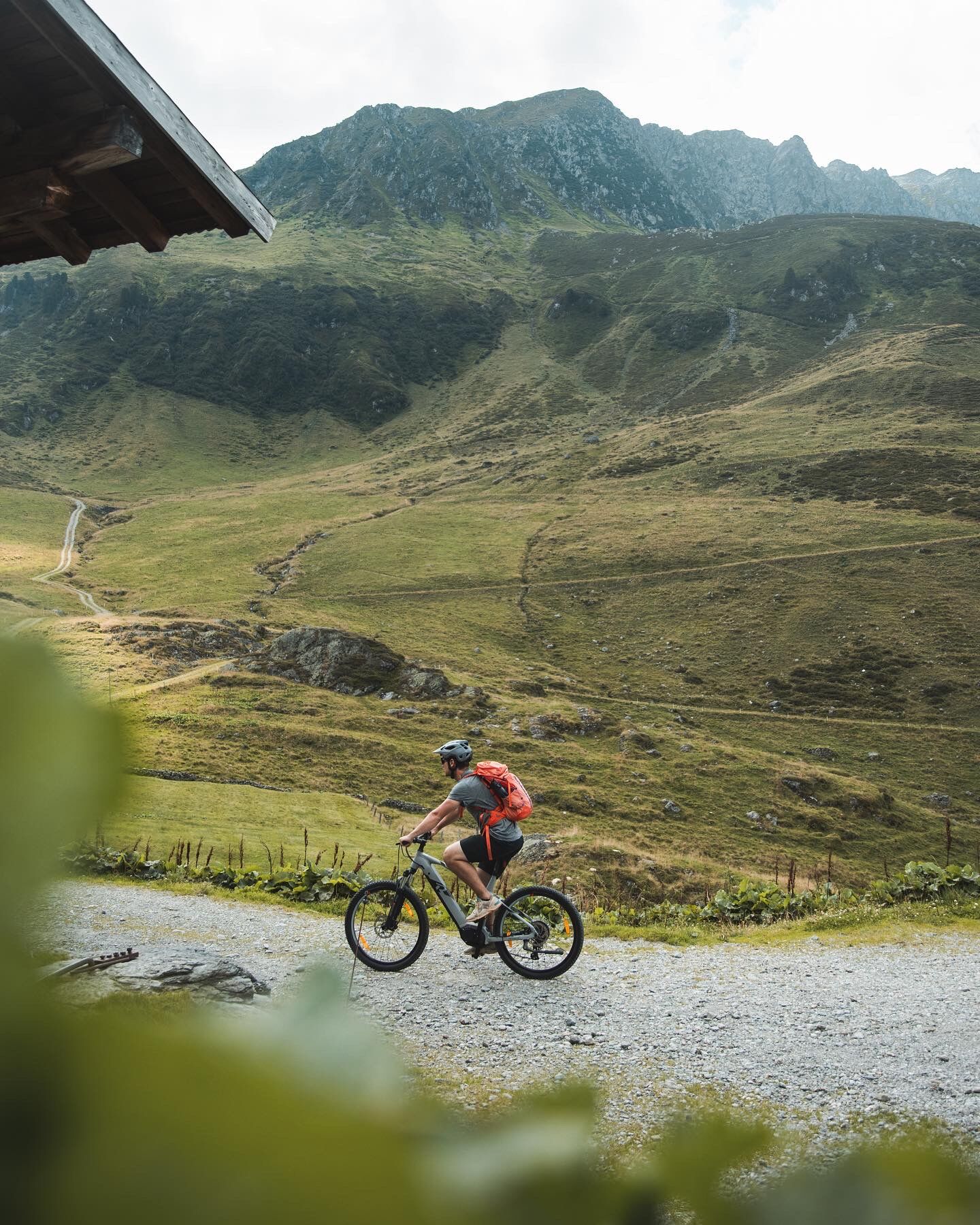
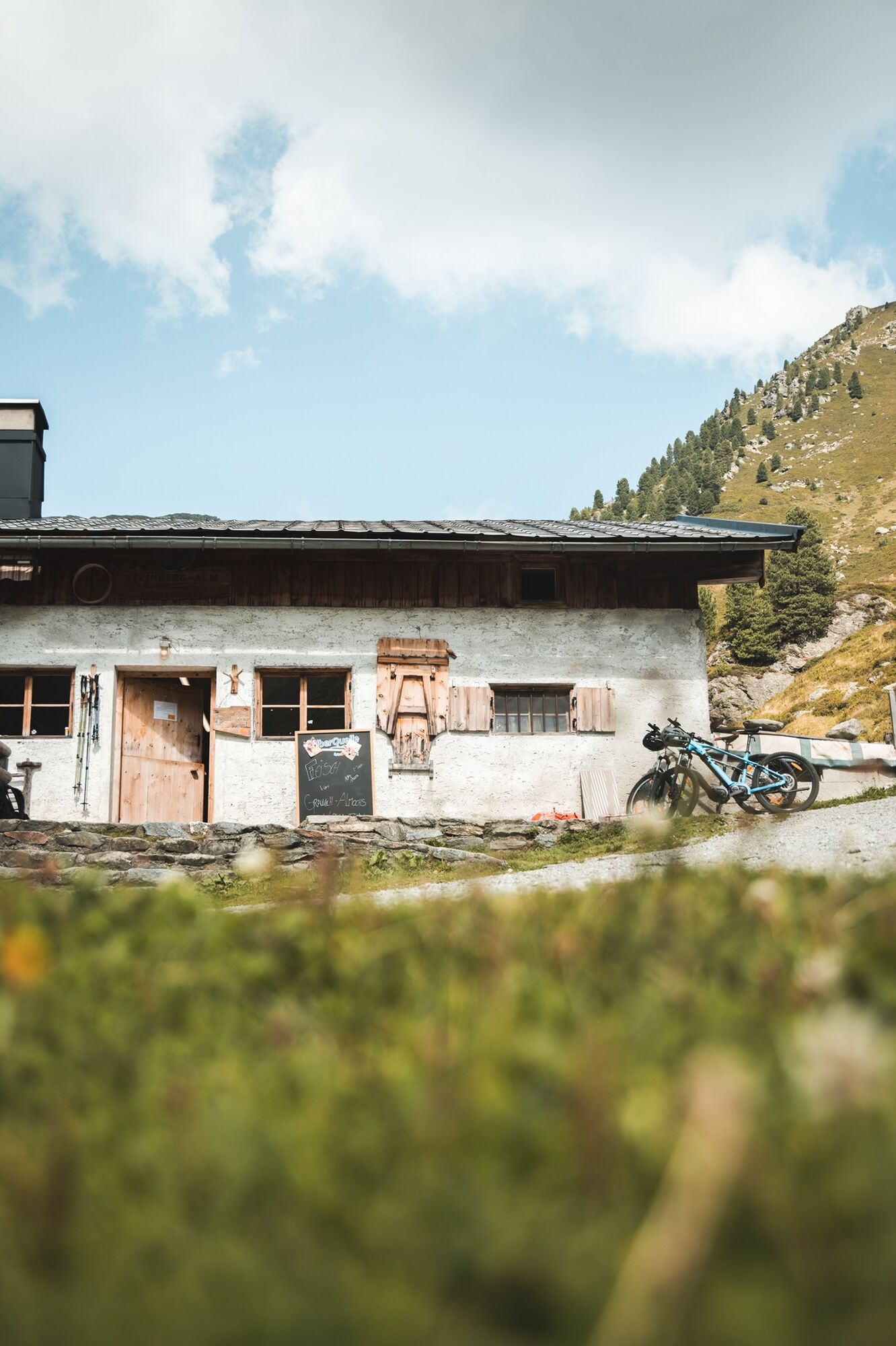
On a mountain bike or an e-bike up the Lueger Valley in Inneralpbach to the Steinbergalm. A culinary reward awaits cheese lovers at the Steinbergalm at the end of the Lueger Valley in Inneralpbach. Dairyman Hannes Klingler produces homemade cheese and grey cheese (Austrian speciality) on his alm. Try some of the cheese with a glass of fresh milk and enjoy the beautiful views.
Hike:
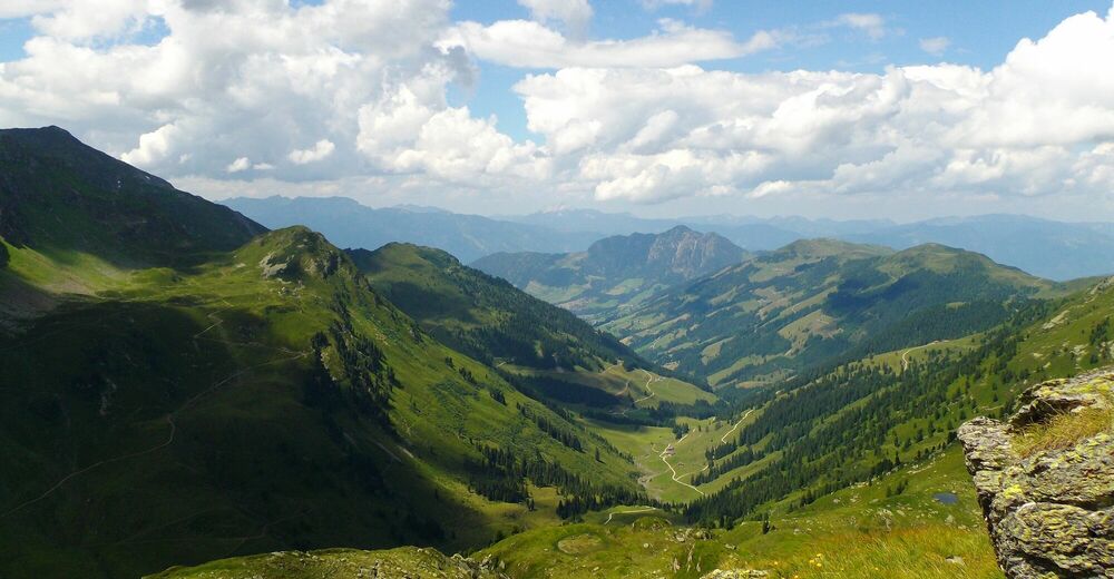
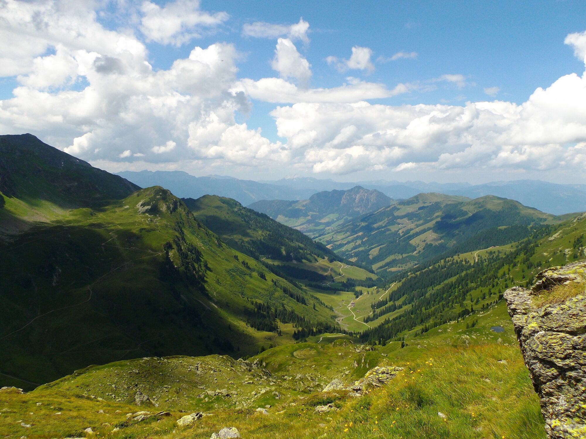
Following a tasty snack at the rustic hut hike up to 2.287 m to the Sonnjoch peak! The trail leads past the Otto-Leixl-Hütte to the Sonnjoch (approx. 1,5h walking time).
Enjoy the tranquil countryside and take in the splendid views before walking back to the Steinbergalm. Get back into the saddle and cycle back out the valley.
- Directions
-
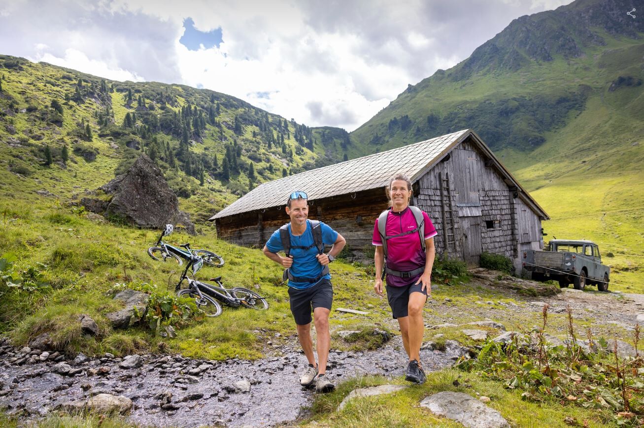
The tour starts in Alpbach. Cycle past the Congress Centre and along the Oberer Höhenweg. Enjoy the wonderful views towards the Großer Galtenberg and the other peaks. After crossing the cattle grid follow the road straight ahead up the Lueger Valley. The tarmacked road finishes at the Hochberg car park and becomes a forest track, leading gently uphill and then becoming steeper. After reaching the Faulbaumgartenalm at 1.490 m. You will reach the Steinbergalm after an approx. further 200 m elevation gain. Park your bike!
Follow the signs for the "Otto-Leixl-Hütte" and Sonnjoch. A pleasant trail leads in approx. 45 min walking time to the "Otto-Leixl-Hütte" (mountain refuge) and in a further approx. 1 h 15 min. to the Sonnjoch peak at 2.287 m.
Walk back to the Steinbergalm the way you came or take the steeper trail along the southern ridge above the Otto-Leixl-Hütte, which meets up with the other trail. You've deserved yourself a rest at the Steinbergalm before cycling back out the valley to Inneralpbach. At the car park next to the Galtenberg Bed & Breakfast hotel turn right and after crossing the bridge turn right again. Cycle uphill along the Mittlerer Höhenweg, when the tarmacked road finishes you will encounter a short section where you will need to push your bike. Follow the signs for Alpbach and back to the village centre.
- Highest point
- 2,285 m
- Endpoint
-
Alpbach
- Height profile
-

- Equipment
-
Helmet, sun glasses, bike shorts, rain proof jacket, hat, drinking bottle, map, first aid kit, mobile phone, camera, bike lock, replacement inner tube, mini tool kit, bike pump, puncture repair kit, sealing (repair) tape, sun cream, energy food (muesli bar), snack, ...
- Tips
-
Trying some of the delicious cheese is a must!
- Additional information
- Directions
-
A12, motorway exit Kramsach/Brixlegg, towards Brixlegg, Alpbachtal to Alpbach
- Public transportation
- Parking
-
Garage at the SPAR supermarket or opposite the garage below the fire brigade building

- Author
-
The tour Bike and Hike Steinbergalm - Sonnjoch is used by outdooractive.com provided.


General info
-
Alpbachtal
299
-
Alpbach
127