Tour data
9.03km
621
- 1,613m
986hm
03:00h
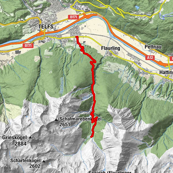
- Brief description
-
Anfangs leicht, dann brutal
- Difficulty
-
difficult
- Rating
-
- Route
-
Oberhofen im Inntal (622 m)Flauringer Alm9.0 km
- Best season
-
JanFebMarAprMayJunJulAugSepOctNovDec
- Highest point
- Flaurlinger Alm (1,613 m)
GPS Downloads


Surfaces
Asphalt
Gravel
Forest
Mountain paths
Single trails
Trial
Traffic
Other tours in the regions
-
Mieminger Plateau & Inntal
400
-
Flaurling
160