
- Brief description
-
Moderate tour to the Schleier Waterfall, a great outdoor experience.
- Difficulty
-
medium
- Rating
-
- Starting point
-
Tourist Info, Going (764 m)
- Route
-
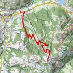
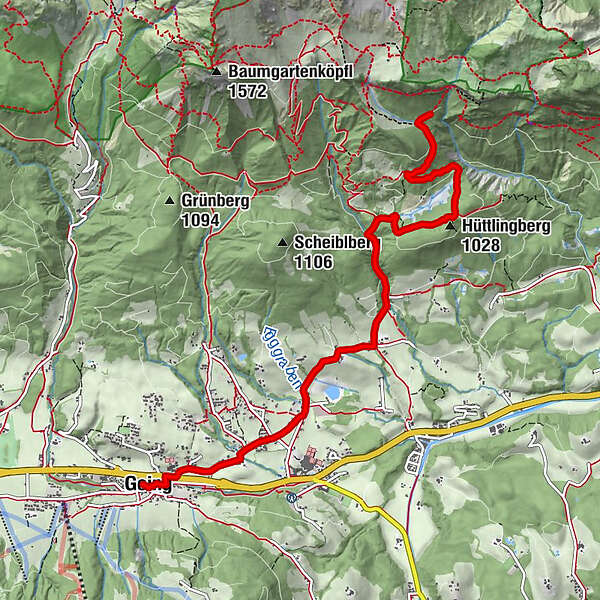
Going0.1 kmDorfwirt0.3 kmPramakapelle1.1 kmPrama1.2 kmAschingerkapelle3.3 kmSteinhügel4.1 kmKletterbock4.8 km
- Best season
-
JanFebMarAprMayJunJulAugSepOctNovDec
- Description
-
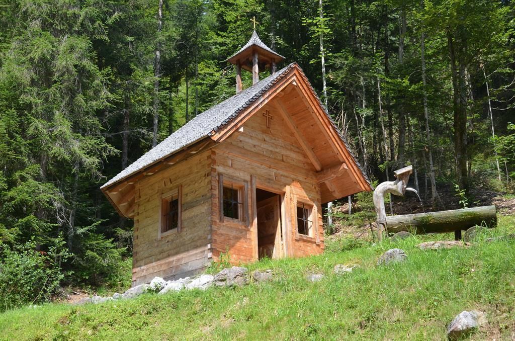
Start at the Tourist Info Going and cycle to the Raiffeisen Bank. Turn left there, cycle through the underpass and then right along Pramaweg, always towards the bathing lake. With the bathing lake on your left, following the road until you reach Hüttling car park. Here you can refresh yourself at the fountain and visit the beautiful Aschinger Chapel. Further on, the forest road leads mostly through the forest until almost below the Schleier Waterfall. The natural spectacle and climbing adventure can be reached on foot in about 15-20 minutes on a path through the forest. The same path leads back to Going.
- Directions
-
You start this medium-difficulty mountain bike tour at Going Tourist Information Office and follow the Dorfstrasse as far as the Raiffeisen Bank. There you turn left, go through the underpass and bear right along the Pramaweg. The trail takes you past buildings and cultivated meadows, continuously heading towards the lake. You bike past the bathing lake and carry on along the road, following the signs to “Schleierwasserfall”, to the Aschau car park. This is a perfect place to enjoy some refreshments and admire the lovely Aschingerkapelle chapel. From there a forest road takes you to just below the Schleier Waterfall. From there it’s only a few minutes on foot to the overhanging rock faces and the waterfall, a short walk which is really worthwhile. After a break during which you can observe the many climbers on the rock, you return by the same route.
- Highest point
- 1,100 m
- Endpoint
-
Tourist Info, Going (764 m)
- Height profile
-

- Equipment
-
Cycle helmet, comfortable cycling clothes, a change of clothes, wind protection, cycling gloves, poss. rucksack with water bottle and food, first aid kit, poss. servicing/repair kit, bike map, route description and information materials (GPX track), ID, insurance card, cash
- Directions
-
Heading from Wörgl or Kufstein on the B178 road, take the exit to Going. You will see the Tourist Info and the hiking starting point on the right-hand side after approx. 100 m.
Heading from St. Johann on the B178 road, take the first exit to Going and drive through the town until you see the Tourist Info and the hiking starting point on the left-hand side after crossing the bridge.
- Public transportation
- Parking
-
Car park opposite the hiking starting point of the Tourist Info (located to the left of the road and before the bridge) or Public car park Schedererfeld – free

- Author
-
The tour MTB Tour Schleier Waterfall is used by outdooractive.com provided.