

- Brief description
-
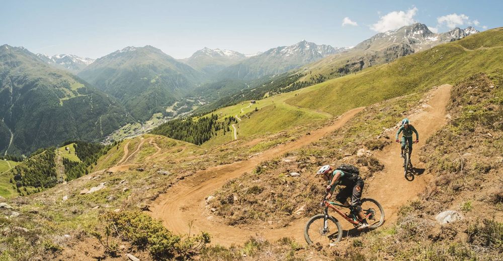
The challenging Gletscher Express reloaded Enduro Trail is nothing for the faint-hearted. Even expert enduro riders can expect a real challenge. On a total length of 30 km, covering about 1600 altitude meters, both stamina and physical skills are absolutely required.
- Difficulty
-
difficult
- Rating
-
- Route
-
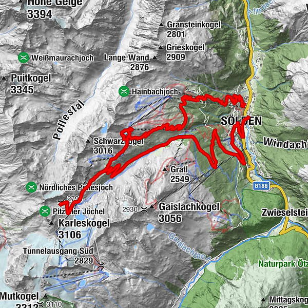
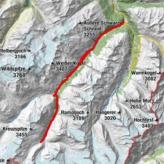
Mariä Heimsuchung0.3 kmSölden (1,368 m)0.4 kmSee1.4 kmWald2.2 kmKehre 12.8 kmKehre 23.1 kmInfang3.1 kmKehre 34.8 kmKehre 46.2 kmKehre 510.7 kmKehre 611.3 kmKehre 711.7 kmKehre 812.0 kmRotkogelhütte19.8 kmLangegg19.9 kmSeekogl19.9 kmSonnblick27.3 kmEugen's Obstlerhütte28.9 kmTalstation Obstlerhütte29.1 kmGrünwald31.4 kmLeite31.9 kmSölden (1,368 m)33.1 km
- Best season
-
JanFebMarAprMayJunJulAugSepOctNovDec
- Description
-
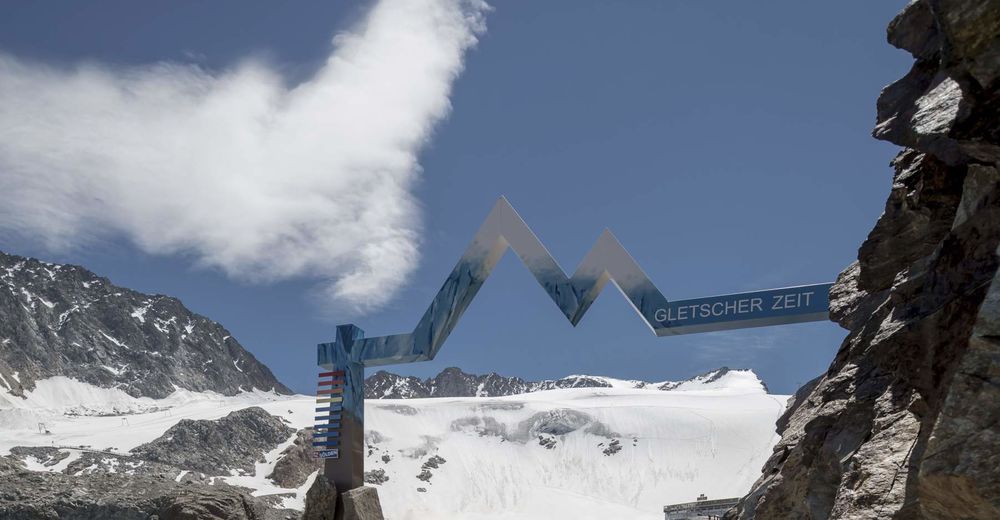
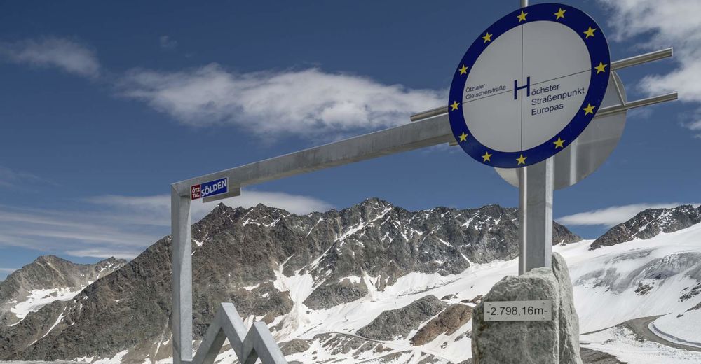
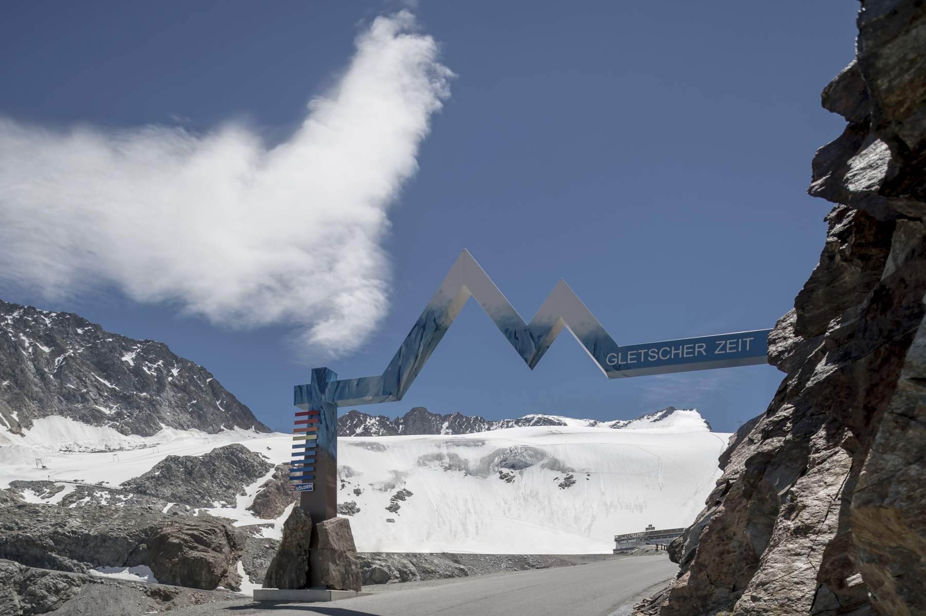
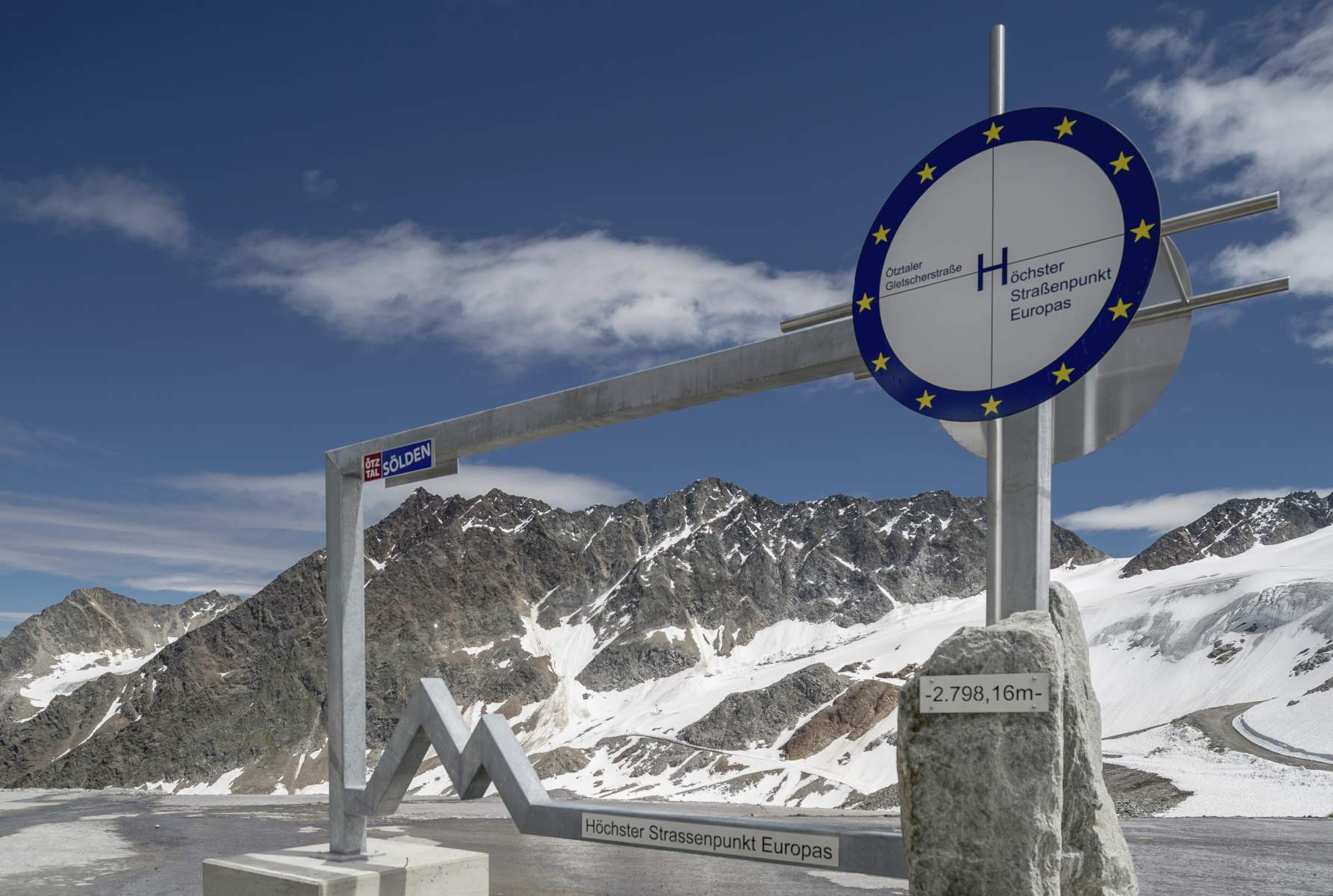
From Freizeit Arena you follow the federal road until you reach the BP gas station, there you turn right into the rising road up to the hamlets of Außerwald and Innerwald. Finally you reach the Glacier Road where you follow the Gletscher Express (648) mountain bike route to Rettenbach Glacier. Once arrived at the glacier, you'll need your ultimate muscle power to reach the tour's highest point and Europe's highest road point at 2800 meters above sea level.
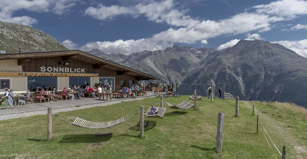
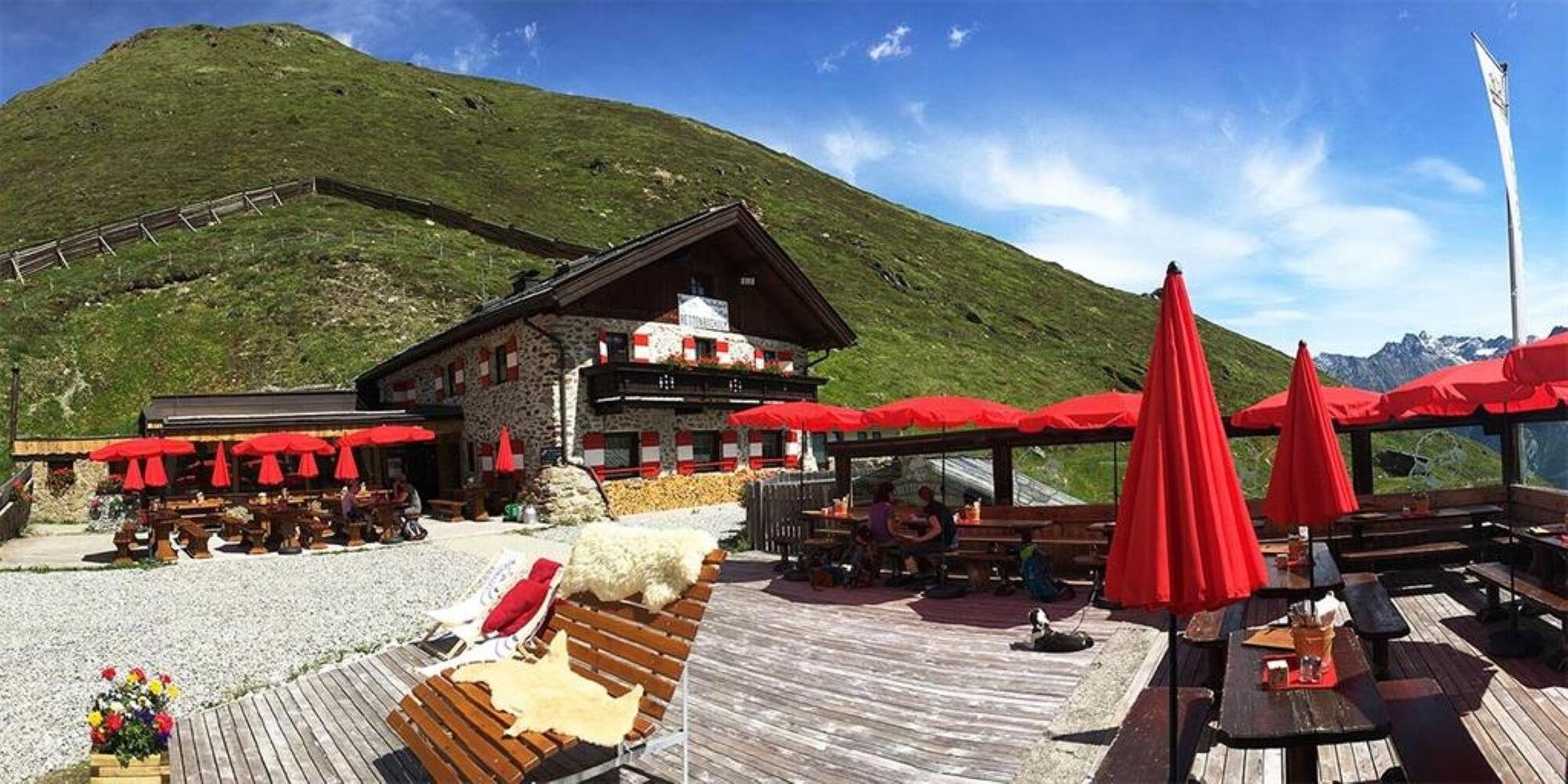
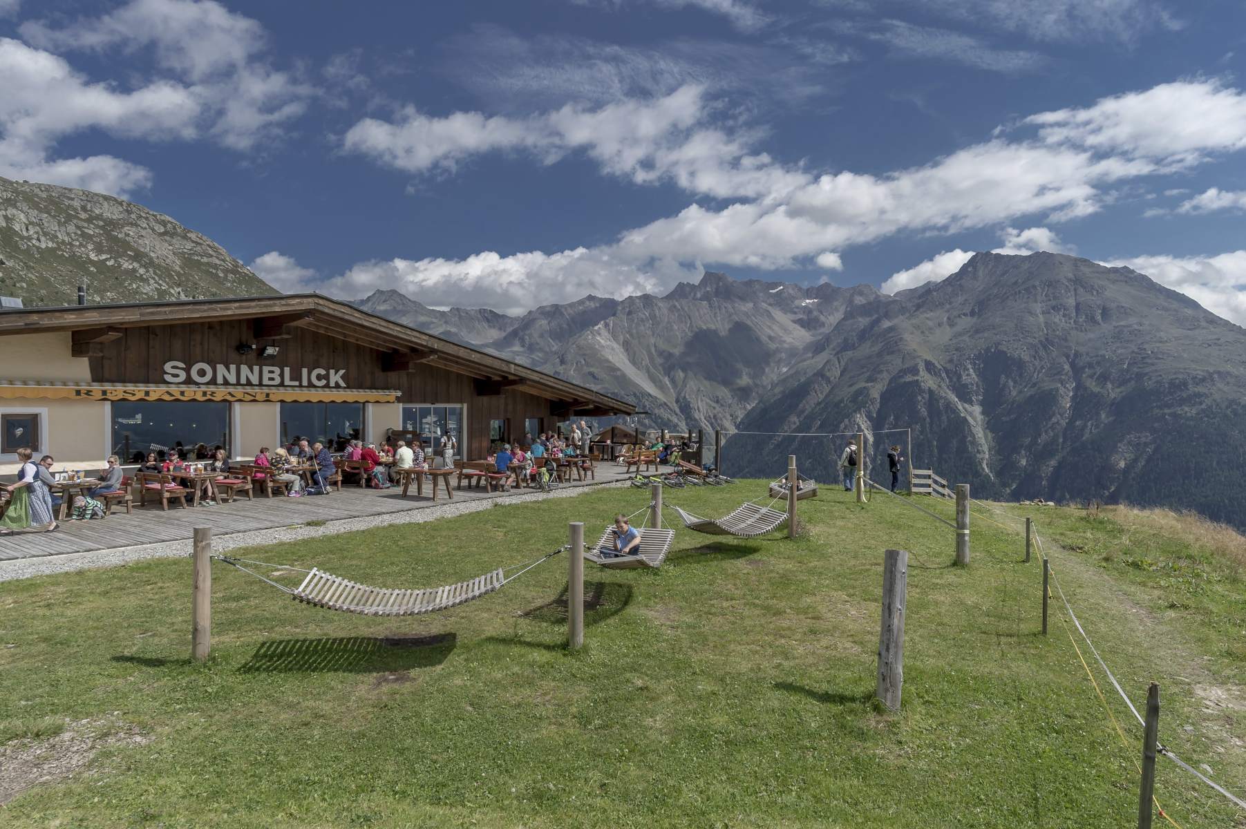
Indulge in picture-book panoramic views before you ride downhill on the Glacier Road. At the silo tower you turn left into the gravel path. A demanding uphill stretch takes you on the steep ski run up to Rotkogelhütte. Downhill again on the lush green ski slopes you get to the top station of the Giggijoch Mountain Gondola. Continue on the red Ollweite Line (6010) until the crossing with the Rettenbach Trail (675), that leads you right to the next refreshment stop at Sonnblick mountain restaurant.
Restore your energy on the sunny terrace, then take the Hochsölden federal road towards the Harise Trail (670) which starts in the 6th hairpin bend on the road from Hochsölden to Sölden. Be careful! It's quite challenging although there are many easily flowing sections. Some parts of the trail might be slippery and wet, and probably you'll find grazing cattle on the trail - which often leave their "traces"...
The trail ends in the hamlet of Grünwald. You return to Freizeit Arena on the asphalt road. All those who are still not tired enough can try the Lettn Line (6009) down to the base station of Giggijoch Mountain Gondola, and further on to Freizeit Arena.
- Highest point
- 2,791 m
- Endpoint
-
Freizeit Arena
- Height profile
-

- Equipment
-
Appropriate Equipment Rules! We strongly recommend to wear protective bike gear (knee and elbow pads, helmet, back protector, ...) on all lines, trails, enduro tracks and mountain bike routes within the BIKE REPUBLIC SÖLDEN. Enter the Republic only with a bike that meets current quality standards.
- Safety instructions
-
Harise Trail (670) is a technically very challenging route suitable only for very skilled bikers.
This one is a Shared Trail for both mountain bikers and hikers. Please show consideration for other sportspeople on the trail! Control your speed, especially on wet and slippery stretches.
- Additional information
- Directions
-
WHERE IS SÖLDEN?
Sölden is located in the West of Austria, more exactly in the Province of TIROL. It nestles amidst the ÖTZTAL Valley, a south-facing side valley of the Inntal.
Best travel route from the West:
From Vorarlberg to Tirol via Arlberg Pass or through Arlberg Tunnel (S 16 Federal Road) - direction Landeck - change to A 12 Autobahn (direction Innsbruck) - exit: Ötztal after driving through Roppener Tunnel - on B 186 Federal Road (35 km) to Sölden
From the North:
- Bad Tölz - Achen Pass - B 181 Federal Road - Jenbach - A 12 Autobahn towards Innsbruck (direction Bregenz) - exit: Ötztal - B 186 Federal Road (35 km) to Sölden
- Pfronten - Reutte - Fernpass - Imst - A 12 Autobahn (direction Innsbruck) - exit: Ötztal after driving through Roppener Tunnel or on B 171 Federal Road to Ötztal (no Vignette toll-sticker required!) - B 186 Federal Road (35 km) to Sölden
- Garmisch Partenkirchen - Ehrwald - Lermoos - Fernpass - Imst - A 12 Autobahn (direction Innsbruck) – exit: Ötztal after driving through Roppener Tunnel or on B 171 Federal Road to Ötztal (no Vignette toll-sticker required!) - B 186 Federal Road (35 km) to Sölden
- Garmisch Partenkirchen - Mittenwald - Scharnitz - Seefeld - Telfs - A 12 Autobahn (direction Bregenz) - exit: Ötztal or on B 171 Federal Road to Ötztal (no Vignette toll-sticker required!) - B 186 Federal Road (35 km) to Sölden
From the East:
Munich or Salzburg - A 93 Autobahn to Kufstein - A 12 Autobahn (direction Bregenz) via Innsbruck – exit: Ötztal - B 186 Federal Road (35 km) to Sölden
From the South:
From Bozen/Bolzano towards Brenner Pass (toll road) – on Brenner Autobahn via Schönberg toll station (direction Innsbruck) to Innsbruck - then change to A 12 Autobahn (direction Bregenz) – exit: Ötztal - B 186 Federal Road (35 km) to Sölden
- Public transportation
-
Arriving by Train
Enjoy a comfortable and relaxing train ride to the train station in Ötztal Bahnhof. The public bus lines to all holiday resorts in the valley (direction Obergurgl) leave directly in front of the train station. The bus ride to Sölden takes about 1 – 1.5 hours.
All important details on bus timetables, direct connections and taxi services are available here.
- Parking
-
There are ample parking areas and covered parking garages at the base stations of Gaislachkogl and Giggijoch Mountain Gondolas. Parking is free of charge between 8.00 am and 7.00 pm!
Night-time parking of motor cars is subject to a charge and allowed only in the parking garage next to Gaislachkogl Mountain Gondola:

-

-
AuthorThe tour Enduro Gletscher Express reloaded - H is used by outdooractive.com provided.


Surfaces
General info
-
Ötztal
155
-
Hochsölden
61


")
