- Brief description
-
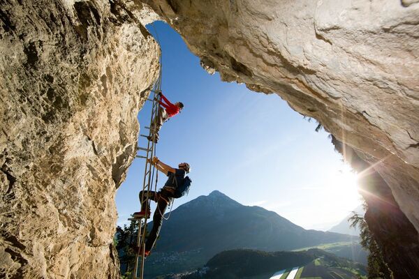
Fantastic via ferrata in a special surrounding, which provides a breathtaking fotospot.
- Difficulty
-
mediumDifficulty level C
- Rating
-
- Starting point
-
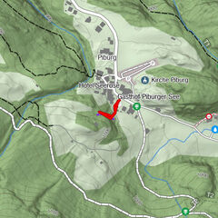
Längenfeld | district Lehn
- Route
-
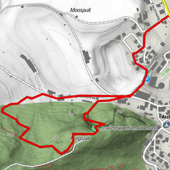
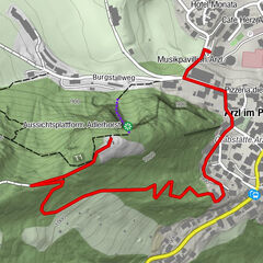
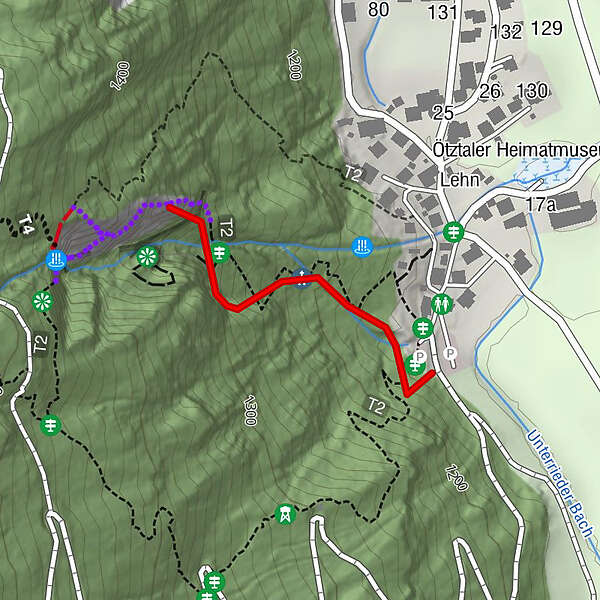
Lehn0.1 km
- Best season
-
JanFebMarAprMayJunJulAugSepOctNovDec
- Description
-
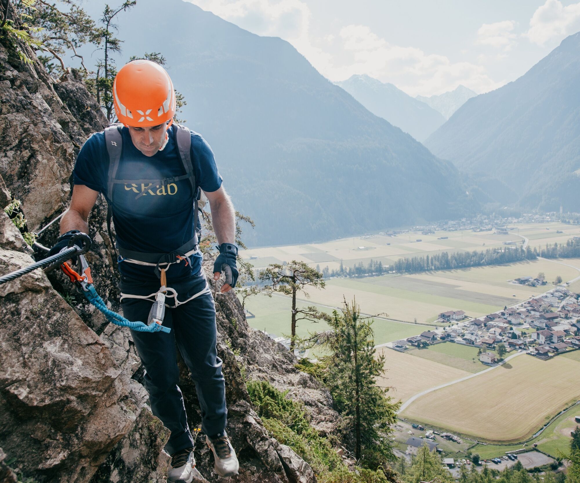
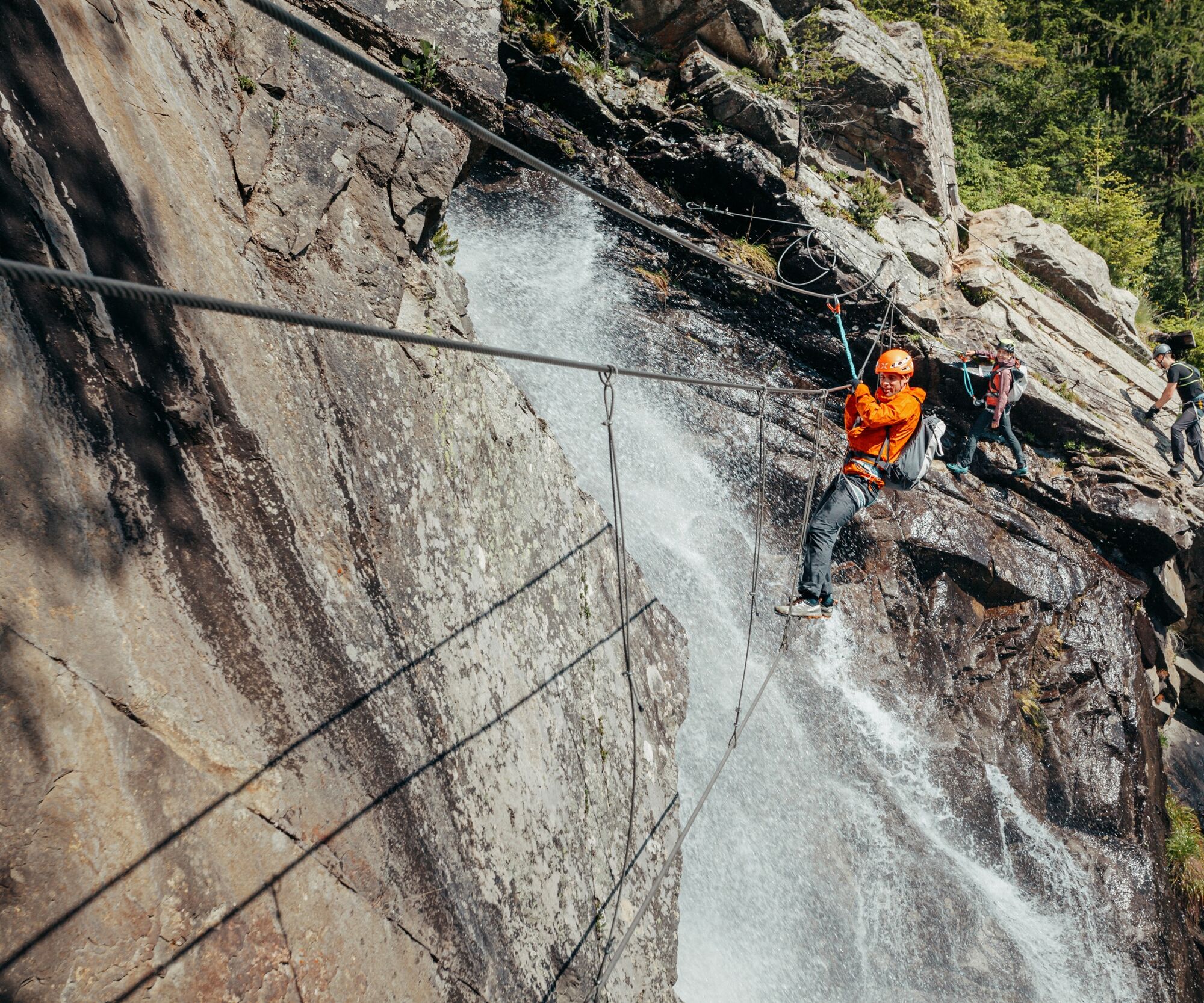
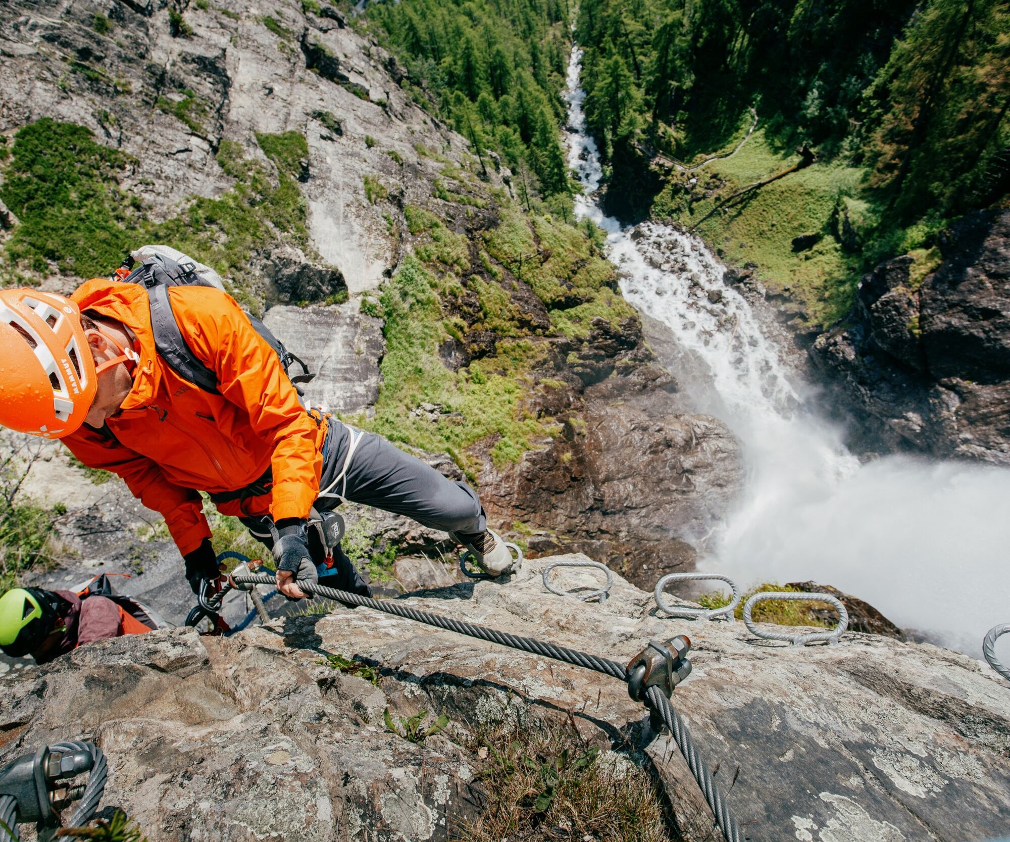
In 2014 the via ferrate Lehner Wasserfall was extended with the left variant. The new variant is for experts on the left. . After an easy traverse, the first overhang has to be climbed with the highest level of difficulty (E). This variant is not suitable for children. The original route, which is to the right of the waterfall, is much easier than the new variant, but still requires strength, sure-footedness and alpine experience. At the original exit you can put your strength to the test on the short but difficult overhang. The overhang can be circumvented on the left with a slight variation. 50 meters above the exit, a hiking trail leads to the new rope bridge, so everyone can enjoy the new highlight.
Trail length and time required
220 meters altitude gain and 430 m rope length. 1.5 - 2 hours right exit and 2.5 - 3 hours left exit, with descent 3 - 3.5 hours.
- Directions
-
Vertical, grade -C access wall, with easier, intermittent sections; past two short grade - B scarps to the vantage corner; ascending grade - B /D traverse; steeper face to the grade - D overhang (sidestepping possible); across a grade - B ledge and a steep grade - B face at the end.
Descent
follow the signs right of the exit and return on the steep trail leading back to Lehn.
- Highest point
- 1,318 m
- Endpoint
-
Längenfeld | district Lehn
- Exposition
- Height profile
-

- Equipment
-
Depending on the climbing route, appropriate equipment such as breathable and weather-appropriate outdoor clothing, helmet, climbing harness with via ferrata set, via ferrata gloves and suitable footwear is required.
- Safety instructions
-
SAFETY ON THE VIA FERRATA
The Austrian Alpine Club has published 10 recommendations for climbing on via ferratas in order to increase safety:
Plan carefully
Destination should correspond to personal abilities
Use complete set of professional climbing equipment
Don’t access the route in the event of a thunderstorm
Check wire rope and anchors accurately and critically
Partner check at the access point
Maintain sufficient distance
Talk clearly when overtaking someone
Watch out for falling rocks
Respect nature and environment
First aid
Whether sport climbing or via ferrata tour, a first aid kit and a cell phone with a full battery you should always with it! Emergency call 140 - Mountain Rescue - Alpine Emergency 112 - European emergency call (works with any mobile phone & in any available network)
- Additional information
- Directions
-
The car drive to the Ötztal valley. Situated in Tirol, the Ötztal valley set off in southerly direction and is the longest side valley in the Eastern Alps. The journey with the car leads you through the Inntal valley to the entrance of the valley and further on through the valley. Among the toll motorways you can also use the country roads. A route planner will show you the easiest and most convenient way: www.google.at/maps
- Public transportation
- Parking
-
The following parking facilities are available in Längenfeld, district Lehn:
- car park behind heritage museum, payable
- Author
-
The tour Via ferrata Lehner Wasserfall | Längenfeld is used by outdooractive.com provided.


")