- Brief description
-
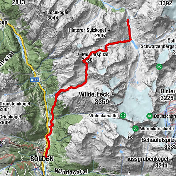
AMBERGER HÜTTE-> Jägerstein -> Rosskar -> Atterkarjöchl -> Speikgruben -> Kaiserbergalm -> SÖLDEN
- Difficulty
-
medium
- Rating
-
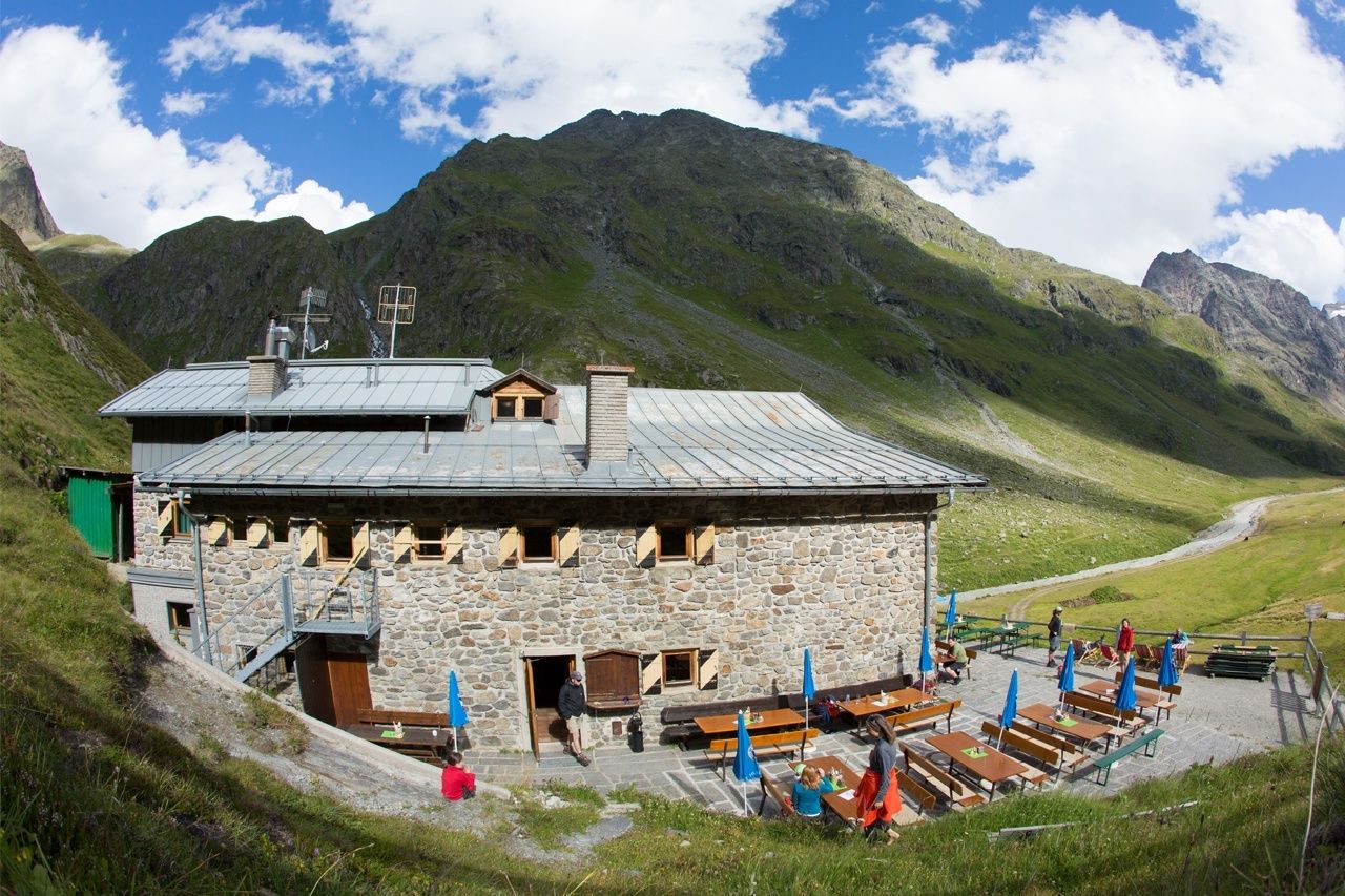
- Starting point
-
Amberger Hütte
- Route
-
Amberger Hütte (2,135 m)0.0 kmKaiserswald10.0 kmKaisers11.5 kmGehörde11.6 kmSchmiedhof12.2 kmRechenau12.9 kmWaldele13.5 kmSölden (1,368 m)13.7 km
- Best season
-
JanFebMarAprMayJunJulAugSepOctNovDec
- Description
-
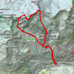
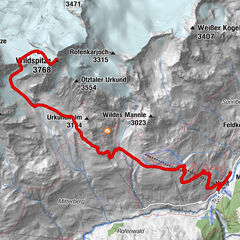
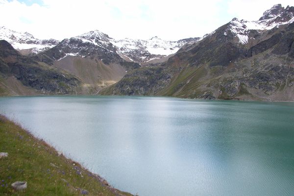
From the Amberger Hütte, it goes on meadow paths towards the valley end of the Sulztales. After approx. 1.2 km the signage at the Lausbühel points the way # 137 right up to the Atterkarjöchl. On narrow stony path, it goes in wide arches through the Rosskar upwards, before a further emerges with a small glacier lake, which is bounded on the left by a ridge of rocks and boulders. Here are old maps often the wrong way on this back, but should not be committed because of strong rockfall hazard. Instead, the new drawn path now goes below the glacier lake through a slight dip and then right past the far end through the blocked terrain to the ice border just below the Jöchls, from where a partially insured with steel pins and steel cable riser leads directly to the Atterkarjöchl.Nun follows the Descent to Ötztal, which is initially very steep and exposed and because of the loose surface requires a very good surefootedness. After a few minutes, this steep section is overcome and it continues on an increasingly better path in a beautiful high valley over a moor area along a small mountain stream. From a height of about 2300m it becomes steeper again and the long descent into the Ötztal begins. On the way you will always come back to partly dilapidated huts, which may provide weather protection, but none of the pastures is managed. Once in the valley, the trail always leads on the east side of the Ötztaler Ache in the direction of Sölden.
- Directions
-
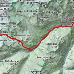
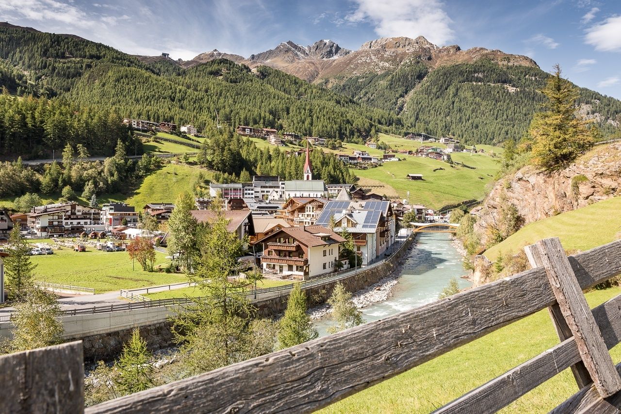
From the hut, it goes first a piece through the lovely Hintere Sulztal. Then the climb follows a rocky path through a very barren scree landscape to Atterkarjöchl. The views back to the Stubai Alps and the bizarre landscape are impressive. Below the Atterkarjöchl, it is still necessary to avoid a further by climbing over huge boulders, last on steel pins along a rock wall above the ice surface. Once at the top, the great view of the Ötztal and the Ötztal Alps makes up for it. Now it goes downhill, first on very demanding and exposed path, later on moorland and on steep paths down to the Ötztal. In Sölden you have a civilization again with all the amenities such as cafes and shopping.
- Highest point
- 2,957 m
- Endpoint
-
Sölden
- Height profile
-

- Equipment
-
Appropriate equipment such as breathable suitable outdoor clothes for the weather, ankle-high walking boots,
wind-, rain- & sun protection, hat, possibly gloves, is for all hikes and tours necessary. Please bring a first-aid
box, a mobile phone, a walking map and if there is no hut on the way a snack and enough to drink.
- Safety instructions
-
For experienced mountaineers that are free from vertigo & surefooted, Very good physical condition, mountain
experience & mountain equipment (see notice equipment) necessary, such as alpine security material, good
weather conditions recommended. Please pay attention to the current weather report:
- Additional information
- Directions
-
The car drive to the Ötztal valley. Situated in Tirol, the Ötztal valley set off in southerly direction and is the
longest side valley in the Eastern Alps. The journey with the car leads you through the Inntal valley to the
entrance of the valley and further on through the valley. Among the toll motorways you can also use the country
roads. A route planner will show you the easiest and most convenient way: https://www.google.at/maps
- Public transportation
-
Travel safe and comfortable with the train to the Ötztal Bahnhof train station. Last stop and exit point is the
train station Ötztal Bahnhof. Afterwards you can travel smoothly and quick with the public transport or our local
taxi companies through the valley to your desired destination. Please find the current bus timetable here:
http://fahrplan.vvt.at
- Parking
-
The following parking facilities are available in Gries:
- Gries at the end of the village - chargeable

- Author
-
The tour Atterkarjöchl 2976m - Längenfeld is used by outdooractive.com provided.