
- Brief description
-
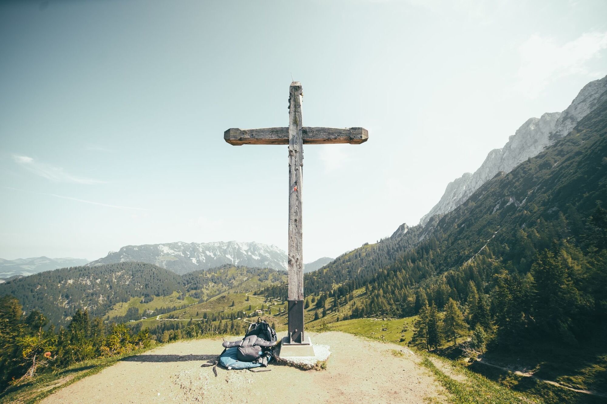
The conservation area of the Wild Kaiser is one of the most beautiful hiking and climbing areas of Tyrol.
- Difficulty
-
difficult
- Rating
-
- Starting point
-
Going bathing lake
- Route
-
Aschingerkapelle1.7 kmObere Regalm5.7 kmBaumgartenköpfl (1,572 m)6.6 kmIm Kübel (1,570 m)8.8 kmGruttenhütte10.0 kmKaiser-Hochalm15.5 kmSteiner Hochalm17.3 kmBeinstingl19.2 kmBärnstatt19.4 kmBärnstattkapelle Sankt Leonhard19.5 kmHinterstein20.0 kmBichl20.3 kmSeestüberl20.4 kmPension Maier23.2 kmStöfflhütte26.2 kmWalleralm26.4 kmJaga Bründl27.4 kmHochegg (1,470 m)27.9 kmSteinbergkapelle29.0 kmAnton-Karg-Haus34.9 kmHinterbärenbad34.9 kmMariahilf-Kapelle35.0 kmKarg-Gartl (747 m)36.8 kmHaupttrift-Klause37.2 kmKaisertal40.0 kmBerg'k'hof Kaisertal - Alpine Hideaway40.3 kmPfandlhof40.3 kmPfandlkapelle40.5 kmGasthaus Veitenhof41.5 kmZottenkapelle41.7 kmKufstein42.6 km
- Best season
-
JanFebMarAprMayJunJulAugSepOctNovDec
- Description
-
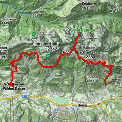
At this three days hiking tour you will pass the most beautiful places at the south side of the Kaiser mountains. The trail begins at the natural lake in Going along the Wilder-Kaiser-Steig up to the Gruttenhütte, further along the Adlerweg hiking trail up to the Hintersteiner lake and at the third day accros the Walleralm to the Anton Karg Haus in the Kaisertal valley. Possible from June to mid October.
Day 1
The tour starts at the bathing lake in Going (750m). It is one of the most beautiful natural bathing lakes in Tyrol and you can park your car at the parking area at the lake (free of charge). From the lake you follow the road to the parking area Aschau and from there a forest path leads you to Graspoint Niederalm (1.075m). Before you arrive at the upper Regalm (1.313) the you will enjoy a breathtaking view at the Kitzbühel Alps.
The first stage of the Adlerweg, a long distance hiking trail with 126 stages across Tyrol, leads to the Baumgartnerkopf (1.572m). Via the "Wilder-Kaiser-Steig" and the more demanding "Jubiläumssteig" (sure-footed and no head for heights) you'll reach the Gruttenhütte at 1.600m.
Day 2
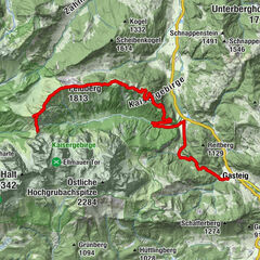
From the hut the Wilder-Kaiser-Steig leads around the Kaiser Hochalm (1.417m). From mid June to mid July the alpenrose flourishes. Take a rest at this beautiful place, cause the destination for the second day, the Hintersteiner lake (880m), is not far from here.
Day 3
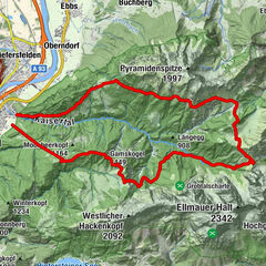
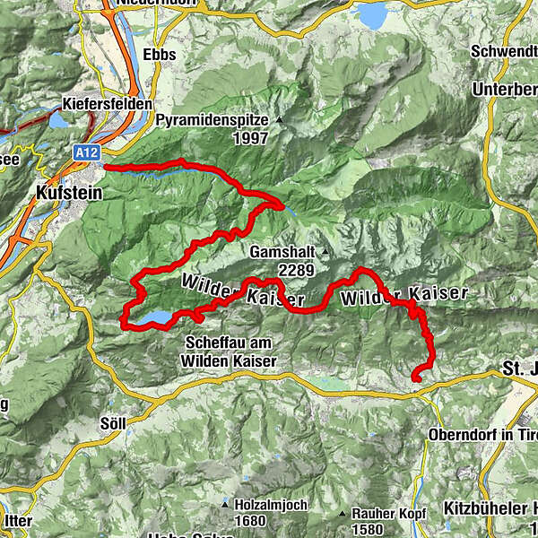
At the third day the route leads you directly to the Stöfflhütte and Walleralm. From there you take the AV-Weg 827 to the next outpost, via Hocheck (1.470m) to Kaindlhütte (1.293m) at the northern side of the Scheffauer. Now you stay on the path which eventually leads you via meadows to the Bettlersteig. Via this path and the Straßwalch-Jagdhütte you'll arrive at the Anton Karg Hütte in Hinterbärenbad (829m) after about 2 hours. You got the opportunity to stay overnight or start your way back through the popular conservation area Kaiser valley. You will come by a variety of alpine cabins/huts who invite you to have a rest and a snack. After 2 hours you'll arrive at the Kaiser valley ascent in Kufstein.
- Highest point
- 1,668 m
- Endpoint
-
Kaiseraufstieg
- Height profile
-

- Equipment
-
Outdoor clothing appropriate to the weather (good footwear, rain protection, breathable clothing...)
Snacks (e.g. fruit, muesli bars, wholemeal breads) and drinks (make sure you drink enough)
First aid equipment
Mobile phone with full battery
Hiking map and guide literature
Sun protection (sun cream and glasses, cap)
Bivouac bag - Directions
-
On the federal road B178 coming from Wörgl or Kufstein, continue to the Goinger Badesee.
- Public transportation
-
From Kufstein to Wörgl by train and then at the main station forecourt take the bus in the direction of St. Johann in Tirol (station). Get off at the Going am Wilden Kaiser Stanglwirt stop and then 11 minutes' walk to the starting point.
- Parking
-
Going bathing lake
- Author
-
The tour Two days tour Wilder Kaiser is used by outdooractive.com provided.


-
Wilder Kaiser
1951
-
Scheffau am Wilden Kaiser
614