- Brief description
-
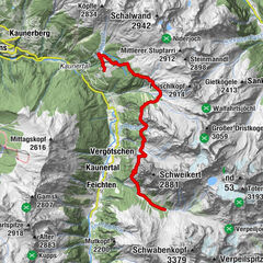
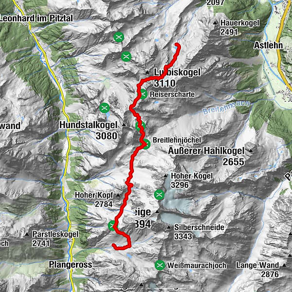
Rüsselsheimer Hütte (2.328 m) –> Kapuzinerjöchl (2.710 m) –> Breitlehnjöchl (2.637 m) –> Sandjöchl (2.826 m) –> Luibisscharte (2.914 m) –> Hauerseehütte (2.383 m)
- Difficulty
-
difficult
- Rating
-
- Starting point
-
Rüsselsheimer Hütte
- Route
-
Rüsselsheimer Hütte0.0 kmHauerseehütte11.4 km
- Best season
-
JanFebMarAprMayJunJulAugSepOctNovDec
- Description
-
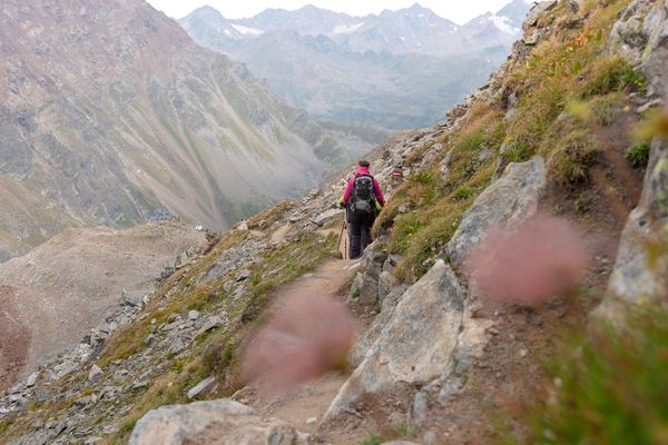
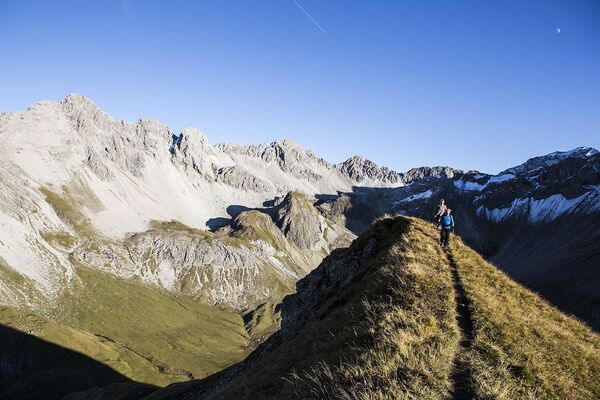
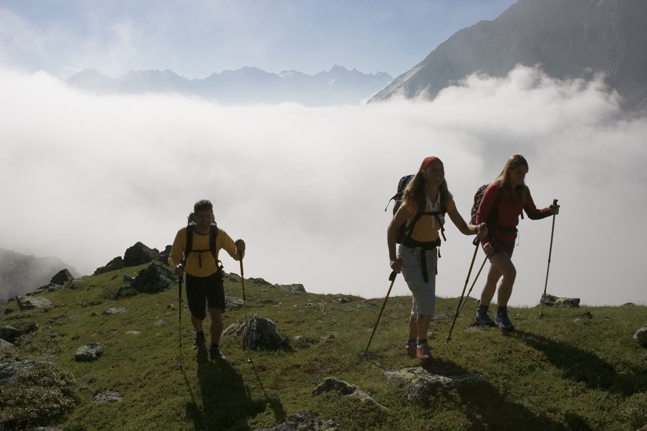
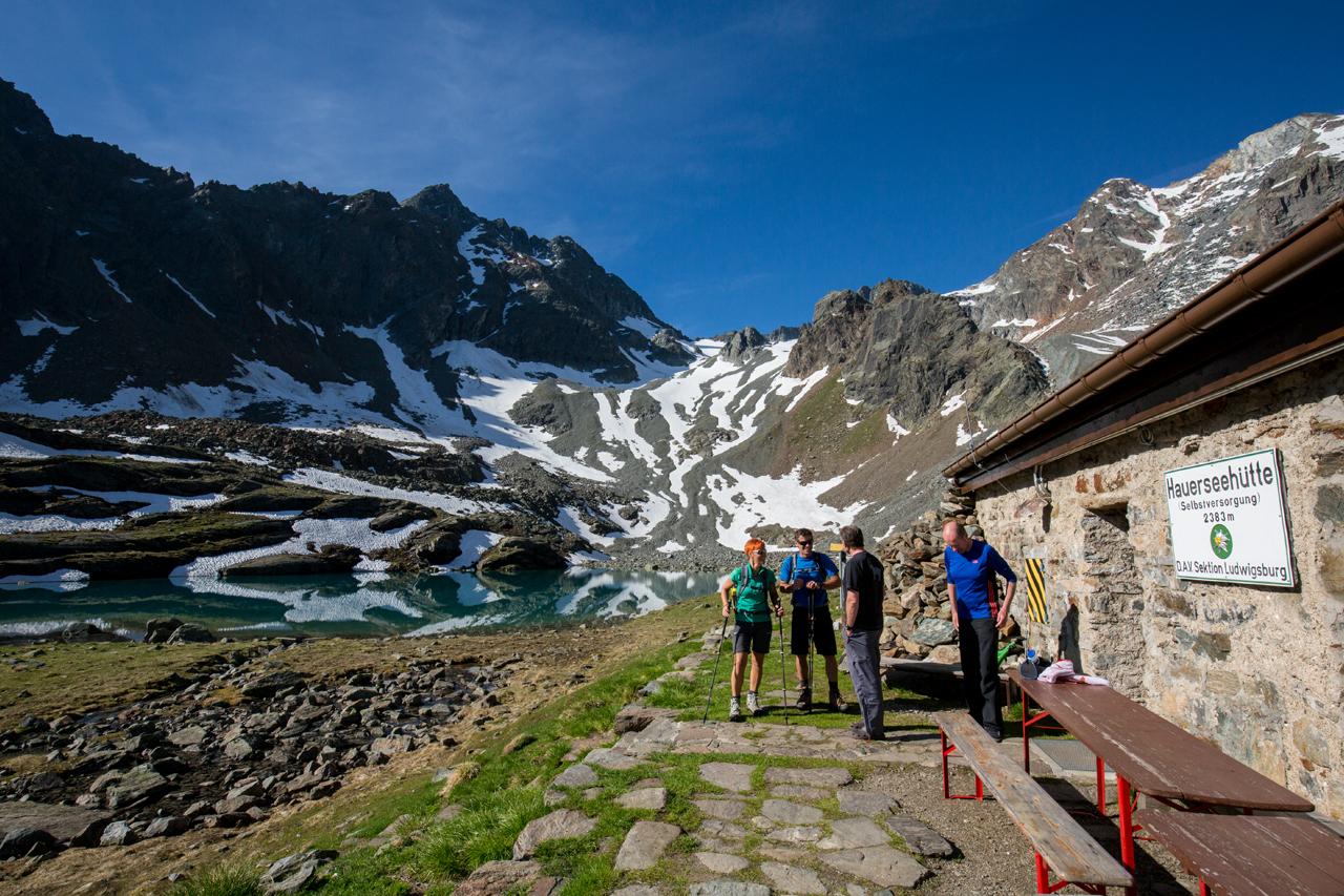
Course: Climbing, Path Requirements: Step safety, dizziness, condition, endurance, high alpine experience; Mountain route black, intersection alpine route Difficulties: hard ascent to Luibisscharte, glacier passage on Hauerferner (columns), assured passages; Stable weather conditions are particularly important; Mountain guide recommended Equipment: normal hiking equipment, depending on the conditions Pickel, crampons, rope Huts : Rüsselsheimer Hut, Hauersee Hut
Acess / exit point: from Unterried or Oberried in Längenfeld to Hauerseehütte (approx. 3.75 h way, approx. 2.5 h descent);
from Plangeross (municipality of St. Leonhard in the Pitztal) to Rüsselsheimer Hütte (about 2 h ascent, approx. 1,5 h descent) - Highest point
- 2,892 m
- Endpoint
-
Hauerseehütte
- Height profile
-

- Equipment
-
It is recommended to wear hiking equipment such as breathable and weather-adapted outdoor clothing, ankle-high mountain boots, wind, rain and sun protection, cap and possibly gloves. It is also important to have enough food, as well as a first-aid package, a cell phone and a hiking map.
- Additional information
- Directions
- Public transportation
- Parking
-
The following parking facilities are available in Längenfeld:
- Parking in Lehn - nearby Heimatmuseum - subject to charges
- Parking Oberried - climbing garden – payable


- Author
-
The tour Ötztal Trek Stage 19 is used by outdooractive.com provided.
GPS Downloads


General info
Refreshment stop
A lot of view
Other tours in the regions
-
Ötztal
1107
-
St. Leonhard im Pitztal
332