- Brief description
-
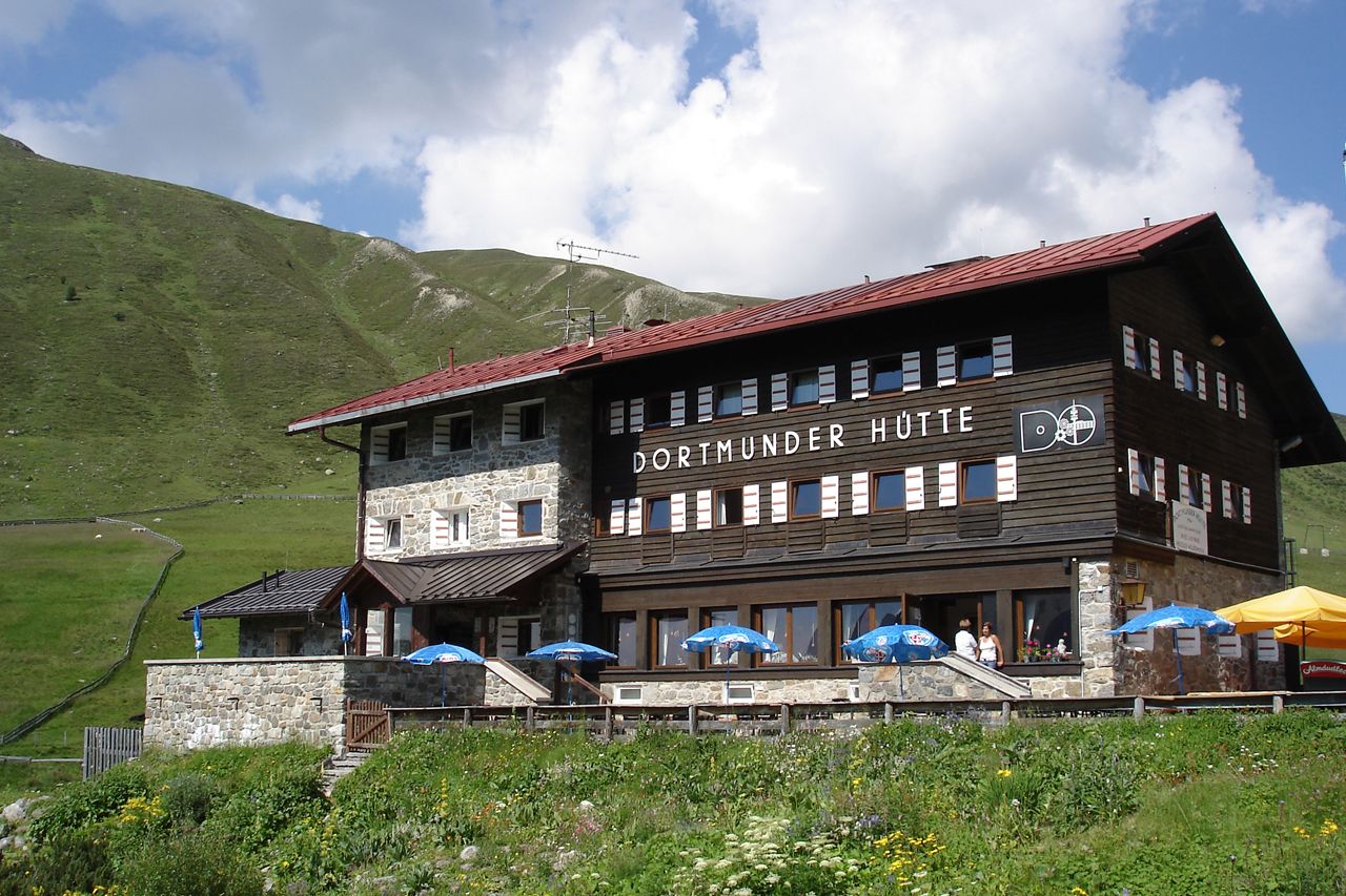
Dortmunder Hütte (1.949 m) - Schweinfurter Hütte (2.028 m)
- Difficulty
-
medium
- Rating
-
- Starting point
-
Dortmunder Hütte
- Route
-
Graf Ferdinand Haus2.4 kmSchweinfurter Hütte10.9 km
- Best season
-
JanFebMarAprMayJunJulAugSepOctNovDec
- Description
-
Route: ascending, walking distance Requirements: stability of the tread, basic degree of dizziness Mountain route red Difficulties: no special difficulties Equipment: normal hiking equipment Huts: Dortmunder Hut, Schweinfurter Hut Acess / exit point: bus from Oetz to Kühtai
from Niederthai (Umhausen) to the Schweinfurt hut (about 2 h ascent, approx. 1,5 h descent) - Directions
-
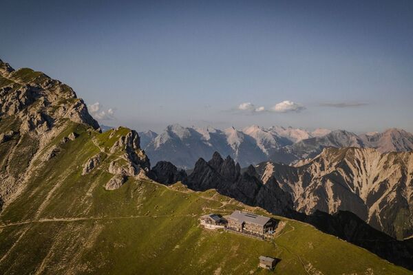
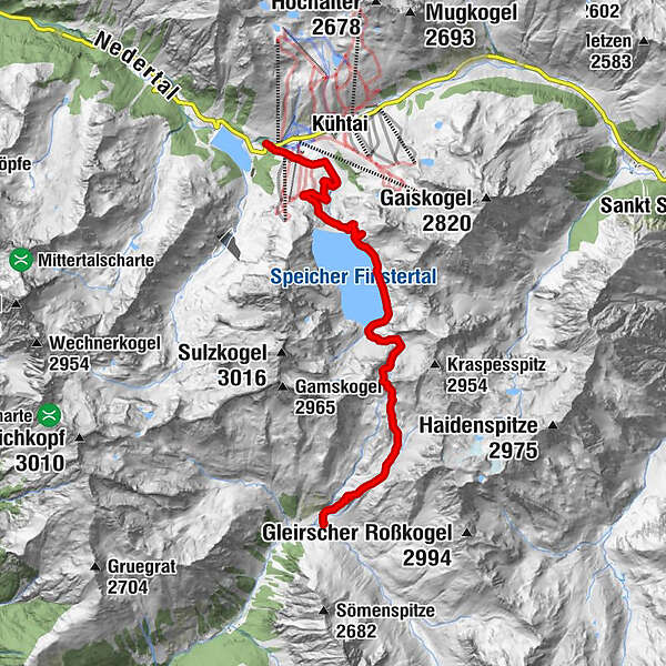
LIKE AN OCEAN IN THE HIGH ALPINE MOUNTAINS
At the entrance to Kühtai you follow the signs to “Finstertaler Scharte” or“ Schweinfurter Hütte”. The route climbs through lush meadows east of the access road to Finstertal water reservoir - with the mighty, 149-meter tall damalways in sight. After a steep stretch you continue along the access road to the crest of the dam. Follow the footpath along the eastern shore of the reservoir which has a capacity of 60 million cubic meters. At the southern end of thereservoir the trail climbs steeply towards Finstertaler Scharte.The 2777 meter high ridge affords spectacular views of the surrounding peaks including Wildspitze, Tirol’s highest mountain, in the south. From the top the trail weaves down through Alpine pastures and then switchbacks along the brook to Schweinfurter Hütte which is beautifully nestled in the area where Horlachtal joins Zwieselbachtal.
- Highest point
- 2,760 m
- Endpoint
-
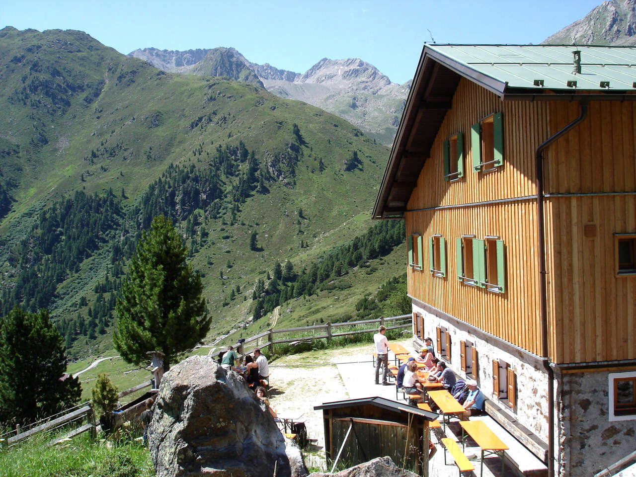
Schweinfurter Hütte
- Height profile
-

- Equipment
-
It is recommended to wear hiking equipment such as breathable and weather-adapted outdoor clothing, ankle-high mountain boots, wind, rain and sun protection, cap and possibly gloves. It is also important to have enough food, as well as a first-aid package, a cell phone and a hiking map.
- Additional information
- Directions
- Public transportation
- Parking
-
At the railway station

- Author
-
The tour Ötztal Trek Stage 2 is used by outdooractive.com provided.


General info
-
Mieminger Plateau & Inntal
1682
-
Kühtai
344