- Brief description
-
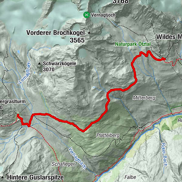
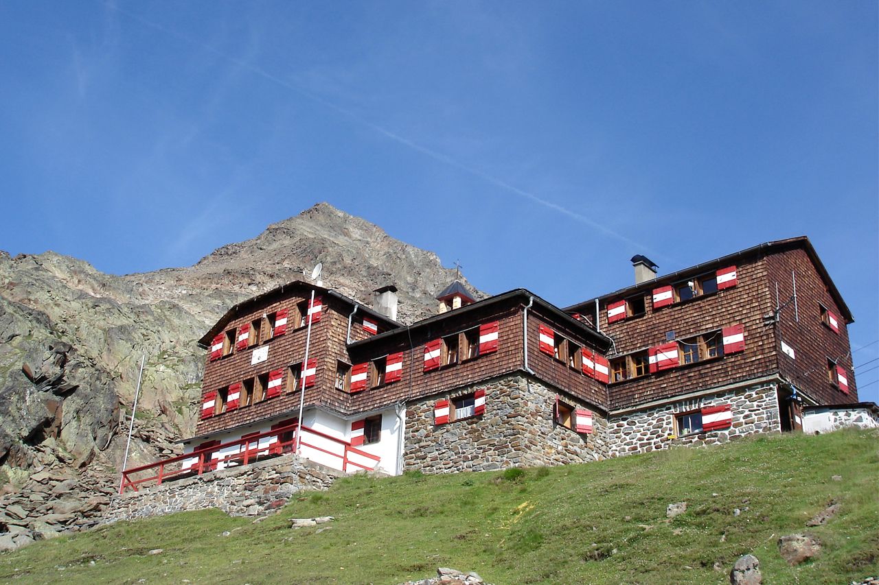
Vernagthütte (2.755 m) –> Breslauer Hütte (2.844 m)
- Difficulty
-
medium
- Rating
-
- Starting point
-
Vernagthütte
- Route
-
Vernagthütte0.0 kmBreslauer Hütte7.0 km
- Best season
-
JanFebMarAprMayJunJulAugSepOctNovDec
- Description
-
Route: Climbing
Requirements: Step safety, dizziness;
Mountain route red Difficulty: no special difficulties Equipment: normal hiking equipment Walking time: approx. 2 h Difference in altitude: approx. 300 Hm Rise, approx. 250 Hm Descent: 2,860 m Distance: approx. 7 km Accommodation, stop: Vernagthütte, Breslauer Hütte , Exit: from Vent via the Vernagtegg to Vernagthütte (approx. 3,5 h ascent, approx. 2,5 h descent); From the Stablein station of the Wildschitze chair lift (valley Vent) to the Breslauer Hütte (about 1.5 h ascent, about 1.25 h descent) - Directions
-
ALONG SEUFERTWEG IN THE FOOTHILLS OF WILDSPITZE
From Vernagthütte you walk down and continue on a trail that branches off to the left, descending towards Vernagtbach brook. From here you enjoy superb views of Großer Vernagtferner glacier including Hochvernagtspitze to the north/northwest. Cross Vernagtbach brook and continue to the flat meadows on opposite Platteiberg slope towering high above Rofental valley.
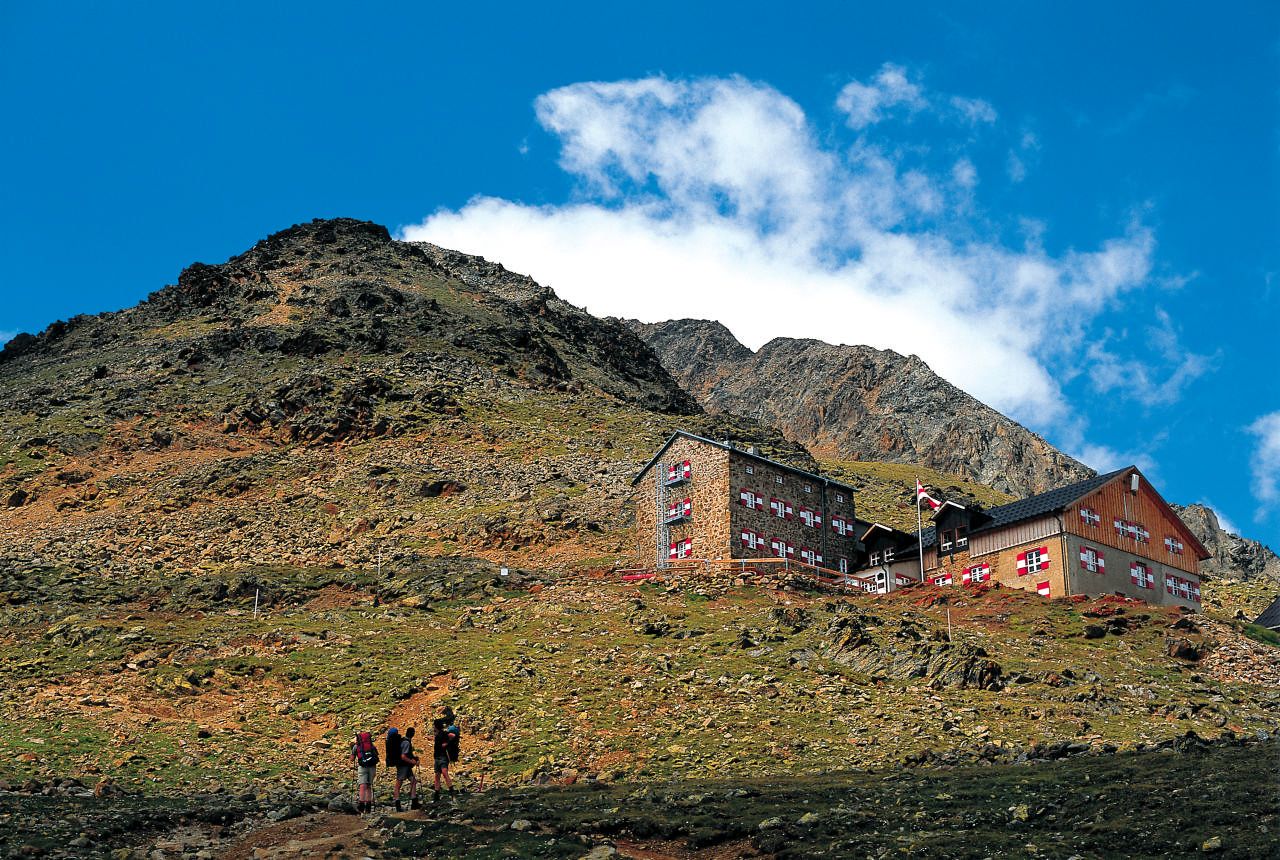
The trail crosses Platteikar cirque and rolls up and down through Mitterkar. Just above Mitterkar you can see Ötztal’s Wildspitze, which looks unusually rocky from this angle. From here it’s only a few more meters down to the refuge hut that affords fabulous views of Kreuzspitze, Hochjochferner in thesouth-west and majestic Weißkugel. - Highest point
- 2,862 m
- Endpoint
-
Breslauer Hütte
- Height profile
-

- Equipment
-
It is recommended to wear hiking equipment such as breathable and weather-adapted outdoor clothing, ankle-high mountain boots, wind, rain and sun protection, cap and possibly gloves. It is also important to have enough food, as well as a first-aid package, a cell phone and a hiking map.
- Tips
-
TIP OF THE DAY
Breslauer Hütte – Urkundholm (3.134 meter) – Breslauer Hütte
Short ascent from the hut to Urkundholm peak. Surefootedness and a good head for heights required!
Level, walking time: average hike, about. 1,45 h
Altitude meters: 290 hm descent and ascent - Additional information
- Directions
- Public transportation
- Parking
-
The following parking facilities are available in Vent:
In front of the village and at the valley station of the chairlift (fee required)

- Author
-
The tour Ötztal Trek Stage 16 is used by outdooractive.com provided.


General info
-
Vinschgau
1285
-
Schnalstal
596
-
Vent
292