European E5 long-distance hiking trail – King's Segment – Obergurgl to Moos in Passeier (alternative route)


- Difficulty
-
difficult
- Rating
-
- Route
-
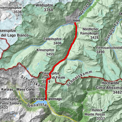
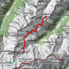
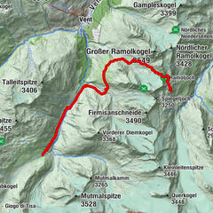
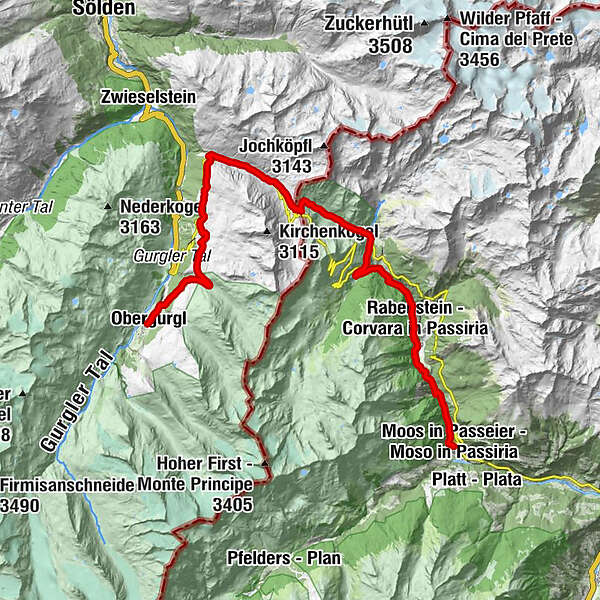
Hl. Johannes NepomukObergurgl (1,907 m)0.0 kmBelmonte0.4 kmFestkoglbahn0.6 kmVorderer Wurmkogllift I4.5 kmGroße Karbahn5.8 kmHochgurgl (2,150 m)5.9 kmCrosspoint7.0 kmAlbergo Hochfirst18.0 kmBichl21.6 kmRabenstein (1,433 m)22.0 kmZirmwirt27.7 kmMoos in Passeier (1,007 m)27.8 kmMooserwirt27.8 km
- Best season
-
JanFebMarAprMayJunJulAugSepOctNovDec
- Description
-
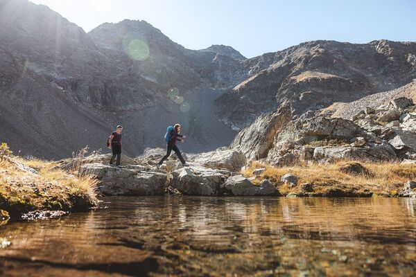
Obergurgl is the starting point for this alternative route. Walk across beautiful slopes full of alpine roses as the trail steadily climbs to the Königstal valley. From there, it will take you to Hochgurgl, past the Top Mountain Crosspoint near the spectacular Timmelsjoch High Alpine Road all the way to the Timmelsjoch pass (2,590 m). Enter your thoughts and experiences in the logbook at the pass. A special embossing stamp will help you remember this moment. The Pass Museum is certainly worth a visit, as is the new Timmel_Transit_Museum.
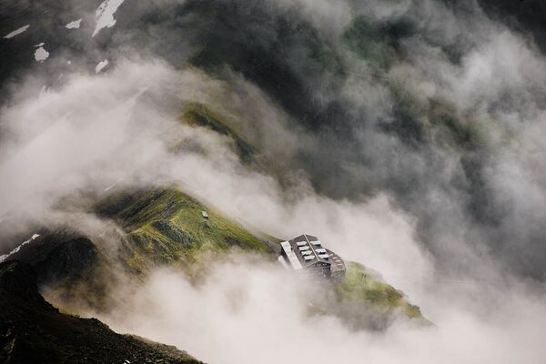
The museums as well as a walkway with viewing platform, a smuggler sculpture, a telescope and a beautiful garnet are part of the Timmelsjoch experience. They embody the heritage of the iconic 50-year-old Timmelsjoch High Alpine Road.
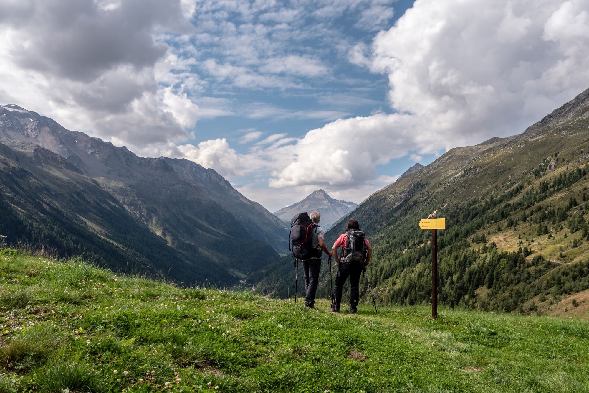
Once you pass the Timmelsjoch, you will enter the Texel Group Nature Park, walking down along the valleys, waterfalls and mountain brooks of the beautiful Passeiertal valley as the landscape becomes gentler and wider. Follow the narrow path past cattle herds and impressive stone walls and feel the historic significance this trail once had for smugglers and cattle drovers. The route will take you to the pretty village of Rabenstein and then through a rather narrow valley to Moos in Passeier.
- Highest point
- 2,482 m
- Height profile
-

- Arrival
-
The car drive to the Ötztal valley. Situated in Tirol, the Ötztal valley set off in southerly direction and is the longest side valley in the Eastern Alps. The journey with the car leads you through the Inntal valley to the entrance of the valley and further on through the valley. Among the toll motorways you can also use the country roads. A route planner will show you the easiest and most convenient was: www.google.at/maps.
- Public transportation
- Parking
-
The following parking facilities are available in Gurgl:
- Parking garage (center of Obergurgl), chargeable | € 2,00/hour
- Parking garage - bottom station Festkogl, chargeable | € 2,00/hour
- Parking Hochgurglbahn valley station, free of charge - no parking at night
- Parking Top Mountain Crosspoint, free of charge
- Parking Hochgurgl, free of charge (very small parking)

- Author
-
The tour European E5 long-distance hiking trail – King's Segment – Obergurgl to Moos in Passeier (alternative route) is used by outdooractive.com provided.


General info
-
Meraner Land
1717
-
Passeiertal
794
-
Hinterpasseier
221