- Brief description
-
STAGE 1:
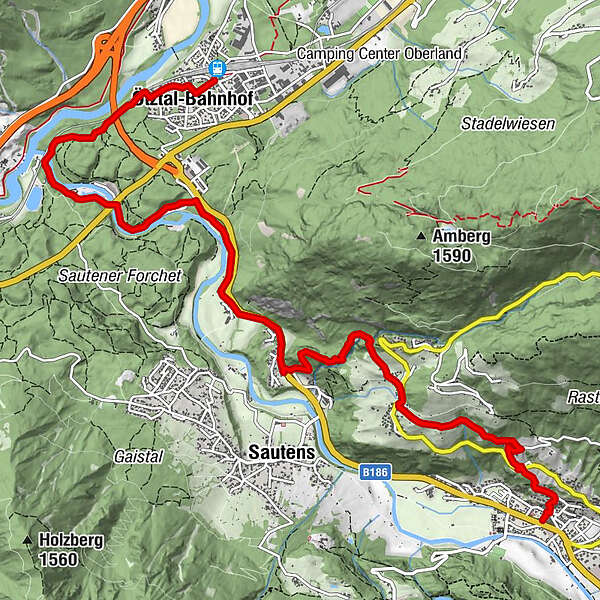
ÖTZTAL BAHNHOF –> Inn/Ötztaler Ache –> AREA 47 –> Brunau –> Ambach –> Auer Klamm –> Oetzerau –> OETZ - Difficulty
-
easy
- Rating
-
- Route
-
Ötztal-Bahnhof0.2 kmLakeside Restaurant2.6 kmBrunau4.8 kmAmbach5.5 kmGasthof Ambach Hof5.6 kmOetzerau7.8 kmKlingenburg9.1 kmPfarrkirche zum Hl. Georg und Nikolaus10.0 kmOetz (812 m)10.3 km
- Best season
-
JanFebMarAprMayJunJulAugSepOctNovDec
- Description
-
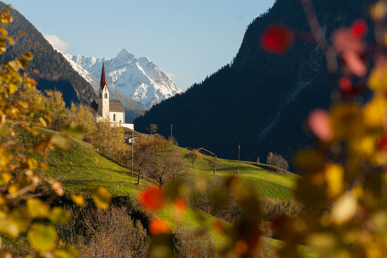
LUSH GREEN ALPINE MEADOWS IN THE FOOTHILLS OF A MIGHTY 3000 METER HIGH PEAK
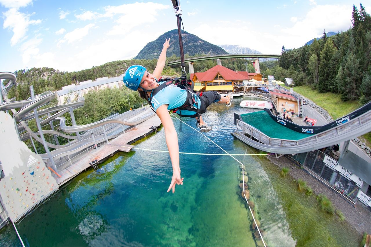
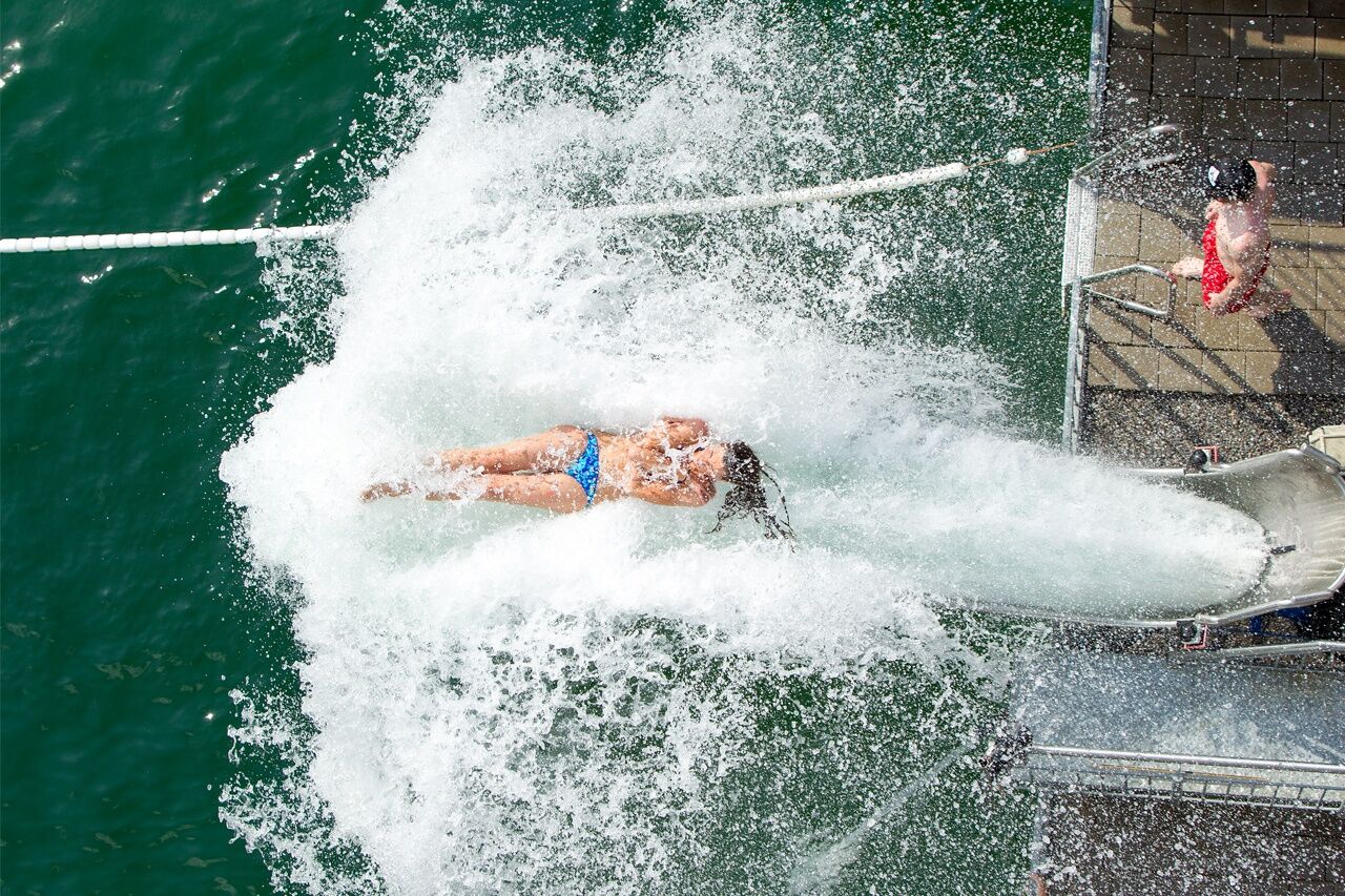
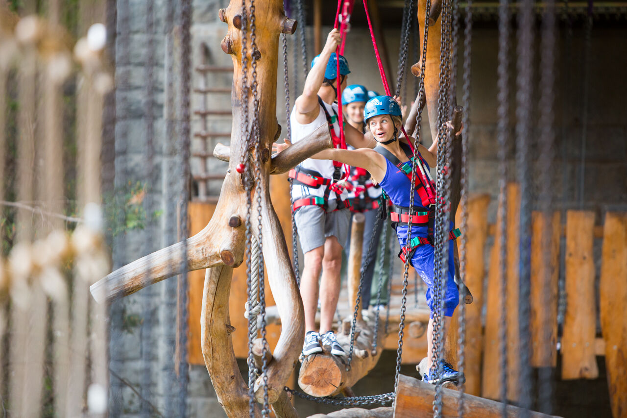
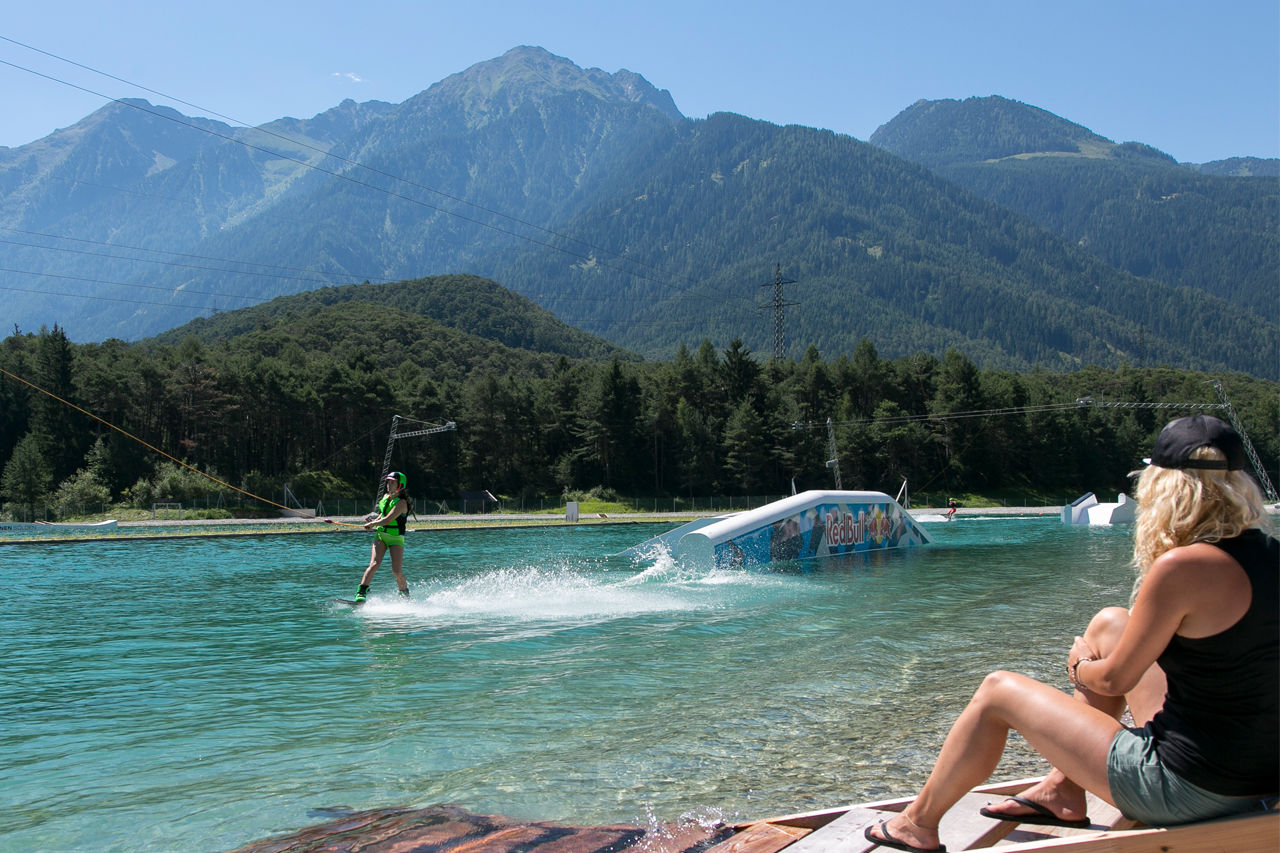
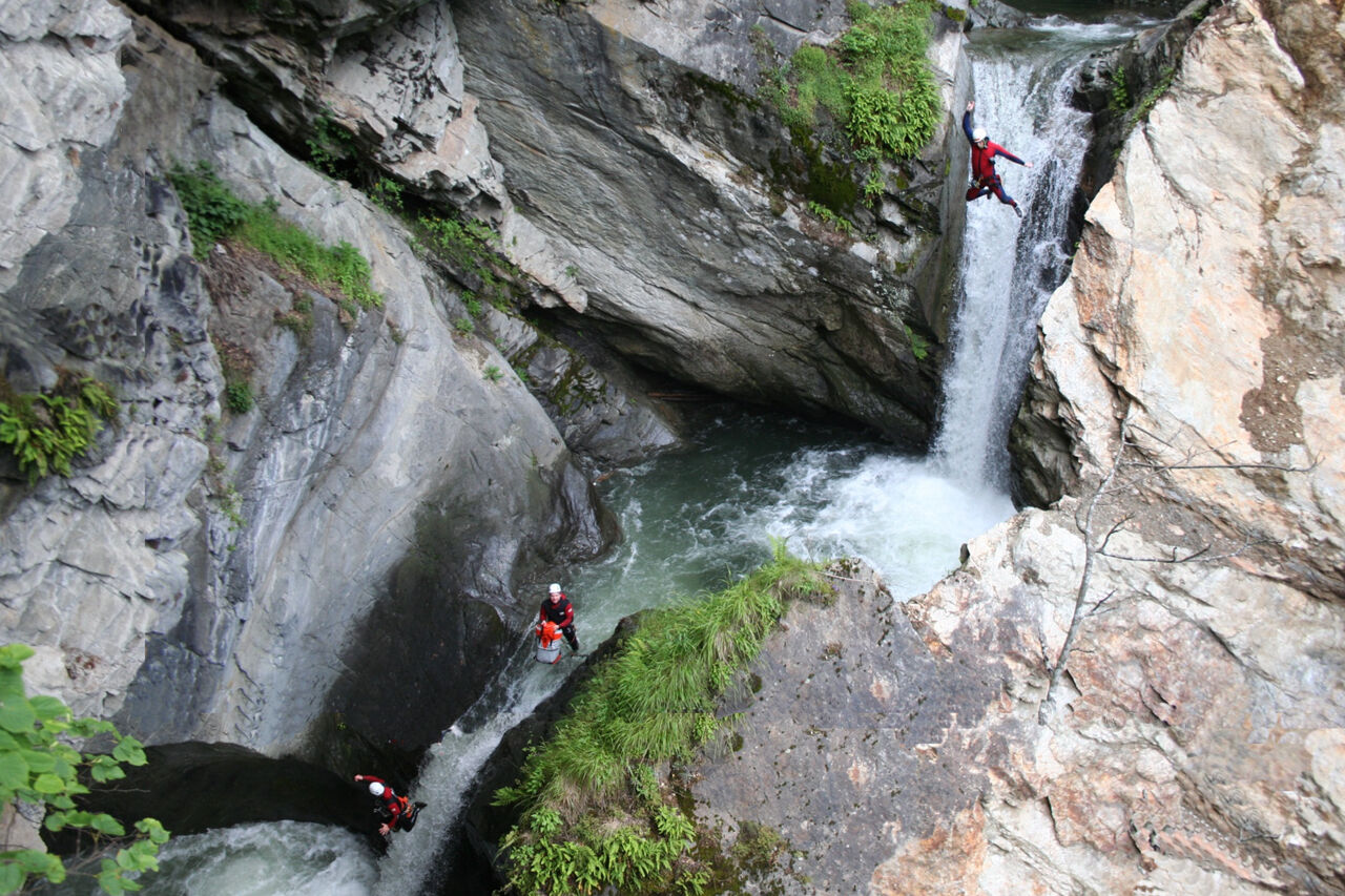
Not far from the small village of Ötztal Bahnhof you can indulge in one of Europe's probably trendiest and coolest outdoor adventure worlds. The adrenaline-seeking guests find a truly unique adventure paradise at the AREA 47, located directly on the white waters of Ötztaler Ache amidst a gigantic landslide area. Dizzy heights and ultimate thrills are guaranteed on exciting trails and activity paths. Unlimited outdoor fun between the rushing Ötztaler Ache mountain brook, the wildly romantic Auerklamm ravine and abandoned castle ruins.
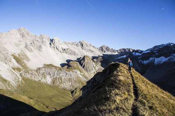
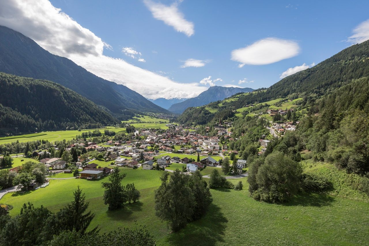
The scenic remains of Auenstein Castle are towering high above Oetz - the destination of this stage - on a huge crest formed by glacial polish. An ancient connecting route leads from the Auerklamm ravine up to the castle. Breathtaking mountain landscapes and steep rock walls await you here in the foothills of splendid Acherkogel peak, the Eastern Alps' northernmost mountain higher than 3000 meters. Down on the valley floor, there are myriad lovely places and scenic Lake Piburger See encircled by lush meadows and Alpine pastures at the heart of the rockslide area.
- Directions
-
The stage starts at the main square in Ötztal-Bahnhof. There you hike along Ambergstraße and Wassertalstraße and then turn right into a gravel path, underpassingthe bridge over the river Inn. Cross Ötztaler Ache mountain brook and turn left. At the AREA 47 outdoor hot spot you turn right, walking from Ötztal‘s riverside road to the hamlet of Brunau.
Then the trail continues to the Ötztal Tourismus Info Point.There you take the hiking trail on the left, leading along the unique Auer Klamm - the Alps‘ undisputed canyoning paradise. High above the ravine you cross a wooden bridge which leads over the pristine Auer Klamm.
Shortly before you reach the small hamlet of Oetzerau, you walk past the hidden remains of the Auenstein castle ruin. In Oetzerau you cross the road and follow a meadow trail towards Oetz. Slightly downhill, you continue through wooded areas and past small hamlets.
You enjoy a marvelous view from the viewing platform at „Hexenplatte“ whichis located about 5 walking minutes to the right, off the trail. The way down also leads past the parish church above Oetz. The stage ends in the old villagecenter of Oetz. - Highest point
- 1,029 m
- Endpoint
-
Oetz
- Height profile
-

- Equipment
-
Standard hiking equipment, sturdy hiking boots
- Safety instructions
-
Surefootedness, a good physical shape, stamina
No major difficulties
- Additional information
-
Did you know that…
... the Tschirgant mountain massif was struck by a severe earthquake in prehistoric times? Back then up to 300 million cubic meters of rock fell down and blocked even some parts of the Ötztal on the opposite side.
More details about hiking In Ötztal: https://www.oetztal.com/wandern
- Directions
- Public transportation
- Parking
-
The following parking facilities are available in Ötztal Bahnhof:
- Parking Train station - subject to charges
- Ötztaler Höhe - free of charge

- Author
-
The tour Ötztaler Urweg E1 Ötztal Bhf - Oetz is used by outdooractive.com provided.


-
Outdoorregion Imst
1226
-
Sautens
334