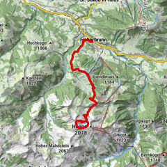
Kaiserkrone - approach/descent Ellmau, Wochenbrunner Alm-Gruttenhütte

long-distance walking trail

- Brief description
-
Wochenbrunner Alm – Gruttenhühtte
- Difficulty
-
medium
- Rating
-
- Starting point
-
Hiking starting point Wochenbrunner Alm, Ellmau (1,085 m)
- Route
-
Gruttenhütte2.6 km
- Best season
-
JanFebMarAprMayJunJulAugSepOctNovDec
- Description
-
Start at the hiking starting point of the Wochenbrunner Alm (1,085 m) and follow the path 825 through the forest and further over a field of scree and past two short rock steps until you reach the Gruttenhütte mountain hut (1,620 m).
- Directions
-
Begin at the hiking starting point of the Wochenbrunner Alm (1,085 m), where free parking facilities are available. Hike along forest road 812/822, enjoying the wonderful views over the Ellmauer Tor as you head directly to the Gaudeamushütte mountain hut (1,270 m).
- Highest point
- 1,619 m
- Endpoint
-
Gaudeamushütte, Going (1,263 m)
- Height profile
-

- Equipment
-
Rucksack, sturdy hiking/mountaineering boots with anti-slip treaded soles, weather-appropriate hiking gear (breathable), a change of clothes, sun protection (sunglasses, sun cream, lip protection, headgear), waterproofs (rain jacket/poncho, pocket umbrella, rucksack protector), cold protection (hat, gloves), sufficient food and drink, hiking poles (height adjustable) if required, first aid kit incl. rescue blanket and bivouac sack, mobile phone with fully charged battery, headlamp, plastic bag for waste, hiking map, route description and information materials (GPX track), ID, insurance card, cash
Additions for overnight stay at mountain hut:
Mountain hut sleeping bag, indoor shoes, toiletries and towel, personal medication, headlamp, Alpine Club ID Card, cash, charger for mobile phone
The hiking routes between the huts are often rather long, we recommend taking plenty of food and drink and booking your overnight stays well in advance. - Directions
-
Heading from Wörgl or Kufstein on the B178 road, take the first exit to Ellmau and then take the first exit at the roundabout. Drive straight on until you reach the junction (green signs - leading towards KaiserBad/Kaisergebirge/Wochenbrunn). Turn left here, then turn right immediately after passing the bus stop. Follow the (toll) road until you reach the Wochenbrunner Alm car park.
Heading from St. Johann on the B178 road, take the first exit to Ellmau and then drive straight on until you reach the junction (green signs – leading towards KaiserBad/Kaisergebirge/Wochenbrunn). Turn right here, then turn right again immediately after passing the bus stop. Follow the (toll) road until you reach the Wochenbrunner Alm car park. - Public transportation
-
The free hikers’ bus runs daily in summer between the Ellmau Dorf/Bauhof bus stop the trailhead of the hike to the Wochenbrunner Alm Alpine hut. Passengers can change to/from the KaiserJet and regular buses at the Ellmau Dorf/Bauhof bus stop.
More information at: www.wilderkaiser.info - Parking
-
Wochenbrunner Alm mountain hut, Ellmau (1,085 m) – free car park (toll road)
- Author
-
The tour Kaiserkrone - approach/descent Ellmau, Wochenbrunner Alm-Gruttenhütte is used by outdooractive.com provided.
GPS Downloads


General info
Refreshment stop
Flora
Fauna
A lot of view
Other tours in the regions
-
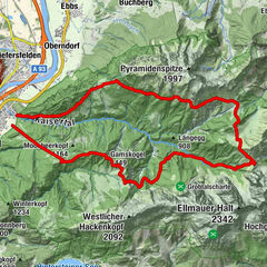
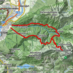
Wilder Kaiser
1945
-
Ellmau
638
 Toni Niederwieser")