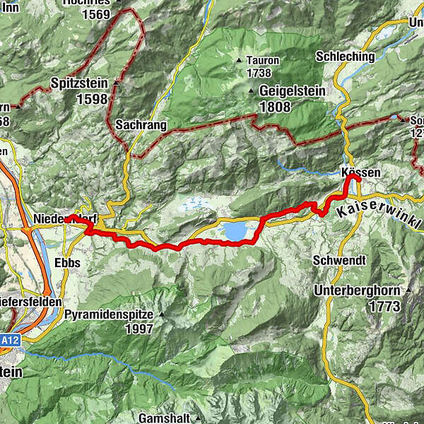
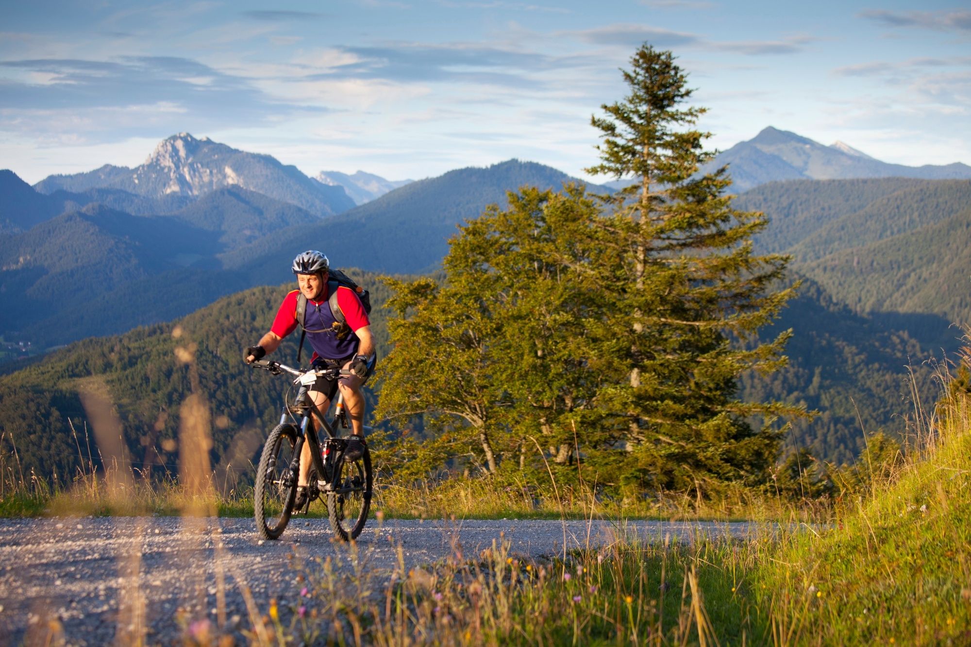
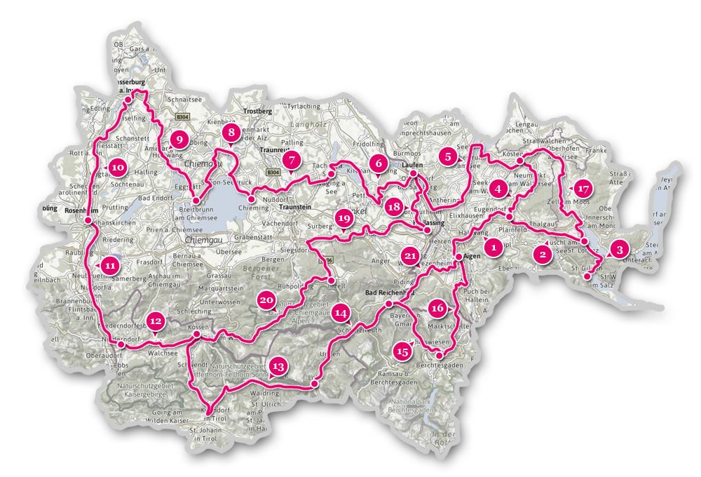
Mozart Cycle Path – Stage 12: Niederndorf – Kössen


- Brief description
-
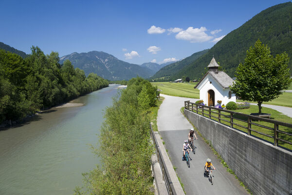
A short but varied stage in the Tyrolean section of the Mozart cycle path. From the Inntal valley, we go up into the Tyrolean Kaiserwinkl as far as Kössen. A longer break by the idyllic Lake Walchsee should definitely be planned in.
- Difficulty
-
medium
- Rating
-
- Starting point
-
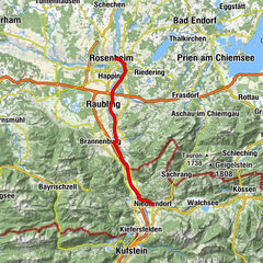
Niederndorf
- Route
-
NiederndorfPfarrkirche St. Georg0.0 kmGasthof Gradlwirt0.1 kmPoint1.9 kmBrand3.4 kmAsching5.0 kmBrandauerhof7.0 kmDurchholzen (690 m)7.0 kmKapelle Durchholzen7.3 kmLiftstüberl7.9 kmLiesfeld (686 m)8.0 kmAmberg8.6 kmBichl (705 m)9.2 kmOed (670 m)9.7 kmCafe am See10.2 kmAnnakapelle18.2 kmErlau19.1 kmKössen19.8 km
- Best season
-
JanFebMarAprMayJunJulAugSepOctNovDec
- Description
-
Take an easterly direction at the church in Niederdorf – past the sports grounds – downhill to the main road which we cross carefully and then left for about 1.5 km on the cycle path next to the road, after which we then turn left towards Rettenschöss – there is a 1.4 km long ascent to Harland and then continue on to Rettenschöss – turn right here towards Walchsee – cycle past the ‘Schwemm’ moorland area and the golf course to Walchsee – go east along the lake promenade – then a short section on the federal road to Kranzach – shortly thereafter, turn right and it is then up and down via Bichlach to Niederbichlfeld where the Mozart cycle path variant via Kössen joins.
- Directions
-
After the village sign Sebi turn right in direction Buchberg. After a slight increase turn left past the Gasthaus Lederer. Continue on Asching until you reach the main road to Durchholzen.
Follow this road and at the Amberg lift turn right into the small road. Turn left at the crossroads at the farm Schnapfl and turn into the next street on the right. Now follow the Seestraße along the Walchsee to Camping Seemühle. There turn left on the main road to the Trachtenstube Achorner and turn right and cycle to Gundharting. There, take the underpass and follow the path first through the forest and then through the settlement of Mooslenz, past the Annakapelle to the sports field. Cross the large wooden bridge and drive into the village center of Kössen, pass the church and follow the road to the next bridge. Just before the junction for the gondola station, keep right towards the Eurocamp. Drive through the district Unterschwendt to Gasthof Lucknerhof. Continue on the left through the center of Schwendt. Descending continues where you turn right towards Kohlenbach, which you then meet up to the place Griesenau again and again and accompany for a while. Then it goes along the main road to Gasteig where they turn left into the town. Follow this road until you reach Kirchdorf.
- Highest point
- 693 m
- Endpoint
-
Kössen
- Height profile
-

- Additional information

- Author
-
The tour Mozart Cycle Path – Stage 12: Niederndorf – Kössen is used by outdooractive.com provided.


General info
-
Kaiserwinkl
19
-
Walchsee
3