
- Brief description
-
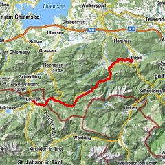
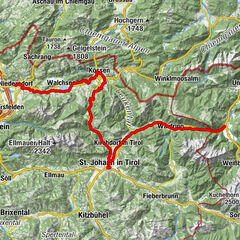
At an altitude of almost 600 metres, this is the most ‘mountainous’ stage of the entire Mozart cycle path. The appeal of this charming landscape of the Kohlen valley and later the Strub valley is therefore even greater for us. In the Achental valley, it is worth considering taking a detour to St. Johann in Tirol. The last part leads through the Strubtal valley, wildly romantic to Lofer and thus back into the Salzburger Land.
- Difficulty
-
medium
- Rating
-
- Starting point
-
Kössen
- Route
-
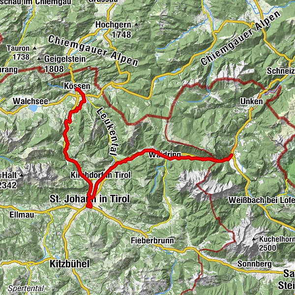
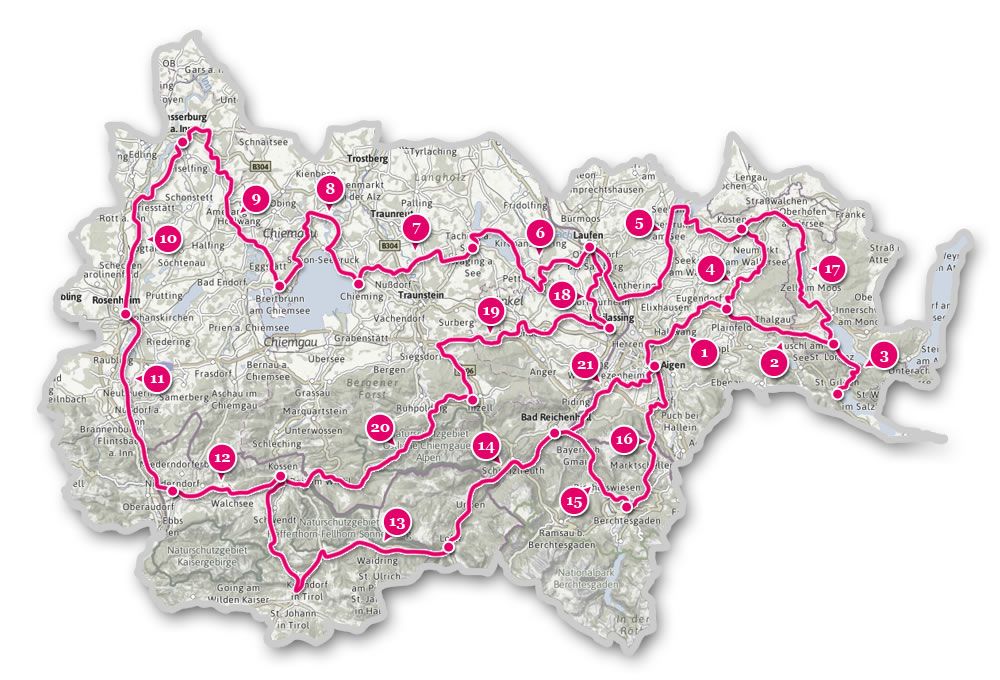
Heiliger Petrus und Paulus0.1 kmKössen0.2 kmHütte1.5 kmThurnbichl1.9 kmKaiseralm2.7 kmCampino2.7 kmLucknerhof3.9 kmBrand5.6 kmRocco (702 m)5.7 kmMairwirt6.5 kmSchwendterwirt6.6 kmSchwendt6.6 kmCafe Restaurant Anneliese6.8 kmFischbach7.1 kmMühlau7.6 kmBichlkapelle9.6 kmKohlental10.5 kmGasthof Griesenau13.9 kmGriesenau13.9 kmTeufelskapelle14.9 kmRupertsau15.6 kmGut Kramerhof17.0 kmMitterjager17.3 kmGasteig17.3 kmNarzen20.8 kmSt. Johann in Tirol22.7 kmPfarrkirche22.8 kmAntoniuskapelle22.9 kmWeberhäusl23.2 kmBruggbäck23.2 kmSchwarzenbacher23.3 kmKirchdorf in Tirol27.8 kmErpfendorf31.0 kmFilialkirche Erpfendorf31.0 kmEnthgries36.2 kmHausergasse37.0 kmAuergasse37.8 kmWaidring39.5 kmGasthof zur Post39.5 kmUnterwasser41.0 kmPension Strub44.1 kmStrub44.1 kmPfarrkirche Hll Maria und Leonhard50.1 kmLofer50.1 km
- Best season
-
JanFebMarAprMayJunJulAugSepOctNovDec
- Description
-
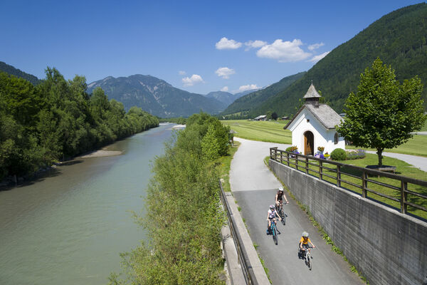
From Niederbichl where the variant via Kössen joins, follows a nearly 1 km long climb – then it continues uphill and downhill on side streets – downhill on a gravel cycle path – a short distance on the federal road – before the bridge, turn left onto a cycle path – along the Kohlenbach, a small river, – at the Gasthof Griesenau (diversion into the Naturschutzgebiet Kaiserbachtal nature reserve) we reach the federal road which is normally relatively quiet and which we now have to follow – past the Teufelskapelle Chapel via Gasteig (parish of Kirchdorf) and Huberhöhe, down to St. Johann in Tirol. Through an underpass, we come across the Gasteiger Straße in the centre of St. Johann. A tour around the Hauptplatz (main square) shows us the Baroque splendour of this market town with the brewery whose special beer was praised by Mozart. Via the Neubauweg, we come back again to the underpass and then turn right onto the ‘Kalksteinrunde’ cycle path which is marked by the Großache river. We ride along the dam at Kirchdorf in Tirol then take the turning to Erpfendorf. Thereafter, we take the old village road onto the cycle path towards Salzburg and then continue on to the entry to the not-to-be-missed Grießbachklamm ravine, past the Hotel Lärchenhof to the underpass beneath the federal road by the Brennerei Seibl distillery. Follow the signpost to the entry to Waidring – continue straight on eastwards via Unterwasser to the Gasthof Strub – here, too, go straight on and slightly downhill towards the Strub Pass (border of Tyrol - Salzburger Land) – on the cycle path along the small river “Loferbach” (warning, some sections are narrow and gravelled) down to Lofer, go under the bypass – the Tauernradweg joins from the right – turn left into the centre of Lofer.
- Highest point
- 785 m
- Endpoint
-
Lofer
- Height profile
-

- Additional information
-
Tourismusverband Kaiserwinkl
Postweg 6, 6345 Kössen / Tirol
T +43 501 100
info@kaiserwinkl.com
www.kaiserwinkl.com
- Author
-
The tour Mozart Cycle Path – Stage 13: Kössen – Lofer is used by outdooractive.com provided.