Children's trail in Leutenberg "On the trail of the fire salamander


- Brief description
-
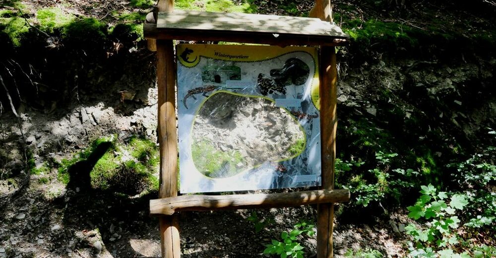
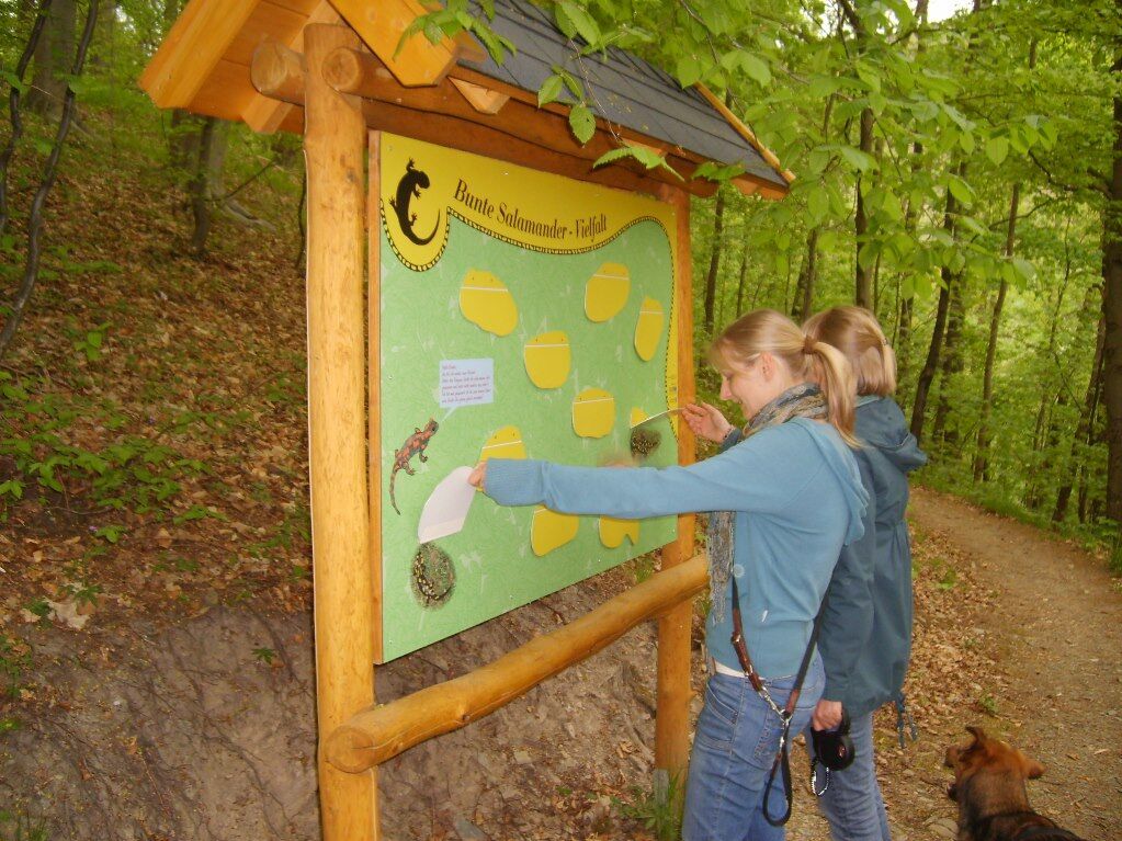
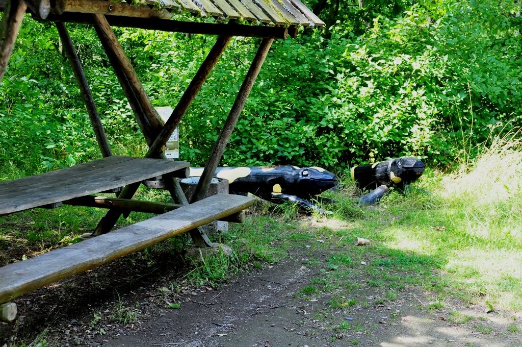
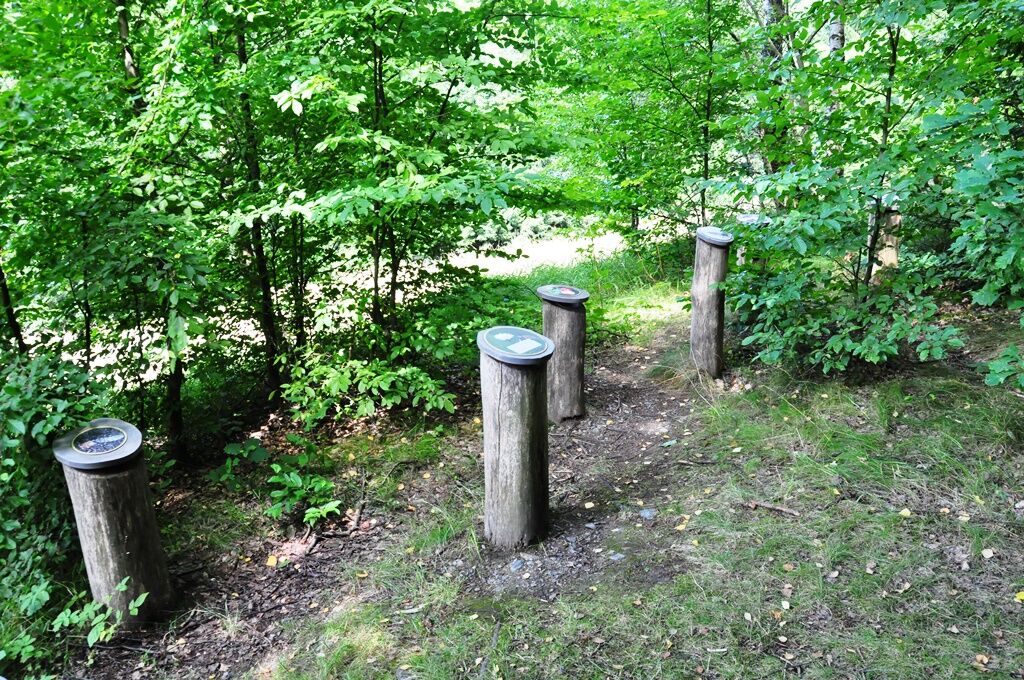
The children's trail is a challenging circular route with information boards, 11 play stations, the nature park house with exhibitions where you can learn all about the fire salamander.
- Difficulty
-
medium
- Rating
-
- Starting point
-
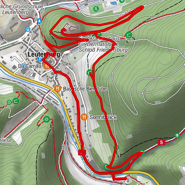
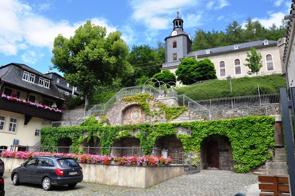
Marketplace Leutenberg
- Route
-
Leutenberg0.0 kmSt. Maria Magdalena0.1 km
- Best season
-
JanFebMarAprMayJunJulAugSepOctNovDec
- Description
-
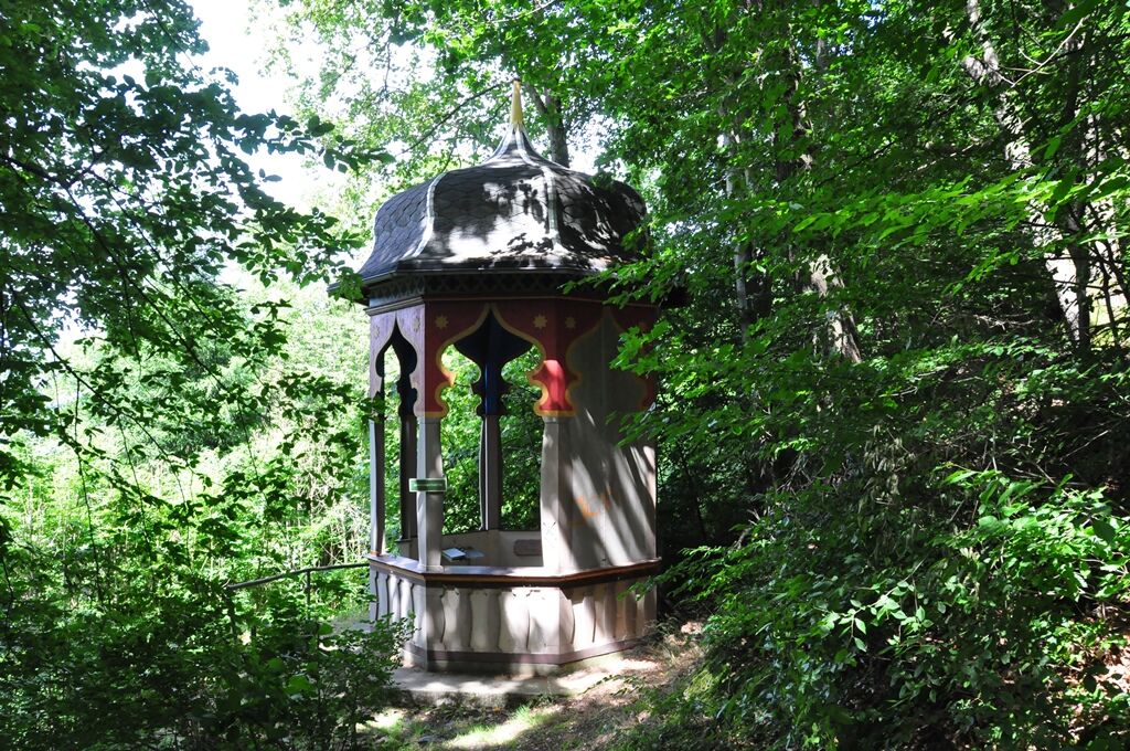
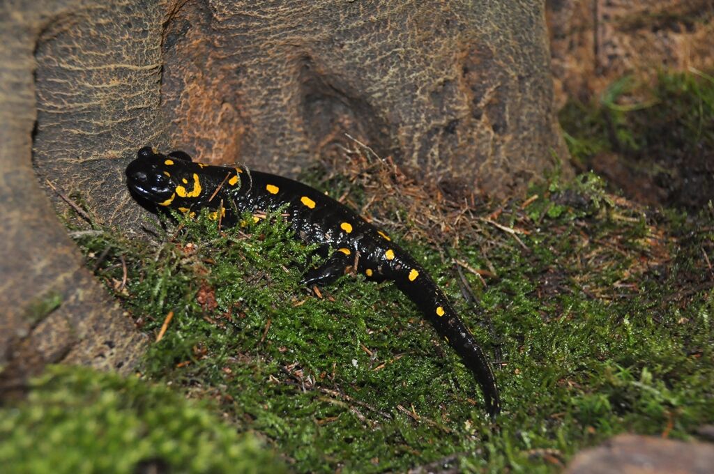
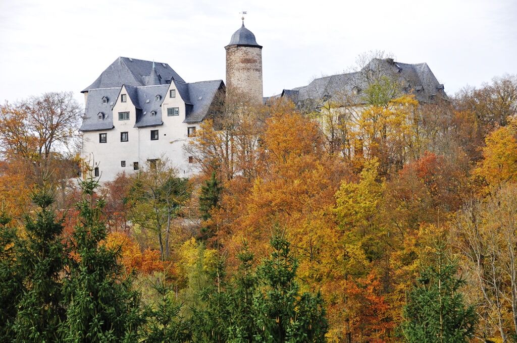
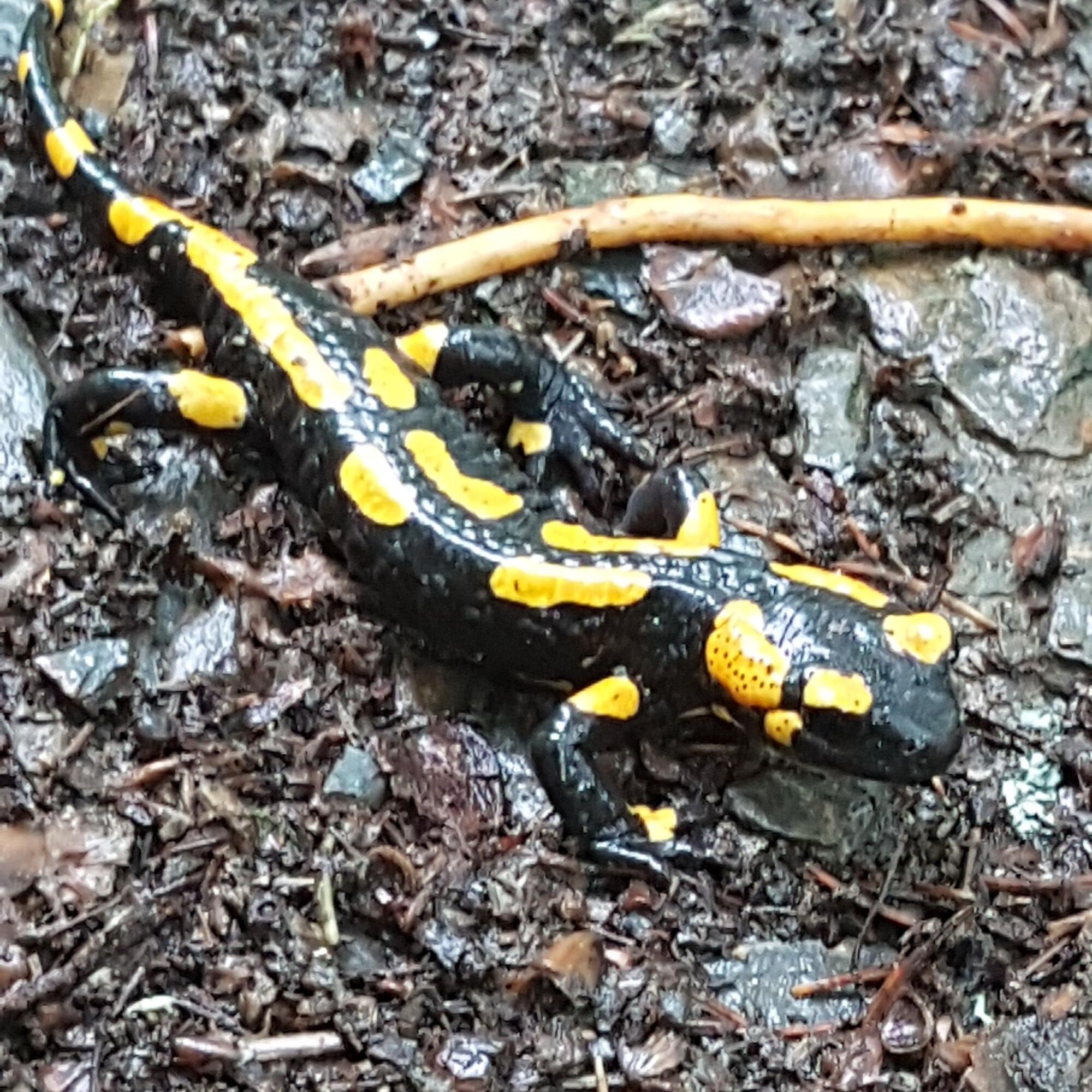
From the market square, walk along the nature trail with many information boards on the castle hill to the car park of Friedensburg Castle. If you book in advance, you can visit the castle. From the castle car park, walk along a forest path to the colourful pavilion with a storybook. The path leads past several play stations to the Hirschbach stream and on to the Nature Park House. There are playgrounds, a treasure chest and much more in the "NaturParkWelten". In the Nature Park House there is a hands-on exhibition on the water ouzel and fire salamander. An extensive collection of minerals and a terrarium with 5 fire salamanders are particularly impressive. You return to the starting point via the Mühlgraben and the historic old town.
- Directions
-
From the market square, follow the signpost (fire salamander on a white background) over the market steps past the church onto the nature trail to Schlossstraße. Walk along Schlossstraße in the direction of the castle until you reach a small car park on the left. Behind the car park, we turn left twice and follow the forest path until we see a colourful pavilion on the right. After the detour to the pavilion (50 metres), we follow the path further through a private property, later downhill into the Hirschbach valley and cross the B90 to the nature park house. From the nature park house, we walk 200 metres next to the B90 and turn right into the old mill race, we follow it and then the "main road" to the market.
- Highest point
- 368 m
- Endpoint
-
Marketplace Leutenberg
- Height profile
-
 © outdooractive.com
 - Equipment
-
Sturdy shoes
First aid kit
Remaining drinks (especially in high temperatures)
Small snack, as there are hardly any supply possibilities on the way, refreshment stops are not open all the time and every day.
GPS device or GPS-enabled smartphone with onboard map material or offline maps. - Safety instructions
-
Please always be aware of logging and storm damage hazards on your walk. Look above you regularly.
Always follow the instructions of forestry personnel.
Avoid walking on moss-covered stones, rocks and roots because of the danger of slipping, and watch out for deadwood, branches and fallen trees. This is especially true in the area of narrow paths.
- Additional information
-
Restaurant and supply options:
(not open continuously and daily!)
Hotel & Gasthof Garküche in Leutenberg (Google-Nav-Punkt) Schwarzburger Hof in Leutenberg (Google-Nav-Punkt) Fleischerei Siegfried Müller in Leutenberg (Google-Nav-Punkt) Agrar Fleischerei Dorfilm in Leutenberg (Google Nav Point) Bakery Ronny Hunger in Leutenberg (Google-Nav-Punkt) Netto Marken-Discount in Leutenberg (Google-Nav-Punkt) Bakery Guder in Leutenberg (Google-Nav-Punkt) Eiscafé Top Melange in Leutenberg (Google-Nav-Punkt) - Public transportation
-
By train to Leutenberg
- Parking
-
- Peopleberg railway station
- Marketplace Leutenberg
- Nature Park House Leutenberg


- Author
-
The tour Children's trail in Leutenberg "On the trail of the fire salamander is used by outdooractive.com provided.


General info
-
Thüringer Wald
996
-
Ludwigsstadt
64