- Brief description
-
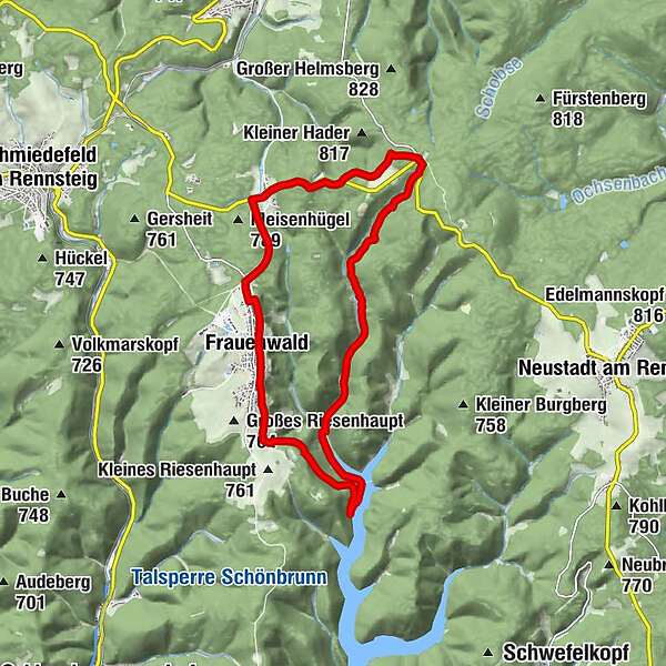
Beautiful hike with very nice views of the Thuringian Forest to the Schönnbrunn Dam along the Luther Trail, via the Rennsteig Ladder Schönbrunn to the large Dreiherrenstein and back on the Rennsteig to Frauenwald.
- Difficulty
-
medium
- Rating
-
- Starting point
-
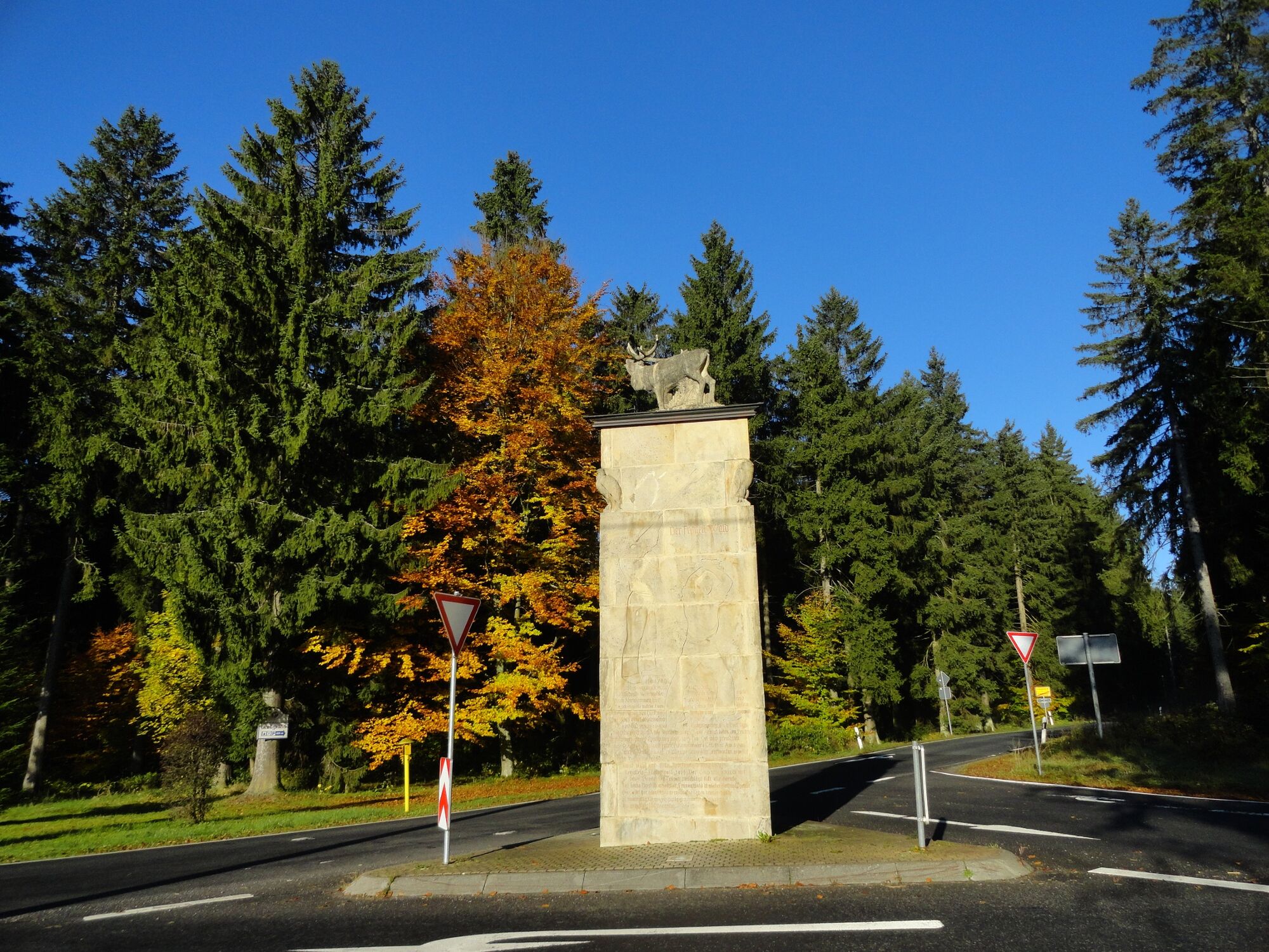
Frauenwald Deer Monument at the Drill Chair
- Route
-
Frauenwald1.0 kmFrauenwalder Bauernstube1.5 kmMühlkopfquelle3.0 kmWaldbaude Großer Dreiherrenstein10.7 kmGroßer Dreiherrenstein10.7 kmKleiner Dreiherrnstein (825 m)11.0 kmAllzunah13.4 kmSkihütte Allzunah13.9 km
- Best season
-
JanFebMarAprMayJunJulAugSepOctNovDec
- Description
-
The hike starts in Frauenwald at the "Monument am Bohrstuhl" and follows the panorama ring on the eastern side of the village. Already from here you have beautiful views down into the valley in every season. At the end of the village, you follow the Eselshauptweg with the Mühlkopfquelle and at the same time follow in Luther's footsteps.
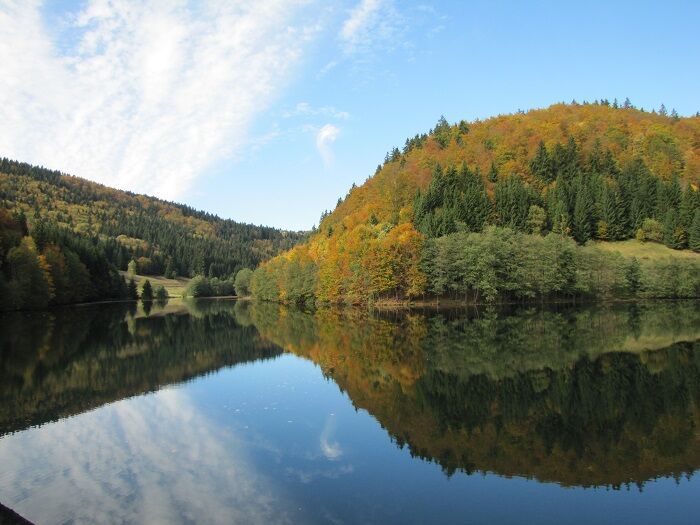
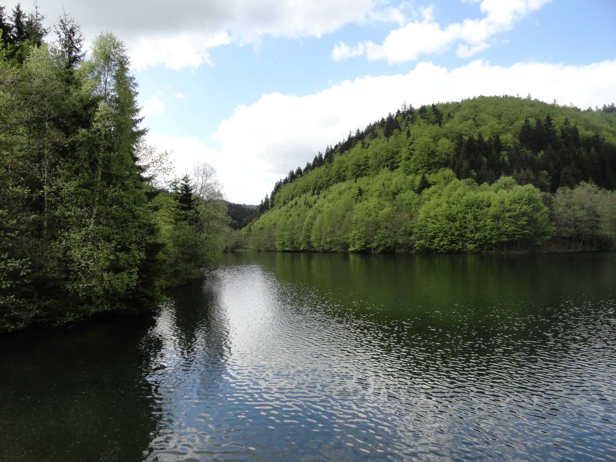
Once in the valley, the Schönbrunn Dam with its azure blue water stretches out.
The dam serves the drinking water supply in the region of Suhl, Hildburghausen, Ilmenau, Meiningen and Schmalkalden as well as flood protection. The Schönbrunn dam supplies 230,000 consumers in southern Thuringia with around 27,000 m³ of drinking water every day.
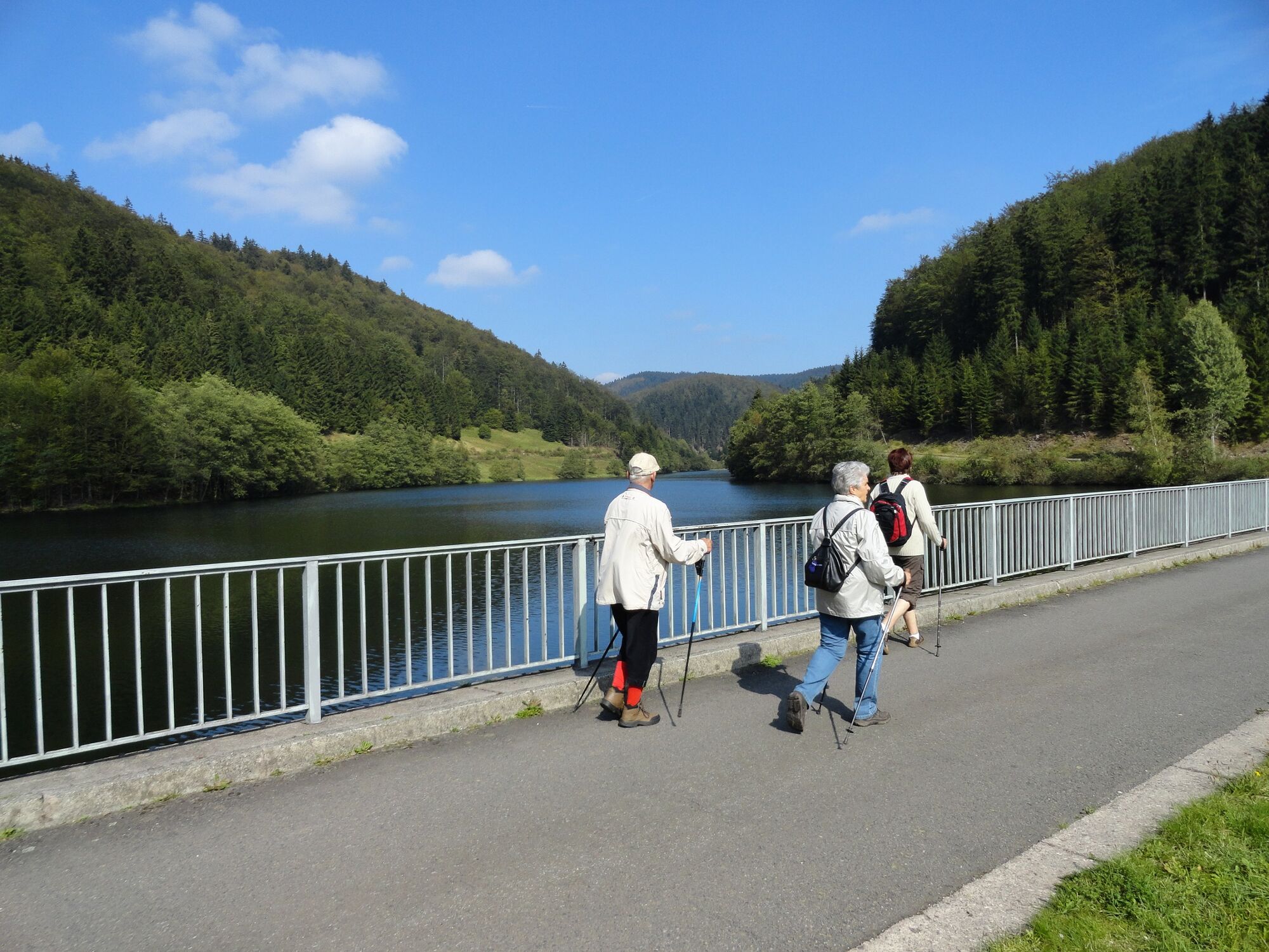
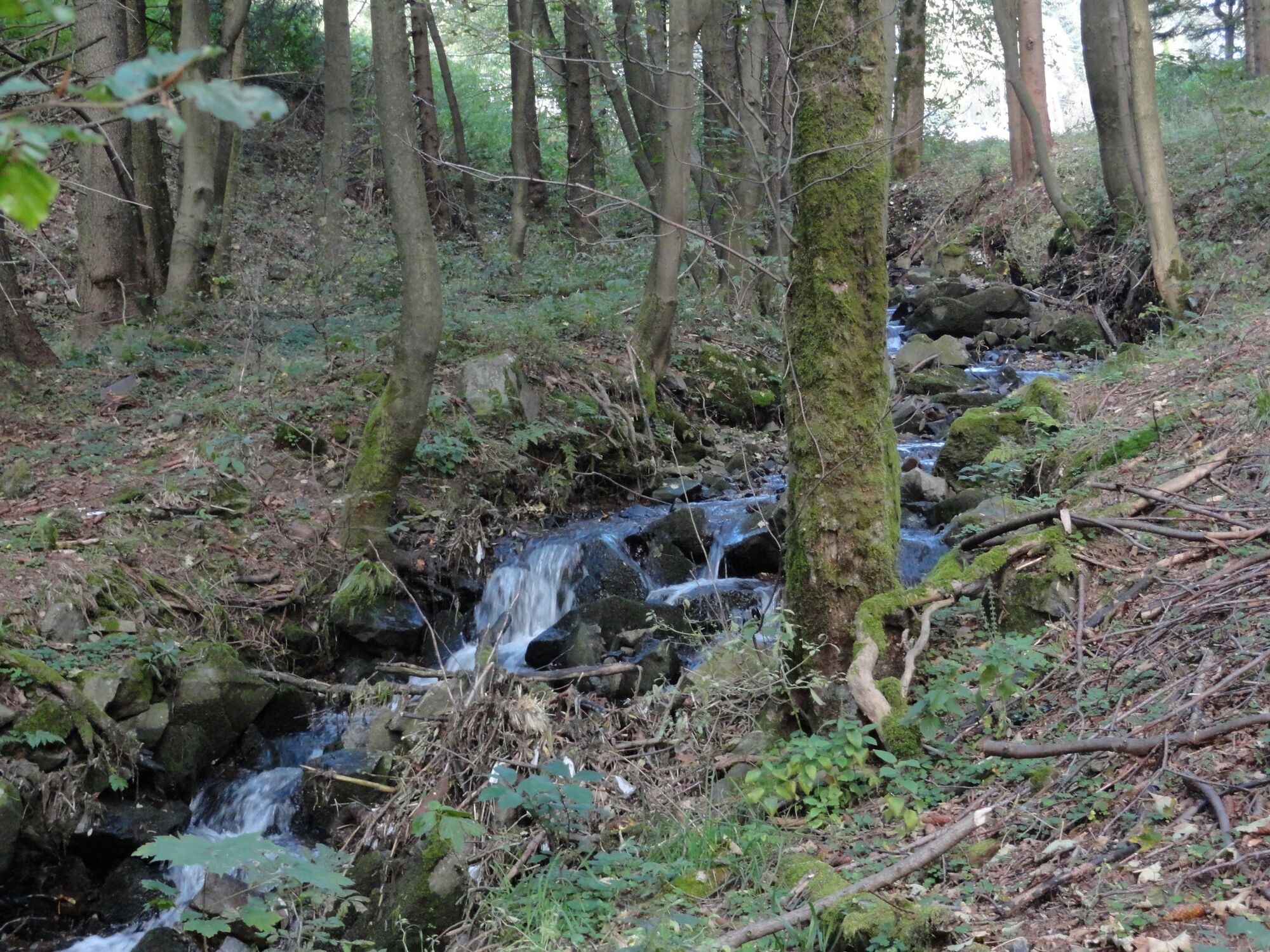
On the left hand side, the Rennsteig ladder Schönbrunn leads through the Schleuse valley up to the Rennsteig at the Großer Dreiherrenstein. The two rivers "Schleuse" and "Böse Schleuse" accompany you. With a lot of luck you can discover one of the here native and rare mouflon sheep.
The Großer Dreiherrenstein is located directly on the Rennsteig at an altitude of 808 meters. It represents the center of the Rennsteig. It also lies on a watershed; the south is drained to the Weser via the lock, to the north the Lengwitz and the Schorte, to the northeast the Schobse and to the east via the Ochsenbach into the Wohlrose. All are tributaries of the Ilm and thus of the Elbe.
The "Großer Dreiherrenstein" (Great Three Lord's Stone) located along the route testifies to the fact that the Rennsteig is not only a high trail, but was also a borderline. The three lordships of the past are the Counts of Henneberg (Kingdom of Prussia), the Duchy of Saxony-Eisenach and the Principality of Schwarzburg-Sondershausen.
Following the Rennsteig you hike back towards Allzunah.
Finally, you follow the historic course of the old Laura railroad line for a bit and arrive back in Frauenwald with plenty of fresh air and a strengthened heart.
- Directions
-
Frauenwald - Mühlkopfquelle / Eselshaupt - Vorsperre Schönbrunn - Rennsteigleiter Schönbrunn - Groß Dreiherrenstein - Rennsteig - Allzunah - Frauenwald
- Highest point
- 827 m
- Endpoint
-
Frauenwald Deer Monument at the Drill Chair
- Height profile
-
 © outdooractive.com
 - Equipment
-
Sturdy shoes
Rainwear
First aid kit
GPS navigation device or smartphone - Safety instructions
-
Pay attention to the typical dangers of the forest! Walking is at your own risk! Avoid walking on moss-covered stones and rocks because of the danger of slipping and watch out for dead wood, branches and fallen trees.
- Tips
-
Halfway from the Großer Dreiherrenstein to Allzunah, it is worth making a detour to the Großer Hundskopf 824 NN. From here you have a very nice view of Frauenwald and the southwestern Thuringian Forest.
- Additional information
- Directions
-
Via the A4 to Erfurter Kreuz, then A71 to exit Ilmenau; from the south via the A71 (from Schweinfurt) and A73 (from Nürnberg) - after Frauenwald continue on the L3004 towards Coburg to Rennsteigkreuzung, then continue on the L1141 towards Frauenwald.
- Public transportation
-
On weekends, you can easily reach Rennsteig station by train from the direction of Erfurt / Ilmenau. The route Ilmenau - Stützerbach - Rennsteig station is served by the RennsteigShuttle of SüdThüringenBahn. All information on tickets, timetable and connections to Erfurt and Saalfeld can be found >>HERE<<
.On weekdays, you can get to Frauenwald by bus from the direction of Schmiedefeld and Ilmenau. Use line 300
.To plan your journey, simply use the Deutsche Bahn travel portal at the following link:
.
→ Getting to Frauenwald - Parking


- Author
-
The tour Circular hike - To the Schönbrunn Dam - Frauenwald is used by outdooractive.com provided.


General info
-
Thüringer Wald
999
-
Coburg Rennsteig / Thüringen
500
-
Frauenwald
275