- Brief description
-
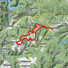
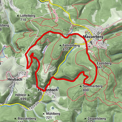
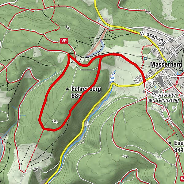
Enjoy the peace and quiet and our healing climate on our circular trail around the Fehrenberg in Masserberg.
- Difficulty
-
medium
- Rating
-
- Starting point
-
Rennsteig Masserberg car park
- Route
-
Masserberg0.1 kmMasserberg4.3 km
- Best season
-
JanFebMarAprMayJunJulAugSepOctNovDec
- Description
-
The TKW 3 leaves on the side of the car park at the Rennsteig.
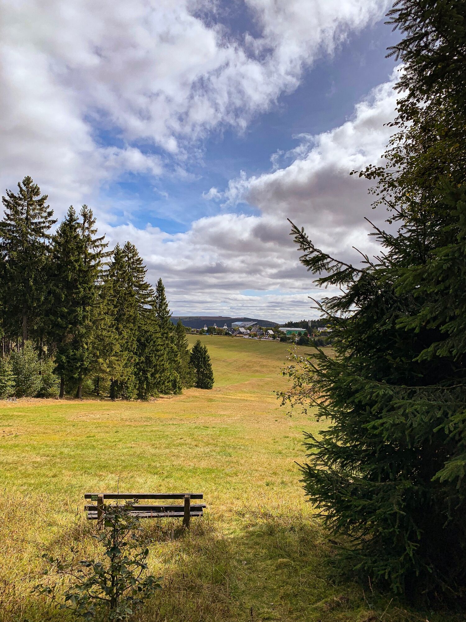
&Uml;ber wonderful mountain meadows with a wonderful view of the Coburger Land, you reach, behind a forest stump, the toboggan run on the left. Continue on the Masserberg circular trail all the way around the Fehrenberg. The path descends slightly at first, then it climbs up again just as slightly to the Rennsteig. At the top, turn right again in the direction of Masserberg. The Bühringshütte and the mountain station of the Masserberg T-bar lift are on the left. Now descend again along the narrow Rennsteig forest trail (always recognisable by the large R on the stones at the side of the trail) until you reach the beautiful mountain meadows again and see the town of Masserberg in front of you. - Directions
-
Race trail
Round path Masserberg
Seat group
Race climb
Mountain station ski lift - Highest point
- 823 m
- Endpoint
-
Rennsteig Masserberg car park
- Height profile
-
 © outdooractive.com
 - Equipment
-
Sturdy shoes
Getter reserves
First aid kit
Smartphone - Tips
-
Not far from the car park is the Krativ- Glasbläserei Christian Sachs, where you can also try your hand at blowing your own glass ball.
- Additional information
- Directions
-
From Eisenach or Dresden A4: Exit the A4 at Erfurter Kreuz onto the new A71, direction Ilmenau (until exit Ilmenau Ost)There, take the B87 (right) and continue in the direction of Stadtmitte Ilmenau (or direction Schleusingen / Suhl) until you reach the signpost for Neustadt / a.R.. , turn off towards Neustadt / a.R.- straight on over the railway track to Neustadt am Rennsteig.From there it is only 9 km to Masserberg.
From Schleusingen: On the B4 in the direction of Eisfeld, turn left at Ratscher in the direction of Masserberg/Neustadt a.Rstg.After the village of Waldau, first turn right, then left in the direction of Masserberg. via Lichtenau, Engenstein, Biberschlag and Tellerhammer continue to Masserberg.
From Bamberg: Take the A73 to Eisfeld-Nord, then take the B4 towards Eisfeld to the roundabout, then take the 3rd exit towards Neuhaus/Masserberg B281a, turn left on the B281a towards Masserberg, continue via Einsiedel, Fehrenbach to Masserberg.
From Schweinfurt: Take the B303 to Coburg, from Coburg take the A73 to Eisfeld-Nord, then take the B4 towards Eisfeld as far as the roundabout, then take the 3rd exit towards Neuhaus/Masserberg B281a, turn left onto the B281a towards Masserberg, via Einsiedel, Fehrenbach continue to Masserberg.
From Eisfeld: Turn right in the direction of Neuhaus / Saalfeld, at the next junction drive in the direction of Masserberg, via Waffenrod-Hinterrod continue to Masserberg.
From Hildburghausen: Drive in the direction of Schleusingen, in Gerhardtsgereuth turn right towards Wiedersbach, there take the B4 towards Eisfeld, after the village of Schwarzbach turn left towards Masserberg, via Lichtenau, Engenstein, Biberschlag and Tellerhammer to Masserberg.
- Public transportation
- Parking


- Author
-
The tour Terrainkurweg Masserberg- TKW 3- Fehrenberg - Thuringian Forest is used by outdooractive.com provided.


General info
-
Thüringer Wald
998
-
Coburg Rennsteig / Thüringen
500
-
Masserberg
198