
- Brief description
-
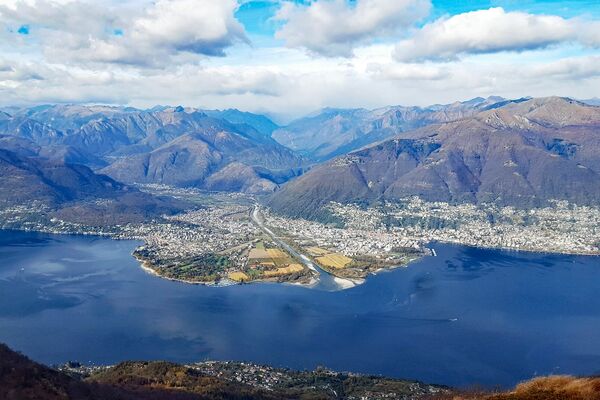
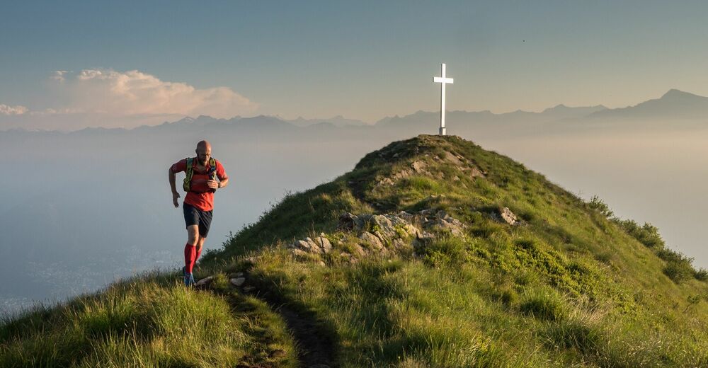
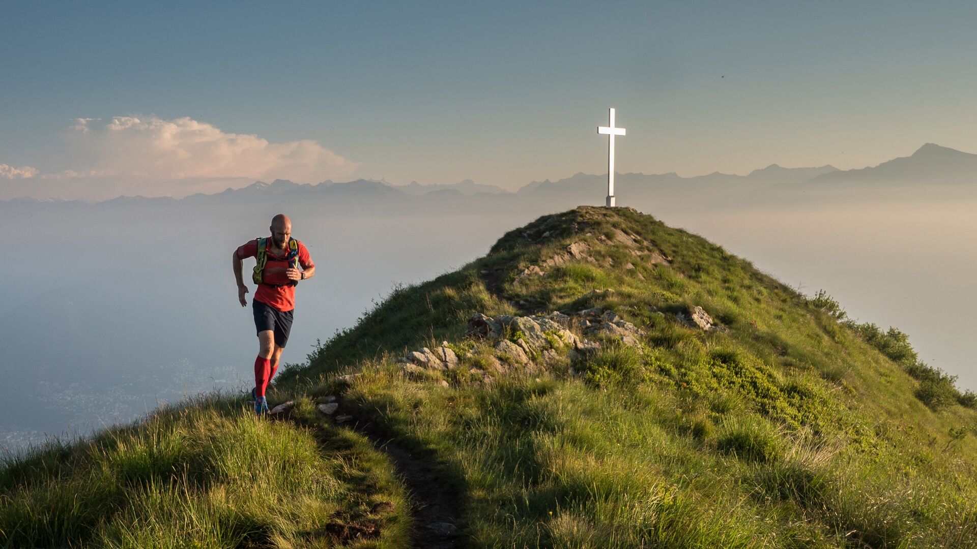
Incomparable view of Lake Maggiore.
- Difficulty
-
medium
- Rating
-
- Starting point
-
Alpe di Neggia
- Route
-
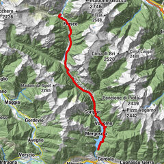
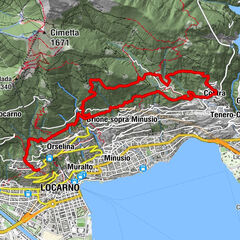
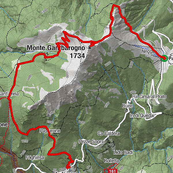
Alpe di Neggia (1,395 m)Monte Gambarogno (1,734 m)2.2 kmStarsBox Lüf2.8 kmAlpe Cedullo4.7 kmSant'Anna5.2 kmRifugio St. Anna5.2 kmPasturone6.5 kmIndemini (939 m)7.5 km
- Best season
-
JanFebMarAprMayJunJulAugSepOctNovDec
- Description
-
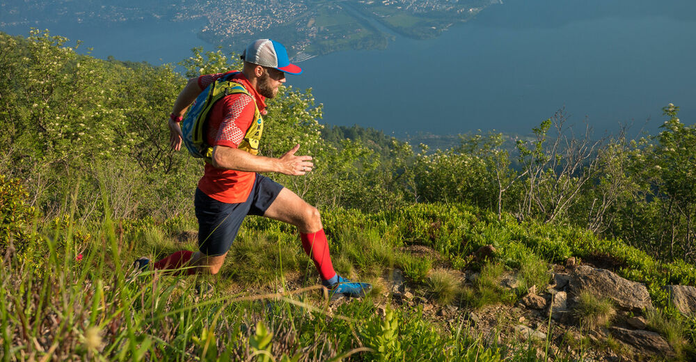
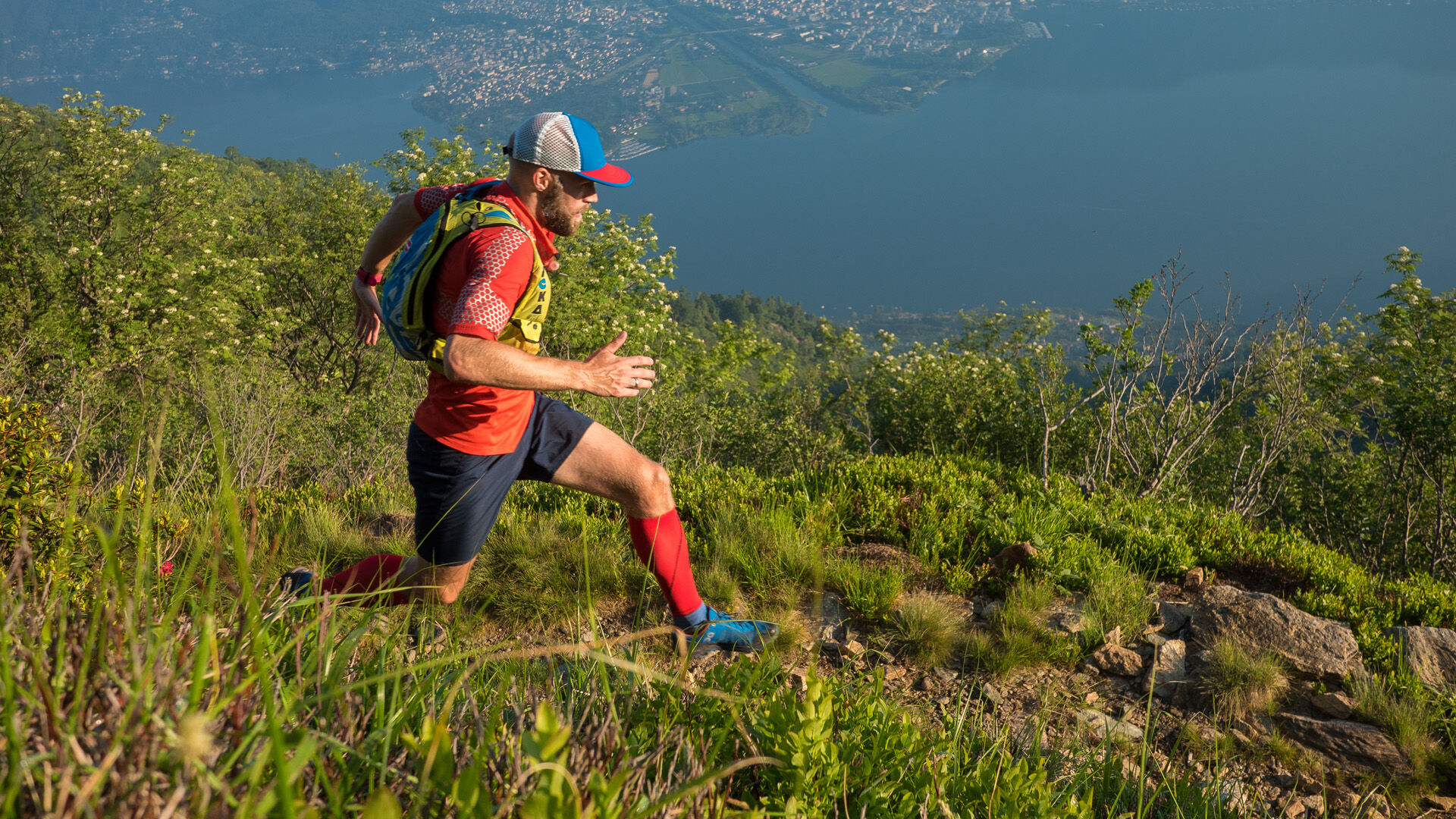
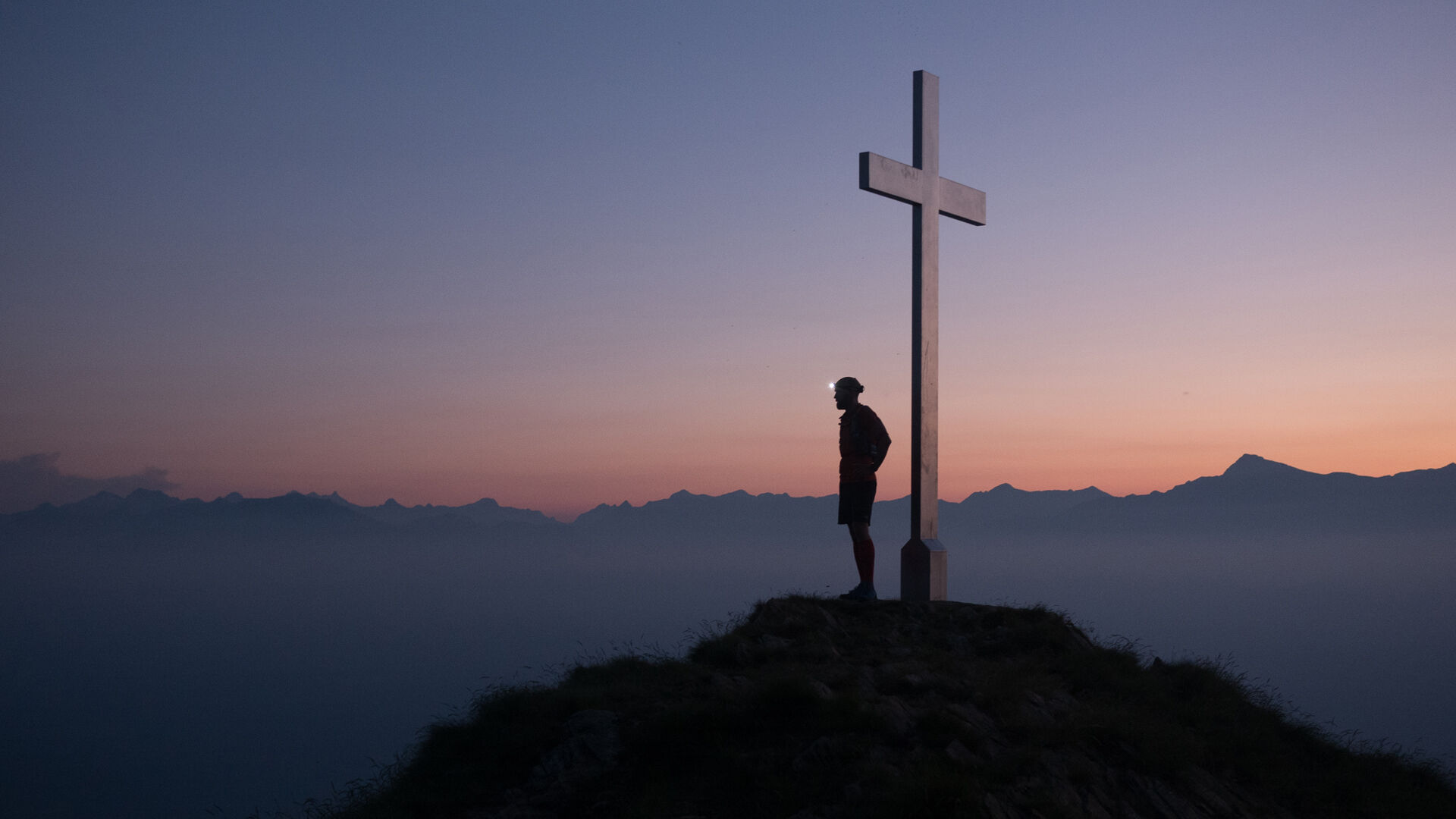
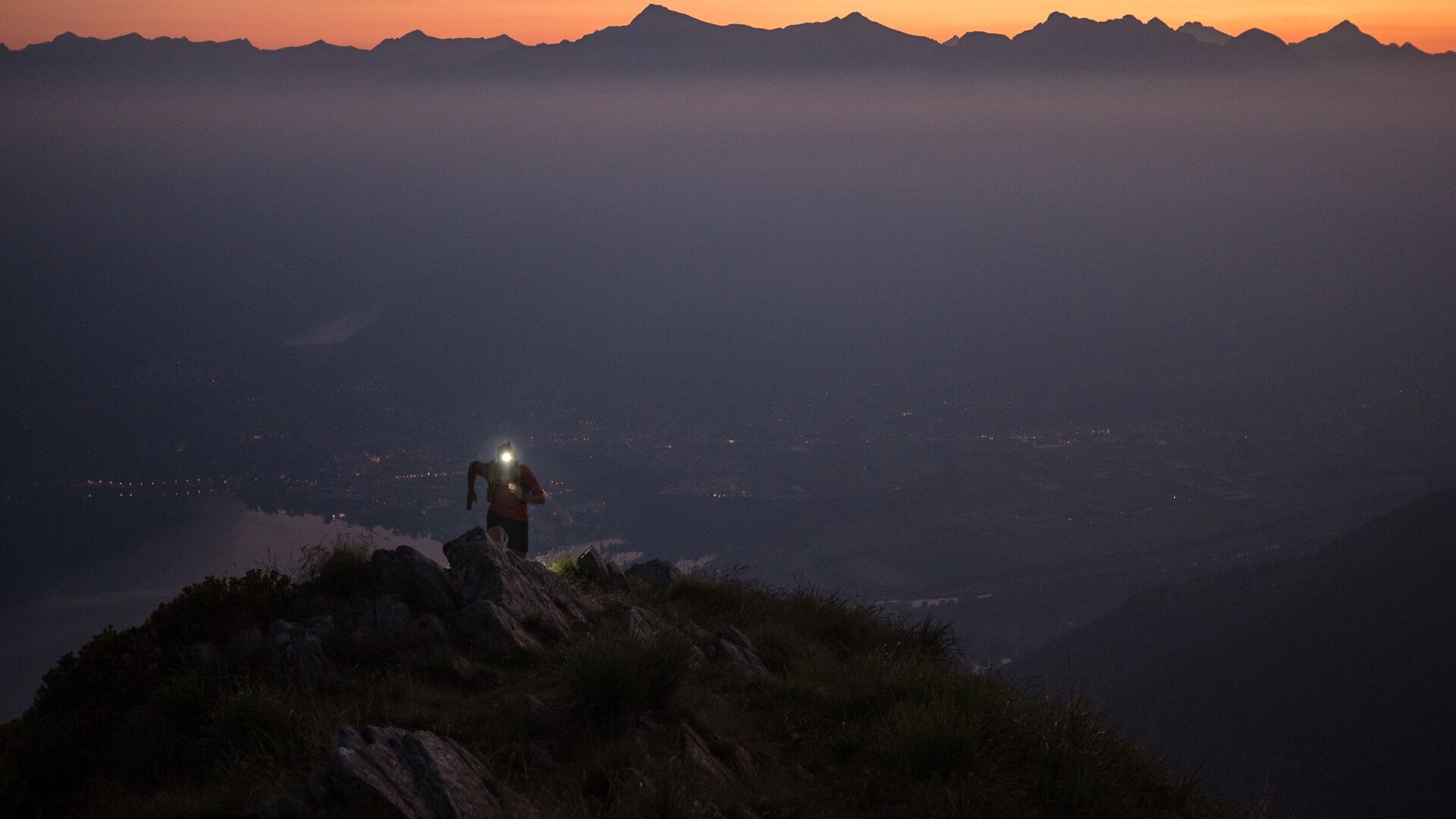
To the north of the Alpe di Neggia autopostale stop, an easy mule track leads to the summit of Monte Gambarogno, with its incomparable view of Lake Maggiore and an entire chain of mountains. It then follows a winding downhill route along the western slope to Alpe Cedullo, where you can sample locally-made cheese. From here, the route rises gently below the rock-strewn landscape of Sant'Anna and reaches the Sant'Anna pass, with its solitary oratory.
The descent into Indemini is an easy one, following the slope of the Sassi Gialli to Val Crosa and then passing through a birch forest. The slate roofs of Indemini come into view shortly afterwards. This is the only traditional Ticinese settlement to be built entirely of rough stone quarried on the site of the village itself. Nearly all of the houses are dark in colour, with identical roofs and wooden outbuildings. Indemini is truly a haven of tranquillity.
- Directions
-
Alpe di Neggia-Monte Gambarogno-Alpe Cedullo-Oratorio di Sant`Anna-Indemini
- Highest point
- 1,712 m
- Endpoint
-
Indemini
- Height profile
-
 © outdooractive.com
 - Equipment
-
Light running backpack (approx. 5 to 10 liters) with rain cover if necessary
Trail running shoes
Special running socks if necessary
Adequate and breathable clothing in multiple layers
Trail running sticks if necessary
Sun and rain protection
Snacks and drinking water
First aid kit
Penknife
Mobile phone
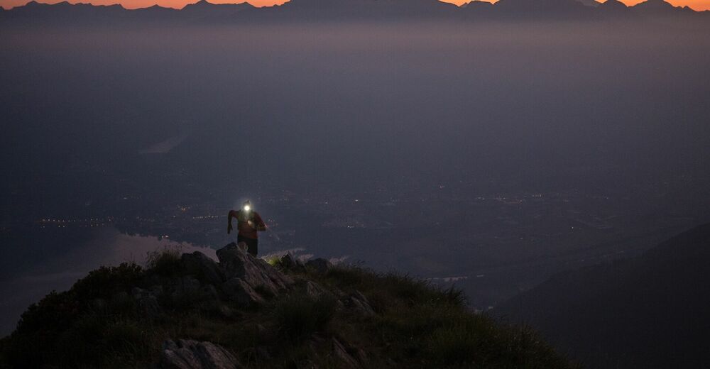
Headlight and reflectors if necessary
Maps
Light running backpack (approx. 5 to 10 liters) with rain cover if necessary
Trail running shoes
Special running socks if necessary
Adequate and breathable clothing in multiple layers
Trail running sticks if necessary
Sun and rain protection
Snacks and drinking water
First aid kit
Penknife
Mobile phone
Headlight and reflectors if necessary
Maps
- Author
-
The tour Monte Gambarogno Trail is used by outdooractive.com provided.