Educational trail - Between the Mountains and the Lake - Stage 1: Dirinella-San Nazzaro


- Brief description
-
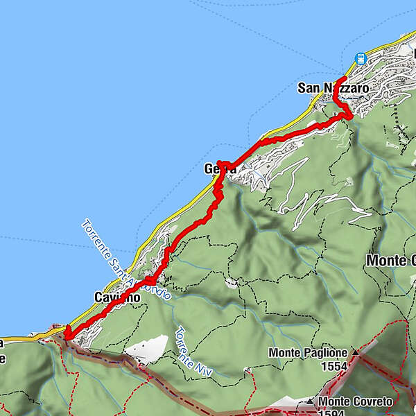
The first part of the Between the Mountains and the Lake educational trail links Dirinella and San Nazzaro.
- Difficulty
-
medium
- Rating
-
- Starting point
-
Dirinella
- Route
-
Dirinella0.1 kmScaiano0.3 kmChiesa di Santa Maria Nascente1.0 kmOsteria del Sole1.1 kmCaviano (282 m)1.1 kmRistorante Grotto Bellavista1.8 kmChiesa di Santa Maria Nascente1.8 kmSant'Abbondio (331 m)2.0 kmCalgiano2.3 kmScimiana4.1 kmGerra (216 m)4.2 kmAl Portico4.7 kmScalo di Gerra4.8 kmRonco5.0 kmGerra (Gambarogno) NLM (222 m)5.0 kmCasenzano6.5 kmSan Nazzaro (201 m)7.0 kmTaverna7.0 kmSan Nazzaro (211 m)7.4 km
- Best season
-
JanFebMarAprMayJunJulAugSepOctNovDec
- Description
-
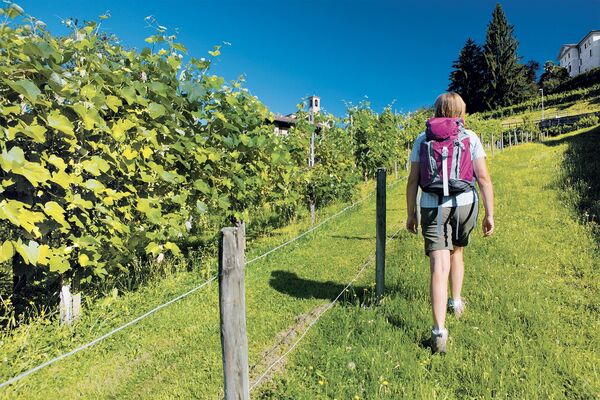
The start of the route in Dirinella is well marked by panels for the two educational and mountain trails located at the entrance to the railway underpass opposite the petrol station. The shady trail climbs up on smart traditional paving towards Scaiano and you will come across the first themed panel about the mammals of Ticino after just a few minutes.
Further on, leaving the mule track that climbs to Scaiano and the mountains (Between the Mountains and the Lake Mountain Trail) behind you, the route turns left through meadows and vineyards and, once in Caviano, lingers in front of a well-preserved wash house used by housewives until the 1960s. The route passes through this traditional village, with the church of Santa Maria Nascente, its ancient houses and narrow streets. Once through the village, the trail continues towards Sant’Abbondio.
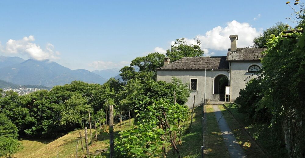
You will reach Sant’Abbondio through the shaded valley of the same name and over a stone bridge that offers views of a picturesque waterfall. In Sant’Abbondio it is well worth visiting the stunning Via Crucis – although it is not on the Between the Mountains and the Lake route – which climbs up to the oratory of the Madonna del Lauro, for the fourteen chapels that contain artworks created by different artists in 2002. These artworks replaced those carried out in 1972 by the artists of the fresco school run by Edgardo Ratti. These sculptures were damaged by vandals shortly after being finished, but eight were restored in 2010 and can now be admired on the lake façade of the church of Santi Abbondio e Andrea, which enjoys stunning views of the lake and is home to a panoramic panel identifying the mountains opposite.
After the town of Sant’Abbondio the route climbs up to the right along Via di Calgiano; after just a few paces, a short detour takes you to the spring, where a panel explains the technique once used by housewives to do their laundry. Once back on the trail, you will soon reach the quiet village of Calgiano; a little further on, you will walk into the cool green chestnut grove where there are panels describing the unusual features of the coppice and the birds that make their home in Switzerland’s woods.
As you leave the wood you will suddenly be greeted by breathtaking views of Gerra, the lake, Ascona and the start of the Vallemaggia. A staircase on your right leads to a small plateau with an interesting panel about the history of the fields beyond the lake that were once used by the peasants of Gerra for haymaking.
As the trail descends towards Gerra you will come across two panels about winemaking and the waterways of Lake Maggiore. Once across the cantonal road by the lake shore, you will see the panel about the development of Gerra’s population and construction. Cross the river towards the public swimming area, the perfect place for a stop and a dip during the summer. A panel by the lake tells you about the winds that blow across it. The trail leads into the picturesque multicoloured centre of Gerra, next to the church dedicated to Santi Rocco e Sebastiano, before it returns to the lake – where you will find an interesting panel about the lake basin and the rivers that flow out of it – and then climbs back to the cantonal road. Following the pavement, the educational trail reaches Gerra’s cemetery before passing under the railway and continuing towards Casenzano.
Of particular interest in Gerra, although it is off the trail, the chapel path and Via Crucis leads up from the cantonal road to the oratory of San Bernardino in the hamlet of Ronco, offering expansive views of the lake.
As you climb up from the cemetery, you will soon come across the panel about the development of the Gambarogno road network. After a pleasant walk, the trail arrives in Casenzano, where a short detour takes you to the oratory of Sant’Antonio, home to a panel that will tell you about the unusual history of the town.
The trail sets off again towards Vairano and, once on the other side of the Valle di Cedullo, descends towards San Nazzaro and passes in front of the entrance to the avenue that leads to the church dedicated to Santi Nazzaro e Celso. In 1790, this lovely church was converted by the famous engineer and politician from Gambarogno Francesco Meschini (1762–1840), known first and foremost for designing the Tremola Road. At the entrance to the avenue there are two panels, one that recounts the life and work of Meschini and another that provides information about how the advent of the railway in 1882 changed the landscape of Gambarogno.
The first part of the route ends in San Nazzaro, on the cantonal road near the Autopostale PostBus stop, above the public swimming area and near the boat jetty.
- Directions
-
Dirinella-Caviano-Calgiano-Torcetto-Gerra Gambarogno)-Lubie-S.Nazzaro
- Highest point
- 351 m
- Endpoint
-
San Nazzaro
- Height profile
-
 © outdooractive.com
 - Equipment
-
Hiking daypack (approx. 20 liters) with rain cover
Comfortable and sturdy footwear
Adequate and durable outdoor clothing in multiple layers
Telescope sticks if necessary,
Sun and rain protection
Snacks and drinking water
First aid kit
Penknife
Mobile phone, headlight if necessary
Maps - Tips
-
Timings:
Taking your time to read the panels and stopping to admire the landscape, you should allow at least three hours.Amenities:
There is at least one restaurant in Caviano, S. Abbondio, Gerra and San Nazzaro.
There are grocery stores in Caviano (only from spring to autumn), Gerra and San Nazzaro.
The two public swimming areas in Gerra and San Nazzaro are open during the summer months. - Public transportation
-
Autopostale PostBus stops in Dirinella, Gerra and San Nazzaro.
Boat jetty in Gerra and San Nazzaro.


- Author
-
The tour Educational trail - Between the Mountains and the Lake - Stage 1: Dirinella-San Nazzaro is used by outdooractive.com provided.


General info
-
Lago Maggiore / Lombardei
746
-
Gambarogno Riviera
593
-
Ascona
220