- Brief description
-
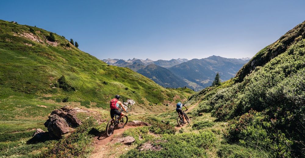
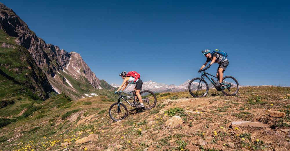
An itinerary rich in unique and unforgettable alpine walks and vistas, ideally suited to those who prefer fun descents that are not too challenging. Bikers will be entertained by breathtaking views, pine forests, pastures and exciting crests.
- Difficulty
-
medium
- Rating
-
- Starting point
-
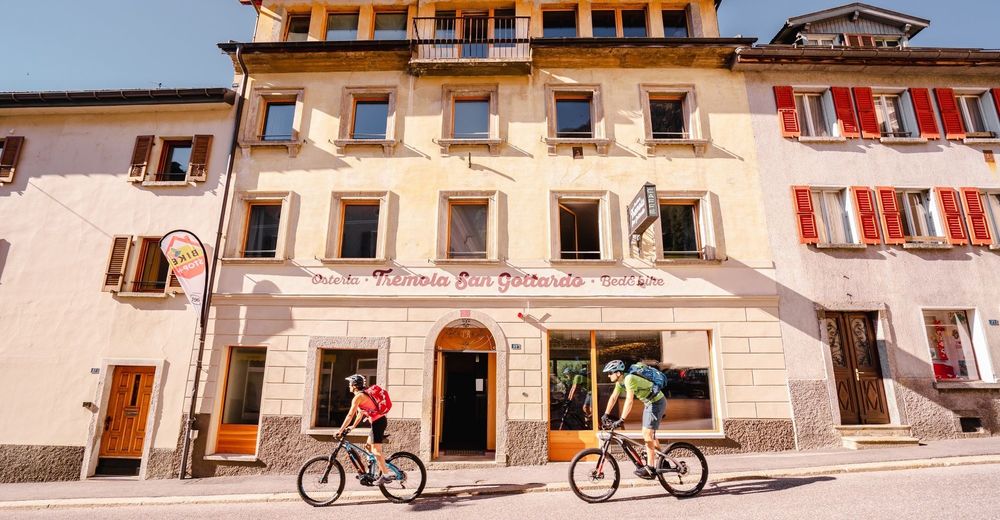
Airolo
- Route
-
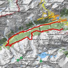
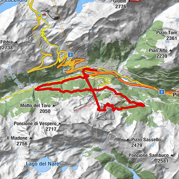
Airolo (1,175 m)0.1 kmDi là dall'Acqua1.8 kmSass dala Bògia3.7 kmRavina6.1 kmRavina6.7 kmNante10.8 kmCulisc11.5 kmFontana16.0 kmCantina di Rovinò16.3 kmCiòss Cecu17.5 kmCioss di Sopra17.8 kmTamblina18.6 kmDi là dall'Acqua19.3 kmAirolo (1,175 m)21.0 km
- Best season
-
JanFebMarAprMayJunJulAugSepOctNovDec
- Description
-
An itinerary rich in unique and unforgettable alpine walks and vistas, ideally suited to those who prefer fun descents that are not too challenging. Bikers will be entertained by breathtaking views, pine forests, pastures and exciting crests.
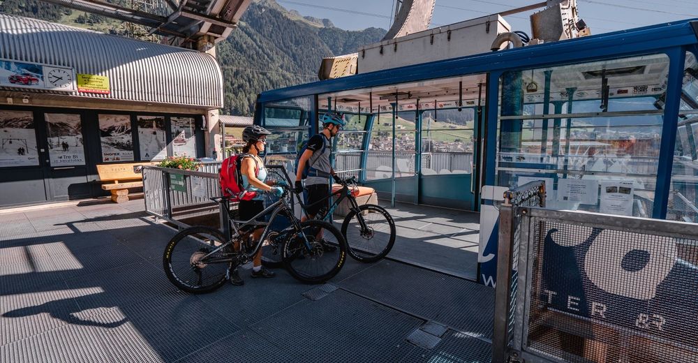
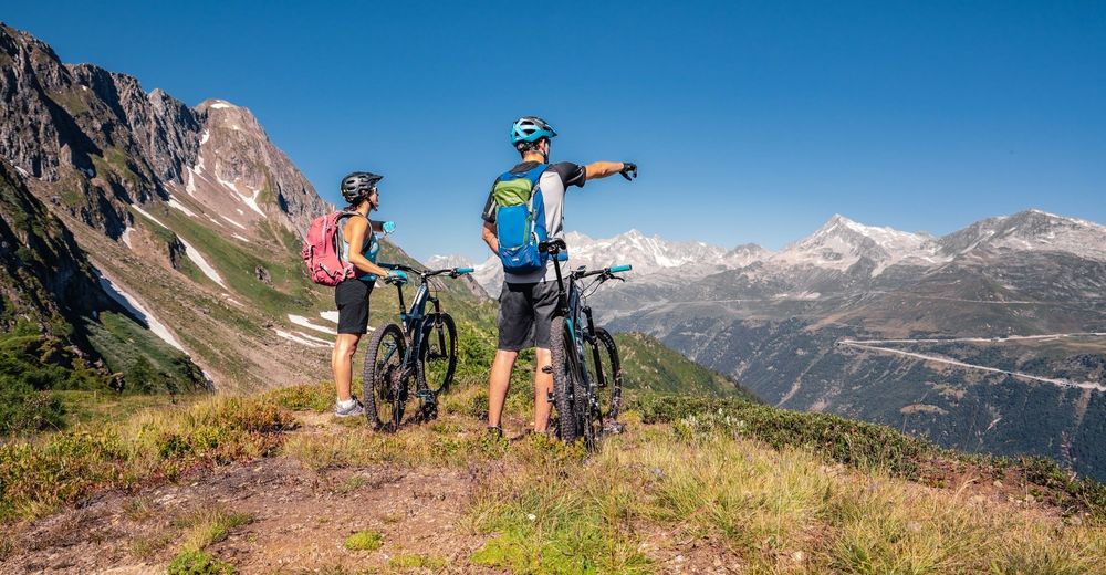
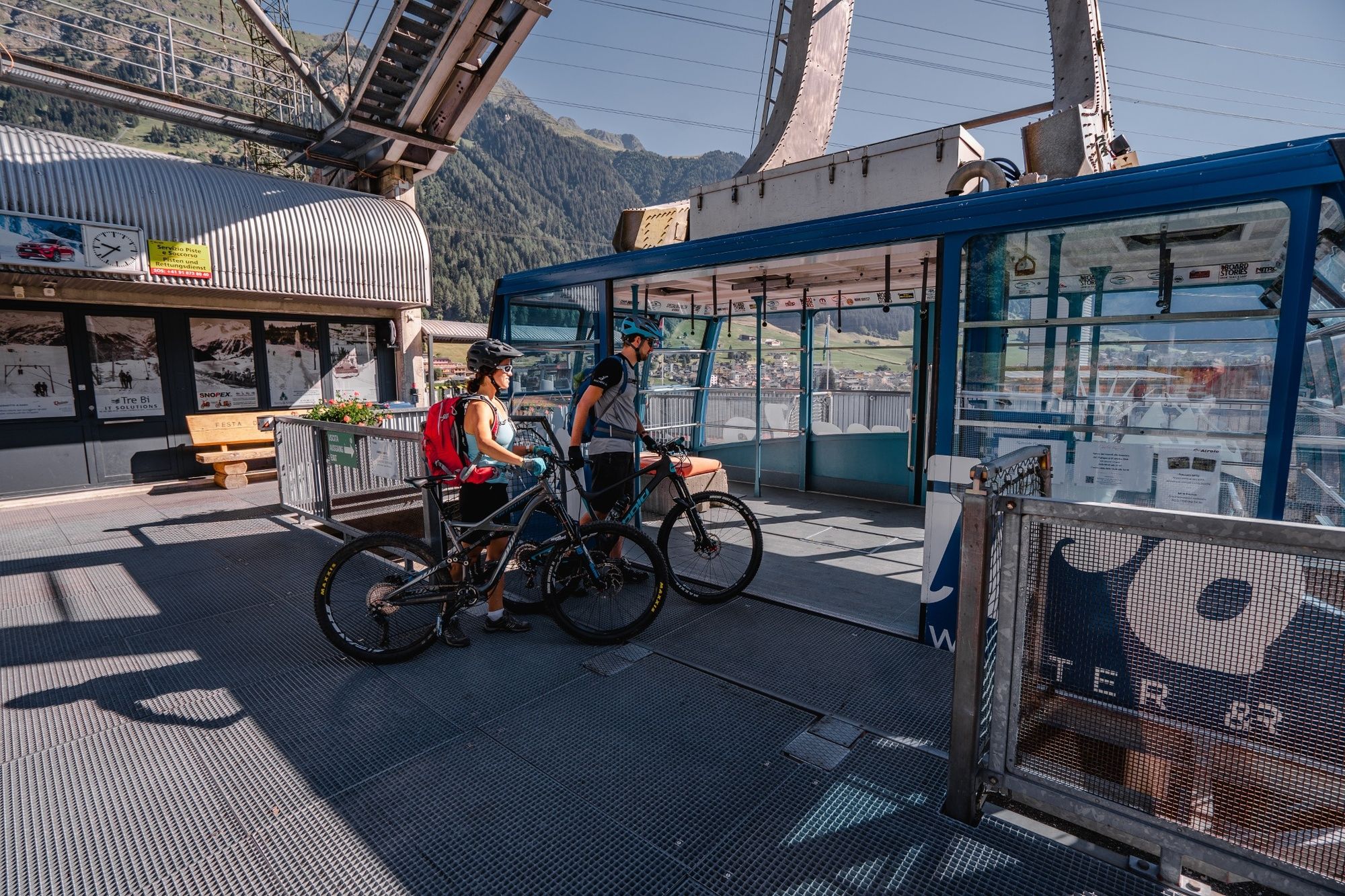
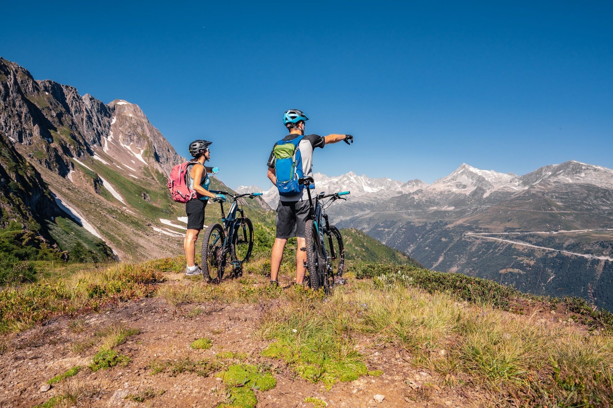
The starting point is the railway station at Airolo, located in the centre of this historic town at the southern gateway to Switzerland. Following the cantonal road in the direction of Valle Bedretto, in a few minutes you arrive at the departure point of the Airolo-Pesciüm cable car. You climb to Sasso della Boggia, located at 2066 m a.s.l., from where you can enjoy a magnificent view of the Saint-Gotthard Massif.
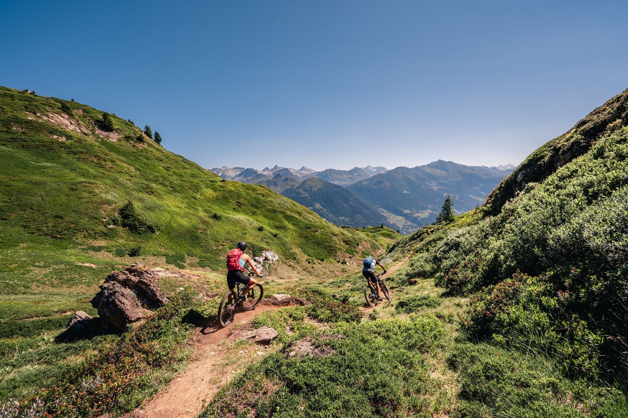
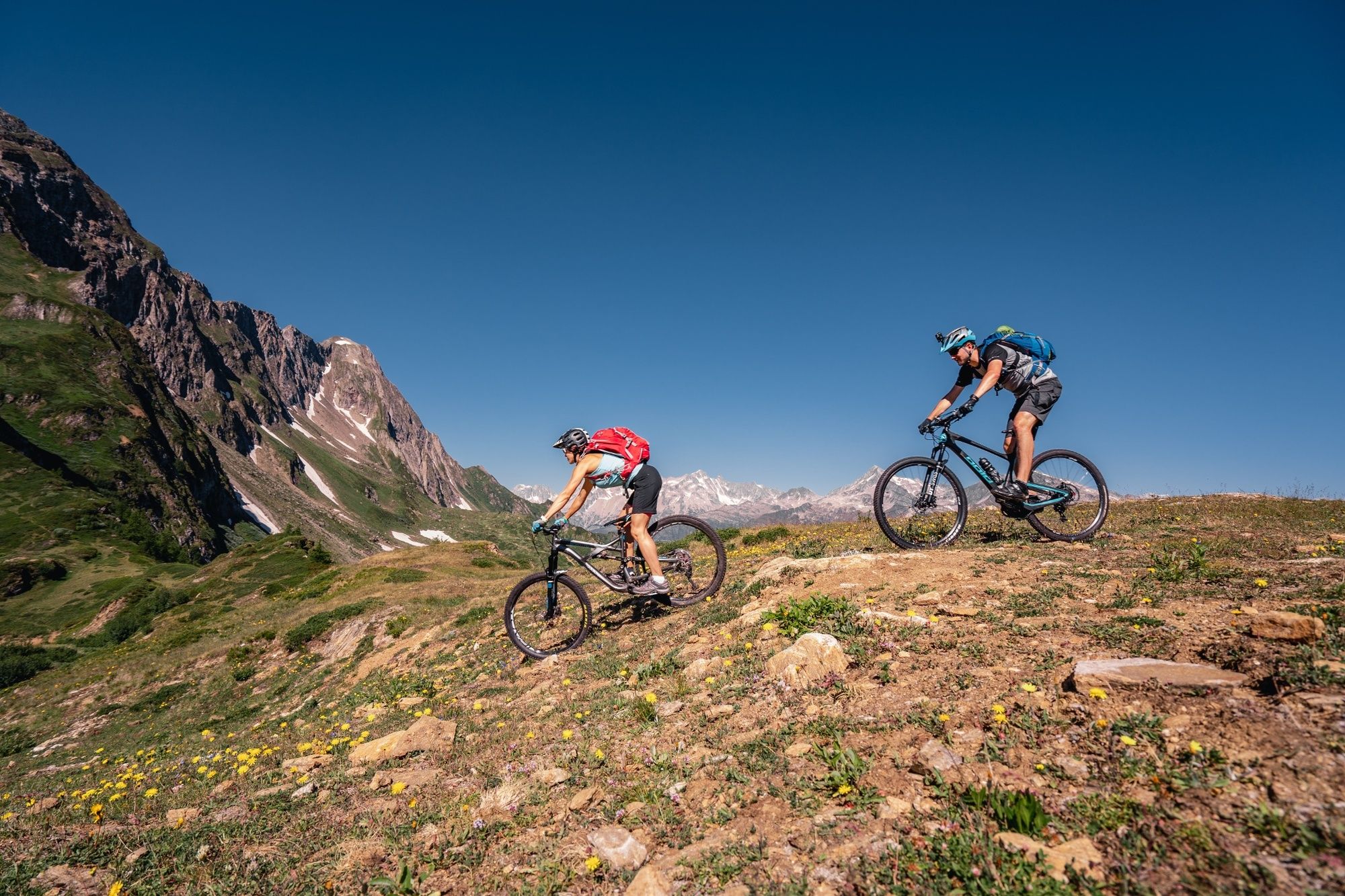
The first descent of this itinerary starts with an easy-medium single trail track in a naturalistic and breathtaking context; a union between pastures and mountains, a dazzling color green ready to guide you to Cassinello and then reach, on a dirt road, the Châlet in Ravina; ideal location for a stopover with Polenta and regional products.Afterwards, continuing towards Nante, one crosses a striking forest and some farmhouses and then, from the center of this small town one continues on a dirt road reaching, at the end, Alpe di Pesciüm. Curving through pine forests, it descends towards Fontana and finally, on a stretch of easy, level road it returns once again to the starting point of the cable car via the "Strada Bassa".
- Directions
-
An itinerary rich in unique and unforgettable alpine walks and vistas, ideally suited to those who prefer fun descents that are not too challenging. Bikers will be entertained by breathtaking views, pine forests, pastures and exciting crests.
The starting point is the railway station at Airolo, located in the centre of this historic town at the southern gateway to Switzerland. Following the cantonal road in the direction of Valle Bedretto, in a few minutes you arrive at the departure point of the Airolo-Pesciüm cable car. You climb to Sasso della Boggia, located at 2066 m a.s.l., from where you can enjoy a magnificent view of the Saint-Gotthard Massif.The first descent of this itinerary starts with an easy-medium single trail track in a naturalistic and breathtaking context; a union between pastures and mountains, a dazzling color green ready to guide you to Cassinello and then reach, on a dirt road, the Châlet in Ravina; ideal location for a stopover with Polenta and regional products.
Afterwards, continuing towards Nante, one crosses a striking forest and some farmhouses and then, from the center of this small town one continues on a dirt road reaching, at the end, Alpe di Pesciüm. Curving through pine forests, it descends towards Fontana and finally, on a stretch of easy, level road it returns once again to the starting point of the cable car via the "Strada Bassa".
With this trail you will reach Sasso della Boggia from Airolo via the cablecar (2 km, height difference 890 m). It runs from the end of June, until the beginning of October.
- Highest point
- 2,056 m
- Endpoint
-
Airolo
- Height profile
-
 © outdooractive.com
 - Safety instructions
-
Wear protective gear Assess your capability accurately Give hikers right of way Stay on the trail Close fence gates.
An enjoyable tour includes the careful planning of the same. Please inform yourself in advance at the local information center about the route and weather conditions. Depending on the season and weather conditions, this route may be blocked or interrupted. - Tips
-
For mountain biking, follow the logo indicated on the red signposts: Airolo Bike no. 391


- Author
-
The tour Airolo Bike (SwitzerlandMobiliy 391) is used by outdooractive.com provided.


Surfaces
General info
-
Uri
198
-
Ritom - Piora
70
-
Airolo
18