- Brief description
-
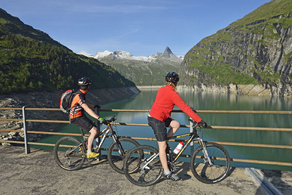
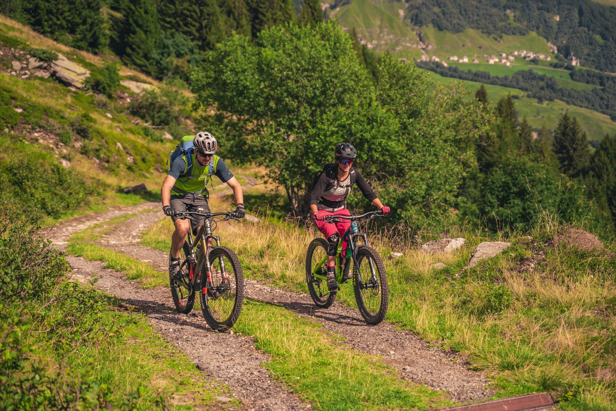
Discover the Nara region on this trail with unparalleled views that take in the whole of the Blenio Valley.
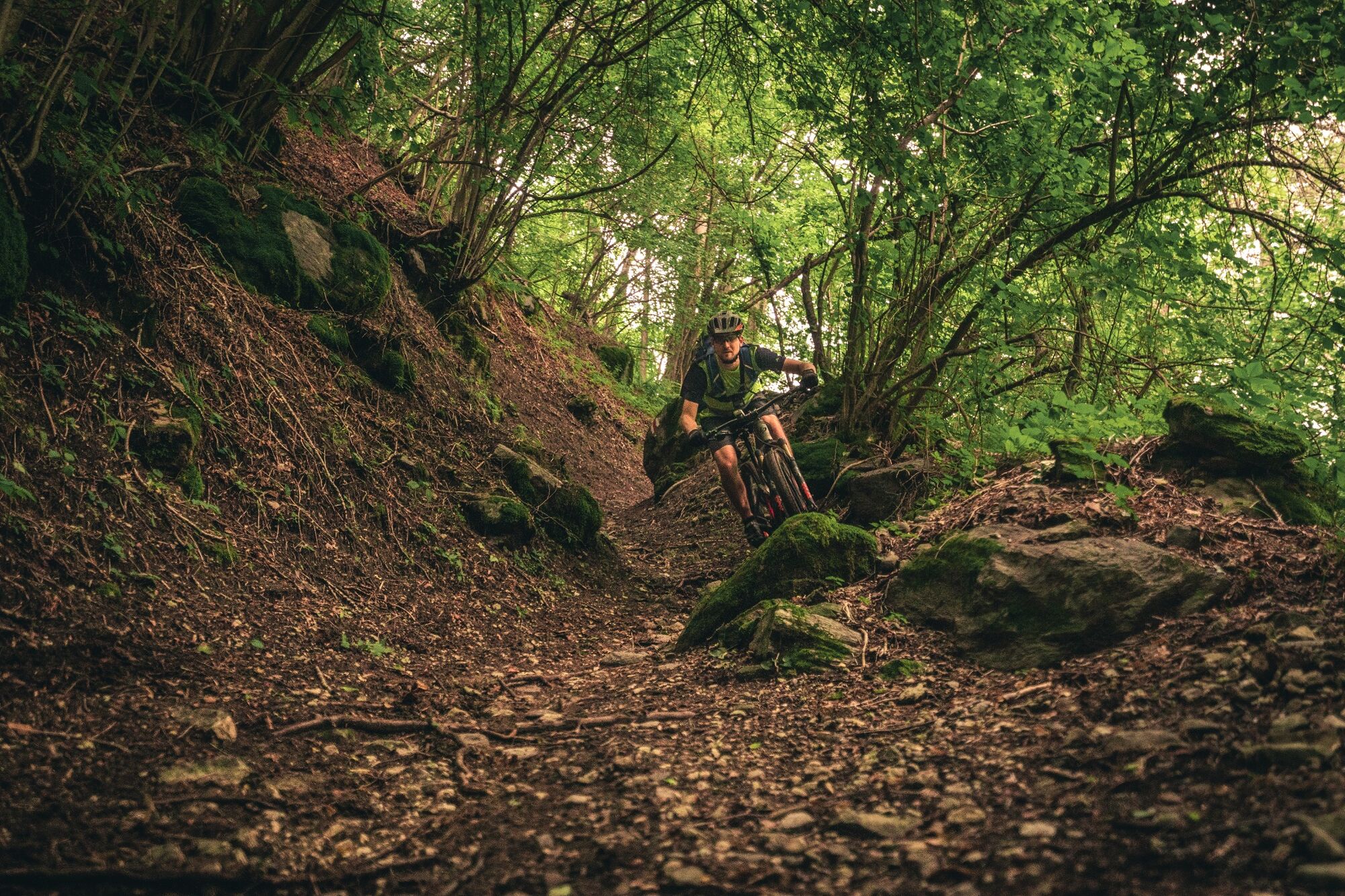
Both physically and technically challenging, this will suit more advanced mountain bikers with mixed-difficulty sections that promise thrills and adventure.
- Difficulty
-
difficult
- Rating
-
- Starting point
-
Acquarossa
- Route
-
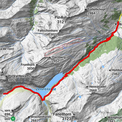
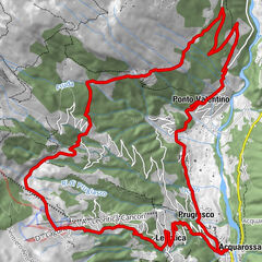
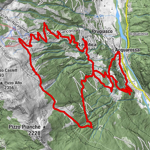
ComprovascoStazioneAcquarossa (430 m)0.1 kmStallaccia0.3 kmPozzo0.6 kmScaradra1.0 kmRoccabella1.2 kmBoscero1.6 kmCorzoneso (715 m)4.0 kmChiesa di San Giovanni Battista6.6 kmLeontica6.7 kmCentrale6.7 kmMognanigo10.9 kmChiesa11.6 kmCancurì12.7 kmLa Pernice12.8 kmFopa13.8 kmGarina17.9 kmCrènn19.2 kmBrüsacüü19.8 kmTizzarascia20.1 kmCricch20.2 kmCastrèda21.3 kmCorzoneso (715 m)23.2 kmNugaréda23.7 kmAcquarossa (430 m)24.6 kmComprovasco24.6 km
- Best season
-
JanFebMarAprMayJunJulAugSepOctNovDec
- Description
-
From the Acquarossa-Comprovasco bus station, proceed on the asphalt road to Monte Foppa, passing through Corzoneso, Leontica and Cancori: this road follows around 14 km of the route used for the popular “Blenio Gold Race” cycle race. The steep climb can be made easier by using the Leontica-Cancorì chairlift. We recommend checking the lift opening hours in advance (www.nara.ch).
From the broad Nara basin, you will have spectacular views over the entire Blenio Valley and Adula glacier. The area gets a lot of sun but is protected from the wind, and is dotted with typical dwellings nestled harmoniously into the landscape.
Continue along a less steep, dirt-track section to Alpe del Gualdo and then follow an easy single track to Alpe di Garina. The 7 km that follow involve a descent of 1100 m towards Comprovasco along a mixed single track comprising various technical sections alternating with more flowing parts. In the lower section there are various points at which bikers have to cross roads open to traffic (although they are not busy), so caution is required. The final part of the trail, from Corzoneso to Acquarossa, includes a number of difficult sections where signs invite bikers to dismount and continue on foot for short stretches.
- Highest point
- 1,787 m
- Endpoint
-
Acquarossa
- Height profile
-
 © outdooractive.com
 - Safety instructions
-
Wear protective gear. Assess your capability accurately. Give hikers right of way. Stay on the trail. Close fence gates.An enjoyable tour includes the careful planning of the same. Please inform yourself in advance at the local information center about the route and weather conditions. Depending on the season and weather conditions, this route may be blocked or interrupted.
- Tips
-
For mountain biking, follow the logo indicated on the red signposts: Cancorì Bike - n. 384


- Author
-
The tour Brüsacü Bike (SwitzerlandMobility 384) is used by outdooractive.com provided.