Brione Verzasca-Capanna Starlaresc-Brione Verzasca


- Brief description
-
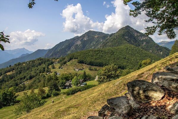
A challenging two-day tour in the wilds of the Verzasca valley. A unique experience featuring alpine terrain, stunning views and deep-green mountain lakes.
- Difficulty
-
difficult
- Rating
-
- Starting point
-
Brione Verzasca, Paese
- Route
-
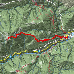
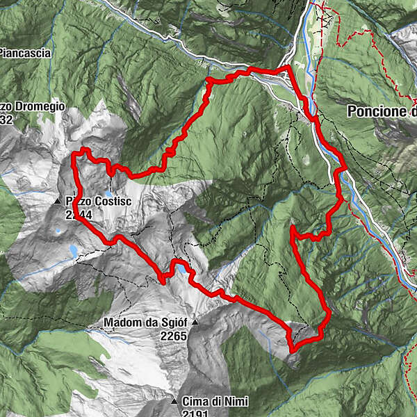
Brione (Verzasca) (756 m)0.1 kmChiesa parrochiale di Santa Maria Assunta0.1 kmAl Masnèe6.7 kmPasso Deva7.8 kmCapanna Starlaresc8.7 kmGanne14.2 kmCappella Grande di Irt15.1 kmRistorante ai Piee15.7 kmBrione (Verzasca) (756 m)16.4 km
- Best season
-
JanFebMarAprMayJunJulAugSepOctNovDec
- Description
-
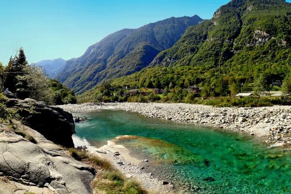
This two-day round walk starts and ends in Brione Verzasca, which can be reached by car or bus (Locarno-Tenero-Sonogno route). Brione Verzasca is a bouldering and swimming mecca.
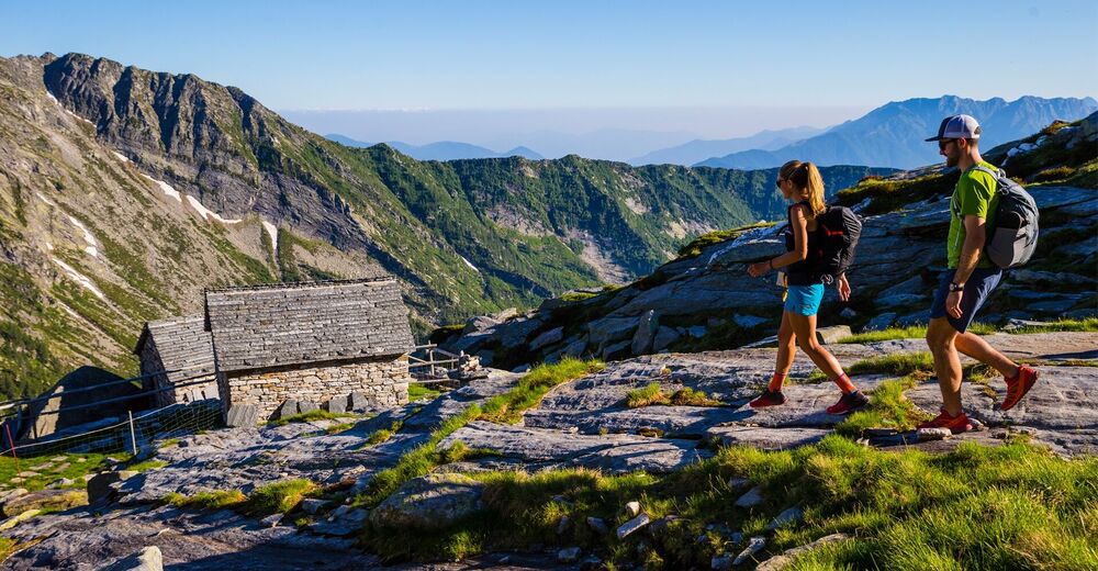
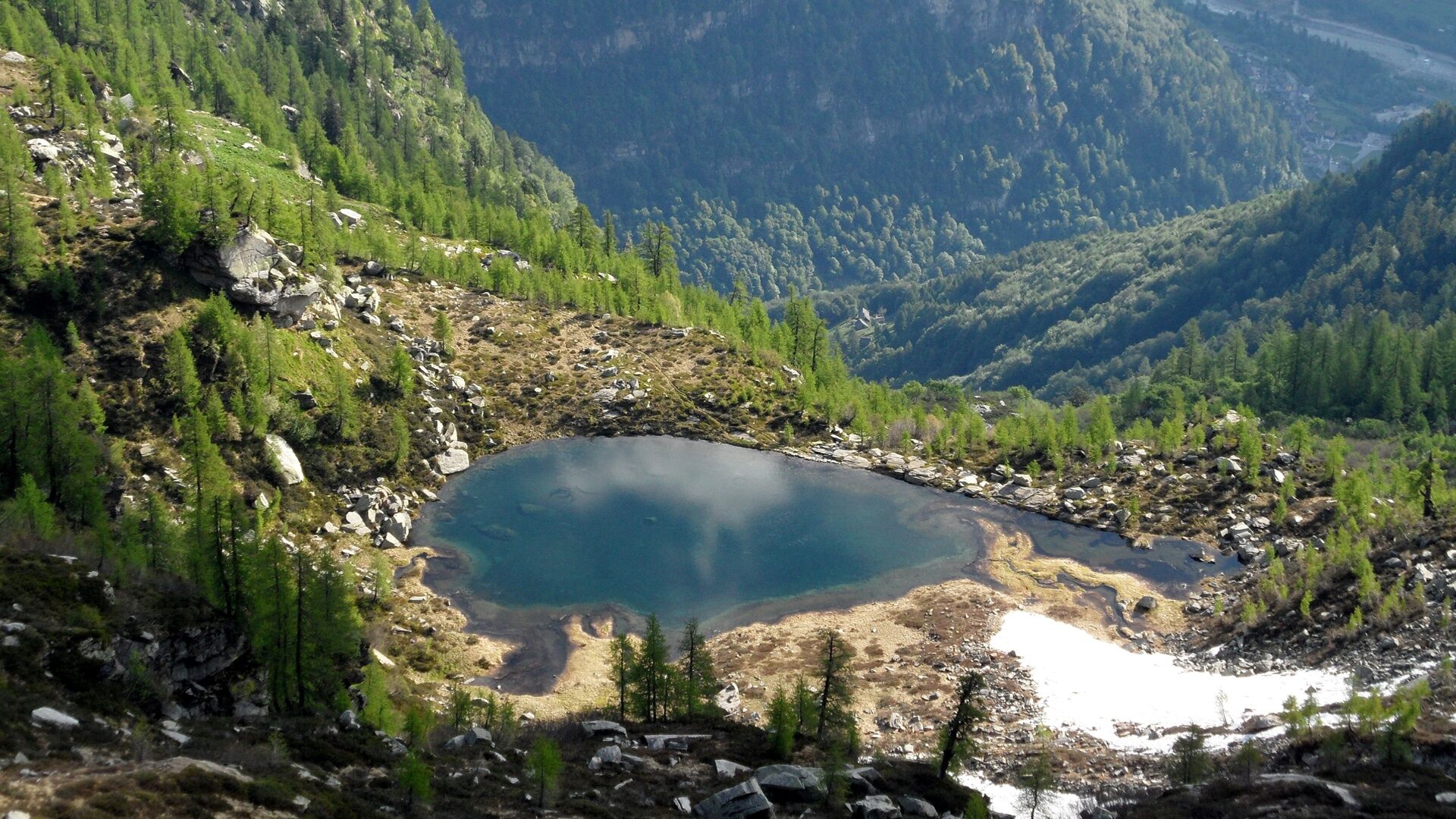
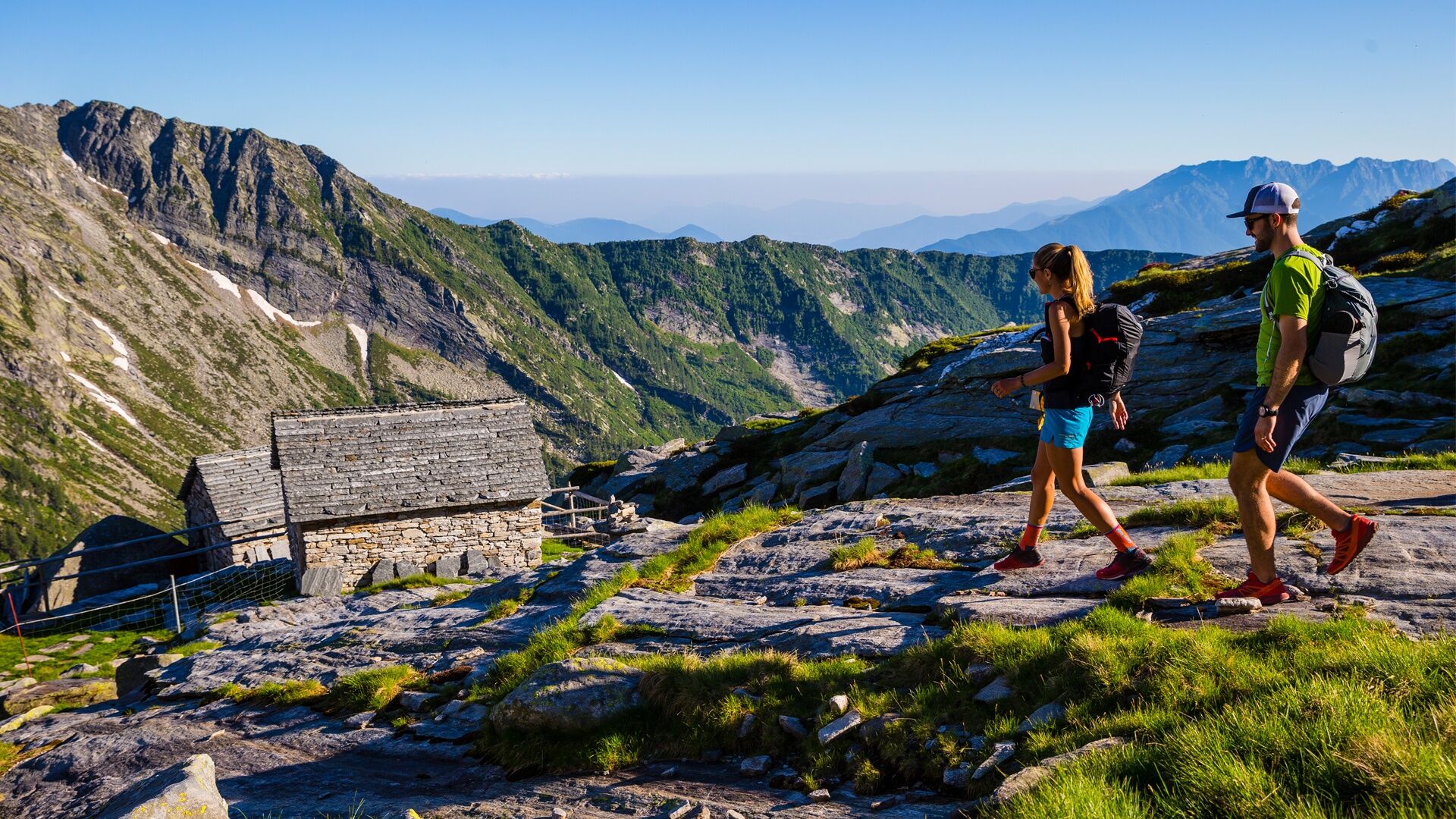
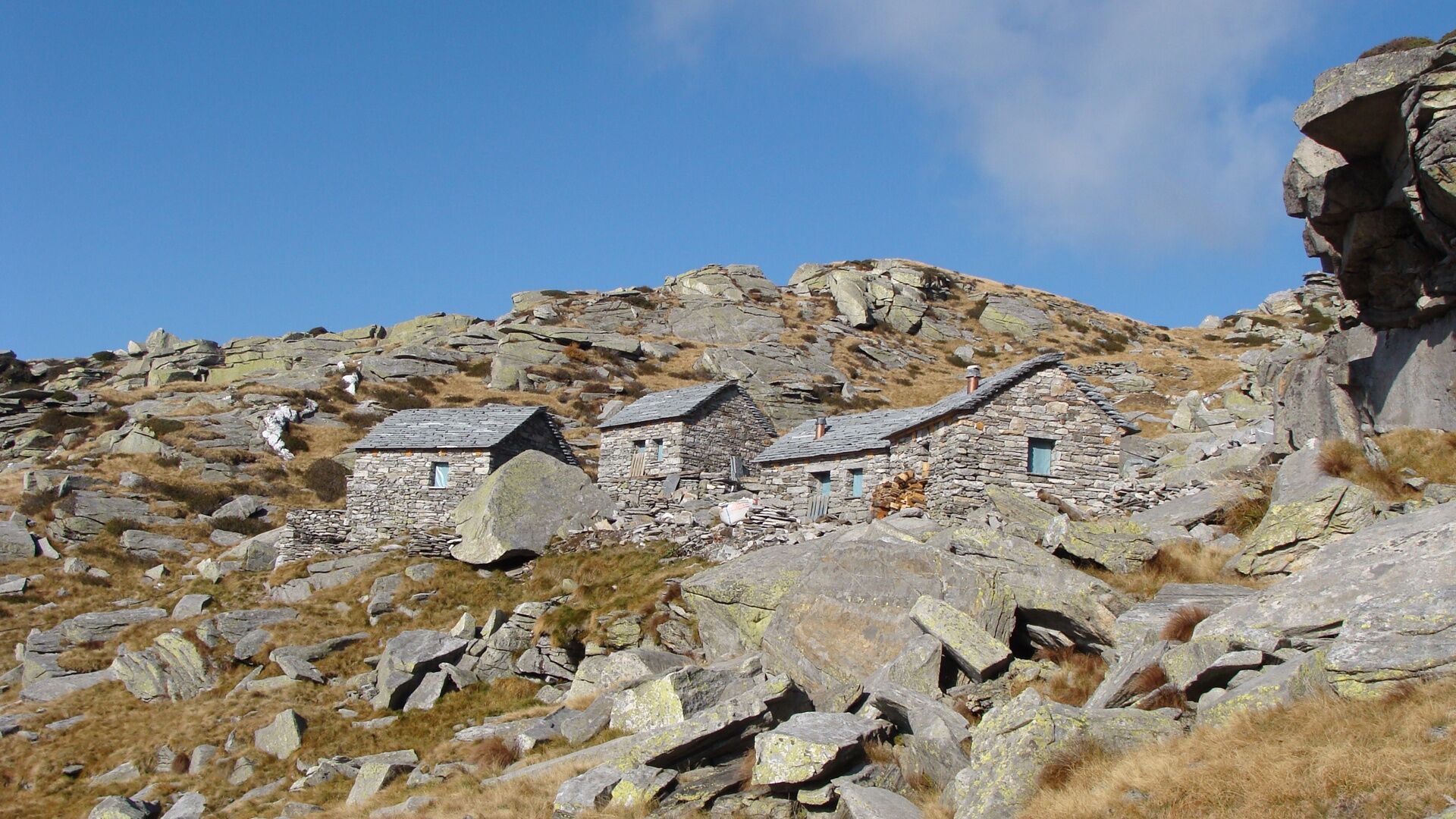
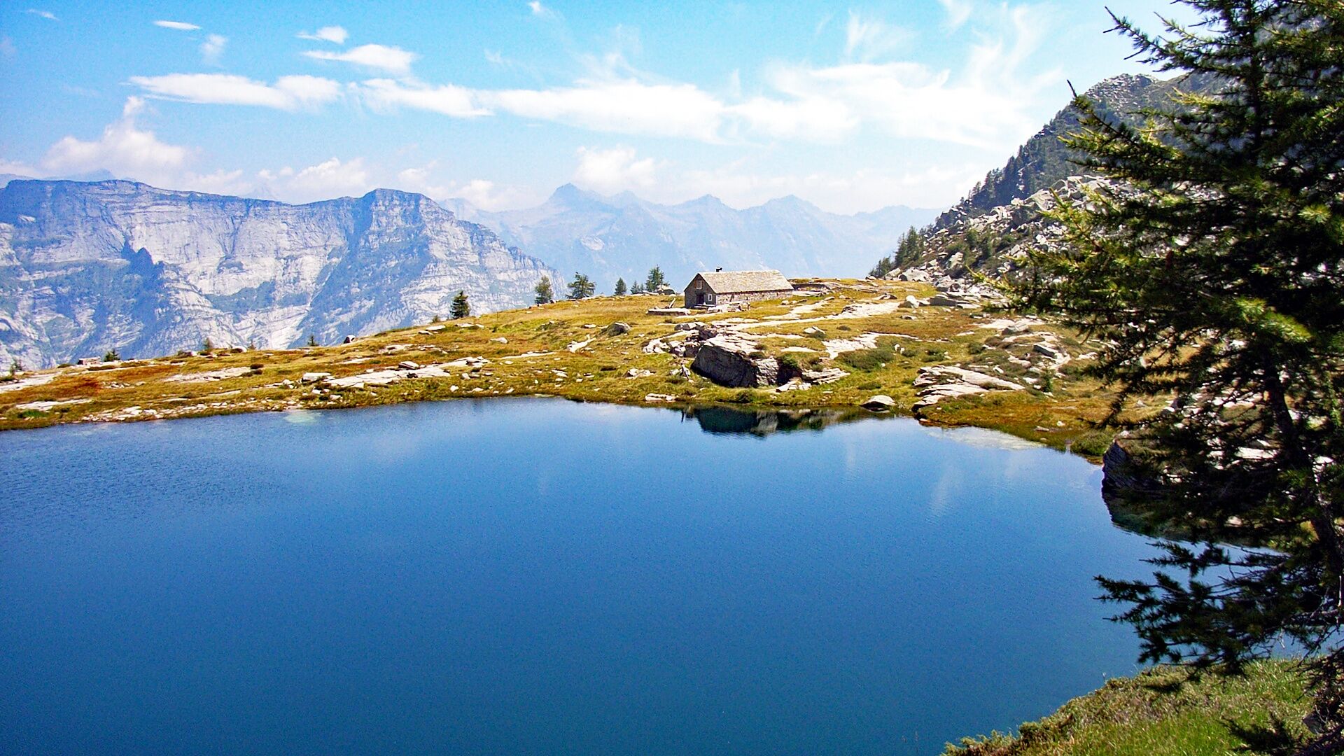
The ascent takes in Sparvé and Scimarmòta (optional short detour to the Lago del Starlaresc da Scimarmòta). Once back on the mountain path, the steep, stony climb passes below the Pizzo Costisc (where it joins the Via Alta Vallemaggia) to reach the ridge. The panoramic views here encompass the Laghetti di Masnee and Pianca. The tour now heads towards the Cima del Masnee (above the Rifugio Alpe Masnee); at the Passo Deva, the path zigzags steeply down to the Lago del Starlaresc and its eponymous unattended refuge (June-October), where you'll be spending the night.
Swimming in an alpine ambience is possible in the refreshing waters of the little lake. The next day features a long descent via the Alpe di Sgióf and a red-and-white path to Piano del Vald and back to Brione Verzasca.
- Directions
-
Brione Verzasca, Paese-Ponte Scuro-Sparvé-Scimaròta-Alpe Masnée-Lago del Starlarèsc da Sgióf-Capanna Starlaresc-Motarüch-Larecc-Piano dle Vald-Ganne-Brione Verzasca, Ai Piee-Brione Verzasca, Paese
- Highest point
- 2,108 m
- Endpoint
-
Brione Verzasca, Paese
- Height profile
-
 © outdooractive.com
 - Equipment
-
Trekking backpack (approx. 50 liters) with rain cover
Comfortable and sturdy footwear, second pair of shoes / sandals if necessary
Adequate and durable outdoor clothing in multiple layers
Change of clothes,
Telescope sticks
Sun and rain protection
Snacks and drinking water
First aid kit
Penknife
Mobile phone
Headlight
Maps
Travel documents
Toilet bag and travel towel, travel detergent and clothesline, camping equipment if necessary (tent, sleeping mat, sleeping bag, cooking equipment), hut equipment if necessary - Safety instructions

-

-
AuthorThe tour Brione Verzasca-Capanna Starlaresc-Brione Verzasca is used by outdooractive.com provided.


General info
-
Lago Maggiore / Lombardei
745
-
Vallemaggia
501
-
Lavertezzo
155