
- Brief description
-
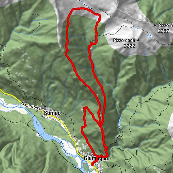
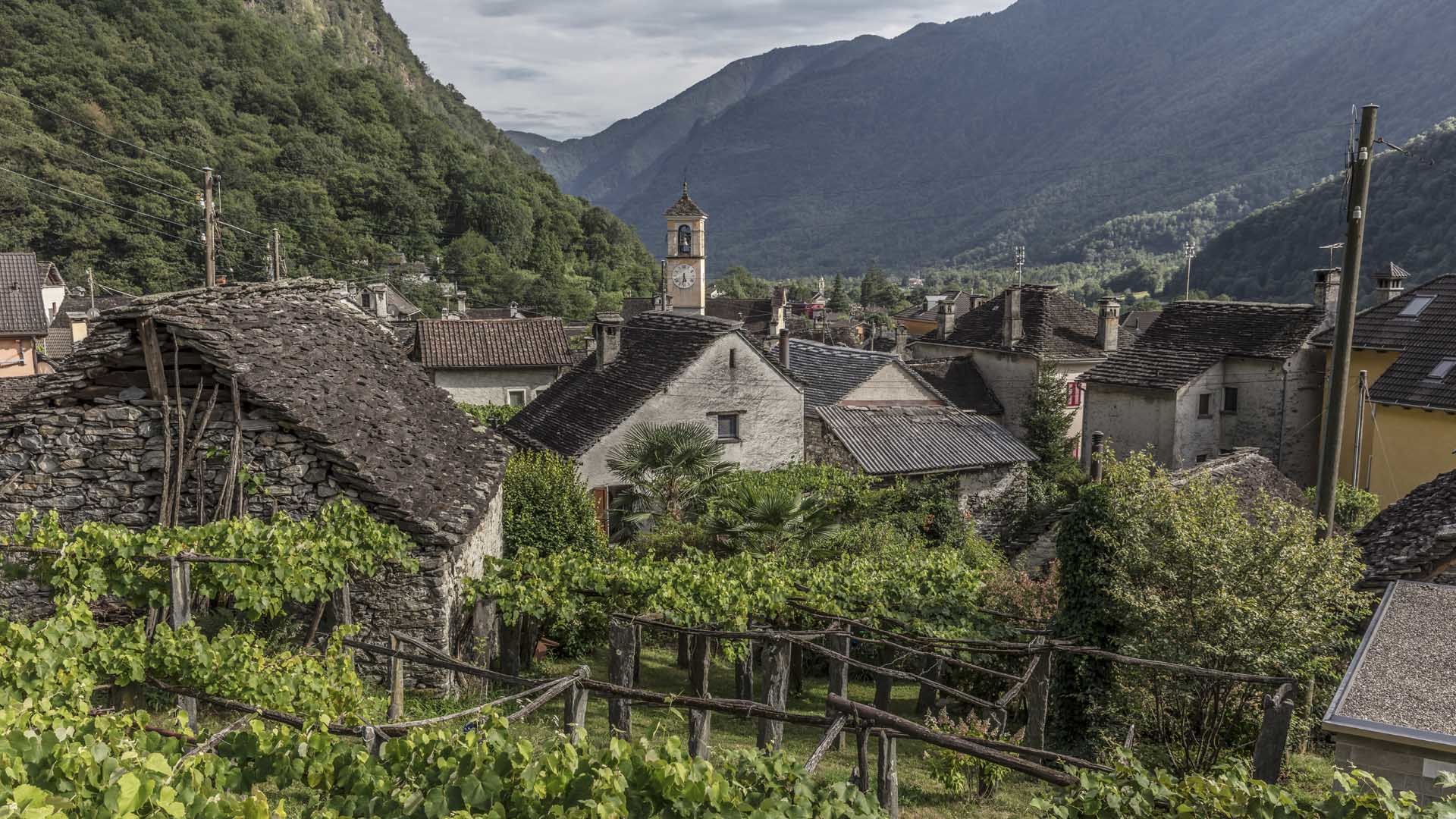
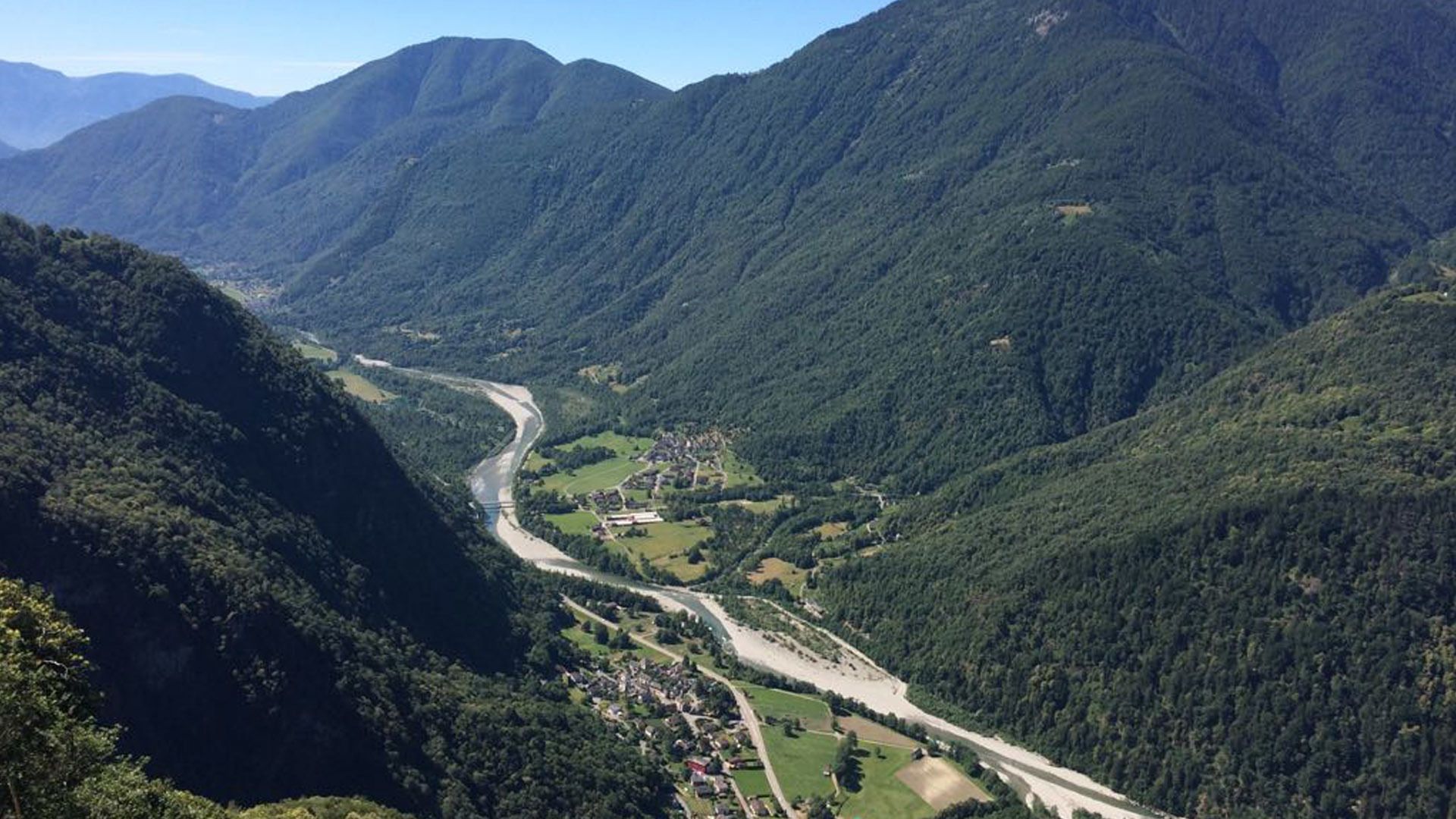
Two-day round walk high above the roofs of Giumaglio. A tour that immerses you in the nature of the Maggia valley.
- Difficulty
-
medium
- Rating
-
- Starting point
-
Giumaglio
- Route
-
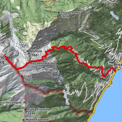
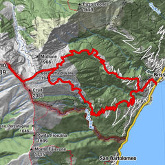
Beata Vergine Assunta0.2 kmGiumaglio (377 m)0.3 kmZött Lirughiee1.7 kmBerzona2.4 kmArnàu (1,108 m)3.3 kmCurtasello3.5 kmCosta (1,505 m)4.8 kmAlpe Spluga8.2 kmRifugio Alpe Spluga8.2 kmCortone (1,593 m)9.4 kmCurtasello12.5 kmArnàu (1,108 m)12.8 kmCascata di Giumaglio14.5 kmGiumaglio (377 m)14.9 kmBeata Vergine Assunta14.9 km
- Best season
-
JanFebMarAprMayJunJulAugSepOctNovDec
- Description
-
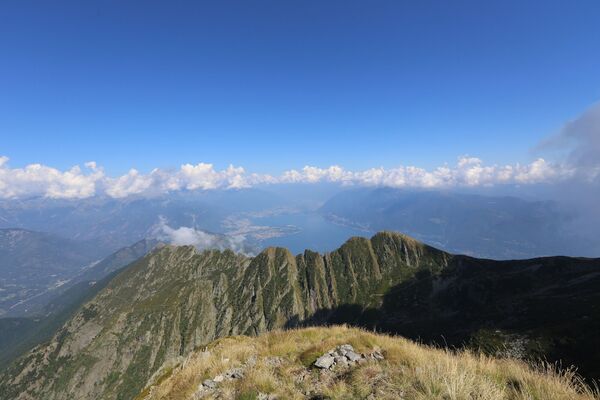
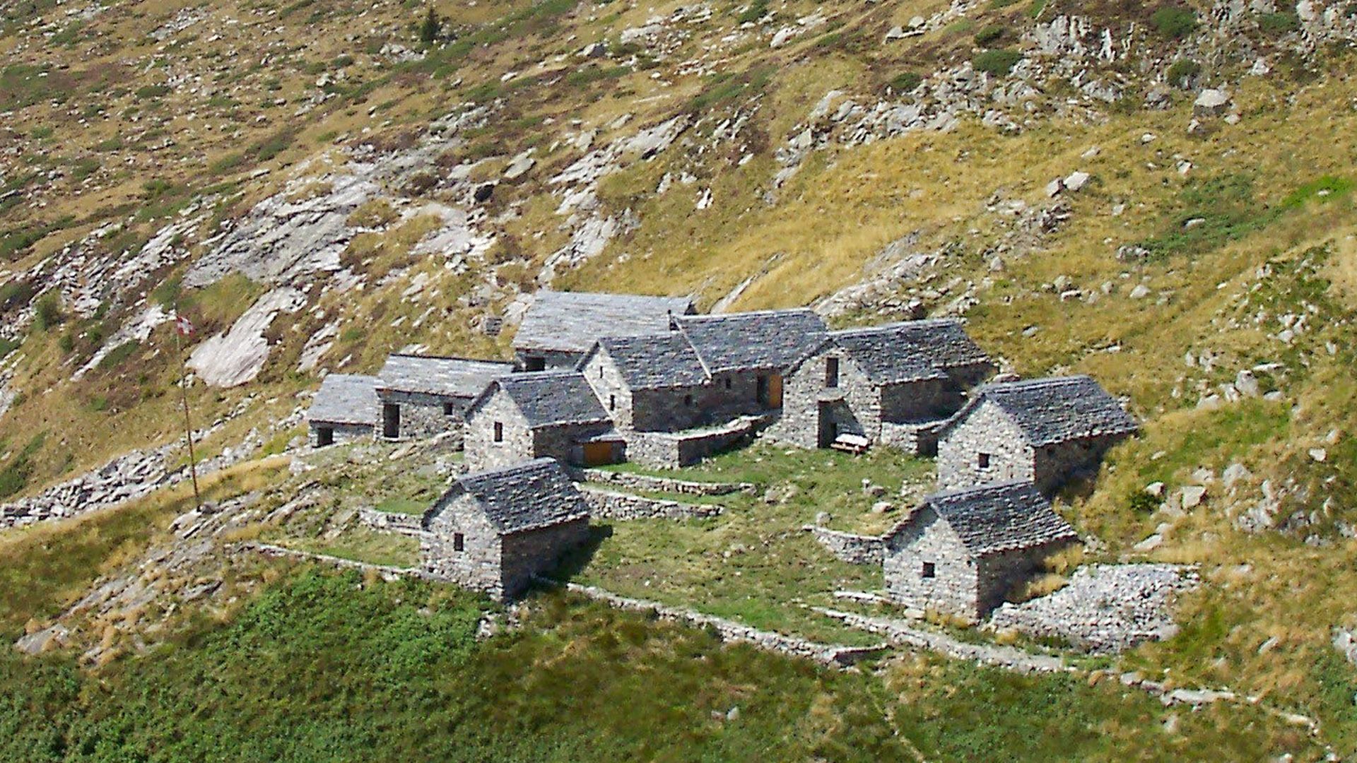
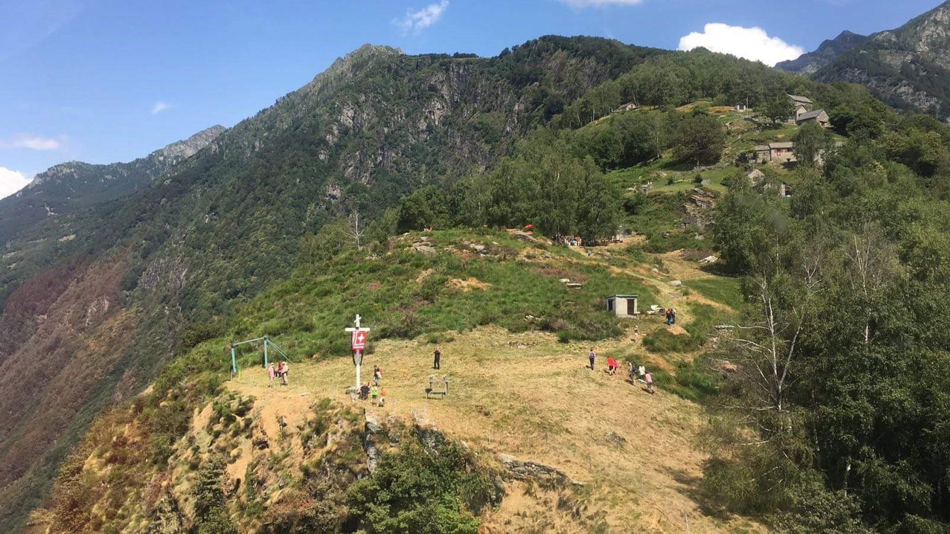
The red-and-white waymarked path on this round walk climbs steeply up to Arnau. Views of the Maggia valley and surrounding mountains can be glimpsed from time to time through the mighty chestnut trees. On reaching the top, you can already spy the distant stone refuges, nestled between barren mountains and lush meadows.
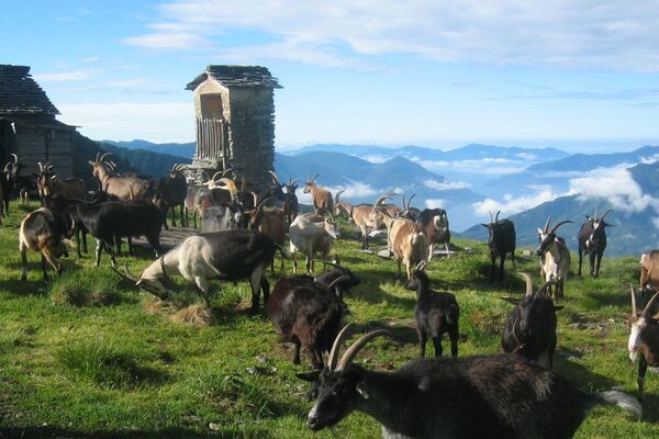
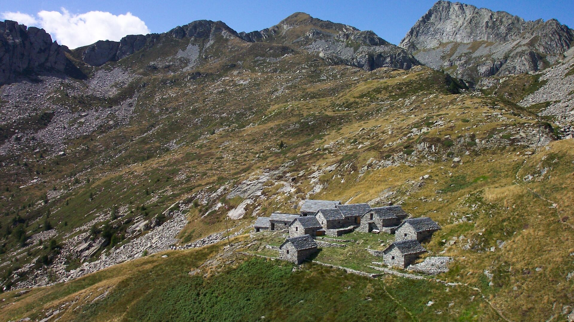
Of the 11 low buildings on the Alpe di Spluga, three are geared to self-catering hikers. They are open from May to October and equipped with a shower/WC, dormitory, kitchen and lounge – and a terrace boasting an immersive "cinema", i.e. nature! Various beverages are available in the hut, paid by means of an honesty box.
A steep ascent must mean there's a descent somewhere: this one is to Cortone. It's then a long yet pleasant descent to Arnau, followed by Giumaglio.
- Directions
-
Giumaglio-Berzona-Arnau-Costa-Capanna Alpe Spluga-Cortone-Arnau-Front-Cappella di Cima-Giumaglio
- Highest point
- 1,871 m
- Endpoint
-
Giumaglio
- Height profile
-
 © outdooractive.com
 - Equipment
-
Trekking backpack (approx. 50 liters) with rain cover
Comfortable and sturdy footwear, second pair of shoes / sandals if necessary
Adequate and durable outdoor clothing in multiple layers
Change of clothes
Telescope sticks
Sun and rain protection
Snacks and drinking water
First aid kit
Penknife
Mobile phone
Headlight
Maps
Travel documents
Toilet bag and travel towel, travel detergent and clothesline, camping equipment if necessary (tent, sleeping mat, sleeping bag, cooking equipment), hut equipment if necessary - Public transportation
-
From Locarno railway station: bus 315 towards Cavergno, Paese. Alight at the bus stop Giumaglio. Return from Giumaglio: Take the bus 315 towards Locarno Stazione. Alight at Locarno station. Further information:


- Author
-
The tour Giumaglio-Alpe Spluga-Giumaglio is used by outdooractive.com provided.


General info
-
Lago Maggiore / Lombardei
746
-
Vallemaggia
502
-
Maggia TI
176