- Brief description
-
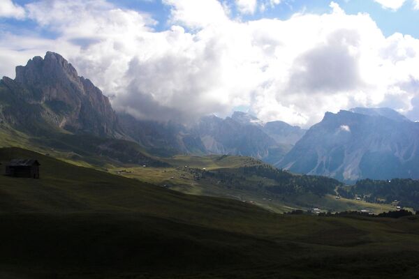
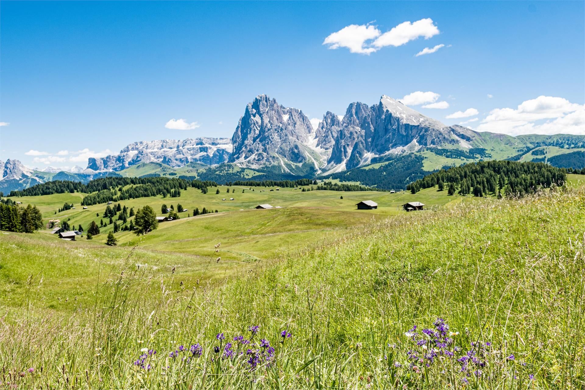
The tour runs over the gentle hills of the Seiser Alm: the paradise for all nature lovers offers innumerable possibilities for hikes in the middle of a wonderful landscape.
- Difficulty
-
easy
- Rating
-
- Route
-
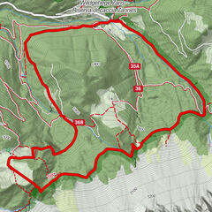
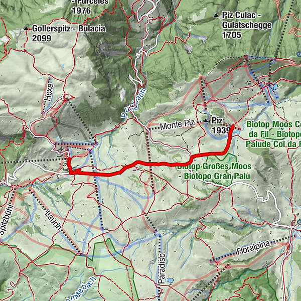
Compatsch0.2 kmFranziskuskirche0.3 kmSanon (1,849 m)3.6 kmFranziskuskirche6.8 kmCompatsch6.9 km
- Best season
-
JanFebMarAprMayJunJulAugSepOctNovDec
- Description
-
Starting from Compatsch on the Seiser Alm (1835 m), passing the new wooden Franziskus church, we follow the small asphalt road that leads to Saltria across the alpine pasture. The traffic-calmed road across the alpine pasture area is used by the typical horse-drawn carriages and horse-drawn sleighs both in summer and in winter. Shortly after the Restaurant Panoramalift we use the pedestrian underpass and after a slight ascent we reach the natural monument Tschonstoan, a huge rocky outcrop, which is located directly at the roadside. The hike continues in slight ups and downs to the wide meadow of the Großes Moos (1860 m). Near a crossroads, we can decide here whether to continue in the direction of Saltria to the nearby Restaurant Ritsch Schwaige or turn left in the direction of Piz. If you continue walking, after a short descent (9%) you leave the asphalt road and take the unpaved road to the Sanon hut on the right. The road leads through beautiful alpine meadows and past several huts dominated by the rocky splendour of the Langkofel and Plattkofel mountains. At a gradient, a path branches off to the left which leads across the meadows down to the alpine pasture: At this point the path becomes much narrower, bumpier and in some places quite steep. Over some wooden footbridges we finally reach the nearby Sanon hut (1848 m). The hut is open all year round and offers a welcome stop for refreshments. The return to Compatsch follows the same route.
- Directions
-
Starting from Compatsch on the Seiser Alm (1835 m), passing the new wooden Franziskus church, we follow the small asphalt road that leads to Saltria across the alpine pasture. The traffic-calmed road across the alpine pasture area is used by the typical horse-drawn carriages and horse-drawn sleighs both in summer and in winter. Shortly after the Restaurant Panoramalift we use the pedestrian underpass and after a slight ascent we reach the natural monument Tschonstoan, a huge rocky outcrop, which is located directly at the roadside. The hike continues in slight ups and downs to the wide meadow of the Großes Moos (1860 m). Near a crossroads, we can decide here whether to continue in the direction of Saltria to the nearby Restaurant Ritsch Schwaige or turn left in the direction of Piz. If you continue walking, after a short descent (9%) you leave the asphalt road and take the unpaved road to the Sanon hut on the right. The road leads through beautiful alpine meadows and past several huts dominated by the rocky splendour of the Langkofel and Plattkofel mountains. At a gradient, a path branches off to the left which leads across the meadows down to the alpine pasture: At this point the path becomes much narrower, bumpier and in some places quite steep. Over some wooden footbridges we finally reach the nearby Sanon hut (1848 m). The hut is open all year round and offers a welcome stop for refreshments. The return to Compatsch follows the same route.
The route can be shortened by taking the Almbus No. 11 to or from Ritsch Schwaige.
Please check the opening hours of the huts and restaurants: www.seiseralm.it/huts
- Highest point
- 1,866 m
- Height profile
-
 © outdooractive.com
 - Directions
-
From Bozen/Bolzano Nord we follow the state road in the direction of the Brenner as far as Blumau, from where a winding state road leads to Völs am Schlern and on to Seis am Schlern. A regular shuttle service and a barrier-free cable car orbit bring day guests from Seis am Schlern up to the Seiser Alm (Compatsch), as the Seis am Schlern is only partially accessible by car (except for guests with disabilities and hotel guests on the Seis am Schlern).
- Public transportation
-
The starting point of the tour or the sight is easily and comfortably accessible by public transport:
Bus n. 1 from Seis am Schlern, n. 2 from Völs am Schlern, n. 3 from Kastelruth or by bus line no. 170 from Bozen Bus Station or Brixen Bus Station to the bus stop of the Seis-Seiser Alm Aerial Cableway at Seis.
- Parking
-
Valley station of the Seiser Alm cable car
- Author
-
The tour Tour on the Seiser Alm is used by outdooractive.com provided.


-
Brixen und Umgebung
1976
-
Seiser Alm
1141
-
Seiser Alm
483