Tour data
13.11km
1,962
- 2,365m
383hm
378hm
05:00h
- Brief description
-
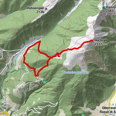
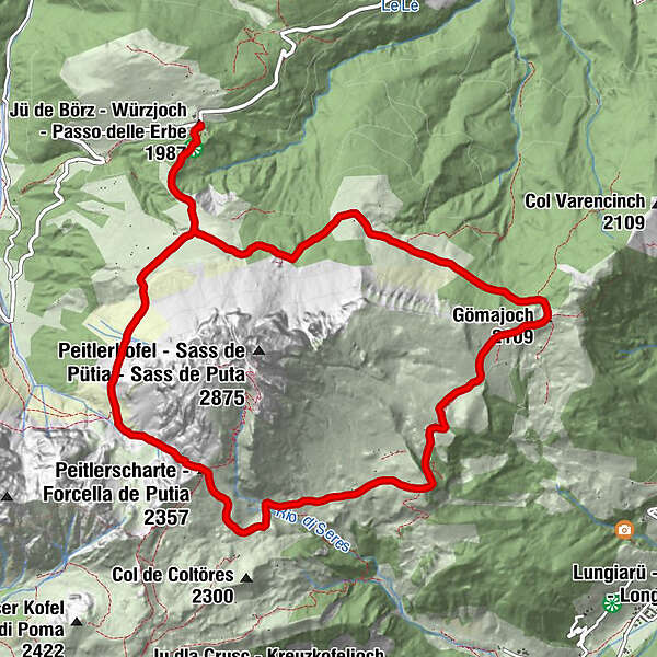
Großartige Umrundung des Peitlerkofels, Begegnung mit verschiedenen Naturschönheiten und prächtige Ausblicke. Die Durchführung ist im Uhrzeigersinn und Gegenuhrzeigersinn möglich!
- Difficulty
-
medium
- Rating
-
- Starting point
-
Würzjoch (St. Martin in Thurn)
- Route
-
Peitlerscharte (2,357 m)3.9 kmVaciara Almhütte7.3 kmGöma Hütte10.2 kmMunt de Fornella11.8 km
- Best season
-
JanFebMarAprMayJunJulAugSepOctNovDec
- Highest point
- Forcella del Putia (2,365 m)
- Rest/Retreat
-
Gasthaus Ütia de Börz, Hütte Cir (am Würzjoch), Hütte Fornella, Hütte Vaciara, Hütte Göma (entlang der Strecke)
GPS Downloads


Trail conditions
Asphalt
Gravel
Meadow
Forest
Rock
Exposed
Other tours in the regions
-
Dolomiten
1826
-
Alta Badia
1056
-
Badia
333