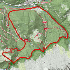
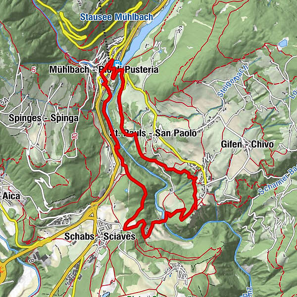
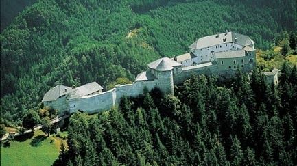
Wanderung von Mühlbach über Schloß Rodeneck und Viums zurück nach Mühlbach

Hiking


- Brief description
-
Talwanderung vom Mühlbach über Wiesen nach Vill Rodeneck bis zum Schloss Rodeneck. Über die Rundl Richtung Viumer Kreuz
- Route
-
Maria-Hilf-Kapelle0.0 kmMühlbach (775 m)0.2 kmSt. Pauls (860 m)2.1 kmAnrat2.2 kmGrasland2.2 kmKofelacker2.7 kmRaut2.9 kmGasplacker3.6 kmRodeneck (882 m)3.7 kmVill (885 m)3.9 kmWaldackerle4.6 kmKapelle beim Rundl6.0 kmSchabs (760 m)6.6 kmSt. Helena10.1 kmGasthof Seppi10.2 kmMühlbach (775 m)10.2 kmMühlbach10.4 kmMaria-Hilf-Kapelle10.4 km
- Highest point
- 856 m
- Height profile
-
 © outdooractive.com
- Author
-
The tour Wanderung von Mühlbach über Schloß Rodeneck und Viums zurück nach Mühlbach is used by outdooractive.com provided.
GPS Downloads


Other tours in the regions
-
Brixen und Umgebung
1976
-
Gitschberg - Jochtal
672
-
Natz-Schabs
221