- Difficulty
-
easy
- Rating
-
- Route
-
Atzwang
- Best season
-
JanFebMarAprMayJunJulAugSepOctNovDec
- Description
-
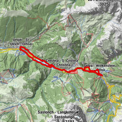
This tour, the Valle Isarco route I, links the biking region of the Seiser Alm/Val Gardena with the bottom of the Eisacktal Valley, where a number of tours lead in the direction of Brixen and Bozen. These well-maintained bike paths guarantee great routes for mountain bikers and road cyclists alike.
- Directions
-
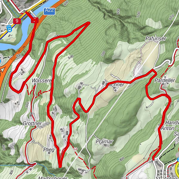
At Atzwang in the Eisack valley and close to the Schlern Ovest motorway service area, you will find the southern link route leading to one of the Seiser Alm mountain bike routes. Along the Isarco Valley bike path, in the small hamlet of Atzwang, the road branches off towards Völs am Schlern, over a new bridge near the old wooden bridge. The road leads steadily uphill, but is a limited-traffic area and open only to local residents. With a good 450 m of elevation to tackle it is by no means child’s play, but your efforts will be amply rewarded with views over vineyards and chestnut groves which line the route around Novale di Fiè. When you come to St. Anton you can either access the Hofer Alpl loop route directly or bike the last few kilometres back to the set off point in Völs am Schlern.
- Highest point
- 828 m
- Height profile
-
 © outdooractive.com
 - Equipment
-
Bike helmet
Good shoes
Sun glasses
Bike wear
MTB Gloves
Drink and snacks
Protective pads - Safety instructions
-
RULES OF CONDUCT:
· On the mountain you greet each other, this is tradition and this applies to bikers and hikers
· Give way to pedestrians
· Respect signage and stay on the trail/path
· Close pasture gates and don’t scare/stroke animals
· Always ride in a way that allowes you to stop in case of emergency (ride with foresight)
· Use your brakes smoothly in order not to ruin trails, paths and gravel roads
- Author
-
The tour 258 Eisacktal I link trail is used by outdooractive.com provided.