- Difficulty
-
medium
- Rating
-
- Route
-
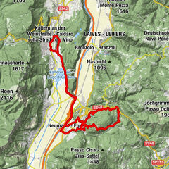
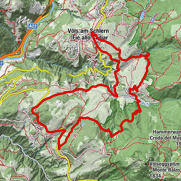
Völs am Schlern0.1 kmObervöls0.4 kmUms4.0 kmSt. Martin4.1 kmVölser Aicha10.1 kmOberaicha10.5 kmSpielplatz Völser Aicha 210.6 kmPröslerhof12.3 kmPrösels12.4 kmObervöls16.1 kmTschafon16.2 kmVöls am Schlern16.4 km
- Best season
-
JanFebMarAprMayJunJulAugSepOctNovDec
- Description
-
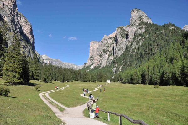
The Schnaggenkreuz Cross loop route begins in Völs am Schlern and passes by the hamlets of Umes, Völser Aicha and Prösels, offering immense variety and close contact with the surrounding countryside. In Prösels, it is well worth taking a detour to the historic Prösels Castel, which organises fascinating guided tours.
- Directions
-
The route begins in Völs am Schlern and leads initially along the Obervöls road towards Ums and, after a brief descent, crossing the shady Völserbach river, where the road on the left-hand side merges with a forest road leading to the Hofer Alpl. Carry on along the forest road for about 500m until you come to the Umser Weiher lake. From here, go right through the hamlet of Ums, along a short downhill stretch to sawmill and, from the crossroads, along a forest trail again. This trail leads up the slopes of the Tschafon to the Schnaggenkreuz cross. You’ll clock up a good few metres of altitude on the way before you can stop off for a well-earned break or take a detour to the nearby Völser Aicha lake. Continue onwards, past Völser Aicha, take the turn-off to Tiers and follow the main road. At the Prösels junction, the trail takes you past the Ums mill and then weaves back towards the set-off point in Völs am Schlern.
- Highest point
- 1,076 m
- Height profile
-
 © outdooractive.com
 - Equipment
-
Bike helmet
Good shoes
Sun glasses
Bike wear
MTB Gloves
Drink and snacks
Protective pads - Safety instructions
-
RULES OF CONDUCT:
· On the mountain you greet each other, this is tradition and this applies to bikers and hikers
· Give way to pedestrians
· Respect signage and stay on the trail/path
· Close pasture gates and don’t scare/stroke animals
· Always ride in a way that allowes you to stop in case of emergency (ride with foresight)
· Use your brakes smoothly in order not to ruin trails, paths and gravel roads
- Author
-
The tour 255 Schnaggenkreuz Cross loop route is used by outdooractive.com provided.