- Difficulty
-
difficult
- Rating
-
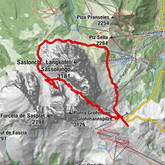
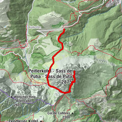
- Route
-
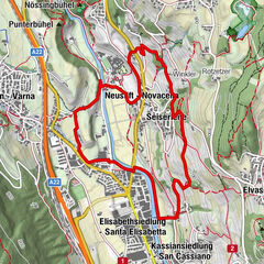
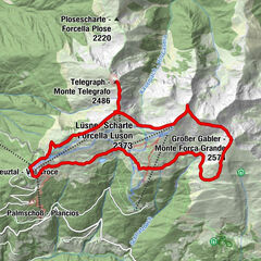
Pfarrkirche von St. Ulrich – Zur Erscheinung des Herrn0.0 kmSt. Ulrich (1,236 m)0.0 kmChalet Raschötz6.6 kmCason-Hütte6.9 kmFlitzer Scharte (2,107 m)8.1 kmBroglessattel (2,119 m)11.1 kmBrogleshütte11.7 kmMittagsscharte (2,600 m)16.3 kmPlan Ciautier17.6 kmPlan dla Roa19.5 kmMunt de Puez22.1 kmPuez Hütte24.1 kmCrespeinajoch (2,528 m)28.3 kmDanter la Pizes29.4 kmJimmy Hütte30.1 kmRestaurant Dantercepies31.0 kmDantercepies31.1 kmSan Mauriz32.1 kmGardena Pass (2,121 m)32.4 kmPisciadù Hütte35.0 kmVal di Tita35.9 kmVal Lasties40.0 kmToni Demetz Hütte47.4 kmLangkofelscharte (2,685 m)47.5 kmLangkofelhütte49.1 kmSaltria56.6 kmLudy59.6 kmFurdenan62.7 kmÜberwasser63.4 kmSt. Antonius63.6 kmSt. Ulrich (1,236 m)63.8 km
- Best season
-
JanFebMarAprMayJunJulAugSepOctNovDec
- Description
-
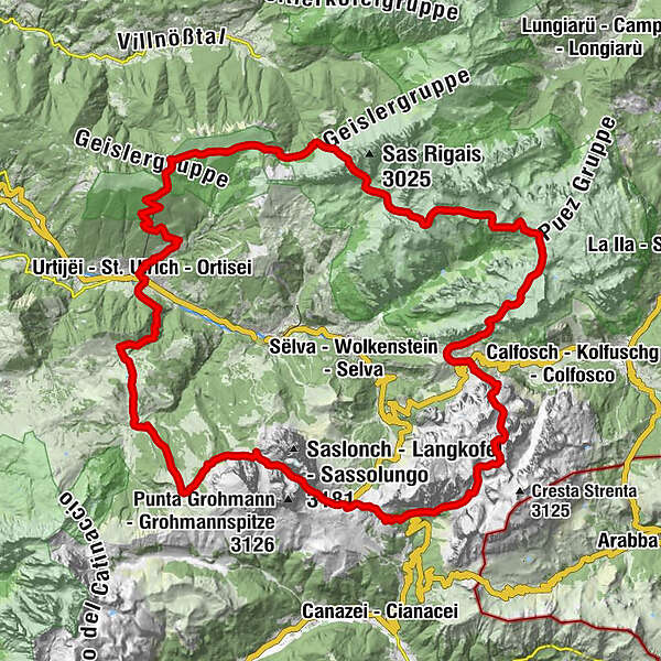
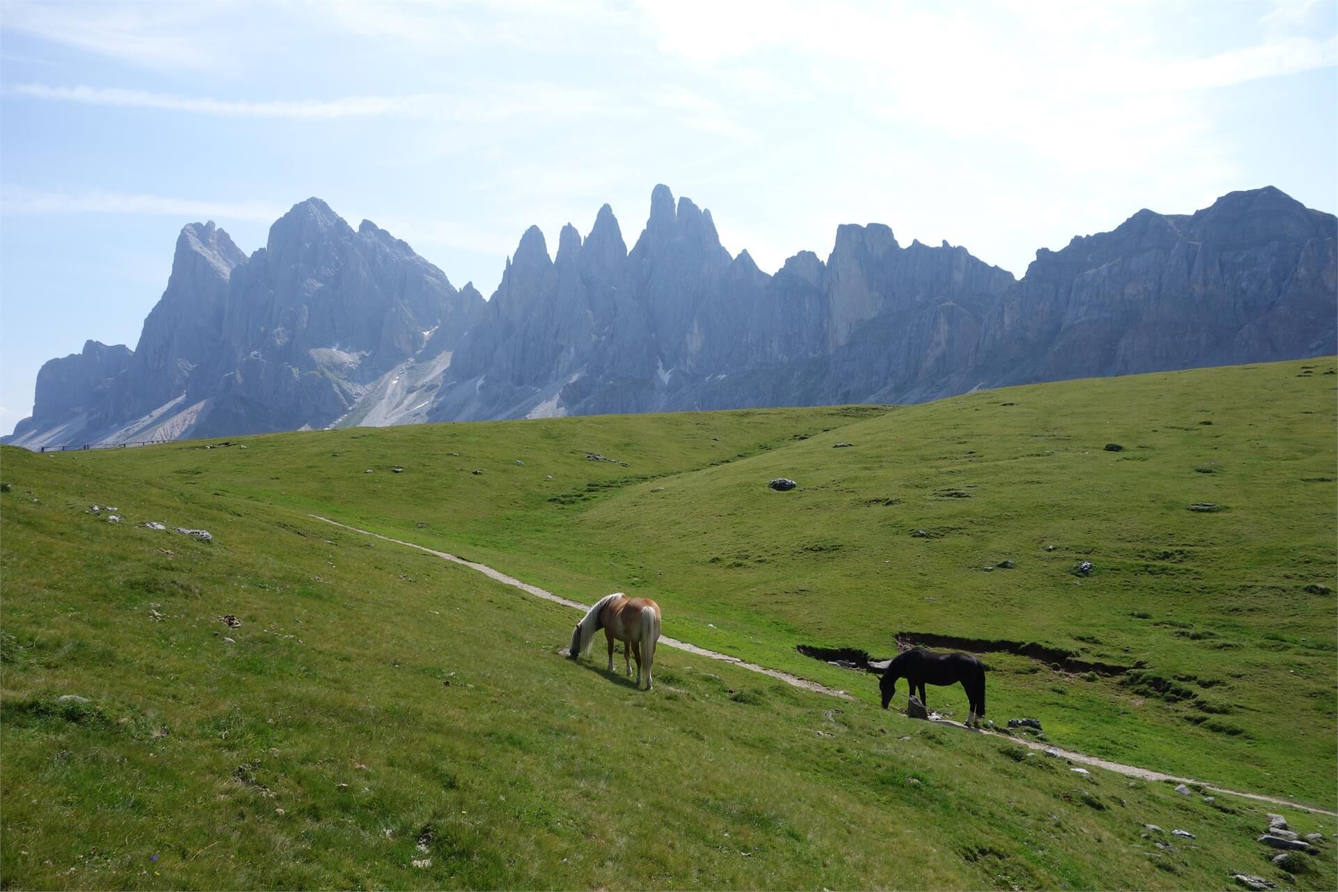
Multi-day trekking tour „Curona de Gherdëina” - On the crown of Val Gardena
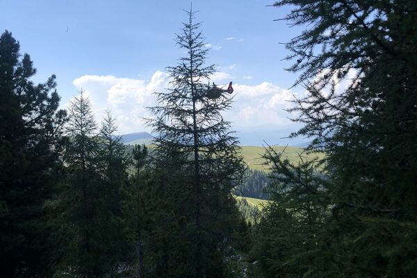
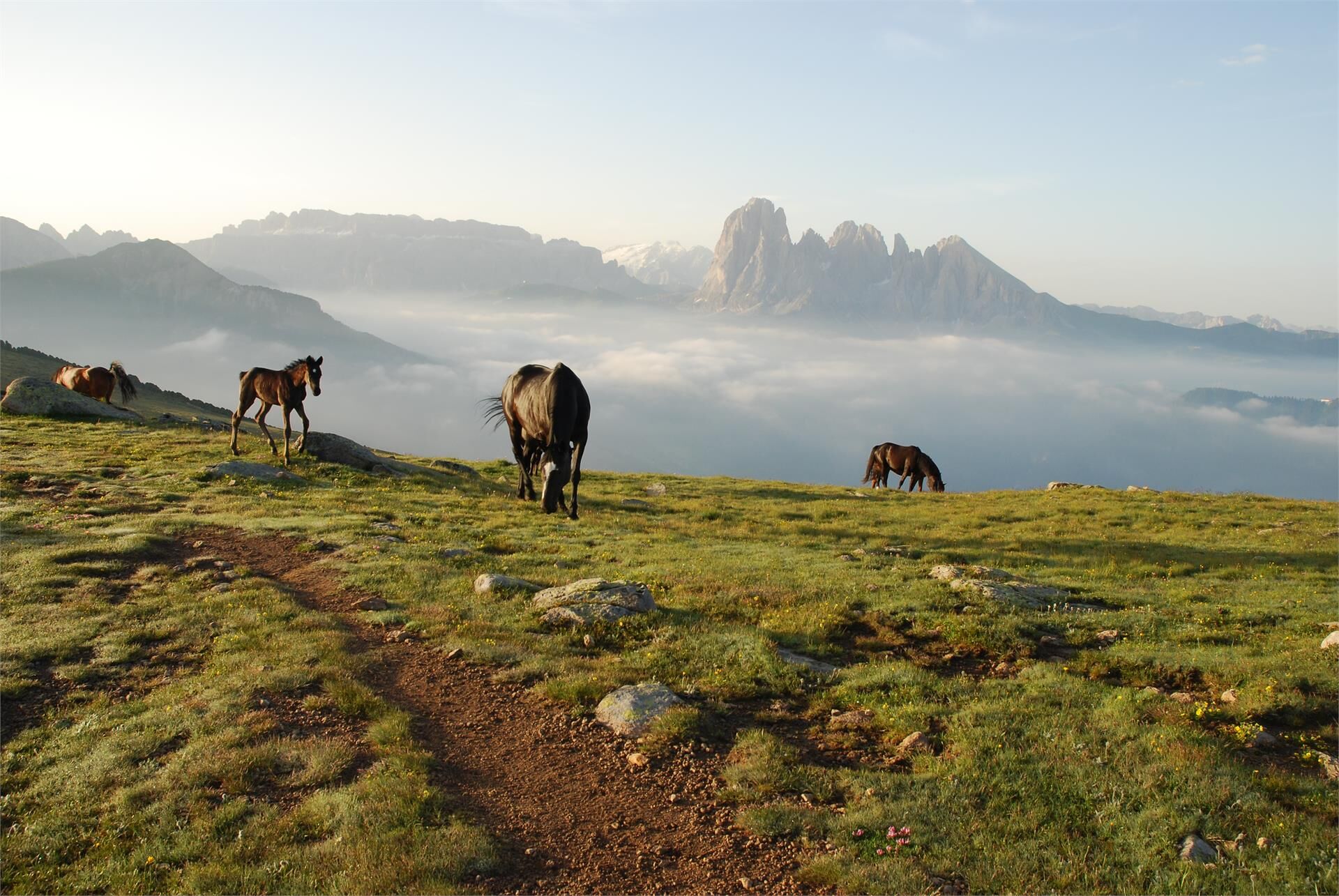
“Curona de Gherdëina” is the unique trekking tour on the fascinating mountain crown of Val Gardena on over 2.000 height meters. The 60 kilometres long tour goes from the Natural Park Puez-Odle in the northeast (Unesco World Heritage), to the Sella plateau in the southeast and the Sassolungo mountain group in the south of the valley. The Dolomites show its particular beauty; on every part of the trekking the “pale mountains” seem to take different shapes. Relaxing opportunities are provided in the mountain huts in which you can enjoy typical dishes and live unforgettable sunrises and sunsets.
- Directions
-
Attention: Actually the forcella Pana is closed, in alternative you can go to the forcella Mezdi/Mittagsscharte.
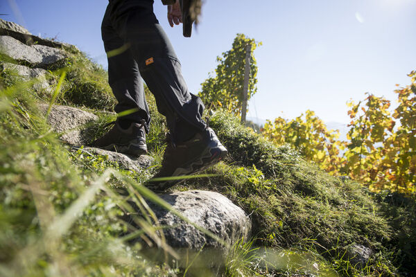
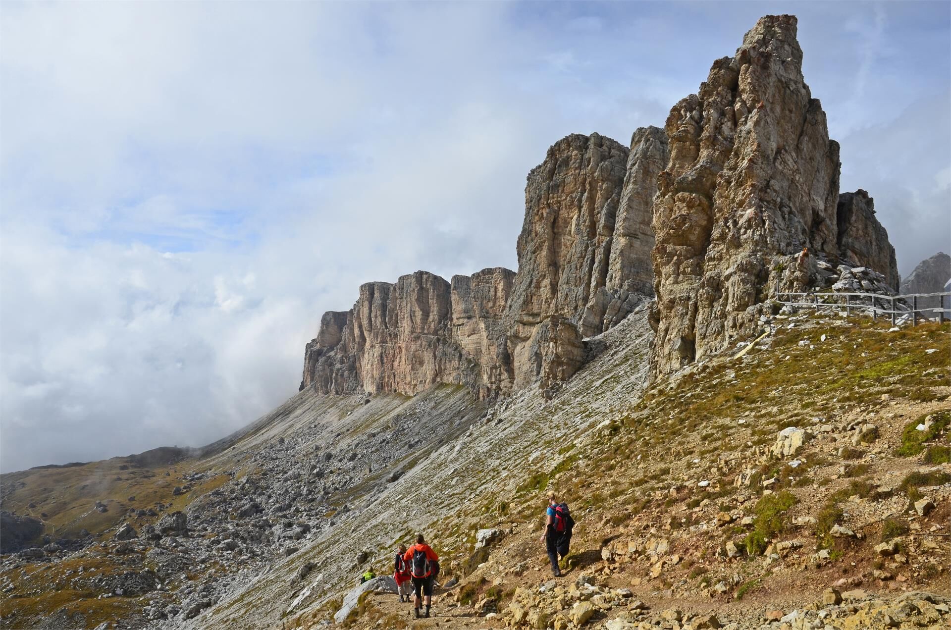
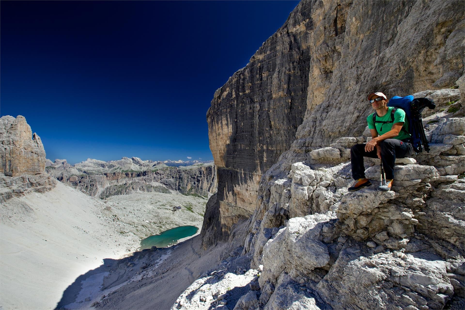
The route is demanding, with considerable altitude differences both when climbing and descending the paths. The trails are always well marked, yet hikers must be comfortable walking on a rocky terrain. Steel ropes have been installed on certain sections of the path (for secured climbing). The technical key points are located on the Altopiano del Sella, and consist of a rocky path which is partly suspended but can be safely traversed with the aid of such a steel rope. These paths are outlined on the maps by crosses (+++++).The very special: you have two different choices to design your trekking. The four days mountain huts trekking with overnight stay in pleasant dorms or the five days “deluxe” version with overnight stay in comfortable mountain lodges and hotels. For more information visit: http://www.valgardena.it/en/hiking-biking/walking-trekking/trekking-tours/curona-de-gherdeina/
The whole excursion can be completed in four days by very well trained hikers, calculating 8 hours a day with an altitude difference of 1,600 m to overcome.
Average mountain hikers should plan 5 days for the 60 km route with a total of 4,000 m altitude difference for both the climb and descent. When planning your tour you can rely on the countless mountain huts for your overnight stops. Just remember to book in advance!
The suggested route follows the imposing and most important mountain massifs of Val Gardena and is outlined on the map with a blue line.
Alternatives:
You can start from Ortisei, S. Cristina and Selva Gardena and avoid the most difficult parts (the Altopiano del Sella, for example) using easier routes. These alternatives are outlined with a light blue line.
Using these alternative routes will shorten the hike to 2 or 3 days.
Lift facilities:
Parts of the route can be taken using lift facilities (see map). The same applies to the starting points from the three villages in the valley.
Level assessment:
The ‘Curona de Gherdëina’ (original route) has been classified as a ‘black – difficult mountain climb’ for the area around the Altopiano del Sella and ‘blue to red – easy to medium mountain climb’ for the other areas, following the classification by the DAV (German Mountain Association).
- Highest point
- 2,946 m
- Height profile
-
 © outdooractive.com
 - Directions
-
Val Gardena is located in South Tyrol, right in the heart of the Dolomites. The valley can be reached using the Brenner Motorway (A 22), exit Chiusa. Following the well-marked roads, you should reach Ortisei in about 20 minutes, then S. Cristina and Selva Val Gardena.

- Author
-
The tour Trekking tour "Curona de Gherdëina" is used by outdooractive.com provided.