
- Brief description
-
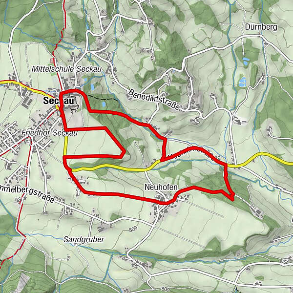
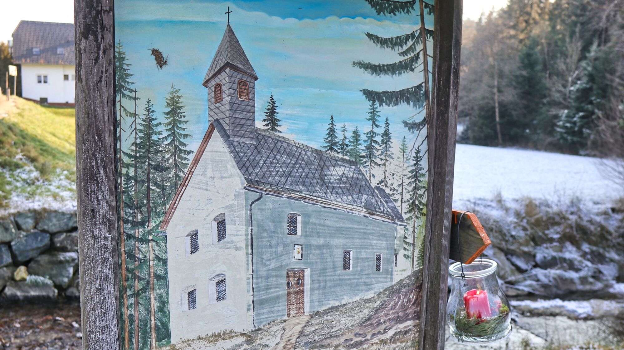
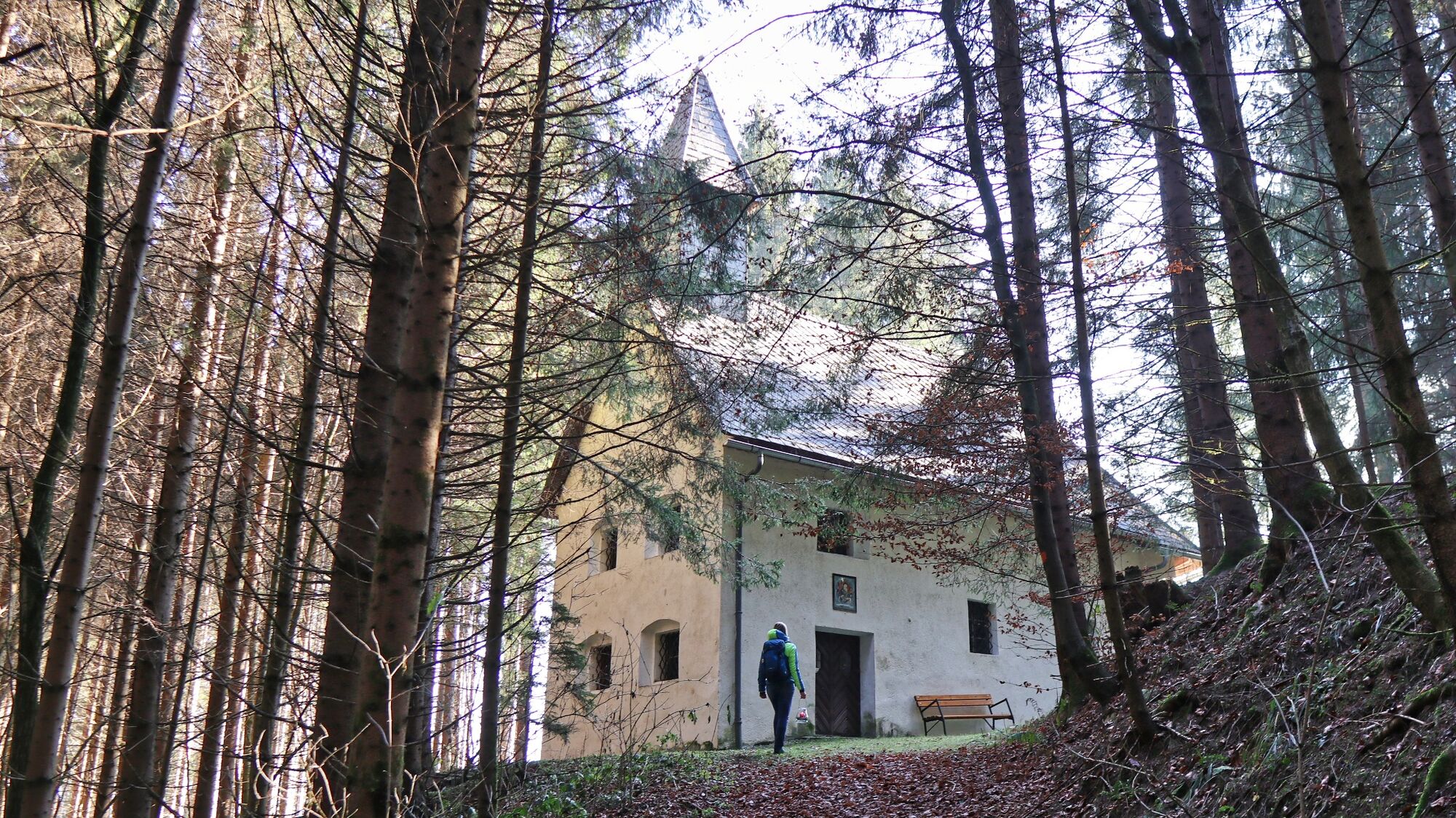
This winter hike in Seckau takes us to the Schachenkirche church hidden in the forest.
- Difficulty
-
easy
- Rating
-
- Starting point
-
Parking lot Jufa Seckau
- Route
-
Seckau0.1 kmRestaurant Hofwirt0.1 kmSchachenkirche2.4 kmNeuhofen3.0 kmSeckau5.6 km
- Best season
-
AugSepOctNovDecJanFebMarAprMayJunJul
- Description
-
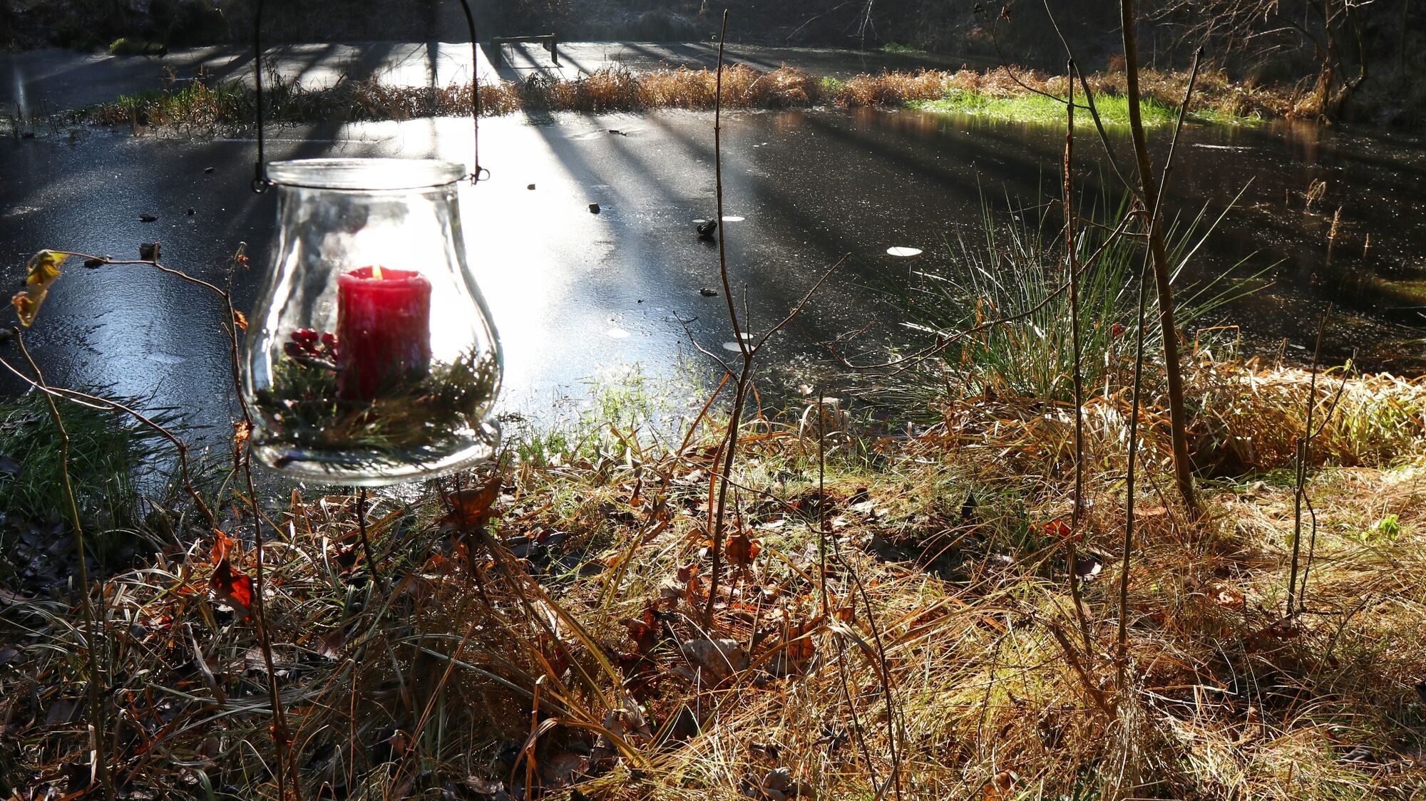
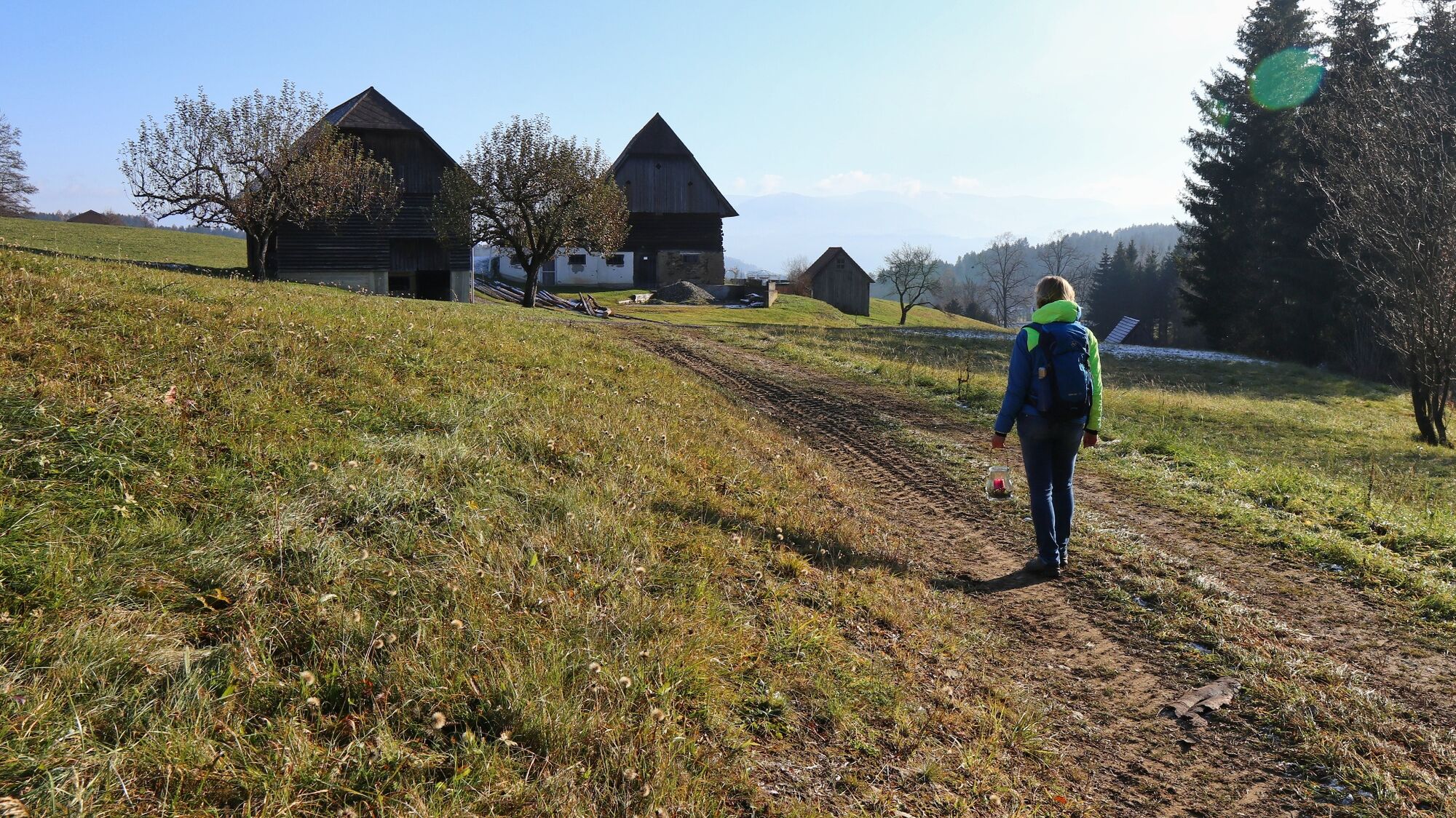
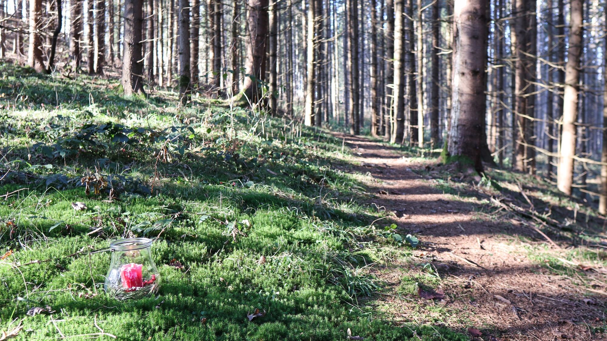
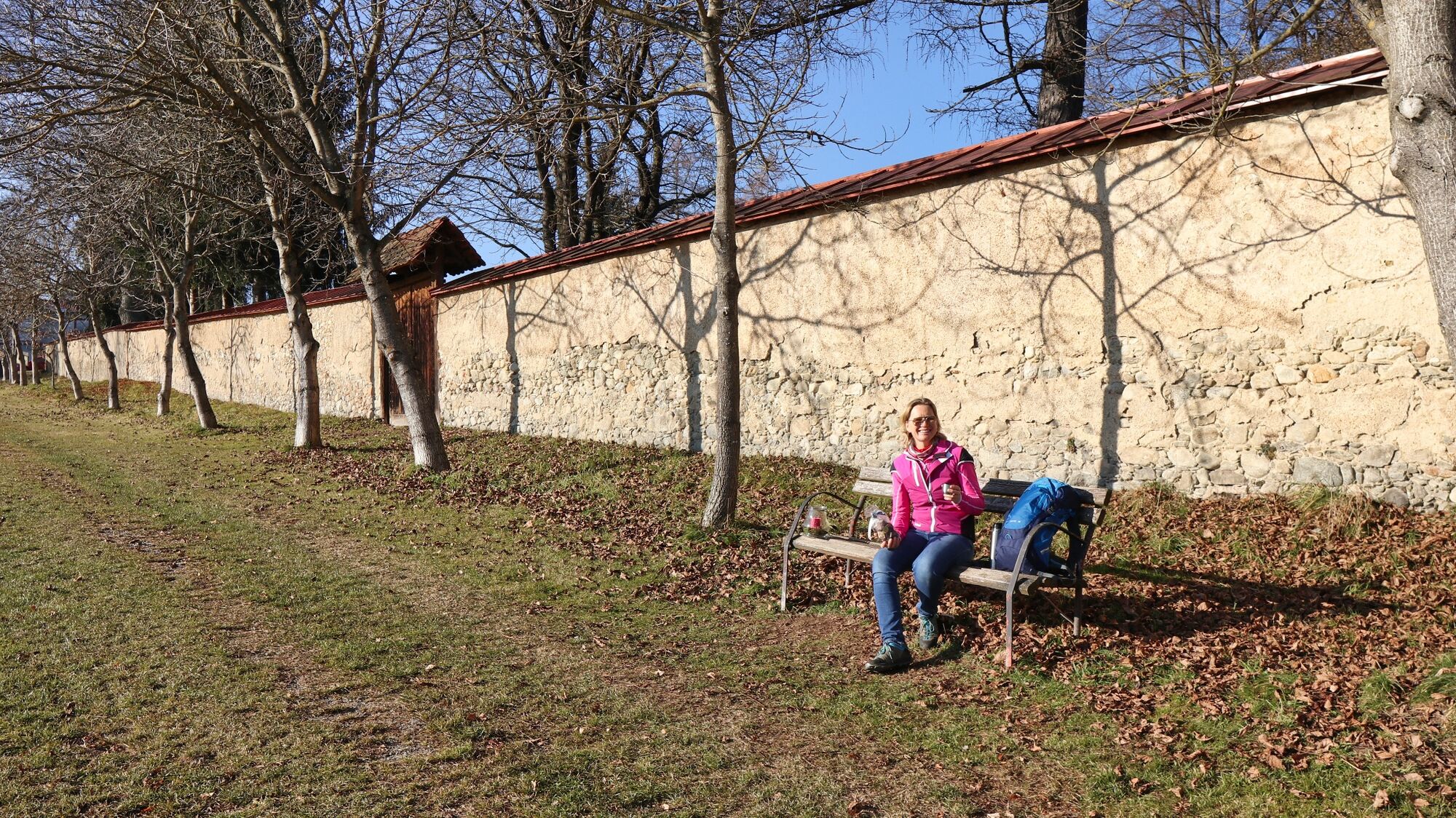
With a winter hike in the municipality of Seckau, you can combine several sensual and enjoyable moments. There are numerous local recreational and circular hiking trails in the municipality, so you can also extend this winter hike a little. As some sections of the tour are in the forest, we recommend doing the hike in the late morning or around midday so that you can enjoy the warmth of the winter sun. During the hike, we come to the first resting place, the Schachenkirche, which is also known as the Schutzengelkirche and is somewhat hidden in the forest. The Schachenkirche was built in the 18th century and is now a branch church of the parish of Seckau, as are the churches on the Hochalm and Tremmelberg. We recommend the 2nd resting place, the St. Christopher's Cross, near Seckau Abbey, on the large meadow in front of the abbey. There are several benches along the way where you can make yourself comfortable and enjoy the view as well as the Seckau gingerbread, for example.
- Directions
-
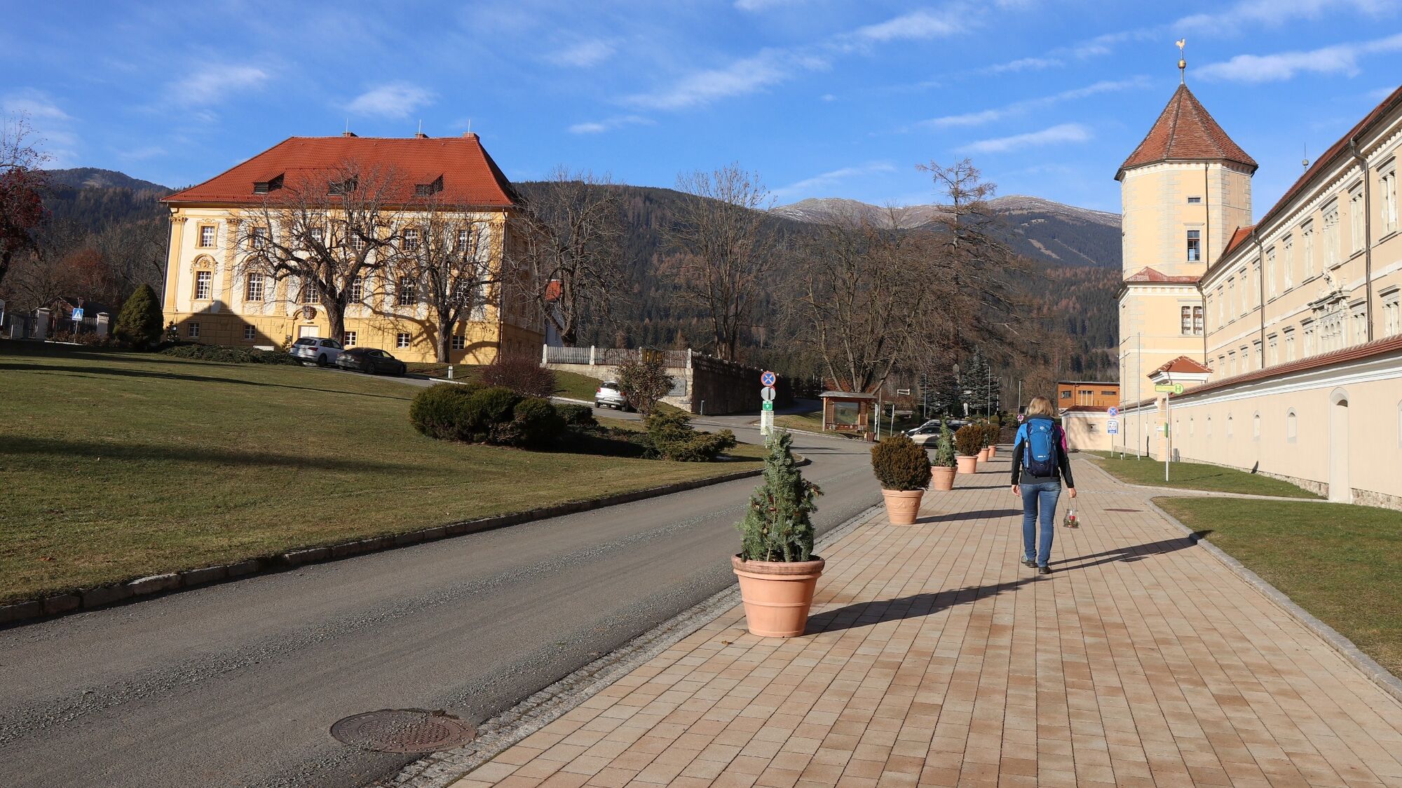
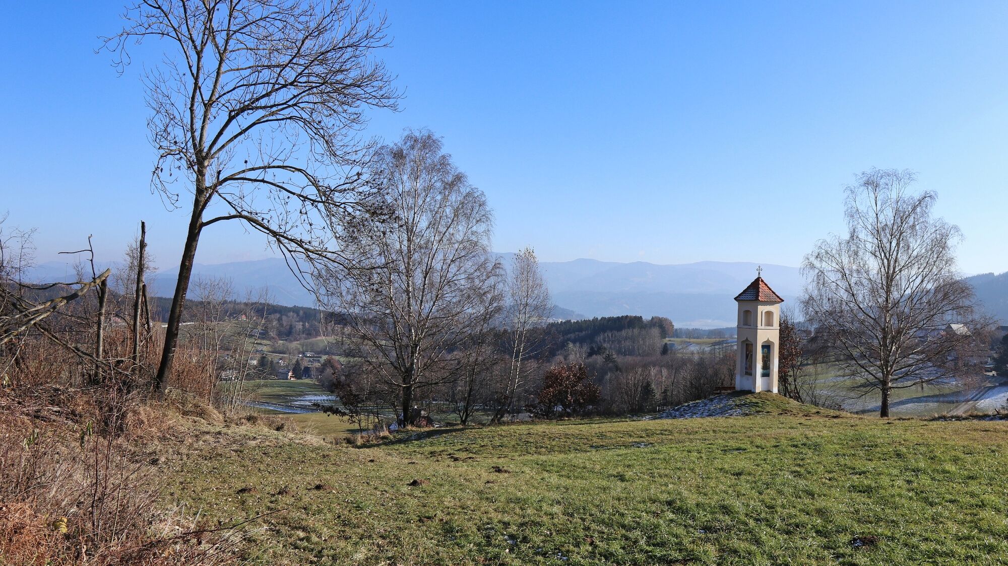
We walk from the starting point in the direction of Marktplatz Seckau (1), 843 m, past the front of the monastery and then past the elementary school. Immediately afterwards, the hiking trail leads slightly to the right away from the road. We come to a barrier, keep right and now stay on the forest road, which leads slightly downhill through the forest. We pass a pond, meadows and a stream before reaching an asphalt road. Here we keep to the right and follow the road slightly downhill, crossing the stream again and then immediately turning left. We continue parallel to the stream until we reach the road, which we follow to the left for approx. 350. On the right-hand side we see a signpost to the Schachenkirche church. Now we walk comfortably uphill following the gravel road, see the turn-off to the right to the church and immediately reach the Schachenkirche (2), 741 m. Note: The church is marked as Maria Schach on the official map. The hiking trail continues to the right, initially almost flat, past the deer feeding station and further slightly uphill along the edge of the forest. We follow the forest road and soon reach the populated area of Neuhofen. At the first crossroads, we keep right and come to a square with several streets. For orientation, we follow the regional cycle signposts in the direction of cycle junction no. 77. The route continues gently uphill, passing the Neuhofen village sign. Now we follow the asphalt road and soon see the center of Seckau in front of us. Before we reach our starting point again, however, we turn right across the meadow. Immediately after the wooden hut we see a meadow path, which we follow to the Christophorus cross (3), 801 m. Then continue along the edge of the meadow and along the abbey wall. It is now only a few minutes to the starting point of the hike.
- Highest point
- 845 m
- Endpoint
-
Parking lot Jufa Seckau
- Height profile
-

- Equipment
-
Backpack with rain cover Telescopic / hiking poles Mountain / hiking boots Gloves: waterproof and warming Headgear / sunglasses Outerwear: Onion layer system, T-shirt, sweater, jacket and winter jacket with hood Hiking pants Seat pad Drinking bottle / thermos flask (on cooler days a warming drink is pleasant) Snack First aid kit with blister plaster and tick tongs
Other important equipment
Route descriptionDetailed plan of the hike Hiking map: For overview a map in scale 1 : 50 000 of the respective region GPS device cell phone - Safety instructions
-
For a conflict-free coexistence on alpine pastures and meadows it is important to observe a few rules, especially when traveling with dogs. (Source: www.sichere-almen.at - 06/2021) Avoid contact with grazing animals, do not feed them, keep a safe distance! Keep calm, do not frighten grazing animals! Mother cows protect their calves. Avoid encounters between mother cows and dogs! Always keep dogs under control and on a short leash. If an attack by a grazing animal is foreseeable: Immediately unleash! Do not leave hiking trails on alpine pastures and meadows! If grazing animals block the way, avoid them as far as possible! When grazing animals approach: Stay calm, do not turn your back, avoid the animals! Leave the grazing area quickly at the first sign of restlessness of the animals!Fences must be respected! If there is a gate, use it, then close it well and cross the pasture quickly! Treat the people working here, nature and the animals with respect!
A few tips for correct and fair behavior in the forest: (Source: www.bundesforste.at - 6/2021)
Hikers should avoid visits to the forest about 1.5 hours before sunrise and after sunset, as wildlife is especially active during this time. Plastic bottles, handkerchiefs, cigarette butts & Co have no place in the forest! Please make sure that you do not leave any trash in the forest. Camping and making fire - is strictly forbidden in the forest! In principle, each person is allowed to collect 2 kg of mushrooms and berries per day for personal use in the forest. It is only forbidden if the forest owner expressly forbids it.Alpine emergency call:
Mountain rescue emergency number: 140
EU emergency number: 112
Weather service: www.zamg.ac.at
Direct link mountain weather Styria: https://www.zamg.ac.at/cms/de/wetter/produkte-und-services/bergwetter/steiermark
- Tips
-
Before your hike, visit the Regner confectionery and buy a pack of the gingerbread house mix for the road.
www.lebkuchen-regner.at/lebkuchen
- Additional information
- Directions
-
Take the expressway exit (S36) St. Lorenzen/Feistritz near Knittelfeld, continue on the Bundesstrasse 78 to Kobenz. At the traffic circle, turn towards Seckau (L517) and follow the main road for approx. 7 km.
Winter hiking by car - a few things you should be aware of!
- Good winter tires are an absolute MUST!
- Ice scraper, snow broom, de-icer for the door locks and a small shovel are part of the basic equipment.
- Put snow chains and a tow rope in the car, even if you are not good with them yourself. There are always helpful and knowledgeable hikers on the mountain!
- Clear all snow and ice from the car, especially the roof.
- When parking, make sure that you also leave space for other drivers.
- Always park in such a way that the rest of the road remains clear for cars, timber trucks and snow clearing vehicles.
- Find out about the snow situation on the access road or parking facilities before setting off. (Hüttenwirt, webcams)
- Public transportation
- Parking
-
Large parking lot Jufa Seckau

- Author
-
The tour Winter hike in Seckau is used by outdooractive.com provided.