- Brief description
-
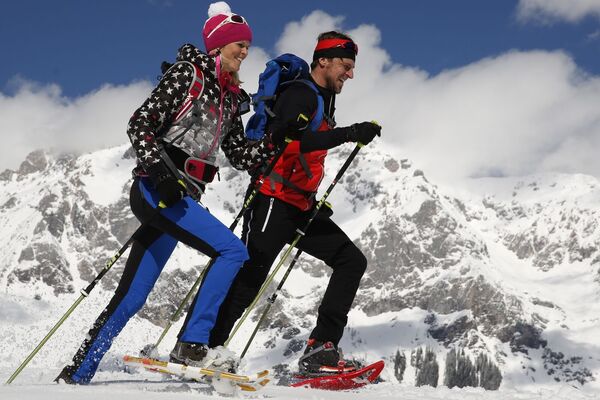
Enjoy the snowy winter landscape around the Rosemi Alm on the Stoderzinken.
- Difficulty
-
easy
- Rating
-
- Starting point
-
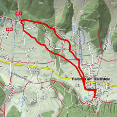
Trail Head Rosemi Alm
- Route
-
Rosemi Alm0.1 kmStoder0.3 km
- Best season
-
AugSepOctNovDecJanFebMarAprMayJunJul
- Description
-
Hike from the Rosemi Alm to the Steinerhaus in snow-covered terrain and make your own tracks in the snow at 1,800 m above sea level.
- Directions
-
The prepared winter hiking trail starts at the Rosemi Alm. Hike up along the old lift route towards the Steinerhaus. From there walk down to the Stoderhütte and turn right. Then take the path down to the right towards Rosemialm again.
- Highest point
- 1,821 m
- Endpoint
-
Trail Head Rosemi Alm
- Height profile
-

- Equipment
-
Snow shoes, poles, good winter shoes, warm clothing, tuque, and gloves. You might also want to carry a small backbag with a warm drink in a thermos jug.
- Safety instructions
-
Changes in weather patterns, quick falls in temperature, thunderstorms, wind, fog and snow are some of the dangers that can be encountered on a hiking tour. Hosts of alpine huts and mountain refuges have a lot of experience in the mountains and can give good advice about weather and the trails. Poor equipment, overestimation of one's own capabilities, carelessness, poor personal constitution and/or wrong judgement can lead to critical situations. In case of thunderstorms: avoid summits, ridges and steel ropes.
GPS data and orienteering
Available GPS data - just like hiking maps - is only a guidance for orientation and can never depict a trail exactly with all its details. Especially at dangerous spots it is essential to judge on site how to proceed.
In an emergency please call:
140 - for Alpine emergencies (all over Austria) 112 - European GSM emergency numberIn winter, caution is advised on even supposedly easy tours. The ground can be slightly icy in shady places, and there is a risk of avalanches on slopes. Mountain sports are therefore - all the more so in winter - subject to personal responsibility. Before every ski tour or snowshoe hike, the current avalanche report should be checked - available at www.lawine.at.
Tourism associations or avalanche warning services assume no liability for the information provided.
- Additional information
-
Info & information tourist office Gröbming: +43 3687 23310

- Author
-
The tour Winter hiking trail Roßfeldrunde - Stoderzinken is used by outdooractive.com provided.


General info
-
Schladming - Dachstein
75
-
Haus - Aich
34
-
Aich
15