
- Brief description
- Difficulty
-
difficult
- Rating
-
- Starting point
-
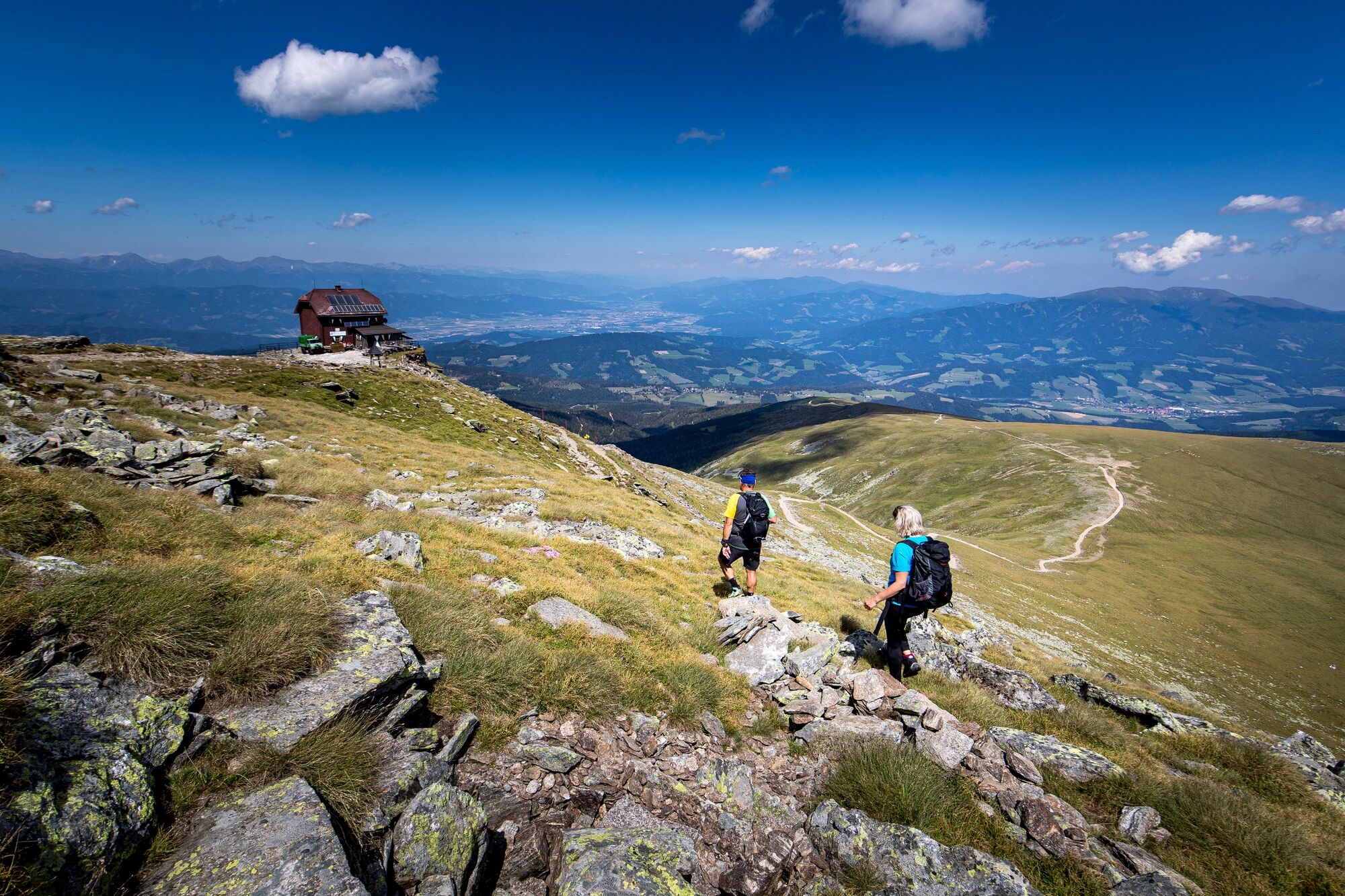
Waldheimhütte hut
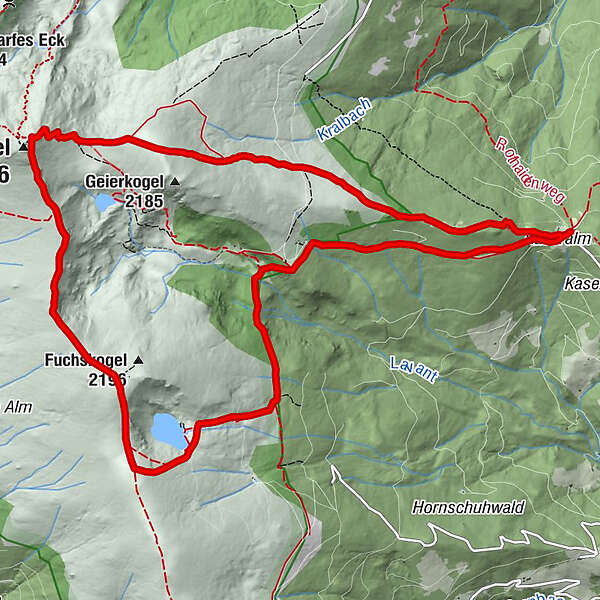
- Route
-
WaldheimhütteMaria in der Zirbe1.2 kmTürkenkreuz2.6 kmKatholisches Kreuz (1,814 m)3.7 kmZirbitzkogel (2,396 m)8.9 kmZirbitzkogel Schutzhaus8.9 kmWaldheimhütte14.3 km
- Best season
-
JanFebMarAprMayJunJulAugSepOctNovDec
- Description
-
From the Waldheimhütte take path 320 to the Zirbitzkogel mountain (2,396 m).
The decent over the Fuchskogel mountain (2,214 m, path 308) and the Wildsee lake (path 321) is nice here. Then you pass the Türkenkreuz and the Maria in der Zirbe (Marry in the stone pine) resting point back to the Waldheimhütte hut in the Murtal adventure region in Styria.
- Directions
-
Starting at the Waldheimhütte hut we take path 320 to the Zirbitzkogel mountain. The hiking trail is well signed and easy to follow. We will pass the Geierkogel mountain and then hike on to the Zirbitzkogel mountain (2,396 m). The Zirbitzkogel is the highest mountain in the Seetal Alps and the most-hiked mountain in the Eastern Alps. The mountain is much loved by the locals and a coveted place for visitors.
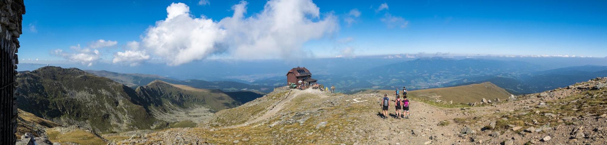
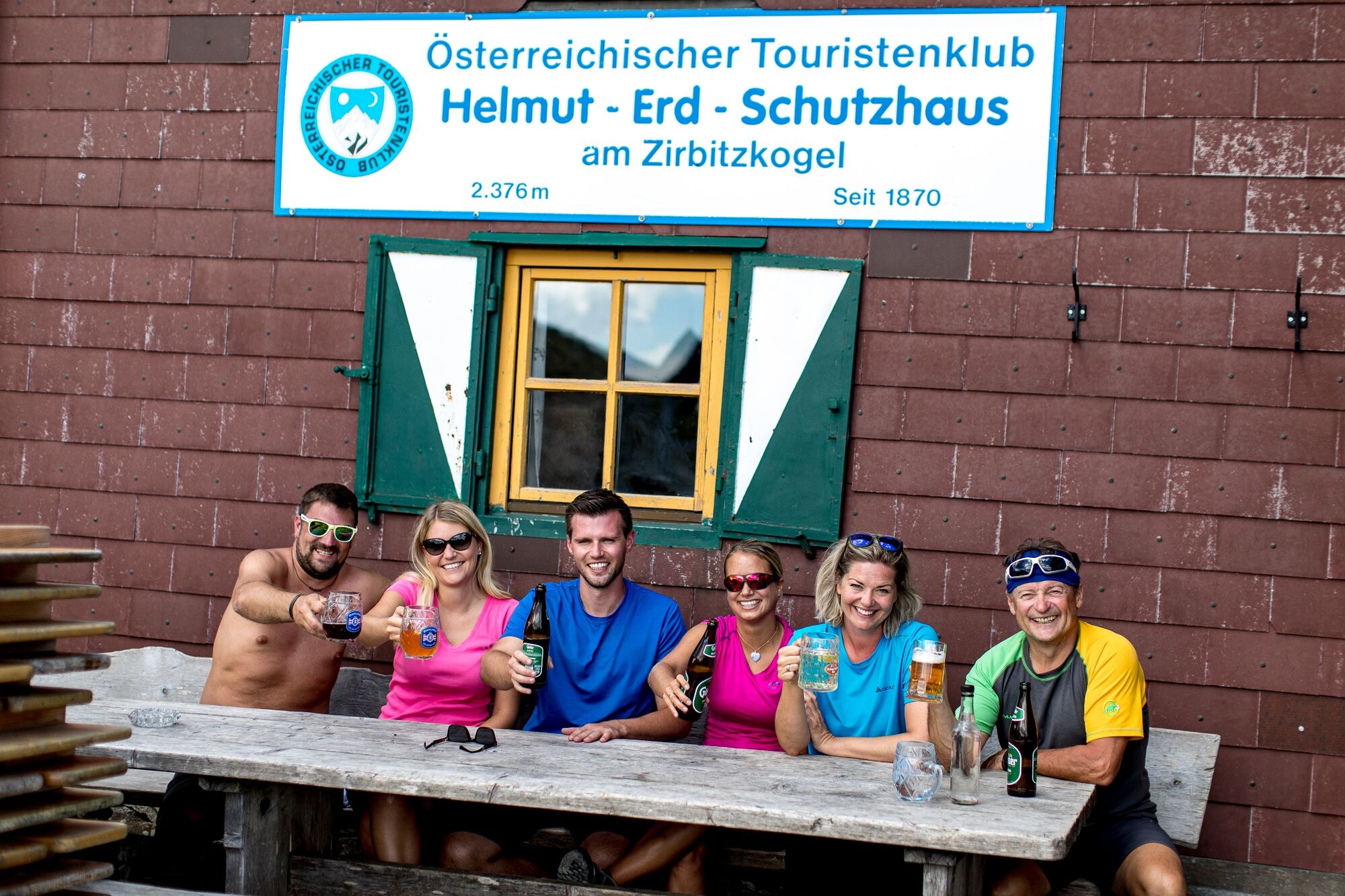
We take a decent break in the Zirbitzkogel alpine hut (2,376 m). At Zirbitz-Werner's hut it is also possible to rest over the night.
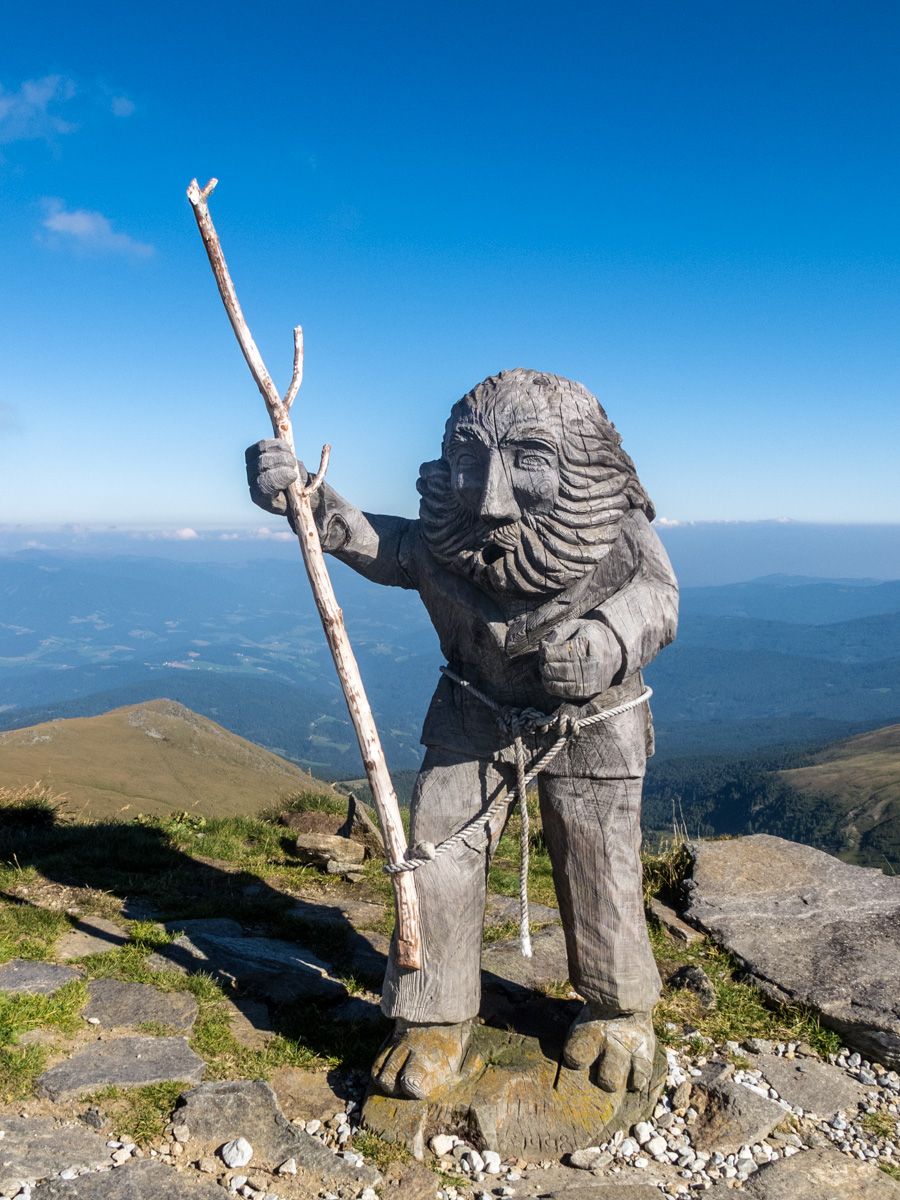
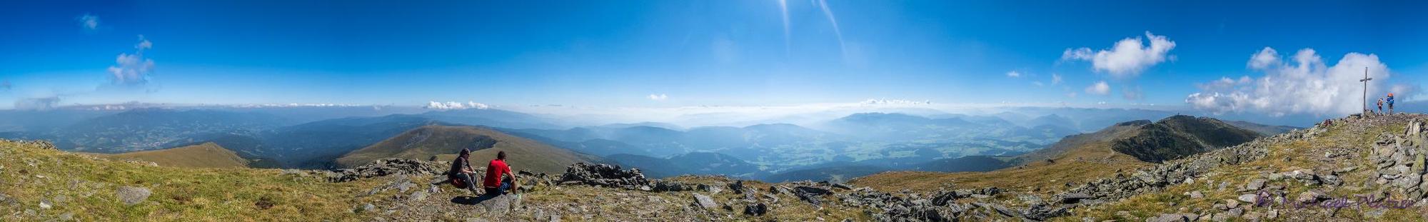
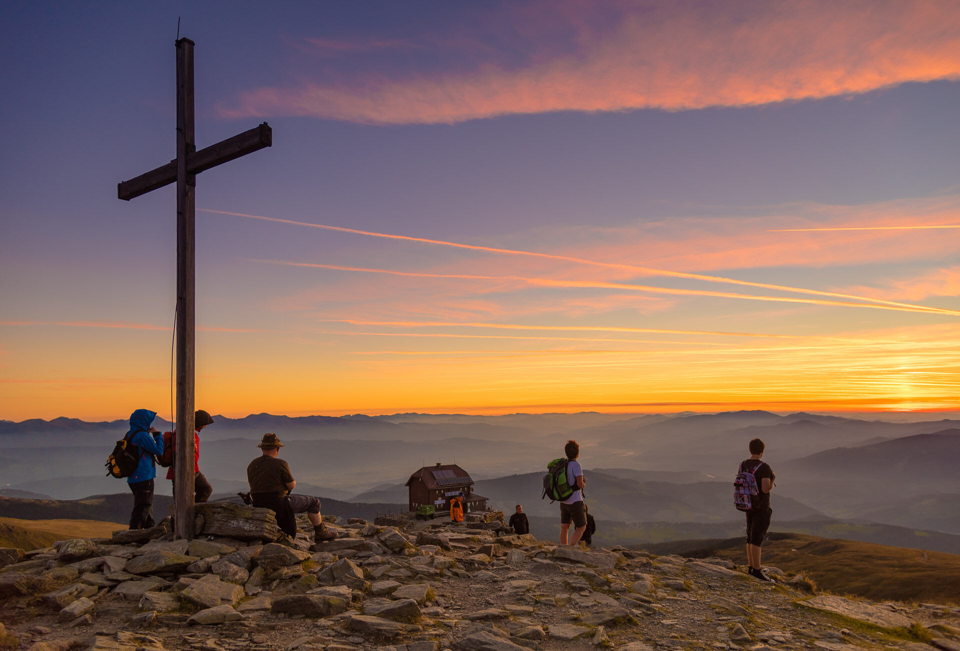
A few steps across the alpine hut is the big summit cross (2,396 m). Here we can enjoy an impressive panorama of the Karawanks over the Julian Alps, Seckau Alps and Northern Limestone Alps including the Dachstein, Gesäuse and Hochschwab.
The descent over the Fuchskogel mountain (2,214 m, path 308) and the Wildsee lake (path 321) is nice here. Then it goes past the Türkenkreuz cross and the Maria in der Zirbe (Marry in the stone pine) monument and resting point back to the Waldheimhütte hut.
- Highest point
- 2,372 m
- Endpoint
-
Waldheimhütte hut
- Height profile
-

- Equipment
-
Dress appropriately for a hike:
Wear weather-appropriate, durable clothing. In any case, the clothing should protect you from possible rain and cold or sun and heat.
Even low mountain ranges often hold meteorological surprises. It is not uncommon, even in June, for a cold snap to occur at higher altitudes.
Sandals, bathing slippers, even sneakers are not the appropriate footwear for a hike.
Use hiking boots with ankle protection. Make sure they have a good tread and grip. After rain showers, it can be very slippery in the forest, even in summer, on roots, leaves and stones. - Safety instructions
-
In order to really enjoy a hike in the Zirbenland and relax, please note the following points:
Plan your stages according to your condition and ability. Take your time. Organize your energy very well, take enough breaks.
There are very long sections. Not everywhere there are possibilities to stop for refreshments. For a long-distance hiker it goes without saying that he should have enough drinks (and snacks) with him.
Adapt your behavior to the respective conditions, both meteorological and ground conditions. Study the weather forecast daily.
Pay attention to yourself and other hikers. - Tips
-
Make sure that you take your camera with you! The Wildsee lake is a really beautiful place with an impressive panorama.
- Additional information
-
You can also find this hike in the following hiking maps:
Spielberg - Hiking map 1 - Seckauer Alpen/Seetaler Alpen - Tour IV
Zirbenland - Hiking map "ZARTE" - Tour
These maps are available free of charge from the tourist office "Tourismus am Spielberg" - info@tourismus-am-spielberg.at - Tel.: 0043 664 3577 2022 7166
and at the tourist office "Tourismusbüro Judenburg" - info@judenburg.com - Tel.: 0043 3572 85000, Hauptplatz 20, 8750 JudenburgYou can also find more information about the region on - www.tourismus-am-spielberg.at or in the free app of the holiday region Murtal
- Directions
-
From Obdach, follow the road B78 towards Carinthia on the Obdacher Sattel. At the Obdacher Sattel, turn right towards St. Anna. Follow the street, drive through the village of St. Anna and follow the street to the Waldheimhütte. Approach from the main road about 9km (4km gravel).
- Public transportation
-
This tour is NOT considered "accessible by train and bus" because there is no regular connection.
- Parking
-
Parking spaces are available at the Waldheimhütte - parking ticket machine € 3,00


- Author
-
The tour From the Waldheimhütte hut to the Zirbitzkogel is used by outdooractive.com provided.


General info
-
Erlebnisregion Murtal
1783
-
Steirisches Zirbenland
711
-
Mühlen
222