St. Lambrechter Rundwanderweg 29 / 5.000 Übersetzungsergebnisse Übersetzung St. Lambrecht circular hiking trail


- Brief description
-
Hike with a few meters of altitude, which reflects the character of the spiritual spa and the diverse landscape around St. Lambrecht from different perspectives.
- Difficulty
-
easy
- Rating
-
- Starting point
-
Abbey Gate St. Lambrecht
- Route
-
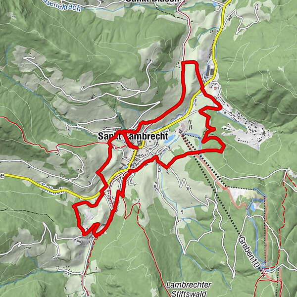
StifterlTorwirtMarktcaféSankt Lambrecht0.3 kmHeiligenstadt2.3 kmSeppwirt2.9 kmKupferdachl3.6 kmWeißenbach3.8 kmSankt Lambrecht7.0 kmWieskreuzkapelle8.9 kmVorstadt10.5 kmSankt Lambrecht12.4 kmStifterl12.6 kmTorwirt12.7 kmMarktcafé12.7 km
- Best season
-
JanFebMarAprMayJunJulAugSepOctNovDec
- Description
-
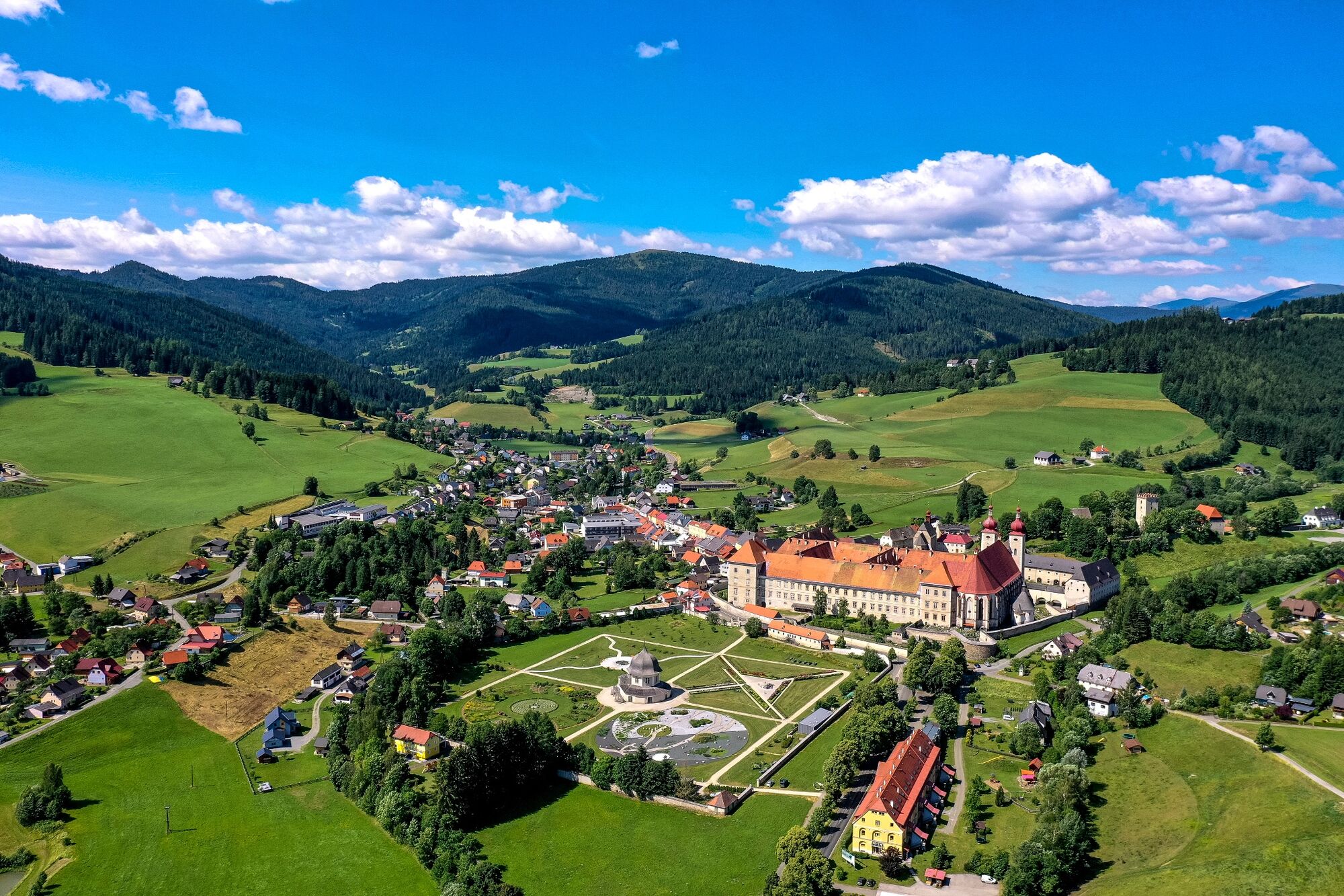
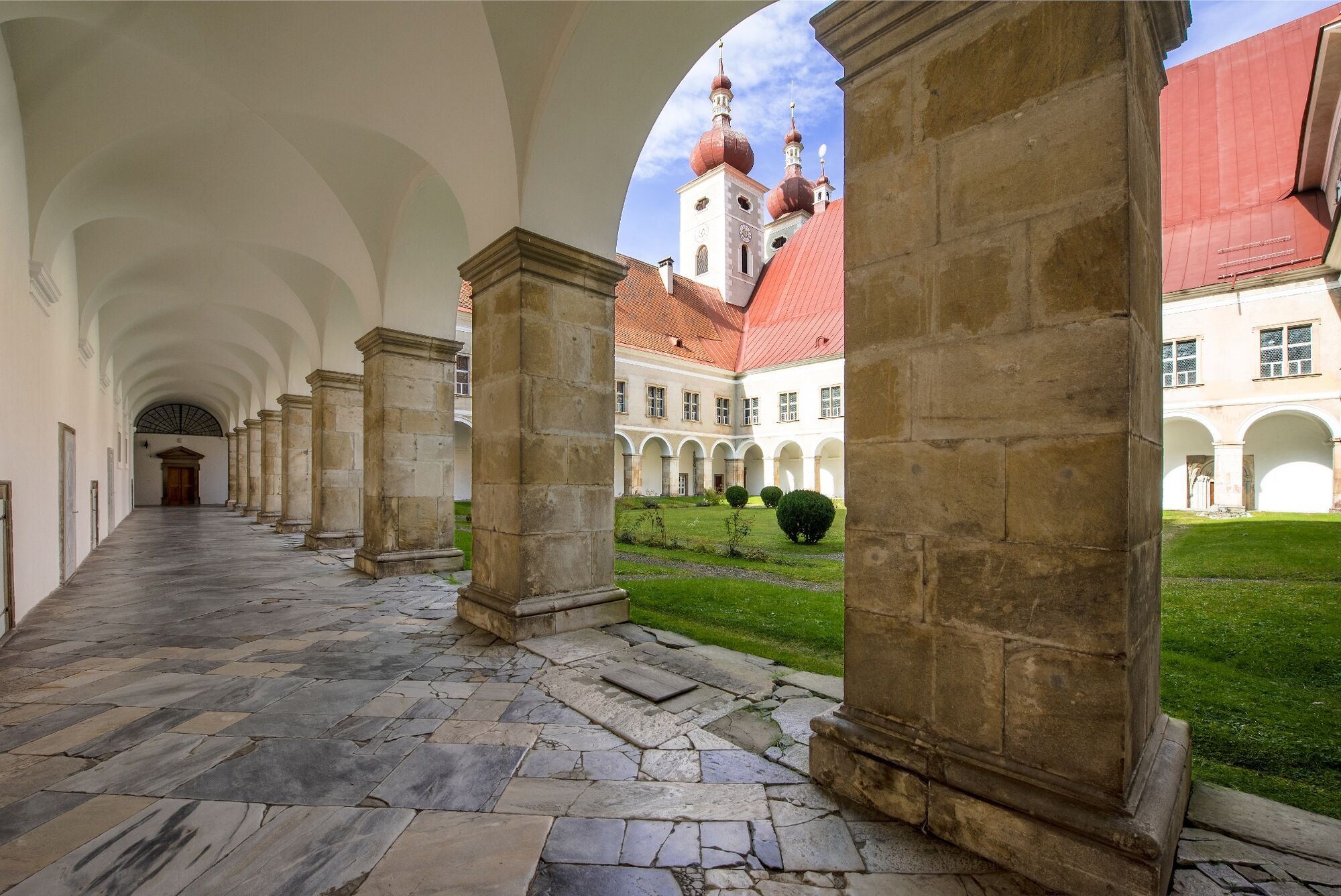
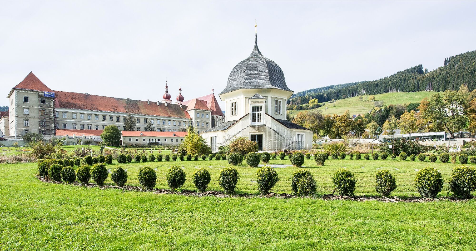
The Benedictine monastery of St. Lambrecht, which is the starting and ending point of this hike, tells a 900-year story. It shapes the place and the people in and around St. Lambrecht. Visitors can get to know the monastery on tours of the monastery, in the temporary monastery, the school of existence, tours of the monastery gardens or in the monastery and nature park shop.
- Directions
-
This circular hiking trail leads clockwise around St. Lambrecht. After starting at the monastery, you go up to the entrance to the gorge and in the open area to Heiligenstadt. From there you go down to Thajagraben and to Weißenbach. We continue through the forest up to the Engelsbrunnen, where you can take a pleasant rest. You go back down to St. Lambrecht via the Stations of the Cross and past the school center into the suburbs. The final loop leads over the Wieskreuz Chapel, the Trattenhof, over the Hohe Brücke and past the gorge back to the starting point.
- Highest point
- 1,159 m
- Endpoint
-
Abbey Gate St. Lambrecht
- Height profile
-

- Equipment
-
Good shoes
Sun protection
Sufficient food - Safety instructions
-
All forest visitors are asked to only enter the forest between 8 a.m. and 4 p.m. in order to give the forest animals the vital rest they need in the morning and evening.
- Additional information
-
This tour can be hiked all year round.
- Directions
-
By car from Germany
From Munich via the A8 towards Salzburg. From Salzburg on the A10 Tauernautobahn to St. Michael im Lungau. On the B 96 to Tamsweg, then on the B 95 to Predlitz. The B 97 leads via Stadl/Mur to Murau. There at the roundabout towards St. Lambrecht to Murauer train station and further towards St. Lambrecht. You reach St. Lambrecht via Laßnitz near Murau. The monastery is located in the town center.Arrival from Eastern Austria/Hungary
At the motorway junction in St. Michael near Leoben, take the S 36 towards Klagenfurt. Past Knittelfeld and Judenburg to Scheifling. In Scheifling continue towards Klagenfurt to Neumarkt, via Unzmarkt and Perchau am Sattel you reach Neumarkt. Turn right there towards Mariahof and St. Lambrecht. In Mariahof, after the railway crossing, turn left towards St. Lambrecht. The monastery is located in the center of St. Lambrecht.Arrival from southern Austria/Italy
Via Klagenfurt on the S 37 past St. Veit/Glan, Treibach and Friesach. In Friesach continue towards Vienna, via Dürnstein and Wildbad to Neumarkt. After the town center of Neumarkt turn left towards Murau, in Mariahof turn left after the railway crossing towards St. Lambrecht. The monastery is located in the center of St. Lambrecht. - Public transportation
-
With the BusBahnBim app from the interconnected line, timetable information is easier than ever before: all bus, train and tram connections in Austria can be queried by entering locations and/or addresses, stops or important points. The app is available as a free app for smartphones (Android, iOS) - on Google Play and in the App Store.
- Parking
-
Public parking spaces are available near the town entrance sign, the monastery entrance/pharmacy or at the market pond.
- Author