- Brief description
-
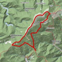
Panoramic hike from Eppenstein via the Kickerlochhütte (1517m) to the Größenberg (2152m).
- Difficulty
-
difficult
- Rating
-
- Starting point
-
Eppenstein
- Route
-
Größenberg (2,152 m)7.8 km
- Best season
-
JanFebMarAprMayJunJulAugSepOctNovDec
- Description
-
Marking 520: The trail climbs gently along the stream into the forest towards the Kickerlochhütte. After approx. 1 1/2 hours of walking, the path leads very steeply uphill to the right. After another ½ hour you reach the Kickerlochhütte. Once at the hut, you can stop for refreshments. Continue through the forest along the 520 markings until you reach the tree line and the Planriegel. From there, you can briefly see the summit cross. The last section leads across wonderful alpine pastures. From the summit cross, on a clear day, you have a wonderful panoramic view of the Seetal, Seckau and Eisenerz Alps as well as the Gleinalpe and nearby Amering.
- Directions
-
Eppenstein - Kickerlochhütte (1517m) - Größenberg (2152m)
Marking 520: The trail climbs gently along the stream into the forest towards the Kickerlochhütte. After approx. 1 1/2 hours of walking, the path leads very steeply uphill to the right. After another ½ hour you reach the Kickerlochhütte. Once at the hut, you can stop for refreshments. Continue through the forest along the 520 markings until you reach the tree line and the Planriegel. From there, you can briefly see the summit cross. The last section leads across wonderful alpine pastures. From the summit cross, on a clear day, you have a wonderful panoramic view of the Seetal, Seckau and Eisenerz Alps as well as the Gleinalpe and nearby Amering.
- Highest point
- 2,153 m
- Endpoint
-
Eppenstein
- Height profile
-

- Equipment
-
Dress appropriately for a hike:
Wear hard-wearing clothing that is suitable for the weather. Your clothing should always protect you from rain and cold or sun and heat.Even low mountain ranges often have meteorological surprises in store. It is not uncommon, even in June, for a cold snap to occur at higher altitudes (so-called sheep cold).Sandals, flip-flops and even trainers are not suitable footwear for a hike.Use hiking boots with ankle protection. Make sure they have a good tread and grip. After rain showers, it can be very slippery in the forest, even in summer, on roots, leaves and stones.
- Safety instructions
-
So that you can really enjoy and relax on a hike in Zirbenland, please note the following points:
Plan your stages according to your fitness level and ability. Take your time. Manage your strength well and take plenty of breaks.There are very long sections. Refreshment stops are not available everywhere. For a long-distance hiker, it goes without saying that you should have enough drinks (and snacks) with you.Adapt your behaviour to the prevailing conditions, both meteorological and ground conditions. Check the weather forecast daily.Take care of yourself and other hikers.
- Directions
-
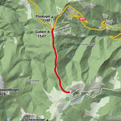
Via Murtal Schnellstraße (S36) or via Gaberl (B77) to Eppenstein - in Eppenstein turn off at the railway station - follow signpost 520 to the start of the forest road.
- Public transportation
-
This tour is NOT considered "accessible by train and bus" as there is no regular connection.
- Parking
-
Free car parking.


- Author
-
The tour Eppenstein - Größenberg is used by outdooractive.com provided.