- Brief description
-
Hike to the Friedenskirchlein in the footsteps of Peter Rosegger and to the summit of the Gröbminger and Aicher local mountains.
- Difficulty
-
medium
- Rating
-
- Starting point
-
from Gröbming, 12 km up Stoderzinken Alpine Road to the P
- Route
-
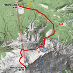
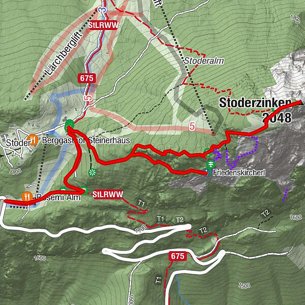
Rosemi Alm0.1 kmFriedenskircherl1.4 kmStoderzinken2.6 kmRosemi Alm4.5 km
- Best season
-
JanFebMarAprMayJunJulAugSepOctNovDec
- Description
-
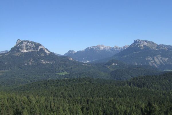
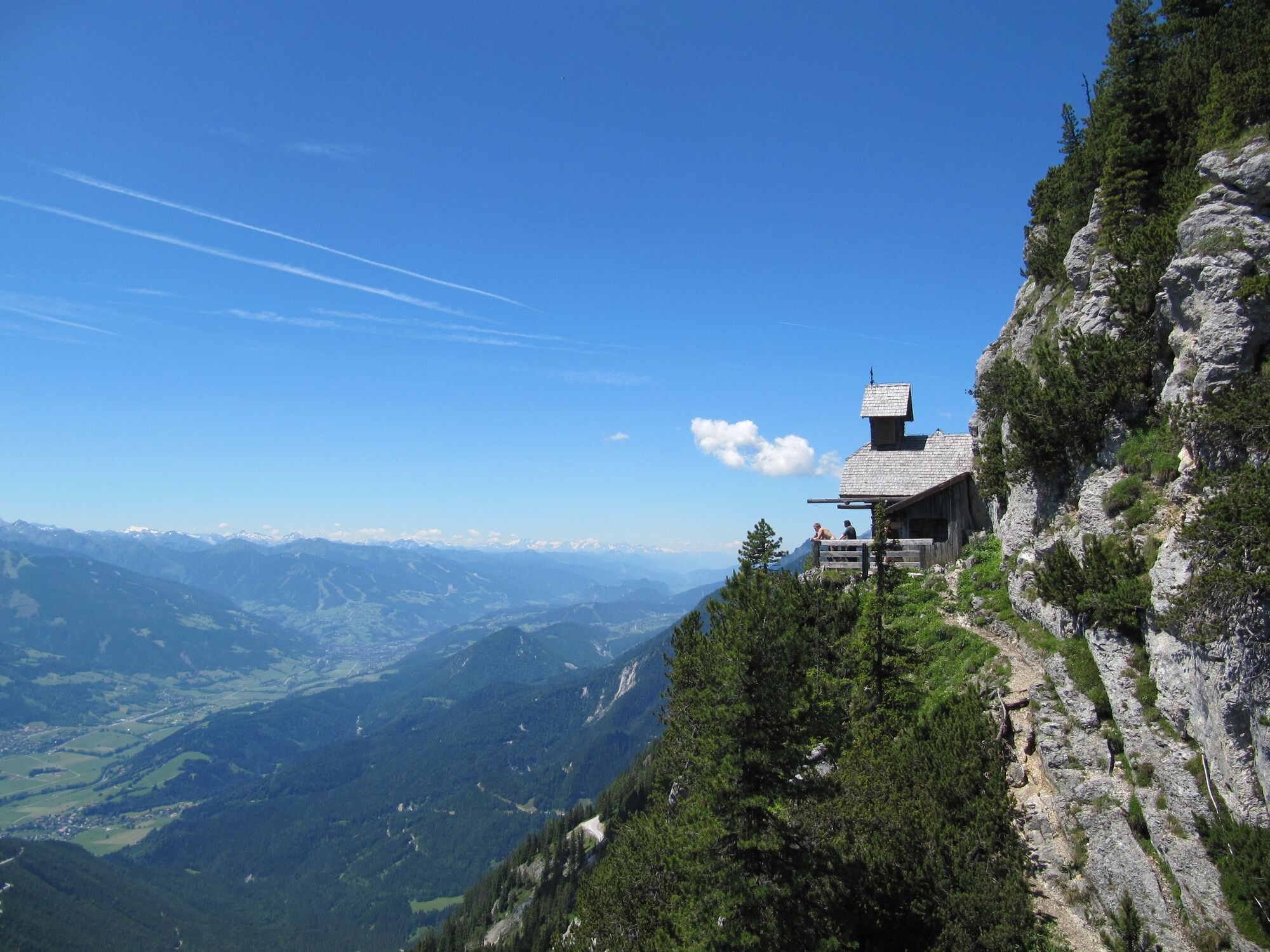
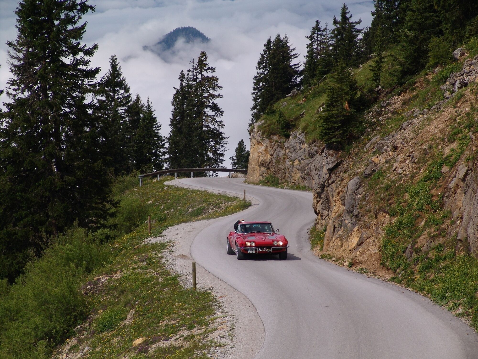
The drive up Stoderzinken Alpine Road is an experience in its own right (not a toll road), especially the last third, where the road clings tightly to the rocky mountainside until reaching its highest point. During our brief hike up to Alpengasthof Steiner, we catch a first glimpse of the Dachstein Glacier high above the forest. At the trail crossing next to the Tritscher Alm, the trail branches off towards the summit and Peace Chapel, which we will reach in about 20 minutes. This beautiful trail is narrow and right up against the cliffs, leading us to the chapel, perched there like an eagle’s nest and treating us to magnificent views.
Built as a memorial to Emil Ritter von Horstig, a pioneer on the Stoderzinken, it has since become a popular lookout point. In order to reach the summit, we hike back the way we came, as far as the Peter Rosegger memorial, then hike up through larch, beyond the tree line and across the tree-less mountaintops to the summit. This is a spot you will want to stay and enjoy for a while – 360° exceptionally captivating views of the Dachstein and its glaciers, and of the karst alpine terrain known as “Am Stein”, as well as of Gröbming’s wide valley basin, above which towers the jagged, rocky ridgeline of the Kammspitze, much closer than we might have expected. We can also return along trail No. 675 to the Brünnerhütte (ca. a ½-hour walk). - Directions
-
The drive up Stoderzinken Alpine Road is an experience in its own right (not a toll road), especially the last third, where the road clings tightly to the rocky mountainside until reaching its highest point. During our brief hike up to Alpengasthof Steiner, we catch a first glimpse of the Dachstein Glacier high above the forest. At the trail crossing next to the Tritscher Alm, the trail branches off towards the summit and Peace Chapel, which we will reach in about 20 minutes. This beautiful trail is narrow and right up against the cliffs, leading us to the chapel, perched there like an eagle’s nest and treating us to magnificent views. Built as a memorial to Emil Ritter von Horstig, a pioneer on the Stoderzinken, it has since become a popular lookout point. In order to reach the summit, we hike back the way we came, as far as the Peter Rosegger memorial, then hike up through larch, beyond the tree line and across the tree-less mountaintops to the summit. This is a spot you will want to stay and enjoy for a while – 360° exceptionally captivating views of the Dachstein and its glaciers, and of the karst alpine terrain known as “Am Stein”, as well as of Gröbming’s wide valley basin, above which towers the jagged, rocky ridgeline of the Kammspitze, much closer than we might have expected. We can also return along trail No. 675 to the Brünnerhütte (ca. a ½-hour walk).
- Highest point
- 2,041 m
- Endpoint
-
Stoderzinken
- Height profile
-

- Equipment
-
A well-packed backpack is helpful and especially when touring Alpine terrain a tuque, gloves, a windproof jacket and pants are standard equipment. Good, waterproof shoes, sun glasses, sun cream and sufficient beverages are essential too. Torch light, a map of the area, knie and a small first-aid kit should also be in the backpack.
- Safety instructions
-
Changes in weather patterns, quick falls in temperature, thunderstorms, wind, fog and snow are some of the dangers that can be encountered on a hiking tour. Hosts of alpine huts and mountain refuges have a lot of experience in the mountains and can give good advice about weather and the trails. Poor equipment, overestimation of one's own capabilities, carelessness, poor personal constitution and/or wrong judgement can lead to critical situations. In case of thunderstorms: avoid summits, ridges and steel ropes.
GPS data and orienteering
Available GPS data - just like hiking maps - is only a guidance for orientation and can never depict a trail exactly with all its details. Especially at dangerous spots it is essential to judge on site how to proceed.
In an emergency please call:
140 - for Alpine emergencies (all over Austria) 112 - European GSM emergency number - Additional information
-
Safety information
Safety on the mountainside: changes in the weather, sudden fall in temperature, thunder storms, wind, fog and snow fields are all objective dangers and require the correct behaviour whilst underway. the landlords of the huts are all very knowledgeable about the mountains and can give you good tips about the weather and the routes. Insufficient equipment, exaggerated opinion of ones capabilities, frivolousness, poor health condition and a false evaluation of the situation can lead to a critical situation. In thunder storms: summits, crest-sites and safety rope aids are to be avoided.
If something should happen call following emergency numbers:
No. 140 - the number for all Alpine Emergencies in all of Austria
No. 112 - European emergency call GSM emergency-call-service - Directions
-
Exit the B320 Ennstalbundesstraße in Gröbming. Follow the signs towards the Stoderzinken Alpenstrasse. From the Adventure Park/Gröbminger Alm, the Stoderzinkenstraße is a toll road.
- Public transportation
-
Hiking taxi Sport Kornberger, minimum of 4 people.
Register by phone; Tel.: +43 3685 22 172 - Parking
-
Parking area Stoderzinken Alpenstraße

-

-
AuthorThe tour To the Friedenskircherl chapel and to Stoderzinken is used by outdooractive.com provided.


General info
-
Schladming - Dachstein
3000
-
Haus - Aich
1365
-
Aich
276