Stage 13 From Glacier to Wine South Route Neumarkt - Tonnerhütte Zirbitzkogel


- Brief description
-
This stage of the hiking route "From glacier to wine" in the Zirbitzkogel-Grebenzen Nature Park leads us to the Tonnerhütte at the foot of the Zirbitzkogel. As in the 12th stage, we also hike here in sections along the Via Natura, a 130 km long-distance hiking trail through the entire Zirbitzkogel-Grebenzen Nature Park.
- Difficulty
-
medium
- Rating
-
- Starting point
-
St. Marein bei Neumarkt
- Route
-
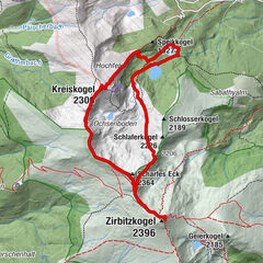
Neumarkt in der Steiermark0.1 kmNeumarkterhof0.1 kmGasthaus Haas0.1 kmGasthof zum Bräuer - Hermine Seidl0.1 kmSankt Marein bei Neumarkt0.6 kmMareinerwirt1.3 kmSchützenhof1.7 kmTauchendorf4.3 kmUnterviertel5.9 kmSankt Veit in der Gegend6.8 kmPfarrkirche hl. Veit6.9 kmNiederdorf8.1 kmPörtschach9.7 kmOrtskapelle hll. Maria und Rochus12.7 kmGasthaus Gössler12.8 kmMühlen12.9 kmGasthaus Hirschenwirt12.9 kmSchmellingkogel (1,482 m)18.6 km
- Best season
-
JanFebMarAprMayJunJulAugSepOctNovDec
- Description
-
Where hiking competence is at home: This is how one could describe the hiking village of Mühlen, idyllically situated at the foot of the Zirbitzkogel. As a founding member of the group "Austria's hiking villages", hiking service for the guest is not only capitalized here, but also lived with total commitment and cordiality. In addition to guided hikes on the Zirbitzkogel and along the themed trails around the "Hans im Glück - Fairy Tale" or the Hörfeld Moor, also hut hikes lasting several days, a hiking cab, equipment rental and much more is offered to make the hiking vacation perfect.
- Directions
-
From St. Marein near Neumarkt, this stage of the hiking route "From Glacier to Wine" takes us first a short distance along the bike path in a southerly direction to St. Veit. At St. Georgener Bach we keep to the left and now continue hiking ever so slightly uphill along fields and meadows as well as through small contemplative, beautifully maintained settlements and farms to St. Veit in the area, an equally idyllically situated small village. The further way leads us to the hiking village Mühlen on the Zirbitzkogel. Just before Mühlen there is also the possibility to make a detour to the idyllically located bathing pond with its campsite. Incidentally, this is the 1st campsite in Austria to be awarded the Austrian Hiking Quality Seal for establishments.
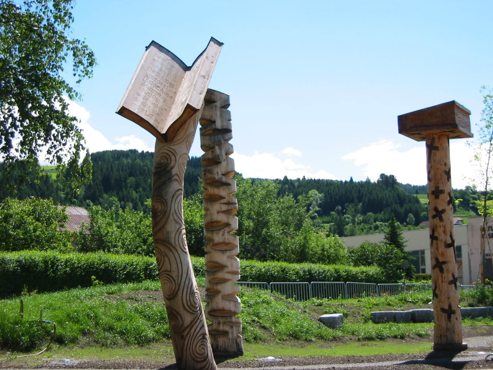
From the center of Mühlen, where we find the "NatureReading Island" on the subject of "Working in harmony with nature", we walk about 100 m northeast to the road fork Jakobsberg-Tonnerhütte or Noreia-Mondorf. From here we follow the slightly ascending road in the direction of Noreia until we reach the fork in the road to Greith, which we follow until we reach the fork in paths 3, 4 and 5 and at the Mühlradl hiking trail near Haus Egger. From here we have a beautiful view of Mühlen and Hitzmannsdorf as well as Jakobsberg, which is on the other side of the valley, and to the Wölzer Tauern. Now we continue uphill past the Schnedl homestead and large pastures, always with a magnificent view of the Zirbitzkogel, to the Übelbacher Hütte. We now keep to the right here and after a little more than 2 km we reach our stage destination, the Tonnerhütte (Tel. +43 3586 30077), which has an extremely surprising offer at 1,600 meters above sea level. The beautiful location with a breathtaking panorama is underlined by the homey atmosphere with its pine wood rooms, an alpine wellness area with crushed pine bath and pine panorama saunas as well as culinary delicacies, which the son of the house conjures up with his team from regional products and genuine alpine delicacies. Thus, relaxation is announced before the next stage over the Zirbitzkogel to Obdach in the Zirbenland.
- Highest point
- 1,582 m
- Endpoint
-
Tonnerhütte am Zirbitzkogel
- Height profile
-

- Equipment
-
Proper backpack packing makes many things easier: Pack heavy things first. The water bottle should always be within reach in a side pocket. All the things that are often needed, such as sunglasses, camera or hiking map, belong on top. An emergency kit, including blister plasters, belongs in every rucksack and it is always advisable to dress in layers.
- Safety instructions
-
Emergency call mountain rescue: 140
Tips when reporting an emergency – Answer these six WH questions: What happened? How many people are injured? Where did the accident happen (are there GPS coordinates)? Who is reporting the incident (callback number)? When did the accident happen? What is the weather like at the site of the incident?
- Additional information
-
Steiermark Tourismus
Tel. +43 316 4003
If you would like to hire a tour operator, simply book with Steiermark Touristik, the official travel agency of Steiermark Tourismus:
Tel. +43 316 4003 450,
The Steiermark Touren app, available free of charge on Google Play and the App Store (Android, iOS), offers detailed first-hand information: brief facts (length, duration, difficulty, ascent and descent/elevation gain, ratings), map, route descriptions, altimeter, compass, peak finder, navigation along the tour. You can also create your own personal lists of favourite tours and sites, store tours and destinations offline, use social media channels, and much more.
- Public transportation
-
Accessible by train and bus.
Detailed information about arriving by ÖBB (Austrian Federal Railways) can be found at www.oebb.at or on the Verbundlinie Steiermark website www.busbahnbim.at
With Verbundlinie’s BusBahnBim route planner app, planning your journey has never been easier: simply enter towns and/or addresses, stop names or points of interest to check all bus, train and tram connections in Austria. The app is available free of charge for smartphones – on Google Play and in the App Store
- Parking
-
There are plenty of parking spaces available in St. Marein bei Neumarkt.


-

-
AuthorThe tour Stage 13 From Glacier to Wine South Route Neumarkt - Tonnerhütte Zirbitzkogel is used by outdooractive.com provided.