Immerse yourself in nature in the Hartberger Gmoos, Hartberg


- Brief description
-
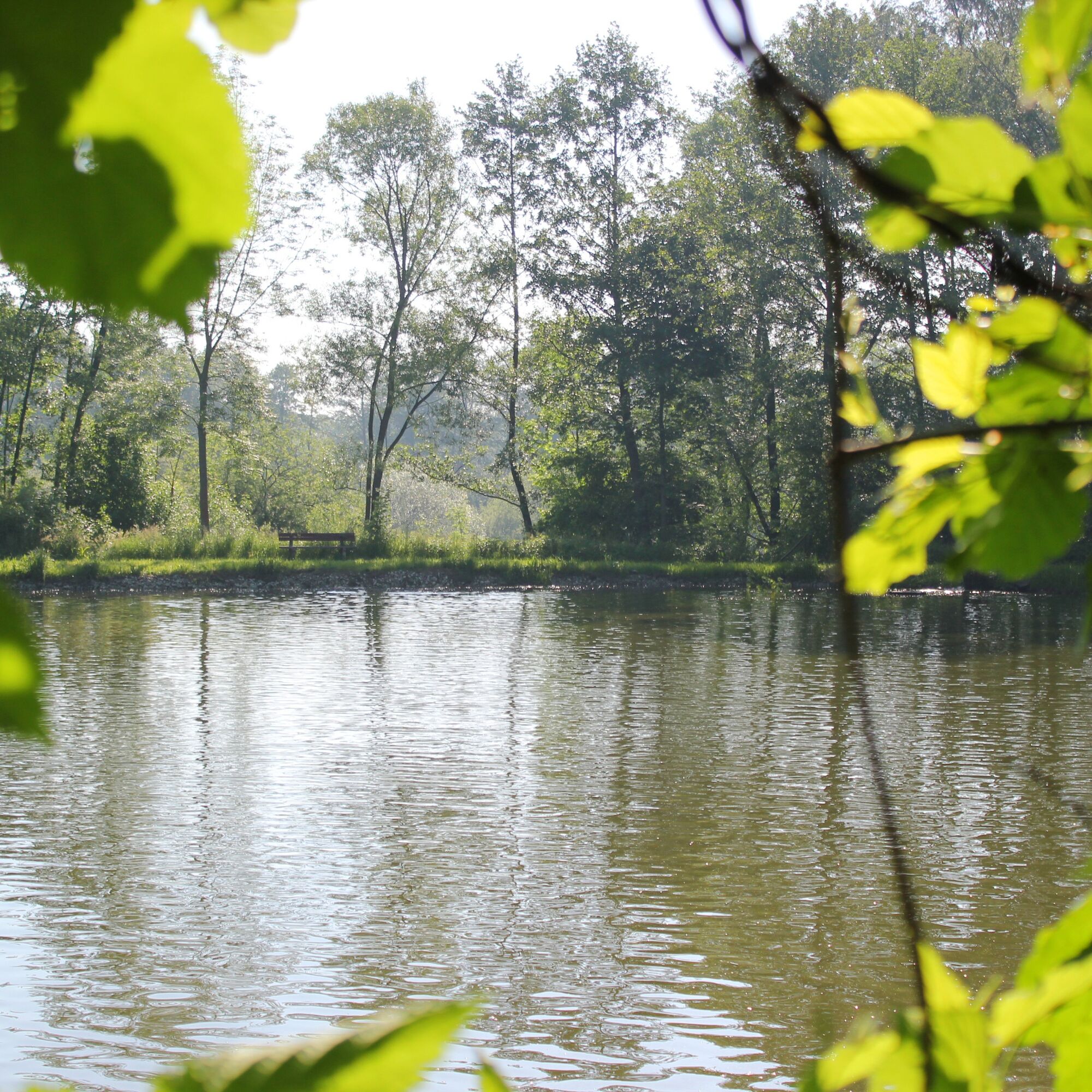
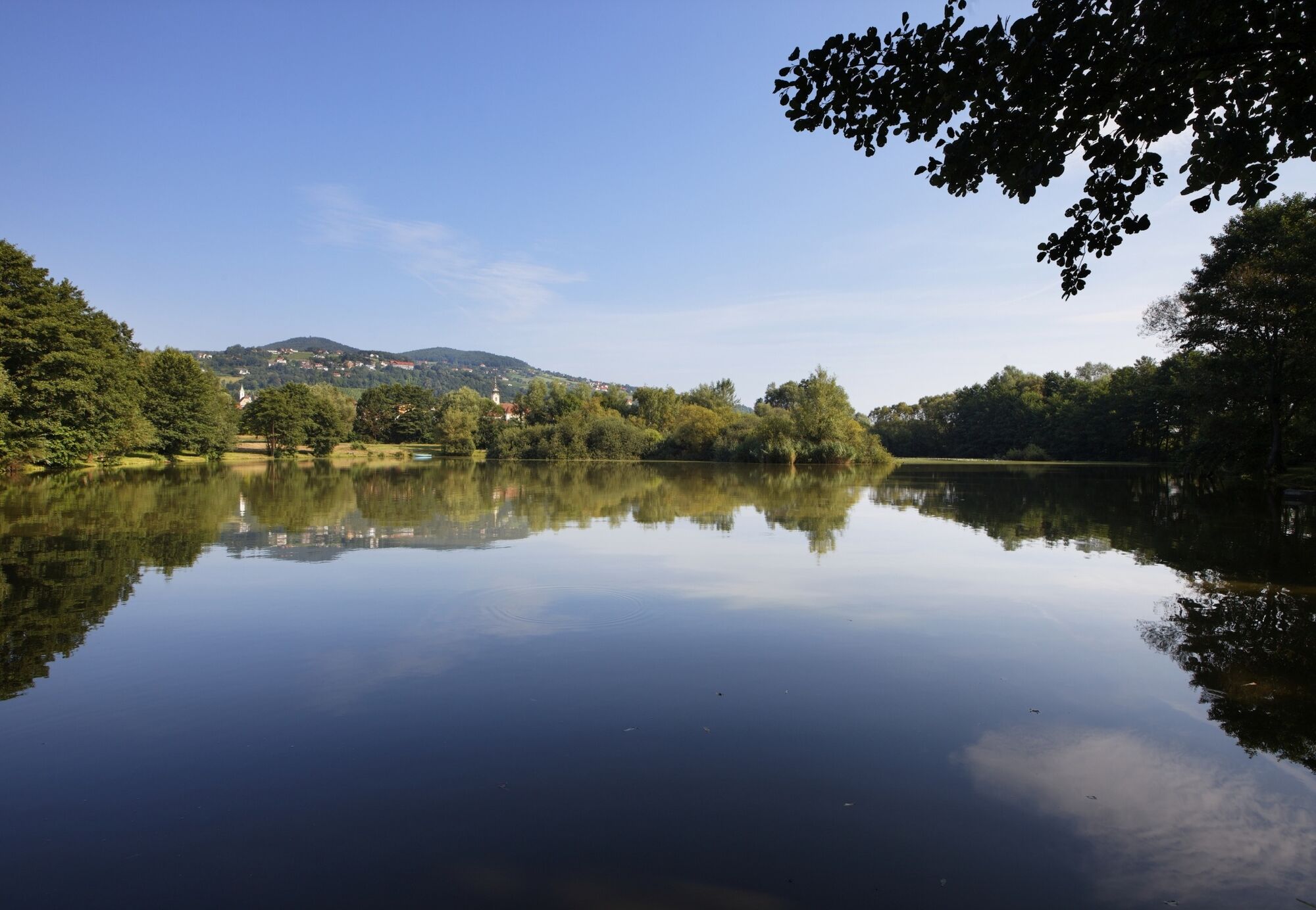
Explore natural history up close. The Hartberg Gmoos has changed: from a silted-up lake to an ecologically valuable green island. A theme trail provides insight into the world of ecology.
- Difficulty
-
easy
- Rating
-
- Starting point
-
Hartberg, Stadtwerke Hartberg Hall
- Route
-
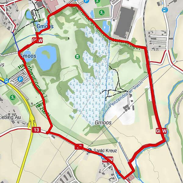
Gmoosblick3.3 kmHartberg3.5 km
- Best season
-
JanFebMarAprMayJunJulAugSepOctNovDec
- Description
-
Location & History
In a shallow depression, at an altitude of 319 to 328 meters above sea level, it borders directly on the built-up urban area of the district capital Hartberg. The fen developed through silting up of the "Edelsee", the remains of which can still be found in the deepest parts. The average sea level is 324 m.
Typical animals of the Hartberg bog are warblers, water rails, white storks, insects like butterflies and dragonflies, frogs and toads. The area is structured by rows and groups of alders and willows (Alnus glutinosa, A. incana, Salix cinerea, S. fragilis). On the Safenbach there are remains of a hardwood meadow with oaks, elms and ashes (Quercus robur, Ulmus laevis, Fraxinus excellsior).
The area of about 65 ha has been a nature reserve since 1992 and was declared a European nature reserve in 2005.
- Directions
-
Starting from the Hartberg recreation center (HERZ), we walk south past the Hartberghalle and past the Hartberg carpet factory Durmont to the railroad tracks of the Thermenbahn, which connects Eastern Styria to the railroad network from Vienna via Wiener Neustadt, Aspang and Friedberg,
at the railroad crossing the red-white marked path No. 12 to Loretto Chapel turns off to the left. We go straight until the Safen forces us to follow the path to the right. Over the bridge we cross the Hartberger Safen to the Safenau tennis courts,
after the tennis courts we follow the accompanying path of the Safenau road on the right to the brick chapel wayside shrine called "Sankl Kreuz" and are now also on the yellow and white marked pilgrims' path from Maria Heiligenbrunn via St. Johann in der Haide to Maria Lebing St. Stefan and Fieberbründl,
about 300 meters after the chapel wayside shrine we leave the Safenauer Straße to the right and walk past the dog school to the fish ponds of the district fishing club Hartberg,
here we continue over 2 bridges over the Brühl to the view Hartberger Gmoos on the right side and left past the natural pond and right past the tennis courts back to the starting point. - Highest point
- 327 m
- Endpoint
-
Hartberg, Stadtwerke Hartberg Hall
- Height profile
-

- Equipment
-
In winter: On a short stretch along the natural pond there is no winter service. Therefore, sturdy shoes are recommended after snowfall.
- Safety instructions
-
Important telephone numbers:
European emergency number: 112
Rescue: 144
Fire department: 122
Police: 133
The trail is easy to walk and therefore suitable for the whole family.
- Tips
-
A beaver moved into the small ponds in November 2017, the traces of its activities can be easily seen.
- Additional information
- Directions
- Public transportation
- Parking


- Author
-
The tour Immerse yourself in nature in the Hartberger Gmoos, Hartberg is used by outdooractive.com provided.


General info
-
Thermen- & Vulkanland
1324
-
Hartbergerland
830
-
Hartberg
212